Tennessee State Route 151

Last updated

Tennessee 151.svg

State Route 151

Tennessee State Route 151
TN 151 highlighted in red
Route information
Maintained by TDOT
Length7.4 mi (11.9 km)
Major junctions
West endTennessee 56.svg SR 56 in Red Boiling Springs
Major intersectionsTennessee 52.svg SR 52 near Red Boiling Springs
East endTennessee 56.svg SR 56 in North Springs
Location
Country United States
State Tennessee
Counties Macon, Clay, Jackson
Highway system
Secondary Tennessee 150.svg SR 150 Secondary Tennessee 152.svg SR 152

State Route 151 (SR 151) is a state highway in the central portion of the U.S. state of Tennessee.

Contents

Route description

SR 151 begins in Macon County at an intersection with SR 56 in downtown Red Boiling Springs. It goes southeastward as E Main Street to leave the town and have an interchange with SR 52. [1] It continues southeast through farmland to cross into the southwestern corner of Clay County for a short distance before crossing into the mountains of Jackson County. [2] SR 151 continues southeastward through the mountains along a narrow valley before entering North Springs and coming to an end at an intersection with SR 56. [3] The entire route of SR 151 is a rural two-lane highway. [4]

Major intersections

CountyLocationmikmDestinationsNotes
Macon Red Boiling Springs 0.00.0Tennessee 56.svg SR 56 (Main Street) Carthage, Gamaliel, KY Western terminus
1.11.8Tennessee 52.svg SR 52  Lafayette, Celina Interchange via Two-way access road
Clay
No major junctions
Jackson North Springs 7.411.9Tennessee 56.svgSecondary Tennessee 56.svg SR 56  / SR 56 (Jennings Creek Highway) Gainesboro, Lafayette Eastern (signed southern at this intersection) terminus
1.000 mi = 1.609 km; 1.000 km = 0.621 mi

Related Research Articles

<span class="mw-page-title-main">U.S. Route 412 in Tennessee</span> U.S. Highway in Tennessee

In Tennessee, U.S. Route 412 stretches for 181.93 miles (292.79 km) through the farmland of West Tennessee and the hills of Middle Tennessee, starting at the Missouri state line near Dyersburg and running to an interchange between I-65 and SR 99 in Columbia.

<span class="mw-page-title-main">U.S. Route 31A</span> U.S. Highway in Tennessee

U.S. Route 31A is a 76.94-mile-long (123.82 km) alternate route of U.S. Route 31 that exists between Nashville and Pulaski, Tennessee. It is located entirely in Middle Tennessee and except for the Lewisburg bypass, where it is concurrent with SR 106, it is entirely concurrent with unsigned State Route 11.

<span class="mw-page-title-main">Tennessee State Route 139</span> State highway in Tennessee, United States

State Route 139 is a 25-mile-long (40 km) state highway in Jefferson and Sevier counties in the eastern portion of the U.S. state of Tennessee. It connects Strawberry Plains to Dandridge.

<span class="mw-page-title-main">Tennessee State Route 355</span> State highway in Tennessee, United States

State Route 355 is a state highway in Kingsport, Sullivan County, Tennessee.

<span class="mw-page-title-main">Tennessee State Route 108</span> State highway in Tennessee, United States

State Route 108 (SR 108) is a 61.7-mile-long (99.3 km) state highway in Southeastern and Eastern Middle Tennessee. It connects SR 28 in Whitwell to SR 55 Bus/SR 56/SR 380 in McMinnville.

<span class="mw-page-title-main">Tennessee State Route 167</span> State highway in Tennessee, United States

State Route 167 is a state highway in Johnson County, Tennessee and a spur route of Tennessee State Route 67.

<span class="mw-page-title-main">Tennessee State Route 105</span> Highway in Tennessee

State Route 105 is a 44.34-mile-long (71.36 km) east–west state highway in West Tennessee. It traverses mainly rural areas and farmland.

<span class="mw-page-title-main">Tennessee State Route 122</span> Road in the USA

State Route 122 is a 7.11 mile long east–west state highway in Middle Tennessee. It connects the town of Huntland with the community of Elora. For the majority of its length, SR 122 is known as John Hunter Highway.

<span class="mw-page-title-main">Tennessee State Route 130</span> State highway in Tennessee, United States

State Route 130 is a 51.3-mile-long (82.6 km) east–west state highway in Middle Tennessee.

<span class="mw-page-title-main">Tennessee State Route 138</span> Highway in Tennessee

State Route 138 is a 23.01-mile-long (37.03 km) state highway in West Tennessee, connecting the town of Toone with Interstate 40 (I-40).

<span class="mw-page-title-main">Tennessee State Route 152</span> State highway in Tennessee

State Route 152 is a 36.88-mile-long (59.35 km) east-west state highway traversing the flat farmland of West Tennessee.

<span class="mw-page-title-main">Tennessee State Route 288</span> State highway in Tennessee, United States

State Route 288 is a 17.8-mile-long (28.6 km) north-south state highway in Warren and DeKalb counties of Middle Tennessee.

<span class="mw-page-title-main">Tennessee State Route 289</span> Road in Sparta, Tennessee

State Route 289, also known as North Spring Street, is a short 2.63-mile-long (4.23 km) north-south state highway located entirely in the city of Sparta, Tennessee.

<span class="mw-page-title-main">Tennessee State Route 367</span> State highway in Tennessee, United States

State Route 367, also known as College Street, is a short 4.80-mile-long (7.72 km) north-south state highway located entirely in the city of Trenton, Tennessee.

<span class="mw-page-title-main">Tennessee State Route 369</span> Highway in Tennessee

State Route 369, also known as N Washington Avenue, is a short 1.11-mile-long (1.79 km) east-west state highway located entirely in the city of Brownsville, Tennessee.

<span class="mw-page-title-main">Tennessee State Route 373</span> State highway in Tennessee, United States

State Route 373 is a 17.1-mile-long (27.5 km) east-west state highway in southern Middle Tennessee. It connects the community of Culleoka with the cities of Lewisburg and Columbia, along with I-65.

<span class="mw-page-title-main">Tennessee State Route 417</span> State highway in Lewisburg, Tennessee

State Route 417, also known as W Ellington Parkway, is a short 1.90-mile-long (3.06 km) north-south state highway located entirely in the city of Lewisburg, Tennessee.

<span class="mw-page-title-main">Tennessee State Route 421</span> State highway in Tennessee, United States

State Route 421 is a 5.4-mile-long (8.7 km) north-south state highway in Hardin and Henderson counties of eastern West Tennessee. It connects the community of Lebanon with the town of Sardis via Hinkle.

<span class="mw-page-title-main">Tennessee State Route 425</span> State highway in Tennessee, United States

State Route 425, also known as Middle Road, is a short 2.14-mile-long (3.44 km) east-west state highway located entirely in the city of Milan, Tennessee.

<span class="mw-page-title-main">Tennessee State Route 366</span> Highway in Tennessee

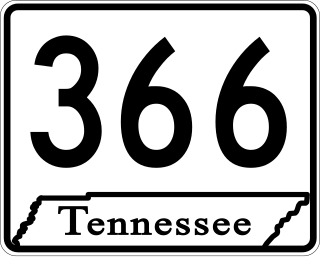
State Route 366 is the unsigned designation for the 5.48-mile-long (8.82 km) northern beltway around the city of Humboldt in Gibson County, Tennessee. Throughout its length, the highway is signed as U.S. Route 45W, US 70A Bypass, and US 79 Bypass.

References

  1. Tennessee Department of Transportation (TDOT). "Macon County road map" (PDF). www.tn.gov. Retrieved November 1, 2019.
  2. Tennessee Department of Transportation (TDOT). "Clay County road map" (PDF). www.tn.gov. Retrieved November 1, 2019.
  3. Tennessee Department of Transportation (TDOT). "Jackson County road map" (PDF). www.tn.gov. Retrieved November 1, 2019.
  4. Google (November 1, 2019). "Tennessee State Route 151" (Map). Google Maps . Google. Retrieved November 1, 2019.