
Hamblen County is a county located in the U.S. state of Tennessee. As of the 2020 census, the population was 64,499. Its county seat and only incorporated city is Morristown. Hamblen County is the core county of the Morristown Metropolitan Statistical Area, which includes Hamblen, Jefferson, and Grainger counties. The county and the Morristown MSA is included in the Knoxville-Morristown-Sevierville, TN Combined Statistical Area.

U.S. Route 79 is a United States highway in the Southern United States. The route is officially considered and labeled as a north-south highway, but its path is actually more of a diagonal northeast-southwest highway. The highway's northern/eastern terminus is in Russellville, Kentucky, at an intersection with U.S. Route 68 and KY 80. Its southern/western terminus is in Round Rock, Texas, at an interchange with Interstate 35, ten miles (16 km) north of Austin. US 79, US 68, and Interstate 24/US 62 are the primary east–west access points for the Land Between the Lakes recreation area straddling the Kentucky/Tennessee border.

U.S. Route 431 (US 431) is a spur of U.S. Route 31. It currently travels for approximately 556 miles (895 km) from US 231/Alabama State Route 210 and US 231 Business and US 431 Bus. in Dothan, Alabama, to Owensboro, Kentucky, at US 60 and Kentucky Route 2831. The major cities US 431 connects to are Dothan and Huntsville, Alabama, Franklin and Nashville, Tennessee, and Owensboro, Kentucky.

U.S. Route 11W (US 11W), locally known as Bloody 11W, is a divided highway of US 11 in the U.S. states of Tennessee and Virginia. The United States Numbered Highway, which is complemented by US 11E to the south and east, runs 110.28 miles (177.48 km) from US 11, US 11E, and US 70 in Knoxville, Tennessee, north and east to US 11, US 11E, US 19, and US 421 in Bristol, Virginia. US 11W connects Knoxville and the twin cities of Bristol, Virginia, and Bristol, Tennessee, with the East Tennessee communities of Rogersville and Kingsport. The U.S. Highway has an unsigned concurrency with State Route 1 (SR 1) for its whole length in Tennessee. In 2021, the route in its entirety was labeled among the top 25 deadliest highways in the U.S.

U.S. Route 11E (US 11E) is a divided highway of US 11 in the U.S. states of Tennessee and Virginia. The United States Numbered Highway, which is complemented by US 11W to the north and west, runs 120.94 miles (194.63 km) from US 11, US 11W, and US 70 in Knoxville, Tennessee, north and east to US 11, US 11W, US 19, and US 421 in Bristol, Virginia. US 11E connects Knoxville and the twin cities of Bristol, Virginia, and Bristol, Tennessee, with the East Tennessee communities of Morristown, Greeneville, and Johnson City. The U.S. Highway runs concurrently with US 70 and US 25W east of Knoxville, US 321 from Greeneville and Johnson City, and both US 19W and US 19 between Johnson City and Bristol. US 11E also has an unsigned concurrency with State Route 34 (SR 34) for almost all of its course in Tennessee.
U.S. Route 25E (US 25E) is the eastern branch of US 25 from Newport, Tennessee, where US 25 splits into US 25E and US 25W, to North Corbin, Kentucky, where the two highways rejoin. The highway, however, continues as US 25E for roughly two miles (3.2 km) until it joins Interstate 75 (I-75) in the Laurel County community of North Corbin at exit 29. The highway serves the Appalachia regions of Kentucky's Cumberland Plateau and the Ridge-and-Valley section of East Tennessee, including the urbanized areas of Corbin and Middlesboro in Kentucky and Morristown in Tennessee.

U.S. Route 25W is the western branch of U.S. Route 25 from Newport, Tennessee, where US 25 splits into US 25E and US 25W, to North Corbin, Kentucky, where the two highways rejoin.

State Route 66 is a state-maintained highway in eastern Tennessee, including a six-lane divided highway known as Winfield Dunn Parkway in Sevier County, a four-lane expressway in Hamblen and Jefferson counties and a two-lane rural collector through mountainous terrain continuing to the northeast terminus in Hancock County.

State Route 9 (SR 9) is a west-to-east state highway in the U.S. state of Tennessee that is 131.33 miles (211.36 km) long. It begins in Campbell County and ends in Cocke County. SR 9 is little-known by the general public by this designation as it is overlain by U.S. Route 25W and U.S. Route 25 east of Newport; the "9" designation is seen on mileposts. The entire route is located in East Tennessee. Despite running concurrent with a North-South US Route, Route 9 is signed as east-west.

State Route 5 is a 120-mile-long (190 km) north–south state highway in the western part of the U.S. state of Tennessee. Except for the section northwest of Union City, it is entirely concurrent with U.S. Route 45 and US 45W.
State Route 160 is a state highway in East Tennessee that has both four-lane expressway and two-lane rural collector sections. It serves as a arterial bypass route of US 11E/SR 34 in the city of Morristown in Hamblen County.

U.S. Route 11 (US 11) in the U.S. state of Tennessee travels from the Georgia state line in Chattanooga to Knoxville, where it then splits into US 11E and US 11W. These two highways then travel to the Virginia state line near Kingsport and Bristol. During its length, it shares concurrencies with State Route 2 (SR 2) and SR 38.

State Route 70 is a state-maintained highway in East Tennessee, beginning at the border with North Carolina in the midst of the Cherokee National Forest and the Great Smoky Mountains and ending at the Virginia border in the extremely rural and mountainous terrain of Hancock County.

State Route 347 is a state-maintained, secondary highway in eastern Tennessee, beginning at I-26 in the Rock Springs community of Kingsport and ending at the intersection of US 11W and SR 70 in Rogersville.
State Route 49 is a state highway in Tennessee. The route forms a broad southern arc that passes through the rural Middle Tennessee towns of Dover, Erin, Charlotte, Ashland City, Pleasant View, and Springfield.
State Route 172 is a state highway in Greene County, Tennessee. It begins at a partially unsigned intersection with US 321 near downtown Greeneville and it is signed starting at its intersection with US 11E/US 321 Truck and ends at Interstate 81 in Baileyton.

State Route 32 is a state highway in East Tennessee. For most of its route, it is an unsigned companion route concurrent with U.S. Route 25E. The highway stretches 89 miles from the North Carolina state line to the Tennessee-Kentucky state line near the town of Cumberland Gap.

State Route 113 is a north–south state highway in East Tennessee.
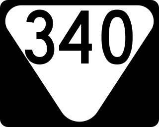
State Route 340 is a state highway in the eastern portion of the U.S. state of Tennessee. It travels south-to-north through portions of Cocke, Greene and Hamblen counties.

State Route 343 is a state highway in Morristown, Hamblen County in the U.S. state of Tennessee. It serves as connector from US 25E into downtown Morristown.

