Terrell, North Carolina

Last updated

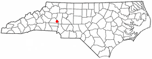
Terrell is an unincorporated community in Catawba County, North Carolina, United States. [1] Since the 2010 census, it has been included within the Lake Norman of Catawba CDP.

Contents

Geography

Location of Terrell, North Carolina NCMap-doton-SherrillsFord.PNG
Location of Terrell, North Carolina

Terrell is located at 35°35′20.72″N80°58′39.5″W / 35.5890889°N 80.977639°W / 35.5890889; -80.977639 within area code 828, ZIP code 28682, and FIPS place code 67180. It sits at an elevation of 289 m (948 ft).

The community center lies at the intersection of North Carolina Highway 150 and Sherrills Ford Road. The widening of NC 150 through Terrell has been delayed numerous times and is currently scheduled for construction in the late 2020s. [2] Neighboring communities include Sherrills Ford to the north and west, Mooresville to the east and Denver to the southwest. Terrell is a Lake Norman community with many lake-centric activities and businesses ("Top of the Lake").

History

The Terrell Historic District is listed in the National Register of Historic Places. The most notable building contained therein was the Terrell Country Store, built in 1891, once a focal point of trade and commerce in the area. The store was removed in 2020.

The town was named after Pinckney Lawson Terrell (1853-1926), a circuit-riding Methodist preacher with ties to the nearby Rehobeth Methodist Church. The Terrell family history reports that a post office was established in 1893 at the T.F. Connor store, and that the community was at that point named for Pinckney Lawson Terrell "because" he had paid all his debts (presumably to the store, but this is speculation only).

Water and sewer lines, primarily trunk lines, were installed in 2013-14 (not all neighborhoods), and a new library opened in 2014.

On May 24, 2016, Publix Supermarkets announced a new store in Terrell, at the intersection of NC 150 and Slanting Bridge Road (northeast corner), to open in late 2017. Publix opened in February 2018. [3]

Demographics

There are approximately 860 people and 332 households residing in the community. [4] The racial makeup of the community is 97.4% White, 1.40% African American, and 1.16% from other races. Hispanics or Latinos of any race were 0.35% of the population.

The mean income for a household in the community is $57,212. Many residents commute to Charlotte from this suburb, either via I-77 on the east side of Lake Norman, or via the equidistant NC 16 on the west side of Lake Norman.

Schools

Catawba County Schools

Private schools

Charter schools

Notable people

Related Research Articles

<span class="mw-page-title-main">Iredell County, North Carolina</span> County in North Carolina, United States

Iredell County is a county located in the U.S. state of North Carolina. As of the 2020 census, the population was 186,693. Its county seat is Statesville, and its largest community is Mooresville. The county was formed in 1788, subtracted from Rowan County. It is named for James Iredell, one of the first justices of the Supreme Court. Iredell County is included in the Charlotte-Concord-Gastonia, NC-SC Metropolitan Statistical Area, as defined by the Office of Management and Budget with data from the U.S. Census Bureau.

<span class="mw-page-title-main">Davidson County, North Carolina</span> County in North Carolina, United States

Davidson County is a county located in the U.S. state of North Carolina. As of the 2020 census, the population was 168,930. Its county seat is Lexington, and its largest community is Thomasville.

<span class="mw-page-title-main">Catawba County, North Carolina</span> County in North Carolina, United States

Catawba County is a county in the U.S. state of North Carolina. As of the 2020 census, the population was 160,610. Its county seat is Newton, and its largest community is Hickory.

Lake Norman of Catawba is a census-designated place (CDP) in Catawba County, North Carolina, United States. The population was 11,395 at the 2020 census up from 7,411 at the 2010 census. It is part of the Hickory-Lenoir-Morganton Metropolitan Statistical Area.

<span class="mw-page-title-main">Sherrills Ford, North Carolina</span> Unincorporated community in North Carolina, United States

Sherrills Ford is an unincorporated community and former census-designated place (CDP) in Catawba County, North Carolina, United States. Since the 2010 census, it has been included within the Lake Norman of Catawba CDP. It is part of the Hickory-Lenoir-Morganton Metropolitan Statistical Area.

<span class="mw-page-title-main">Mooresville, North Carolina</span> Town in North Carolina, United States

Mooresville is a town located in the southwestern section of Iredell County, North Carolina, United States, and is a part of the fast-growing Charlotte metropolitan area. The population was 50,193 at the 2020 census, making it the most populous municipality in Iredell County. It is located approximately 25 miles (40 km) north of Charlotte.

<span class="mw-page-title-main">Hickory, North Carolina</span> City in North Carolina, United States

Hickory is a city in North Carolina primarily located in Catawba County. It is the 25th most populous city in North Carolina, with its formal boundaries extending into Burke and Caldwell counties. It is located approximately 60 miles (97 km) northwest of Charlotte. Hickory's population in the 2022 United States Census Bureau estimate was 44,084. Hickory is the main city of the Hickory–Lenoir–Morganton Metropolitan Statistical Area, which had a population of 368,347 in the 2022 census.

<span class="mw-page-title-main">Davidson, North Carolina</span> Town in North Carolina, United States

Davidson is a suburban town located in Iredell and Mecklenburg counties, North Carolina, United States, on the banks of Lake Norman. It is a suburb in the Charlotte metropolitan area. The population was 10,944 at the 2010 census, and in 2019 the estimated population was 13,054. The town was founded in 1837 with the establishment of the Presbyterian Davidson College, named for Brigadier General William Lee Davidson, a local Revolutionary War hero. The land for Davidson College came from Davidson's estate, a large portion of which was donated by his son.

<span class="mw-page-title-main">Catawba River</span> River in North Carolina and South Carolina, United States

The Catawba River is a major river located in the Southeastern United States. It originates in Western North Carolina and flows into South Carolina, where it later becomes known as the Wateree River. The river is approximately 220 miles (350 km) long. It rises in the Appalachian Mountains and drains into the Piedmont, where it has been impounded through a series of reservoirs for flood control and generation of hydroelectricity. The river is named after the Catawba tribe of Native Americans, which lives on its banks. In their language, they call themselves "yeh is-WAH h’reh", meaning "people of the river."

Denver, formerly known as Dry Pond, is a census-designated place and unincorporated community in Lincoln County, North Carolina, United States. As of the 2010 census it had a population of 2,309.

<span class="mw-page-title-main">Lake Norman</span> Man-made lake in North Carolina, United States

Lake Norman is the largest man-made body of fresh water in North Carolina. It was created between 1959 and 1964 as part of the construction of the Cowans Ford Dam by Duke Energy. Located in Iredell County 40 miles north of Charlotte, Lake Norman State Park boasts the region's popular mountain biking trail system.

<span class="mw-page-title-main">North Carolina Highway 150</span> State highway in North Carolina, US

North Carolina Highway 150 (NC 150) is a primary state highway in the U.S. state of North Carolina. It serves the Foothills and Piedmont Triad areas of the state, connecting the cities of Shelby, Mooresville, Salisbury and Winston-Salem.

<span class="mw-page-title-main">Cowans Ford Hydroelectric Station</span> Dam in North Carolina

Cowans Ford Hydroelectric Station is a hydroelectric power plant and dam located near Huntersville, North Carolina, approximately 20 miles north of Charlotte on Lake Norman. It is the largest conventional hydro station owned by Duke Energy, generating up to 350 MW of power.

The Battle of Cowan's Ford was a battle in the Southern Theater of Cornwallis's 1780–1782 Campaign that eventually led to the British Army's surrender at Yorktown during the American Revolutionary War. It was fought on February 1, 1781, at Cowan's ford on the Catawba River in northwestern Mecklenburg County, North Carolina, between a force of about 2,400 British and about 800 Whig militia who were attempting to slow the British advance across the river. The American general William Lee Davidson was killed in this battle.

<span class="mw-page-title-main">Mount Ulla Township, Rowan County, North Carolina</span> Township in North Carolina, United States

Mount Ulla Township is one of fourteen townships in Rowan County, North Carolina, United States. It is currently the smallest township in Rowan County by population.

<span class="mw-page-title-main">Hickory–Lenoir–Morganton metropolitan area</span> MSA in North Carolina, United States

The Hickory-Lenoir-Morganton, NC Metropolitan Statistical Area, as defined by the United States Census Bureau, is an area consisting of four counties, Catawba, Burke, Caldwell, Alexander. It is located in the Catawba Valley region of western North Carolina. Local residents often refer to the area as The Unifour, although this name is largely unknown outside of the region.

<span class="mw-page-title-main">Charlotte metropolitan area</span> Metropolitan area in the United States

The Charlotte metropolitan area, sometimes referred to as Metrolina, is a metropolitan area of the U.S. states of North and South Carolina, containing the city of Charlotte. The metropolitan area also includes the cities of Gastonia, Concord, Huntersville, and Rock Hill as well as the large suburban area in the counties surrounding Mecklenburg County, which is at the center of the metro area. Located in the Piedmont, it is the largest metropolitan area in the Carolinas, and the fourth largest in the Southeastern United States. The Charlotte metropolitan area is one of the fastest growing metropolitan areas in the United States.

<span class="mw-page-title-main">Battle of Torrence's Tavern</span> Part of the American Revolutionary War

The Battle of Torrence's Tavern was a minor engagement of the American Revolutionary War that took place in what was the western portion of Rowan County, North Carolina, approximately 10 miles (16 km) east of the Catawba River near modern-day Mooresville in Iredell County. Torrence's Tavern was a part of the larger Southern campaign of the American Revolution, which, by 1780–1781 involved a series of clashes between the British Army and Loyalist militia and the Continental Army and Patriot militia in the Piedmont region of North and South Carolina.

<span class="mw-page-title-main">Davidson Township, Iredell County, North Carolina</span> Township in North Carolina, United States

Davidson Township is a non-functioning administrative division of Iredell County, North Carolina, United States. By the requirements of the North Carolina Constitution of 1868, the counties were divided into townships, which included Davidson township as one of sixteen townships in Iredell County.

References

  1. U.S. Geological Survey Geographic Names Information System: Terrell, North Carolina
  2. My Map maps.arcgis.com
  3. The Charlotte Observer [ dead link ]
  4. "Terrell, NC at citiesAmerica.com" . Retrieved July 31, 2023.