Territorial Road (Michigan)

Last updated

Territorial Road of Michigan
  • St. Joseph Indian Trail
  • St. Joseph Road
  • Chicago Road
Route information
Length200 mi (320 km)
Existed1830s–present
Known forpopulating Michigan Territory in the 19th century
Territorial Road Informational Designation, Paw Paw, Michigan Territorial Road.jpg
Territorial Road Informational Designation, Paw Paw, Michigan

Territorial Road was the first main road through Michigan, from Detroit to Chicago, Illinois. In the 19th century, it led people from the Eastern United States through Michigan Territory. [1] It was also called the Chicago Road. [2]

Contents

Route

Starting at Michigan Avenue (modern-day US Highway 12) in downtown Detroit, it generally parallels the present-day Interstate 94. The 200-mile (320 km) route runs from Detroit to Ann Arbor, Albion, Marshall, Battle Creek, Paw Paw, and Benton Harbor. In some areas, it is still known as Territorial Road, like Calhoun County. [1]

Background

External image
Searchtool.svg Native American trails in Michigan

Generally, Michigan's main highways followed trails used by Native Americans for centuries to travel between their villages and hunting and fishing grounds. [3] Native Americans are believed to have lived in Michigan since 11,000 BC. [4] The trails were narrow paths, about 12 to 18 inches (300 to 460 mm) wide, located on high, dry ground along streams and watersheds. [3] Native Americans used dog sleds to move their cargo, a tradition that was followed in Michigan's territorial days, when dogs pulled sleds with mail and cargo on the trails. [4]

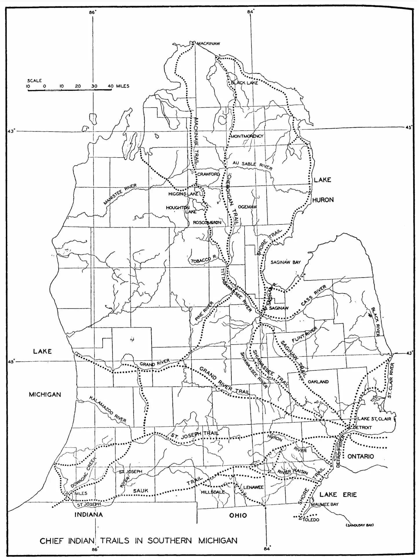
The St. Joseph Indian Trail connected with the Great Trail, from Chesapeake Bay on the Atlantic Seaboard to the Mississippi River and the Plains States to the west. The Great Trail connected with Michigan trails from Toledo to Detroit, and up to Lake Huron. [3]

The trails were used by fur traders, explorers, and missionaries to travel into the frontier. The roads were improved and widened for pack horses and settlers. [3] Initially, branches and bushes were cleared, making the trails two to three feet wide to allow room for pack horses. Then, the trails were further widened for oxen-drawn wagons. [3] Federal funds were appropriated to improve the roads, which involved cutting down trees and filling in swampy and low areas. Traveling by wagon was slow, particularly after the roads developed ruts. Later improvements were gravel and then paved roads. [3]

History

Along the route, local and state historical markers tell of its historical significance. [1] It was initially a path used by Native Americans. It then became a muddy wagon trail. [1] Michigan Territory's legislative council voted to survey land for a route from the east to the west side of the territory in 1829, [5] following the St. Joseph Indian Trail. The road began at Sheldon Inn at the corner of what is now Michigan Avenue and Geddes Road (named for Washtenaw County settlers Robert and John Geddes) and ended at its western-most point at the mouth of the St. Joseph River at Lake Michigan. [6] It was initially called the St. Joseph Road. [3]

Corduroy road Corduroyroad.jpg
Corduroy road

Construction of the road began in 1830, when settlers of Eastern Michigan began to use the road. The survey was completed by 1831. [6] Father Gabriel Richard, a delegate to the United States Congress from 1823 to 1825, helped garner support for the road that would facilitate settlement in the state and provide a means for travel between Chicago and Detroit. [7] The federal government provided $20,000 (equivalent to $568,000in 2020 [8] ) to upgrade and complete the road, [6] to accommodate the weight of settler's wagons. [9] It was built of logs in a corduroy pattern. [10] It was declared a public highway on May 3, 1831, and soon after began to be called Territorial Road. [9] On May 30, 1834, the road was first used by a stagecoach line. In 1836, it would take three days to travel 80 miles (130 km) from Detroit to Jackson. Inns and taverns were built along the territorial road for travelers' convenience, and the road helped form communities in Wayne, Washtenaw, Jackson, Calhoun, Kalamazoo, Van Buren, and Berrien counties. Michigan Territory's population grew 250% from 1830 to 1840. [6]

Territorial Road was used by General William Henry Harrison and his troops during the War of 1812 to travel between Indiana and Detroit to attack the British in the Siege of Detroit. During World War I, it was designated a military route called the Red Arrow Highway. [11]

Historical markers

Historical markers were located east to west at:

Related Research Articles

<span class="mw-page-title-main">Wayne County, Michigan</span> County in Michigan, United States

Wayne County is the most populous county in the U.S. state of Michigan. As of 2020, the United States Census placed its population at 1,793,561, making it the 19th-most populous county in the United States. The county seat is Detroit. The county was founded in 1796 and organized in 1815. Wayne County is included in the Detroit-Warren-Dearborn, MI Metropolitan Statistical Area. It is one of several U.S. counties named after Revolutionary War-era general Anthony Wayne.

<span class="mw-page-title-main">Berrien County, Michigan</span> County in Michigan, United States

Berrien County is a county on the south line of Michigan, at the southwestern corner of the state. As of the 2020 Census, the population was 154,316. The county seat is St. Joseph.

<span class="mw-page-title-main">Ann Arbor Charter Township, Michigan</span> Charter township in Michigan, United States

Ann Arbor Charter Township is a charter township of Washtenaw County in the U.S. state of Michigan. The population was 4,361 at the 2010 census. The township borders the city of Ann Arbor and contains numerous exclaves, but the two are administered autonomously.

<span class="mw-page-title-main">Canton, Michigan</span> American township in Michigan

Canton, officially the Charter Township of Canton, is a charter township of Wayne County in the U.S. state of Michigan. As of the 2020 census, the township had a population of 98,659.

<span class="mw-page-title-main">Minnesota Territory</span> United States territory from 1849 to 1858, part of which became the state of Minnesota

The Territory of Minnesota was an organized incorporated territory of the United States that existed from March 3, 1849, until May 11, 1858, when the eastern portion of the territory was admitted to the Union as the State of Minnesota and western portion to the unorganized territory then the land shortly became the Dakota territory.

<span class="mw-page-title-main">Clinton–Kalamazoo Canal</span> United States historic place

The Clinton–Kalamazoo Canal is a canal in Michigan that was abandoned after being only partially completed. The canal was to connect Lake St. Clair with Lake Michigan. Project backers were inspired by the success of the Erie Canal in New York, which was completed in 1825. After gaining statehood in 1837, Michigan elected its first governor, Stevens Thomson Mason, who initiated an ambitious program of internal improvements, including three railroads and two canals. On March 21, 1837, the Legislature authorized Governor Mason to contract a loan for the construction of the canal from Mt. Clemens to Rochester, a railroad from Shelby to Detroit, a railroad from Detroit across the State and a railroad from Port Huron into the interior, to be known as the Port Huron & Grand River road. In the spring of 1838, a Board of Commissioners composed of seven men, was appointed to take charge of the canal work.

<span class="mw-page-title-main">M-1 (Michigan highway)</span> State highway in Michigan, United States

M-1, commonly known as Woodward Avenue, is a north–south state trunkline highway in the Metro Detroit area of the US state of Michigan. The highway, called "Detroit's Main Street", runs from Detroit north-northwesterly to Pontiac. It is one of the five principal avenues of Detroit, along with Michigan, Grand River, Gratiot, and Jefferson avenues. These streets were platted in 1805 by Judge Augustus B. Woodward, namesake to Woodward Avenue. The Federal Highway Administration (FHWA) has listed the highway as the Automotive Heritage Trail, an All-American Road in the National Scenic Byways Program. It has also been designated a Pure Michigan Byway by the Michigan Department of Transportation (MDOT), and was also included in the MotorCities National Heritage Area designated by the US Congress in 1998.

<span class="mw-page-title-main">M-5 (Michigan highway)</span> State highway in Michigan, United States

M-5, commonly referred to as Grand River Avenue and the northern section as the Haggerty Connector, is a 27.9-mile-long (44.9 km) state trunkline highway in the Metro Detroit area of the US state of Michigan. The highway runs through suburbs in Oakland and Wayne counties in addition to part of Detroit itself. It starts in Commerce Township as a north–south divided highway and freeway called the Haggerty Connector and connects with Interstate 96 (I-96) in Novi. The freeway then turns southeasterly to bypass the suburb of Farmington as an east–west highway. The freeway ends on the southeast side of Farmington, and M-5 follows Grand River Avenue as boulevard into Detroit. The eastern terminus is at the five-way intersection between Grand River Avenue, Cass Avenue, and Middle Street in Downtown Detroit, where it had been extended to in May 2016 from an interchange with I-96 on the northwest side of the city. The trunkline passes between suburban residential subdivisions and along urban commercial areas while serving 17,200–68,800 vehicles on average each day.

<span class="mw-page-title-main">U.S. Route 16 in Michigan</span> Former U.S. Highway in Michigan

US Highway 16 (US 16), also called Grand River Avenue for much of its length in the state, was one of the principal roads prior to the post-World War II construction of freeways in the state of Michigan. Before the creation of the United States Numbered Highway System in 1926, the highway had been designated as a state highway numbered M-16. The modern route of Grand River Avenue cuts across the Lower Peninsula in a northwest–southeast fashion from near Grand Rapids to Detroit. Before the late 1950s and early 1960s, US 16 followed other roads between Muskegon and Grand Rapids, and then Grand River Avenue through Lansing to Detroit. In the years immediately preceding the creation of the Interstate Highway System, US 16 was shifted from older roads to newer freeways. Later, it was co-designated as an Interstate. When the gap in the freeway was filled in around Lansing, the US 16 designation was decommissioned in the state. The freeway was solely designated Interstate 96 (I-96) east of Grand Rapids and I-196 west of that city.

There are many historic trails and roads in the United States which were important to the settlement and development of the United States including those used by American Indians.

<span class="mw-page-title-main">Fort Kearny</span> United States historic place

Fort Kearny was a historic outpost of the United States Army founded in 1848 in the western U.S. during the middle and late 19th century. The fort was named after Col. and later General Stephen Watts Kearny. The outpost was located along the Oregon Trail near Kearney, Nebraska. The town of Kearney took its name from the fort. The "e" was added to Kearny by postmen who consistently misspelled the town name. A portion of the original site is preserved as Fort Kearny State Historical Park by the Nebraska Game and Parks Commission.

<span class="mw-page-title-main">Gabriel Richard</span> American priest and politician


Gabriel Richard October 15, 1767 – September 13, 1832, was a French Roman Catholic priest who ministered to the French Catholics in the parish of Sainte Anne de Détroit, as well as Protestants and Native Americans living in Southeast Michigan. He established schools, a library, and vocational training with weaving looms. After Detroit was nearly destroyed by a fire in 1805, he and others created a new layout for the city. His motto following the fire, Speramus meliora; resurget cineribus is inscribed on the Seal of the City of Detroit.

<span class="mw-page-title-main">U.S. Route 12 in Michigan</span> U.S. Highway in Michigan

US Highway 12 (US 12) is an east–west US Highway that runs from Aberdeen, Washington, to Detroit, Michigan. In Michigan it runs for 210 miles (338 km) between New Buffalo and Detroit as a state trunkline highway and Pure Michigan Byway. On its western end, the highway is mostly a two-lane road that runs through the southern tier of counties roughly parallel to the Indiana state line. It forms part of the Niles Bypass, a four-lane expressway south of Niles in the southwestern part of the state, and it runs concurrently with the Interstate 94 (I-94) freeway around the south side of Ypsilanti in the southeastern. In between Coldwater and the Ann Arbor area, the highway angles northeasterly and passes the Michigan International Speedway. East of Ypsilanti, US 12 follows a divided highway routing on Michigan Avenue into Detroit, where it terminates at an intersection with Cass Avenue.

<span class="mw-page-title-main">Ida, Michigan</span> Census-designated place & unincorporated community in Michigan, United States

Ida is an unincorporated community and census-designated place (CDP) in Monroe County in the U.S. state of Michigan. The CDP had a population of 790 at the 2020 census. The community is mostly within Ida Township with a smaller portion extending north into Raisinville Township.

<span class="mw-page-title-main">Michigan State Trunkline Highway System</span> Highway system in Michigan

The State Trunkline Highway System consists of all the state highways in Michigan, including those designated as Interstate, United States Numbered, or State Trunkline highways. In their abbreviated format, these classifications are applied to highway numbers with an I-, US, or M- prefix, respectively. The system is maintained by the Michigan Department of Transportation (MDOT) and comprises 9,669 miles (15,561 km) of trunklines in all 83 counties of the state on both the Upper and Lower peninsulas, which are linked by the Mackinac Bridge. Components of the system range in scale from 10-lane urban freeways with local-express lanes to two-lane rural undivided highways to a non-motorized highway on Mackinac Island where cars are forbidden. The longest highway is nearly 400 miles (640 km) long, while the shortest is about three-quarters of a mile. Some roads are unsigned highways, lacking signage to indicate their maintenance by MDOT; these may be remnants of highways that are still under state control whose designations were decommissioned or roadway segments left over from realignment projects.

In the history of the American frontier overland trails were built by pioneers throughout the 19th century and especially between 1829 and 1870 as an alternative to sea and railroad transport. These immigrants began to settle much of North America west of the Great Plains as part of the mass overland migrations of the mid-19th century. Settlers emigrating from the eastern United States were spurred by various motives, among them religious persecution and economic incentives, to move to destinations in the far west via routes including the Oregon Trail, California Trail, and Mormon Trail. After the end of the Mexican–American War in 1849, vast new American conquests again enticed mass immigration. Legislation like the Donation Land Claim Act and significant events like the California Gold Rush further lured people to travel overland to the west.

<span class="mw-page-title-main">Sheldon Inn</span> Historic inn in Michigan, United States

The Sheldon Inn was a two-story apartment building located at 44134 Michigan Avenue, in Sheldon Corners in Canton Township, Michigan. It was built in 1825, and previously used as a single-family home and a travelers' inn. It was listed on the National Register of Historic Places in 2000. It was demolished in 2021.

The Fort Walla Walla–Fort Colville Military Road was built in June 1859 to connect the Walla Walla area with its fairly easy access to the Columbia River to the mountainous area of the Huckleberry and Selkirk Mountains of current Northeast Washington and the Inland Northwest. Brigadier General William S. Harney, commander of the Department of Oregon, opened up the district north of the Snake River to settlers in 1858 and ordered Brevet Major Pinkney Lugenbeel, 9th Infantry Regiment to establish a U.S. Army post to restrain the Indians perceived as hostile to the U.S. Army's Northwest Division and to protect miners who traveled to the area after first reports of gold in the area appeared in Western Washington newspapers in July 1855.

<span class="mw-page-title-main">Mojave Road (Los Angeles)</span> California Historic Landmark

The Mojave Road Los Angeles was designated a California Historic Landmark on March 19, 1985. It runs from Drum Barracks in Los Angeles County to the Colorado River in San Bernardino County, California

<span class="mw-page-title-main">Mooreville, Michigan</span> Unincorporated community in Michigan, United States

Mooreville is an unincorporated community in Washtenaw County in the U.S. state of Michigan. The community is located within York Township. As an unincorporated community, Mooreville has no legally defined boundaries or population statistics of its own.

References

  1. 1 2 3 4 Carlson, Chuck (June 27, 2015). "Biker finds Territorial's a long and winding road". Battle Creek Enquirer. Retrieved March 4, 2022.
  2. 1 2 "Sheldon's Corners Historical Marker". Historical Marker Database. Retrieved March 4, 2022.
  3. 1 2 3 4 5 6 7 Mason, Philip P. (January 12, 1987). "Indians started roads: from paths to freeways" (PDF). Sentinel-Standard. Ionia, Michigan. Archived from the original (PDF) on April 22, 2022. Retrieved March 5, 2022 via Michigan Department of Transportation.
  4. 1 2 "Sled dogs earned their keep in Michigan's earliest years". Lansing State Journal. February 22, 1987. p. 8D. Retrieved March 5, 2022 via Newspapers.com.
  5. State of Michigan (1874). Laws of the Territory of Michigan. Vol. 2. W.S. George & Co. p. 744. Be it enacted by the Legislative Council of the Territory of Michigan, That there shall be a territorial road laid out and established commencing in the Chicago Road, at or near the Inn of Timothy S. Sheldon, in the township of Plymouth, in the county of Wayne, thence west on the most direct and eligible route, through the village of Ann Arbor, by Samuel Clements' to Grand River, where the St. Joseph Trail crosses the same, and also through the Coghwagiac and Grand praries, thence westerly on the most eligible route to, or near the Paw Paw, to the mouth of the St. Joseph River of Lake Michigan...
  6. 1 2 3 4 5 "Territorial Road Historical Marker". Historical Marker Database. Retrieved March 4, 2022.
  7. "Richard, Father Gabriel". Detroit Historical Society. Retrieved March 5, 2022.
  8. Johnston, Louis; Williamson, Samuel H. (2022). "What Was the U.S. GDP Then?". MeasuringWorth. Retrieved February 12, 2022. United States Gross Domestic Product deflator figures follow the Measuring Worth series.
  9. 1 2 3 Passic, Frank (June 24, 2007). "Territorial Road". Morning Star. p. 3. Retrieved March 4, 2022 via www.albionmich.com.
  10. Meier, Eric. "Construction Project Unearths Oldest Road in Southwest Michigan". WRKR. Retrieved March 4, 2022.
  11. Wyatt, Ken (October 23, 2010). "Peek through time: St. Joseph Trail played an important part in the settlement of Jackson". Jackson Citizen Patriot. Retrieved March 5, 2022 via MLive.
  12. "Father Gabriel Richard". The Historical Marker Database. Retrieved March 5, 2022.
  13. "Historical Marker - S163 - Territorial Road (Marker ID#:S163)" (PDF). Michigan Department of Natural Resources.

Coordinates: 42°16′29″N83°28′29″W / 42.27472°N 83.47472°W / 42.27472; -83.47472