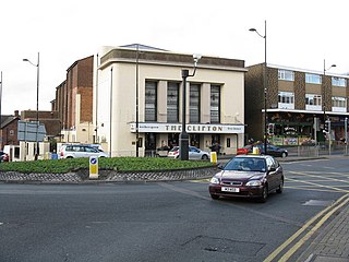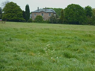
Willenhall is a historic market town and civil parish in the Metropolitan Borough of Walsall, in the West Midlands, England, with a population taken at the 2011 census of 28,480. It is situated between Wolverhampton and Walsall, historically in the county of Staffordshire. It lies upon the River Tame, and is part of the Black Country.

Sedgley is a town in the north of the Metropolitan Borough of Dudley, in the West Midlands, England.

Ye Olde Fighting Cocks is a public house in St Albans, Hertfordshire, England. It is one of several pubs that lay claim to being the oldest in England, claiming to have been in business since 793 AD. The pub was once recognized as the oldest in England by the Guinness World Records, but this title was wrested in 2000. The building is described by Historic England as being of 16th-century appearance, but as the earliest date for which it can be proved to have been licensed is 1756, and even that date is not certain, its claim to this record is somewhat uncertain. Others such as the Ye Olde Man & Scythe in Bolton, Greater Manchester, and Ye Olde Trip to Jerusalem in Nottingham may have better claims. Even in St Albans, the White Hart and the Fleur de Lys are believed to have been trading as inns in the late medieval period.

Stoke-on-Trent railway station is a mainline railway station serving the city of Stoke-on-Trent, on the Stafford to Manchester branch of the West Coast Main Line. It also provides an interchange between local services running through Cheshire, Staffordshire and Derbyshire.

Madeley is a village and ward in the Borough of Newcastle-under-Lyme, North Staffordshire, England. It is split into three parts: Madeley, Middle Madeley, and Little Madeley. Madeley Heath is also considered by many to be part of Madeley. In the 2001 census, the population was recorded as 4,386, decreasing to 4,222 at the 2011 Census.
Colton is a village and civil parish in Lichfield District, Staffordshire, England. It is situated just outside the town of Rugeley off the B5013 road which heads towards Uttoxeter to the north.
Holden's Brewery is a family-run English regional brewery. It was founded in 1915 at the Park Inn in Woodsetton, Dudley, in the West Midlands.

Ford Green Hall is a Grade II* listed farmhouse and historic house museum in Stoke-on-Trent, Staffordshire. The oldest parts of the house date from the late 16th century, with one wing being either added or greatly repaired at some point in the early 18th century. In its grounds, there also stands an 18th-century dovecote which shares the listed building status of the main farmhouse.
Stourton is a hamlet in Staffordshire, England a few miles to the northwest of Stourbridge. There is a fair amount of dispute over the pronunciation, being pronounced 'stower-ton', 'stir-ton' or 'store-ton' by different people from the area. The nearest sizeable villages are Wollaston and Kinver, the nearest hamlets are Prestwood and Dunsley. It lies on the River Stour. The Staffordshire and Worcestershire Canal and Stourbridge Canal meet at Stourton Junction, which places Stourton on the Stourport Ring, a navigable waterway popular with narrowboat holidaymakers.

Longport is an area of Stoke-on-Trent, England. It is the location for Longbridge Hayes industrial estate.

Wolverhampton is a city and metropolitan borough in the West Midlands, England. The population was 263,700 in 2021. People from the city are called "Wulfrunians". The city is located 12 miles (19 km) north-west of Birmingham.

Stoke is a former civil parish, now in the parish of Stoke and Hurleston, in the unitary authority area of Cheshire East and the ceremonial county of Cheshire, England. The parish was predominantly rural with a total population of around 200, measured with the inclusion of Hurleston at 324 in the 2011 Census. The largest settlement was Barbridge, which lies 3½ miles to the north west of Nantwich. The parish also included the small settlements of Stoke Bank and Verona. Nearby villages include Aston juxta Mondrum, Burland, Calveley, Haughton, Rease Heath and Wardle.

Warslow is a small village in Staffordshire, England. It is located in the Peak District National Park about 10 miles (16 km) north of Ashbourne. Although in the county of Staffordshire, the village lies close to the Derbyshire border, and has a Stockport postal code (SK), but the address is Warslow, Buxton, Derbyshire. Warslow has a public house, The Greyhound Inn circa 1750s 6 ensuite rooms for guests, Fresh food, music and cask Ales. Dogs welcome.

Stoke sub Hamdon Priory is a complex of buildings and ruins which initially formed a 14th-century college for the chantry chapel of St Nicholas, and later was the site of a farm in Stoke-sub-Hamdon, Somerset, England. The only building remaining from the college is a great hall and attached dwelling, dating from the late 15th century. The hall is designated by English Heritage as a Grade I listed building, while the outbuildings and gateway are Grade II listed. The whole site has been scheduled as an ancient monument. A number of the farm buildings are in poor condition, and have been added to the Heritage at Risk Register.

Trysull is a rural village in the county of Staffordshire, England approximately five miles south-west of Wolverhampton. With the adjacent village of Seisdon, it forms the civil parish of Trysull and Seisdon, within the South Staffordshire non-metropolitan district. Until 1974 it formed part of Seisdon Rural District. The 2011 census recorded a usually resident population for the parish of Trysull & Seisdon of 1,150 persons in 455 households.

Leigh is a civil parish in the English county of Staffordshire. The parish includes the village of Church Leigh, together with the settlements of Withington, Upper Leigh, Lower Leigh, Morrilow Heath, Middleton Green, Dodsley, Godstone, Nobut and Field.

Amington Hall is an early-19th-century former country house at Amington, near Tamworth, Staffordshire which has been converted into residential apartments.

Oulton is a small village in the English county of Staffordshire. The village is located north of the market town of Stone and near to the Trent and Mersey Canal. In 2020 it had an estimated population of 597.
Stow Heath is an area and ancient manor in the city of Wolverhampton, West Midlands, located in the east half of the city.

Chell is a suburb of the city of Stoke-on-Trent in the ceremonial county of Staffordshire, England, that can be subdivided into Little Chell, Great Chell and Chell Heath. It lies on the northern edge of the city, approximately 1-mile (1.6 km) from Tunstall, 2 miles (3.2 km) from Burslem and 3 miles (4.8 km) from the county border with Cheshire. Chell borders Pitts Hill to the west, Tunstall to the south west, Stanfield and Bradeley to the south, with the outlying villages of Packmoor and Brindley Ford to the north and Ball Green to the east. Since 2011 the area has been divided into the electoral wards of Bradeley & Chell Heath, Great Chell & Packmoor and Little Chell & Stanfield.


