
Lake Ontario is one of the five Great Lakes of North America. It is bounded on the north, west, and southwest by the Canadian province of Ontario, and on the south and east by the U.S. state of New York. The Canada–United States border spans the centre of the lake.

The Don River is a watercourse in southern Ontario that empties into Lake Ontario, at Toronto Harbour. Its mouth was just east of the street grid of the town of York, Upper Canada, the municipality that evolved into Toronto, Ontario. The Don is one of the major watercourses draining Toronto that have headwaters in the Oak Ridges Moraine.

The Humber River is a river in Southern Ontario, Canada. It is in the Great Lakes Basin, is a tributary of Lake Ontario and is one of two major rivers on either side of the city of Toronto, the other being the Don River to the east. It was designated a Canadian Heritage River on September 24, 1999.

Halton Hills is a town in the Regional Municipality of Halton, located in the northwestern end of the Greater Toronto Area, Ontario, Canada with a population of 61,161 (2016).

Whitchurch-Stouffville is a town in the Greater Toronto Area of Ontario, Canada, approximately 50 km (31 mi) north of downtown Toronto, and 55 km (34 mi) north-east of Toronto Pearson International Airport. It is 206.22 km2 (79.62 sq mi) in area, and located in the mid-eastern area of the Regional Municipality of York on the ecologically-sensitive Oak Ridges Moraine. Its motto since 1993 is "country close to the city".

The Oak Ridges Moraine is an ecologically important geological landform in the Mixedwood Plains of south-central Ontario, Canada. The moraine covers a geographic area of 1,900 square kilometres (730 sq mi) between Caledon and Rice Lake, near Peterborough. One of the most significant landforms in southern Ontario, the moraine gets its name from the rolling hills and river valleys extending 160 km (99 mi) east from the Niagara Escarpment to Rice Lake, formed 12,000 years ago by advancing and retreating glaciers during the last glaciation period. Below the approximately 200 meter thick glacial derived sediments of the moraine lies thick bedrock successions of Precambrian rocks and up to 200 meters of Ordovician aged rock, capped by a regional unconformity of erosion and non-deposition to the Quaternary period. Rivers and lakes scatter the landscape and are important for creating habitat for the rich diversity of species of animals, trees and shrubbery. These are also the supply of fresh water to aquifers in the moraine through complex subterranean connections. Construction development nearby, and with expansion of communities around the moraine in need of potable water, it is a contested site in Ontario, since it stands in the path of major urban development. This region has been subject to multiple decades of scientific research to study the origins of formation, and how early communities used the land. A larger focus currently is how to source potable water without removing the aquifer entirely.

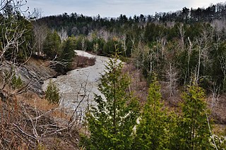
The Rouge River is a river in Markham, Pickering, Richmond Hill and Toronto in the Greater Toronto Area of Ontario, Canada. The river flows from the Oak Ridges Moraine to Lake Ontario at the eastern border of Toronto, and is the location of Rouge Park, the only national park in Canada within a municipality. At its southern end, the Rouge River is the boundary between Toronto and southwestern Pickering in the Regional Municipality of Durham.

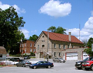
Lanark County is a county located in the Canadian province of Ontario. Its county seat is Perth, which was first settled in 1816.

The Crowe River is a river in the counties of Haliburton, Hastings, Northumberland and Peterborough in southern Ontario, Canada. It is in the Lake Ontario drainage basin and is a tributary of the Trent River.
Marmora is the largest community in the Municipality of Marmora and Lake in Hastings County, Ontario, Canada. It is located on the Crowe River and along Highway 7 between Havelock to the west and Madoc to the east, about the halfway point between Ottawa and Toronto.

The Southern Laurentian Channel is an ancient underground river in southern Ontario, Canada. The river predates the recent ice ages. The river valley was filled with glacial debris. Water still flows down this old valley—underground. The source of the aquifer is the Georgian Bay, approximately 200 kilometres (120 mi) away.
Pottageville is an unincorporated community located in northeastern King Township, in Ontario, Canada. It is near Schomberg. It is named for one of its early settlers, Edward Pottage.
The Toronto and Region Conservation Authority (TRCA) is a conservation authority in southern Ontario, Canada. It owns about 16,000 hectares of land in the Toronto region, and it employs more than 400 full-time employees and coordinates more than 3,000 volunteers each year. TRCA's area of jurisdiction is watershed-based and includes 3,467 square kilometers – 2,506 on land and 961 water-based in Lake Ontario. This area comprises nine watersheds from west to east – Etobicoke Creek, Mimico Creek, Humber River, Don River, Highland Creek, Petticoat Creek, Rouge River, Duffins Creek and Carruthers Creek.
A conservation authority is a local, community-based natural resource management agency based in Ontario, Canada. Conservation authorities represent groupings of municipalities on a watershed basis and work in partnership with other agencies to carry out natural resource management activities within their respective watersheds, on behalf of their member municipalities and the Province of Ontario.
Rouge National Urban Park is a national urban park in Ontario, Canada. The park is centred around the Rouge River and its tributaries in the Greater Toronto Area. The southern portion of the park is situated around the mouth of river in Toronto, and extends northwards into Markham, Pickering, Uxbridge, and Whitchurch-Stouffville.
Charles Joseph Sauriol, was a Canadian naturalist who was responsible for the preservation of many natural areas in Ontario and across Canada. He owned property in the Don River valley and was an advocate for the valley's preservation. As a member of the Metropolitan Toronto and Region Conservation Authority, he was responsible for much of the Don Valley's conservation. A section of the valley is a conservation reserve named in his honour and four other locations in Canada are named in his honour.

Conservation Ontario is the umbrella organization which represents all of the conservation authorities in Ontario. Conservation Ontario is the network of Ontario’s 36 Conservation Authorities.

North Kawartha is a township in northern Peterborough County, Ontario, Canada.
The Toronto ravine system is a distinctive feature of the city's geography, consisting of a network of deep ravines, which forms a large urban forest that runs through most of Toronto. The ravine system is the largest in any city in the world, with the Ravine and Natural Feature Protection Bylaw protecting approximately 110 square kilometres (42 sq mi) of public and privately-owned land. The ravine system has been presented as a central characteristic of the city, with the size of the ravine system leading Toronto to be described as "a city within a park".

The Toronto waterway system comprises a series of natural and man-made watercourses in the Canadian city of Toronto. The city is dominated by a large river system spanning most of the city including the Don River, Etobicoke Creek, Highland Creek, Humber River, Mimico Creek and Rouge River.


