
Llansteffan Castle is a privately owned castle in Llansteffan, Carmarthenshire, Wales, overlooking the River Tywi estuary in Carmarthen Bay.

Moel y Gaer is an Iron Age hillfort at the northern end of the Clwydian Range, located on a summit overlooking the valley of the River Wheeler, near the village of Bodfari, Denbighshire, Wales, five miles north-east of Denbigh. The site is a scheduled monument, classified as a prehistoric defensive hillfort.

Moel y Gaer, also known as Moel-y-Gaer Camp or Moel y Gaer Hillfort, is an Iron Age hillfort located on a western spur of the Clwydian Range, near the village of Llanbedr, Denbighshire, Wales. The site is a scheduled monument, classified as a prehistoric defensive hillfort.

Burfa Castle is an Iron Age hillfort near the tiny town of Old Radnor, Radnorshire in Powys, Wales. The site is a scheduled monument described as a prehistoric defensive hillfort, and was included in an inventory of monuments by 1913. The site is near Offa's Dyke which passes near the bottom of Burfa Bank.

Gaer hillfort is a Celtic Iron Age hillfort near Trellech in Monmouthshire, Wales.

Tref Alaw is a community in Anglesey, north Wales. The community takes in the area west and south west of the Llyn Alaw, a man made reservoir which is also the largest body of water on the island. The community consists of a wide network of dispersed farms, and five settlements. Two small villages, close to each other in the centre of the community area are Llanddeusant and Elim. Llantrisant is a hamlet a mile or so to the south-west of Elim. In the north west is the small village of Llanbabo, and in the far south is the tiny hamlet of Llechgynfarwy, of which the principal building is St Cynfarwy's Church. At the 2001 census the community had a population of 606 inhabitants, reducing to 581 at the 2011 census.

Ceredigion is a large rural county in West Wales. It has a long coastline of Cardigan Bay to the west and the remote moorland of the Cambrian Mountains in the east, with the mountainous terrain of Plynlimon in the northeast. Ceredigion has a total of 264 Scheduled monuments. That is too many to have on a single list page, so for convenience the list is divided into two, 163 prehistoric sites and 101 Roman, Medieval and Post Medieval sites.
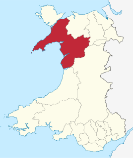
Gwynedd is a large rural county in North Wales. The northern half includes the high mountains of Snowdonia and the mixed farmland and hills of the Llŷn peninsula, which between them make up much of the former county of Caernarfonshire. The southern part of Gwynedd is the softer coastal and upland landscapes of the former county of Merionethshire. Gwynedd, the second-largest county in Wales, has a total of 497 scheduled monuments. That is too many to have on a single list article, so for convenience the list is divided into three. The 365 prehistoric sites are in two lists, covering 171 sites in former Merionethshire, and 194 sites in former Caernarvonshire. The 132 sites dating from Roman to modern times are included in a single list covering the whole of the county. Gwynedd is a unitary authority comprising most of the two historic counties. In 1974 it also merged with Anglesey, and the merged county was also called Gwynedd. Since 1996 Anglesey has been a separate county again.
