Oak Island is a privately owned island in Lunenburg County on the south shore of Nova Scotia, Canada. The tree-covered island is one of several islands in Mahone Bay, and is connected to the mainland by a causeway. The nearest community is the rural community of Western Shore which faces the island, while the nearest village is Chester. The island is best known for various theories about buried treasure or historical artifacts, and the associated attempts to explore the site.

Lunenburg is a port town on the South Shore of Nova Scotia, Canada. Founded in 1753, the town was one of the first British attempts to settle Protestants in Nova Scotia.

Bridgewater is a town in Lunenburg County, Nova Scotia, Canada, at the navigable limit of the LaHave River. With a 2021 population of 8,790, Bridgewater is the largest town in the South Shore region.

Mahone Bay is a town on the northwest shore of Mahone Bay along the South Shore of Nova Scotia in Lunenburg County. A long-standing picturesque tourism destination, the town has recently enjoyed a growing reputation as a haven for entrepreneurs and business startups. The town has the fastest growing population of any municipality in Nova Scotia according to the 2016 census, experiencing 9.9% population growth.
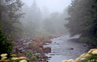
Petite Rivière is a rural community on Route 331 in Lunenburg County on the South Shore of Nova Scotia in Canada. It was formerly known as Petite Rivière Bridge.

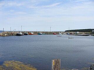
Riverport is a village in Lunenburg County, Nova Scotia, Canada. The harbour of Ritcey Cove is free from shoals and safe from every wind, considered one of the finest in North America. Riverport is a five-minute drive to several public beaches including Hirtle's Beach, Kingsburg Beach, Oxner Beach, Rose Bay Beach and Spindler Beach.

The Halifax and South Western Railway was a historic Canadian railway operating in the province of Nova Scotia.
The Aspotogan Peninsula is a peninsula in the eastern part of Lunenburg County, Nova Scotia, separating St. Margarets Bay in the east from Mahone Bay in the west. The peninsula was originally settled by second generation French immigrants on the east side and by second generation German immigrants on the west side. Traditionally fishing was a major industry for communities throughout the peninsula, however other primary industries such as farming and forestry were historically important as well. Shipping and shipbuilding were secondary and tertiary industries that also came into prominence during the 19th and early 20th centuries.

The Eastern Shore is a region of the Canadian province of Nova Scotia. It is the Atlantic coast running northeast from Halifax Harbour to the eastern end of the peninsula at the Strait of Canso.

Route 332 is a collector road in the Canadian province of Nova Scotia. It is located in Lunenburg County, connecting Bridgewater at Trunk 3 with Lunenburg at Trunk 3. It is commonly referred to residences as Riverport Road as the village appears on all major road signage in the county.

The Municipality of the District of Chester is a Nova Scotia district municipality occupying the northeastern half of Lunenburg County, Canada.

Nova Scotia is a province located in Eastern Canada fronting the Atlantic Ocean. One of the Maritime Provinces, Nova Scotia's geography is complex, despite its relatively small size in comparison to other Canadian provinces.

Cape Chignecto Provincial Park is a Canadian provincial park located in Nova Scotia. A wilderness park, it derives its name from Cape Chignecto, a prominent headland which divides the Bay of Fundy with Chignecto Bay to the north and the Minas Channel leading to the Minas Basin to the east. The park, which opened in 1998, is the largest provincial park in Nova Scotia. It also anchors one end of the UNESCO Cliffs of Fundy Global Geopark.
New Ross is a community in the Canadian province of Nova Scotia, located in the Chester Municipal District. It is home to Ross Farm Museum, a living history agricultural museum. Some localities of New Ross have colloquial names, including Charing Cross, Seffernville, Harriston, Aaldersville, the Forties Settlement, Mill Road, Leville, New Russell, Lake Ramsay, and Fraxville.
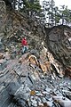
Feltzen South is a small village in Nova Scotia, Canada and features The Ovens Natural Park. The community is located in the Lunenburg Municipal District in Lunenburg County.

The Raid on Lunenburg occurred during the French and Indian War when Mi'kmaq and Maliseet fighters attacked a British settlement at Lunenburg, Nova Scotia on May 8, 1756. The native militia raided two islands on the northern outskirts of the fortified Township of Lunenburg, Rous Island, and Payzant Island. According to French reports, the Raiding party killed twenty settlers and took five prisoners. This raid was the first of nine the Natives and Acadians would conduct against the peninsula over a three-year period during the war. The Wabanaki Confederacy took John Payzant and Lewis Payzant prisoner, both of whom left written account of their experiences.
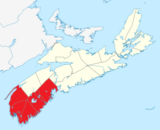
Southern Nova Scotia or the South Shore is a region of Nova Scotia, Canada. The area has no formal identity and is variously defined by geographic, county and other political boundaries. Statistics Canada, defines Southern Nova Scotia as an economic region, composed of Lunenburg County, Queens County, Shelburne County, Yarmouth County, and Digby County. According to Statistics Canada, the region had the highest decrease of population in Canada from 2009 to 2010, with a population decrease of 10.2 residents per thousand. The region also has the second-highest median age in Canada at 47.1 years old.

Gold mining has been a part of Nova Scotia's heritage for 150 plus years and continues to this day. Over a million ounces of gold have been produced in the province since mining began in 1861. Although not as well known as the gold rushes of California, the Klondike, Australia, and South Africa, three distinct rushes resulted in an economic boom in the province and saw the birth and sometimes demise of many new communities.

The Eastern Shore is a tourism region of the province of Nova Scotia, Canada. It provides two percent of the revenue for the province's tourism economy. One of its key features is an archipelago known as the 100 Wild Islands area.