
Heanor (/ˈhiːnə/) is a town in the Amber Valley district of Derbyshire in the East Midlands of England. It lies 8 miles (13 km) north-east of Derby and forms, with the adjacent village of Loscoe, the civil parish and town council-administered area of Heanor and Loscoe, which had a population of 17,251 in the 2011 census.

Beeley is a village and civil parish in northern Derbyshire, England. Located near Bakewell in the Derbyshire Dales, it is situated on the B6012 road, between Rowsley and Edensor. The civil parish population at the 2011 Census was 195.
Ault Hucknall is a village and civil parish in the Bolsover district of Derbyshire, England. The population of the civil parish at the 2011 census was 1,053.

Barlow is a village and civil parish in the North East Derbyshire district of Derbyshire, England. According to the 2001 census the parish had a population of 884, increasing to 920 at the 2011 Census. The village is about 4 miles north-west of Chesterfield.
Wessington is a village and civil parish in the English county of Derbyshire. The population of the civil parish at the 2011 census was 576. It is in the North East Derbyshire district of the county. It is near to the towns of Matlock, Alfreton and the village of Brackenfield. Situated 740 ft above sea level.
Shirley is a small village and civil parish in Derbyshire, 4 miles (6 km) south-east of Ashbourne. The population of the civil parish as taken at the 2011 Census was 270. It is situated in the countryside on top of a small hill.

Stanton by Bridge is a village and civil parish in the English county of Derbyshire. The population of the civil parish at the 2011 census was 246.
Netherseal is a village and civil parish in the English county of Derbyshire, situated in the South Derbyshire district. Together with neighbouring Lullington it is the southernmost village in the county. The population of the civil parish as of the 2011 census was 923.

Beckermet is a village and civil parish in Cumbria, England, between Egremont and Seascale. The parish had a population of 1,619 in the 2011 census.

Sudbury is a village and civil parish in Derbyshire, England, located about 9 miles (14 km) south of Ashbourne. It is part of the Derbyshire Dales district. The population as recorded at the 2001 Census was 976, increasing to 1,010 at the 2011 Census. The £0.5m A50 bypass opened in 1972. The parish includes the hamlets of Aston, Aston Heath, Dalebrook and Oaks Green.

Newhall is a suburban settlement located in Swadlincote, South Derbyshire, England. As of the 2011 census it had a population of 776. The village of Stanton is nearby.

Higher Hurdsfield is a village and civil parish in the unitary authority of Cheshire East and the ceremonial county of Cheshire, England. It has a population of around 300, increasing at the 2011 Census to 717, and is situated on the eastern outskirts of Macclesfield, approximately 7 miles (11 km) from the border of Derbyshire and Cheshire. The nearest village is Rainow.

Stretton is a small village and civil parish in Derbyshire, England. The population of the civil parish as at the 2011 Census was 525. It is located near the towns of Clay Cross and three and a half miles from Alfreton on the A61. The nearest waterways are the River Amber and Smithy Brook. Since 1964, Stretton has been beside Ogston Reservoir which still has the remains of a pub and a light railway within its depths.
Hulland Ward is a village and civil parish in the Derbyshire Dales district of Derbyshire roughly 6 miles west of Belper, Derbyshire England on the A517 road. The parish includes the hamlets of Biggin, Nether Biggin and Millington Green. Hulland Ward itself contains about 400 houses and has a population of just under 1000 inhabitants, being measured at 927 in the 2011 Census.

Foston and Scropton is a civil parish in the Dove valley in South Derbyshire. It includes the village of Scropton and hamlet of Foston. The population of the civil parish at the 2001 Census was 728 increasing to 854 at the 2011 Census.
Charlesworth is a village and civil parish near Glossop, Derbyshire, England. The population of the civil parish at the 2011 Census was 2,449. It is 2 miles (3.2 km) south-west of Glossop town centre and close to the borders of Greater Manchester with the nearby village of Broadbottom in Tameside. The parish church of St John the Baptist was built in 1848–49. The Congregational Chapel was rebuilt from an earlier chapel in 1797. The Baptist Chapel was built in 1835. Broadbottom Bridge, one end of which is in Cheshire, was built in 1683. Charlesworth holds an annual carnival on the second Saturday in July on its recreation ground on Marple Road, which includes fell races and other events.

Shipley is a village in the south-east of Derbyshire in the East Midlands of England. Since 1974 it has been part of the Borough of Amber Valley. The population of the civil parish as taken at the 2011 Census was 710.

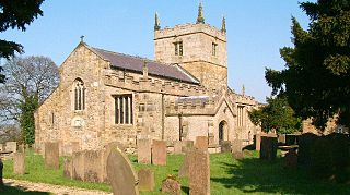
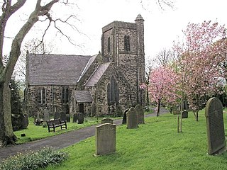
Stanton in Peak is a village in the Derbyshire Dales district of Derbyshire, It is about seven miles north-west of Matlock, on the north side of Stanton Moor, from Birchover. The name of the civil parish is Stanton with a population taken at the 2011 census of 365. There is a 19th-century parish church, and many stone houses, with mullion windows. There is also a stately home, Stanton Park, a combination of the English Classical style, and later Palladian alterations, which is a private house.
Chilcote is a village and civil parish in the North West Leicestershire district of Leicestershire, England. Until 1897 it was in Derbyshire. The parish had a population of 108 according to the 2001 census, including Stretton-en-le-Field and increasing to 200 at the 2011 census.

