Azerley is a hamlet and civil parish in the Harrogate district of North Yorkshire, England. It is about 4 miles (6 km) north-west of Ripon.

Bishop Thornton is a village in the civil parish of Bishop Thornton, Shaw Mills and Warsill, in the Harrogate district of North Yorkshire, England. According to the 2001 census it had a population of 521, decreasing to 507 at the 2011 census. The village is about seven miles north of Harrogate.
Brompton is a civil parish in the Scarborough district of North Yorkshire, England, containing the villages of Brompton-by-Sawdon and Sawdon.

Broughton is a village and civil parish in the former Craven District of North Yorkshire, England. The village is on the A59 road approximately 3 miles (5 km) west of Skipton.

Burton-on-Yore is a civil parish in the former Harrogate district of North Yorkshire, England, facing Masham across the River Ure. There is no village in the parish, but there are two hamlets, Low Burton and High Burton. The parish also includes Nutwith Cote on the west bank of the Ure, between Masham and Grewelthorpe. The population of the parish was estimated at 80 in 2012.

Burythorpe is a village and civil parish in North Yorkshire, England, about 4 miles (6 km) south of Malton. According to the 2001 census it had a population of 289, reducing marginally to 286 at the Census 2011. The Whitegrounds barrow is nearby.

Calton is a village and civil parish in the Craven district of North Yorkshire, England, on the River Aire in Airedale. In both the 2001 and 2011 Censuses the population was less than 100, so details were included in the civil parish of Flasby with Winterburn. In 2015, North Yorkshire County Council estimated the population of the village to be 60.

Yearsley is a small village and civil parish in the district of Hambleton in North Yorkshire, England. The population of the civil parish was less than 100 at the 2011 Census. Details are included in the civil parish of Brandsby-cum-Stearsby. It is situated between the market towns of Easingwold and Helmsley.

Leake is a hamlet and civil parish in the Hambleton district of North Yorkshire, England, about six miles north of Thirsk. The population of the parish was estimated at 10 in 2010. With the population in 2011 being less than 100 information is contained in the civil parish of Borrowby, Hambleton.

Firby is a small village and civil parish in North Yorkshire, England. It lies 1-mile (1.5 km) south of Bedale. The population of the parish was estimated at 30 in 2015. At the 2011 Census the population was included with the civil parish of Bedale, and not counted separately.

Felixkirk is a village and civil parish in the Hambleton District of North Yorkshire, England. The village is situated about three miles north-east of Thirsk. The population of the civil parish was estimated at 100 in 2014.

Ingleby Arncliffe is a village and civil parish in North Yorkshire, England. It is situated between the A172 and A19 roads, 6.5 miles (10.5 km) north-east from Northallerton and 7 miles (11.3 km) south-east from the small market town of Stokesley, and is on the edge of the North York Moors National Park. The village is conjoined to its smaller neighbour, Ingleby Cross. Ingleby Arncliffe lies in the historic county of the North Riding of Yorkshire.

Thornton Steward is a small village and civil parish in North Yorkshire, England, near Wensleydale, with a population of 100–200, measured at 199 in the 2011 Census. The name derives from Old English relating to a hawthorn tree on a farm and Steward. The village was formerly owned by Wymar, who was the steward of the Earls of Richmond. The village is very similar to the others that dot Wensleydale, but Thornton Steward has a reservoir owned by Yorkshire Water.

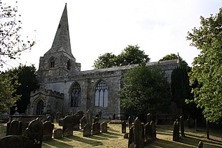
Oswaldkirk is a small village and civil parish 4 miles (6.4 km) south of Helmsley and 20 miles (32 km) north of York in North Yorkshire, England. It is named after the village church of St Oswald, King and Martyr, the Anglo-Saxon King of Northumbria who was slain by the pagan, Penda in 642. There was previously a Catholic church, dedicated to St Aidan, which closed in 2020. The population of the village as taken at the 2011 census was 230.

East Hauxwell or Hauxwell is a village and civil parish in North Yorkshire, England. It is located south of Catterick Garrison.

Speeton is a village in the civil parish of Reighton, in North Yorkshire, England. It lies near the edge of the coastal cliffs midway between Filey and Bridlington. It is North Yorkshire's easternmost settlement, but historically lay in the East Riding of Yorkshire until local government re-organisation in 1974. It was part of the Borough of Scarborough from 1974 until 2023.

Stonegrave is a village and civil parish in North Yorkshire, England. At the 2011 Census the population was less than 100 and so the details are included in the civil parish of Nunnington. By 2015, North Yorkshire County Council estimated the population as 110. It is situated in the Howardian Hills Area of Outstanding Natural Beauty (AONB) and 5 miles (8 km) south east of Helmsley on the Helmsley to Malton road.

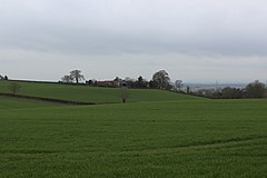
Normanby is a village and civil parish in the Ryedale district of North Yorkshire, England. It is about 4 miles (6.4 km) west of Pickering. It lies on the main road between Malton and Kirkbymoorside.

Seale is a village in Surrey, England. Seale covers most of the civil parish of Seale and Sands and the steep slope and foot of the south side of the Hog's Back as well as a large hill which exceeds it – as such is part of the Surrey Hills Area of Outstanding Natural Beauty.
St Martin's is a civil parish in North Yorkshire, England. It is located south of the town of Richmond, covering the residential areas south of the River Swale, including the former Richmond railway station and Holly Hill.