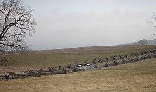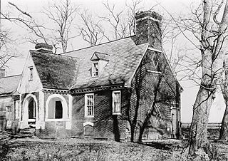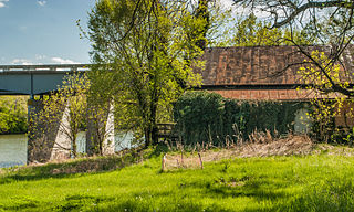
The Battle of South Mountain—known in several early Southern accounts as the Battle of Boonsboro Gap—was fought on September 14, 1862, as part of the Maryland Campaign of the American Civil War. Three pitched battles were fought for possession of three South Mountain passes: Crampton's, Turner's, and Fox's Gaps. Maj. Gen. George B. McClellan, commanding the Union Army of the Potomac, needed to pass through these gaps in his pursuit of Confederate General Robert E. Lee's precariously divided Army of Northern Virginia. Although the delay bought at South Mountain would allow him to reunite his army and forestall defeat in detail, Lee considered termination of the Maryland Campaign at nightfall.

The First Battle of Rappahannock Station, took place on August 23, 1862, at present-day Remington, Virginia, as part of the Northern Virginia Campaign of the American Civil War.

The Battle of Thoroughfare Gap, also known as Chapman's Mill, took place on August 28, 1862, in Fauquier County and Prince William County, Virginia, as part of the Northern Virginia Campaign of the American Civil War. Confederate forces under Maj. Gen. James Longstreet successfully drove back Union forces under Brig. Gen. James B. Ricketts and Col. Percy Wyndham, allowing his corps to unite with that of Thomas J. "Stonewall" Jackson prior to the Second Battle of Bull Run.

The Battle of Aldie took place on June 17, 1863, in Loudoun County, Virginia, as part of the Gettysburg Campaign of the American Civil War.

The Battle of Champion Hill of May 16, 1863, was the pivotal battle in the Vicksburg Campaign of the American Civil War (1861–1865). Union Army commander Maj. Gen. Ulysses S. Grant and the Army of the Tennessee pursued the retreating Confederate States Army under Lt. Gen. John C. Pemberton and defeated it twenty miles to the east of Vicksburg, Mississippi, leading inevitably to the Siege of Vicksburg and surrender. The battle is also known as Baker's Creek.

Antietam National Battlefield is a National Park Service-protected area along Antietam Creek in Sharpsburg, Washington County, northwestern Maryland. It commemorates the American Civil War Battle of Antietam that occurred on September 17, 1862.

Fredericksburg and Spotsylvania National Military Park is a unit of the National Park Service in Fredericksburg, Virginia, and elsewhere in Spotsylvania County, commemorating four major battles in the American Civil War: Fredericksburg, Chancellorsville, The Wilderness, and Spotsylvania.

Malvern Hill stands on the north bank of the James River in Henrico County, Virginia, USA, about eighteen miles southeast of Richmond. On 1 July 1862, it was the scene of the Battle of Malvern Hill, one of the Seven Days Battles of the American Civil War.

Buildings, sites, districts, and objects in Virginia listed on the National Register of Historic Places:

Cedar Creek and Belle Grove National Historical Park became the 388th unit of the United States National Park Service when it was authorized on December 19, 2002. The National Historical Park was created to protect several historically significant locations in the Shenandoah Valley of Northern Virginia, notably the site of the American Civil War Battle of Cedar Creek and the Belle Grove Plantation.

Leesylvania State Park is located in the southeastern part of Prince William County, Virginia. The land was donated in 1978 by philanthropist Daniel K. Ludwig, and the park was dedicated in 1985 and opened full-time in 1992.

Broad Run is a small, unincorporated community in Fauquier County, Virginia. It is on Bust Head Road just north of Interstate 66 and State Route 55, near the Prince William County line. Broad Run is named after the waterway that flows through the town. Broad Run has its own ZIP Code of 20137, and its post office serves a population of 1,510.

Thoroughfare Gap is a water gap in the Bull Run Mountains created by Broad Run between High Point Mountain to the north and Bisquit Mountain to the south. It is located on the border of Prince William and Fauquier counties in Virginia.

Bentonville Battlefield is a North Carolina state historic site at 5466 Harper House Road in Johnston County, North Carolina. It belongs to the North Carolina Department of Natural and Cultural Resources and is the site of the 1865 Battle of Bentonville, fought in the waning days of the American Civil War. It was declared a National Historic Landmark in 1996.

The Petersburg Breakthrough Battlefield is a historic district in Dinwiddie County, near Petersburg, Virginia. It was the location of the Third Battle of Petersburg, in which the Union Army broke through Confederate Army lines protecting Petersburg and Richmond on April 2, 1865, during the American Civil War. The success of the breakthrough led to abandonment of Richmond by General Robert E. Lee, a general retreat, and surrender at Appomattox Court House one week later. Portions of the area were listed on the National Register of Historic Places in 2003, and a different portion was designated a National Historic Landmark in 2006. Much of the battlefield area is part of Pamplin Historical Park, a private park open to the public that interprets the battle. The park includes a full-service visitor center, trails, displays, interpretive signs and history programs. The Civil War Trust and its partners have acquired and preserved 407 acres (1.65 km2) of the Breakthrough battlefield in five transactions since 2004.

Sayler's Creek Battlefield near Farmville, Virginia was the site of the Battle of Sayler's Creek of the American Civil War. Robert E. Lee's army was retreating from the Richmond to Petersburg line. Here, on April 6, 1865, Union General Philip Sheridan cut off and beat back about a quarter of Lee's army. Eight Confederate generals surrendered, and 7,700 men were lost. Confederate Major General George Washington Custis Lee, eldest son of Robert E. Lee, was forcibly captured on the battlefield by Private David Dunnels White of the 37th Massachusetts Regiment. This was the last major engagement of the war in Virginia; Lee's surrender at Appomattox occurred three days later. A portion of the landmarked battlefield area is included in Sailor's Creek Battlefield Historical State Park. The Civil War Trust and its partners have acquired and preserved 885 acres (3.58 km2) of the battlefield in five transactions since 1996.

Braehead is a historic house located in Fredericksburg, Virginia. The 6,000 square foot house was built in 1858-1859 by George Mullen for John Howison, born in Fredericksburg, Virginia, in 1809. John Howison's sister was the now-famous Civil War diarist, Jane Briggs Beale.

Cool Spring Battlefield is a historic American Civil War battlefield and national historic district located near Berryville, Clarke County, Virginia. It encompasses 17 contributing buildings, 26 contributing sites, and 11 contributing structures. The district includes the terrain and hydrography over which the Battle of Cool Spring, July 16–20, 1864, was fought and which served to shape the tactical progress of the engagement in time and space. The district also includes the archaeological and architectural remnants of plantations, farmsteads, transportation, mining, and industrial centers that were a part of the economically prosperous community over which the conflict was fought. Located in the district is the separately listed Wickliffe Church.

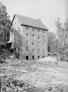
Beverley Mill, also known as Chapman Mill, is a historic grist mill located north of Interstate 66 and Virginia State Route 55 in Thoroughfare Gap near Broad Run, Virginia, straddling the county line between Prince William and Fauquier Counties. It was built about 1759, and is a five-story, four bay by three bay, rubble stone structure. The water power was provided by Broad Run which, in its 1,300-foot (400-metre) passage through the Gap, drops 87 feet. Exterior mill machinery included a 29-foot (8.8-metre) metal waterwheel and sluice gate as well as a stone mill race. The mill continued in operation through World War II. It is included in the Thoroughfare Gap Battlefield.

Saltville Battlefields Historic District is a historic American Civil War battlefield and national historic district located around Saltville, in Smyth County and Washington County, Virginia. The district includes 3 contributing buildings, 31 contributing sites, 4 contributing structures, and 1 contributing object near Saltville. It encompass the core areas of two battles, fought on October 2 and December 20, 1864, known as the Battle of Saltville I and Battle of Saltville II, where Confederate and Union forces contested control of the South's most important salt production facilities. Notable resources include the sites of salt furnaces, Well Fields, Fort Statham, Lover's Leap Defenses, Saltville Gap Overlooks, Mill Cliff gun emplacements, Fort Breckinridge, Fort Hatton, Sanders’ House/Williams Site Battlefield/field hospital, William A. Stuart House, and the Elizabeth Cemetery.


