Thum

Last updated
Thum
Thum Markt.jpg
Wappen Thum.png
Location of Thum within Erzgebirgskreis district
Thum in ERZ.pngAuerbachBreitenbrunnNeukirchenNiederdorfOelsnitzSchneebergSchwarzenbergTannenbergThalheim
Germany adm location map.svg
Red pog.svg
Thum
Saxony location map.svg
Red pog.svg
Thum
Coordinates: 50°40′16″N12°57′5″E / 50.67111°N 12.95139°E / 50.67111; 12.95139
Country Germany
State Saxony
District Erzgebirgskreis
Subdivisions3
Government
   Mayor (202027) Thomas Mauersberger [1]
Area
  Total18.89 km2 (7.29 sq mi)
Highest elevation
630 m (2,070 ft)
Lowest elevation
550 m (1,800 ft)
Population
 (2021-12-31) [2]
  Total4,965
  Density260/km2 (680/sq mi)
Time zone UTC+01:00 (CET)
  Summer (DST) UTC+02:00 (CEST)
Postal codes
09419
Dialling codes 037297
Vehicle registration ERZ, ANA, ASZ, AU, MAB, MEK, STL, SZB, ZP
Website www.stadt-thum.de

Thum is a small town in the district of Erzgebirgskreis in Saxony, Germany. It has a population of about 5,000.

Contents

Geography

Thum is situated in the Ore Mountains, 10 km northwest of Annaberg-Buchholz, and 19 km south of Chemnitz. The Jahnsbach, a tributary to the Zschopau River runs through the town. To the north is Gelenau, east is Drebach, south of Thum is the town of Ehrenfriedersdorf. The Greifensteine area lies to the south west, and Hormersdorf and Auerbach are to the west.

Historic Saxon milepost in Thum Postmeilensaeule Thum.jpg
Historic Saxon milepost in Thum

History

Thum was first mentioned 1389 in historic records of the archdiocese of Prague. From the 14th century, mining in the once densely forested Ore Mountains steadily increased, and a history book of 1445 describes Thum as a small mining town. Several placer deposits, two stamp mills and 27 mines were in the area of Thum. Considerable amounts of Axinite were found, which initially was given the name Thumit. [3] In 1469 the citizens of Thum acquired township.

The last battle of the Thirty Years' War in Saxony was fought on January 15, 1648, near Thum. [3] The destruction caused by the war resulted in mining no longer being sustainable. With the run-down of ore-mining in the area, Thum (like many other towns and villages in the Ore Mountains) turned to wooden toy manufacture – such as Schwibbogen and Christmas pyramids – as well as bobbin lace as a matter of economic survival. In the 18th and 19th centuries, the textile industry was the main source of income for Thum.

In 1886, a narrow gauge railway connected Thum to Wilischthal. This Thumer Netz was part of the narrow gauge railways in Saxony and was expanded throughout the early 20th century.

The Rittergut (manor) of Dorfthum was incorporated into Thum in 1879. With the zoning reforms in the 1990s, the neighbouring Reihendorf villages of Jahnsbach and Herold were incorporated into Thum.

Historical brewery ("Dampfbrauerei")

The original brewery, founded in the 14th century, was the property of the church until 1546 when it was acquired by the town, and a brewing cooperative was formed. This cooperative dissolved in 1882, and brewer William Böttger bought the buildings and inventory. He built new brewery buildings in 1898 and increased production to 15,000 hecto litres. After the death of Böttger, in 1926 his widow sold the brewery back to the town of Thum, which was unable to find a buyer. This ended the long brewing tradition in Thum. In 2000, the brand was revived under the name of Thumer Lager. It is now being brewed using the original recipe by a brewery in Chemnitz.

Coat of arms

Wappen Thum.png The town council approved the current coat of arms after the incorporation of Jahnsbach and Herold.

The coat of arms displays:

  • Top: the hammer and pick symbolize the mining tradition of the area
  • Left: the herald in the left quadrant stands for Herold
  • Bottom: the tower stands for Thum
  • Right: the tree stands for Jahnsbach and symbolizes a Gerichtslinde

Notable persons

Related Research Articles

<span class="mw-page-title-main">Zschopau</span> Town in Saxony, Germany

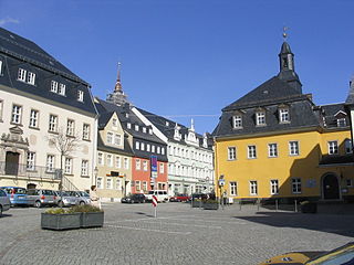
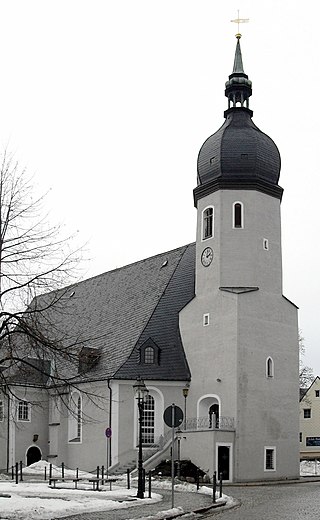
Zschopau, is a town in the Erzgebirgskreis district of Saxony, Germany.

<span class="mw-page-title-main">Bad Gottleuba-Berggießhübel</span> Spa town in Saxony, Germany

Bad Gottleuba-Berggießhübel is a spa town in the district Sächsische Schweiz-Osterzgebirge in Saxony, Germany. The municipality borders the Czech Republic in the south. The municipality was formed on 1 January 1999 by the merger of the former municipalities Bad Gottleuba, Berggießhübel, Langenhennersdorf, and Bahratal. Surrounded by forests and near a water dam, Bad Gottleuba-Berggießhübel has several facilities including a spa health park, a plant garden, and a heated open air pool.

<span class="mw-page-title-main">Hohenstein-Ernstthal</span> Town in Saxony, Germany

Hohenstein-Ernstthal is a town in the Zwickau rural district, Saxony, Germany. The towns of Hohenstein and Ernstthal were united in 1898, and the town is either known by its hyphenated form, or simply called Hohenstein.

<span class="mw-page-title-main">Marienberg</span> Town in Saxony, Germany

Marienberg is a town in Germany. It was the district capital of the Mittlerer Erzgebirgskreis in the southern part of Saxony, and since August 2008 it has been part of the new district of Erzgebirgskreis. As of 2020, the town had 16,716 inhabitants.

<span class="mw-page-title-main">Narrow-gauge railways in Saxony</span> Railway network in Saxony

The narrow-gauge railways in Saxony were once the largest single-operator narrow-gauge railway network in Germany. In Saxony, the network peaked shortly after World War I with over 500 km (311 mi) of tracks. At first, it was primarily created to connect the small towns and villages in Saxony – which had formed a viable industry in the 19th century – to already established standard-gauge railways. But even shortly after 1900, some of the railways would become important for tourism in the area.

<span class="mw-page-title-main">Borna, Leipzig</span> Town in Saxony, Germany

Borna is a town in Saxony, Germany, capital of the Leipzig district. It is situated approximately 30 km southeast of Leipzig city. It has approx. 19,000 inhabitants. The town is the district seat of the district of Leipzig.

<span class="mw-page-title-main">Schneeberg, Saxony</span> Town in Saxony, Germany

Schneeberg is a town in Saxony’s district of Erzgebirgskreis. It has roughly 16,400 inhabitants and belongs to the Town League of Silberberg. It lies 4 km west of Aue, and 17 kilometres (11 mi) southeast of Zwickau.

<span class="mw-page-title-main">Olbernhau</span> Town in Saxony, Germany

Olbernhau is a town in the district Erzgebirgskreis, in Saxony, Germany. It is situated in the Ore Mountains, 35 km southeast of Chemnitz, and 23 km north of Chomutov, Czech Republic.

<span class="mw-page-title-main">Lößnitz</span> Town in Saxony, Germany

Bergstadt Lößnitz, sometimes also called Muhme (“Aunt”) for its age, is a town in the district of Erzgebirgskreis, Saxony, Germany, and belongs to the Town League of Silberberg. Its name comes from the Slavic lesnice, meaning “forest place”.

<span class="mw-page-title-main">Augustusburg</span> Town in Saxony, Germany

Augustusburg is a town in the district of Mittelsachsen, in Saxony, Germany. It is situated 12 km east of Chemnitz. Augustusburg is known for its Jagdschloss, the hunting lodge of the same name.

<span class="mw-page-title-main">Geringswalde</span> Town in Saxony, Germany

Geringswalde is a town in the district of Mittelsachsen, in Saxony, Germany. It is situated 12 km northwest of Mittweida, and 27 km north of Chemnitz.

<span class="mw-page-title-main">Mügeln</span> Town in Saxony, Germany

Mügeln is a town in the district Nordsachsen, in Saxony, Germany. It is located 9 km southwest of Oschatz and 14 km northwest of Döbeln. The town has a population of approximately 5,808 people.

<span class="mw-page-title-main">Oederan</span> Town in Saxony, Germany

Oederan is a town in the district of Mittelsachsen, in Saxony, Germany.

<span class="mw-page-title-main">Wolkenstein</span> Town in Saxony, Germany

Wolkenstein is a town in the district Erzgebirgskreis, in Saxony, Germany. It is situated in the Ore Mountains, on the river Zschopau, 22 km southeast of Chemnitz.

<span class="mw-page-title-main">Geyer</span> Town in Saxony, Germany

Geyer is a town in the district of Erzgebirgskreis, in Saxony, Germany. It has a population of about 4000.

<span class="mw-page-title-main">Schönheide</span> Municipality in Saxony, Germany

Schönheide is a municipality in Saxony's district of Erzgebirgskreis. It lies in the western Ore Mountains, and was founded as an industrial village.

Mittelsachsen is a district (Kreis) in the Free State of Saxony, Germany.

<span class="mw-page-title-main">Thumer Netz</span>

The Thumer Netz was a narrow gauge railway network in the area around Thum in Saxony, Germany that operated from 1886 until 1975. It had a 750 mm gauge. Total length was about 44 km (27.34 mi).

<span class="mw-page-title-main">Annaberg-Buchholz–Flöha railway</span>

The Annaberg-Buchholz–Flöha railway, also called the Zschopau Valley Railway (Zschopautalbahn) is a branch line in the German state of Saxony. It links Annaberg-Buchholz lower station and the Vejprty–Annaberg-Buchholz railway line to Flöha, running through the Zschopau Valley via Wolkenstein and Zschopau. It has been operated since 2001 by the DB Regio subsidiary Erzgebirgsbahn.

<span class="mw-page-title-main">Scharfenstein Castle (Ore Mountains)</span>

Scharfenstein Castle lies on an elongated hill spur above the village of Scharfenstein, in the municipality of Drebach in the Ore Mountains of Saxony, Germany. The castle is one of 24 sites run by the state-owned State Palaces, Castles and Gardens of Saxony.

References

  1. Wahlergebnisse 2020, Freistaat Sachsen, accessed 10 July 2021.
  2. "Bevölkerung des Freistaates Sachsen nach Gemeinden am 31. Dezember 2021" (XLS) (in German). Statistisches Landesamt des Freistaates Sachsen. 2022.
  3. 1 2 Chronicle of Thum