
Mirfield is a town and civil parish in Kirklees, West Yorkshire, England. Historically part of the West Riding of Yorkshire, it is on the A644 road between Brighouse and Dewsbury. At the 2011 census it had a population of 19,563. Mirfield forms part of the Heavy Woollen District.
Dinnington is a town and civil parish in the Metropolitan Borough of Rotherham in South Yorkshire, England. It is near to the towns of Worksop and Rotherham and cities of Sheffield and Doncaster.

Maltby is a former mining town and civil parish in the Metropolitan Borough of Rotherham, South Yorkshire, England. It was historically in the West Riding of Yorkshire. It is located about 6 miles (10 km) east of Rotherham town centre and 10 miles (16 km) north-east of Sheffield city centre. It forms a continuous urban area with Hellaby, separated from the rest of Rotherham by the M18 motorway. It had a population of 16,688 at the 2011 Census.

Thorpe Salvin is a village and a civil parish in the Metropolitan Borough of Rotherham in South Yorkshire, England, on the border with Nottinghamshire. It lies between Worksop and Harthill, and is located at an elevation of around 110 metres above sea level. At the 2011 Census, it had a population of 476, down from 502 in 2001.

Beighton —which includes the districts of Beighton, Hackenthorpe, Owlthorpe, and Sothall—is one of the 28 electoral wards in City of Sheffield, England. It is located in the eastern part of the city, on the border with Rotherham and covers an area of 5.7 km2. The population of this ward in 2011 was 17,939 people in 7,538 households.

Normanton is a town and civil parish in the City of Wakefield in West Yorkshire, England. It is north-east of Wakefield and south-west of Castleford. The civil parish extends west and north to the River Calder, and includes the large village of Altofts. At the time of the 2011 Census, the population of the civil parish was 20,872.

Hackenthorpe is a village 5 miles south east of Sheffield’s city centre, now classed as a historic township of the city. Due to much expansion, the village became a part of Sheffield city during the 1950s. During much of the late 19th and 20th centuries the village was noted for its steelmaking, with the Thomas Staniforth & Co Sickle works being based at Main Street. Another prominent feature of the village is the 17th century Hackenthorpe Hall, built by John Newbould for the Hounsfield family, with James Hounsfield being a prominent land owner. The building is today used as a nursery.

Wath upon Dearne is a town south of the River Dearne in the Metropolitan Borough of Rotherham, South Yorkshire, England, 5 miles (8 km) north of Rotherham and almost midway between Barnsley and Doncaster. It had a population of 11,816 at the 2011 census. It is twinned with Saint-Jean-de-Bournay in France.

Heather is a village west of Ibstock in North West Leicestershire, England. The population of the civil parish was 949 at the 2001 census reducing to 920 at the 2011 census. In the Domesday Book of 1086, its name is recorded as Hadre, meaning "the heathland".
Ravenstone is a village and former civil parish, now in the parish of Ravenstone with Snibstone, in the North West Leicestershire district, in the county of Leicestershire, England. It is within the National Forest, just off the A511 road between Coalville and Ashby-de-la-Zouch, in 2001 it had a population of 2,149.

Barnburgh is a village and civil parish in the City of Doncaster in South Yorkshire, England. The village is adjacent to the village of Harlington - the parish contains both villages, and according to the 2001 census it had a population of 1,979, reducing to 1,924 at the 2011 Census. The village is located 3 miles (4.8 km) north of Mexborough, 2 miles (3.2 km) east of Goldthorpe and 8 miles (13 km) west of Doncaster itself.

Silkstone is a village and civil parish in the Metropolitan Borough of Barnsley in South Yorkshire, England. It is situated in the foothills of the Pennines, between the towns of Barnsley and Penistone. The parish includes the village of Silkstone Common. At the 2001 census it had a population of 2,954, increasing to 3,153 at the 2011 Census.

Cadeby is a village and civil parish in the Metropolitan Borough of Doncaster in South Yorkshire, England. The population at the census of 2011 was 203. It is about five miles west of Doncaster, and four miles east of Mexborough.

Todwick is a village in the Metropolitan Borough of Rotherham in South Yorkshire, England. It has a population of 1,637, reducing marginally to 1,634 at the 2011 Census, and contains a primary school and a nursery, Todwick Early Years. Todwick also is home to a pub, The Red Lion, and a church. There is a village hall adjacent to the primary school, and this is on the corner of Kiveton Lane and The Pastures. The Pastures has the only shops in the village on it; Cyprus Gardens pizza house and Heaven Is Homemade Vintage Tea Room.

Gwersyllt is an urban village and community in Wrexham County Borough, Wales.

Thurcroft Colliery was a coal mine situated in the village of Thurcroft, near Rotherham, South Yorkshire, England.

Langold is a village in the civil parish of Hodsock, in the Bassetlaw district, north Nottinghamshire, England. At the 2011 census it was defined as a ward of Bassetlaw Council with a population of 2,472. It was built to provide housing for the miners of Firbeck Colliery between 1923 and 1927. Langold Lakes Country Park is situated on the south-western edge of the village.

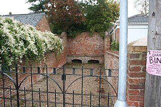
Rawmarsh is a large village in the Metropolitan Borough of Rotherham, in South Yorkshire, England. Historically within the West Riding of Yorkshire, it is 2 miles (3 km) north-northeast from Rotherham town centre and 3 miles (5 km) south-southwest of Swinton. The village also forms part of the Sheffield Urban Area. The Rawmarsh ward of Rotherham MBC had a population of 13,389 at the 2011 Census. Rawmarsh also contains other output areas from neighbouring wards giving it a population of 18,498 in 2011 and 18,535 in 2014.
Rev. Ralph Levett was an English Anglican minister who served as domestic chaplain to an aristocratic family from Lincolnshire with Puritan sympathies, who subsequently installed him as rector of a local parish. A graduate of Christ's College, Cambridge, where he became a protégé of the prominent Puritan minister John Cotton, Levett later married the sister of the wife of his friend Rev. John Wheelwright, another well-known early Puritan settler of New England.


