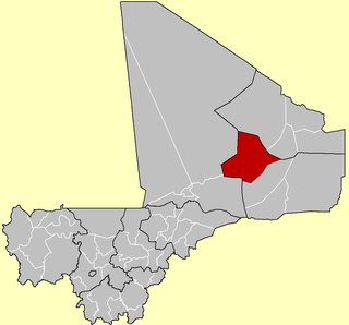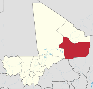
Kidal is a town and commune in the desert region of northern Mali. The town lies 285 km (177 mi) northeast of Gao and is the capital of the Kidal Cercle and the Kidal Region. The commune has an area of about 9,910 km2 (3,830 sq mi) and includes the town of Kidal and 31 other settlements.

Bamba is a small town and rural commune in the Bourem Cercle of the Gao Region of Mali. The town is located on the left (north) bank of the Niger River, 190 km east of Timbuktu and 230 km northwest of the town of Gao. In the 2009 census the commune had a population of 28,524.

Bourem is a commune and small town in the Gao Region of northeastern Mali. The town sits on the left bank of the River Niger.

A Commune is the third level administrative unit in Mali. Mali is divided into eight regions and one capital district (Bamako). These subdivisions bear the name of their principal city. The regions are divided into 49 Cercles. The Cercles and the district are divided into 703 Communes, with 36 Urban Communes and 667 Rural Communes, while some larger Cercles still contain Arrondissements above the Commune level, these are organisational areas with no independent power or office. Rural Communes are subdivided in Villages, while Urban Communes are subdivided into Quartier. Communes usually bear the name of their principal town. The capital, Bamako, consists of six Urban Communes. There were initially 701 communes until the Law No. 01-043 of 7 June 2001 created two new Rural Communes in the desert region in the north east of the country: Alata, Ménaka Cercle in the Gao Region and Intadjedite, Tin-Essako Cercle in the Kidal Region.

Ansongo Cercle is an administrative subdivision of the Gao Region of Mali. The administrative center (chef-lieu) is the town of Ansongo. The Niger River passes through the cercle and plays an important role in transportation and the economy in the region.

Bourem Cercle is an administrative subdivision of the Gao Region of north-eastern Mali. The administrative center (chef-lieu) is the town of Bourem.

Bara is a rural commune and village in the Cercle of Ansongo in the Gao Region of south-eastern Mali.

Talataye is a village and rural commune in the Cercle of Ansongo in the Gao Region of south-eastern Mali. The commune has an area of approximately 8,126 square kilometers. In the 2009 census it had a population of 13,907.

Tarkint is a village and commune in the Cercle of Bourem in the Gao Region of north-eastern Mali. The village is 70 km (43 mi) northeast of Bourem and 123 km (76 mi) from Gao. Tarkint extends for 23,000 km2 and includes part of the Tilemsi Valley. In the 2009 census Tarkint had a population of 19,082.

Taboye is a rural commune and village in the Cercle of Bourem in the Gao Region of south-eastern Mali. The commune is crossed by the River Niger and includes the villages of Bia, Dagha, Ha, Moudakane, Ouani, Tondibi and Taboye. In the 2009 census the commune had a population of 20,503.

Bourra is a commune in the Cercle of Ansongo in the Gao Region of south-eastern Mali. The commune extends along the left (east) bank of the River Niger. It covers an area of approximately 2,323 square kilometers and includes 14 villages. In the 2009 census the commune had a population of 19,163. The main village (chef-lieu) is Tassiga.

Gabero is a rural commune in the Cercle of Gao in the Gao Region of south-eastern Mali. The commune covers an area of approximately 2,007 square kilometers and includes 15 villages. In the 2009 census the commune had a population of 25,688. The Niger River crosses the commune from north to south. The administrative center (chef-lieu) is Haoussa Foulane that lies on the left (east) bank of the Niger. The village is 45 km south of Gao, on the road, the N17, linking Gao and Ansongo.

Gounzoureye is a rural commune in the Cercle of Gao in the Gao Region of south-eastern Mali. The commune includes the villages of Koima, Tchirissoro, Sadou, Lobou, Sidibé, Kosseye, Gorom Gorom, Kadji, Wabaria, Arhabou, Tacharane, Bagoundjé I and Bagoundjé II, which are all located on the banks of the River Niger. The administrative center (chef-lieu) is at the village of Wabaria. In the 2009 census the commune had a population of 30,772.

N'Tillit is a rural commune and village in the Cercle of Gao in the Gao Region of south-eastern Mali. In the 2009 census the commune had a population of 22,100.

Sony Aliber or Soni Ali Ber is a commune in the Cercle of Gao in the Gao Region of south-eastern Mali. The main villages are: Bagnadji, Batal, Berrah, Forgho Arma, Forgho Songhai, Kochakarey, Kokorom, Magnadoué, Seina and Zindiga. The administrative center (Chef-lieu) is the village of Forgo Sourhai which is located 25 km north of Gao. The commune includes the banks of the River Niger for a distance of around 35 km. In the 2009 census the commune had a population of 44,099.

Haoussa Foulane is a village and seat of the Commune of Gabero in the Cercle of Gao in the Gao Region of south-eastern Mali. The village lies on the left (east) bank of the Niger River and is 45 km south of Gao, on the road, the N17, linking Gao and Ansongo. As the name suggests, most of the people in the village are of Hausa or Fula descent.

Madiama is a rural commune and village in the Cercle of Djenné in the Mopti Region of Mali. The commune contains ten villages.

Boni is a village and seat of the commune of Hairé in the Cercle of Douentza in the Mopti Region of southern-central Mali. The village is 5 km south of the main road, the RN15, that links Mopti and Gao. This is the only paved road in this part of Mali.


