Tionesta Township, Forest County, Pennsylvania

Last updated
Tionesta Township,
Pennsylvania
Tionesta Lake.jpg
Map of Tionesta Township, Forest County, Pennsylvania Highlighted.png
Map of Forest County, Pennsylvania highlighting Tionesta Township
Map of Pennsylvania highlighting Forest County.svg
Map of Forest County, Pennsylvania
Country United States
State Pennsylvania
County Forest
Settled1795
Government
  TypeBoard of Supervisors
Area
[1]
  Total46.46 sq mi (120.32 km2)
  Land44.98 sq mi (116.49 km2)
  Water1.48 sq mi (3.84 km2)
Population
 (2020) [2]
  Total670
  Estimate 
(2022) [2]
657
  Density14/sq mi (5.6/km2)
Time zone UTC-5 (Eastern (EST))
  Summer (DST) UTC-4 (EDT)
Area code 814
FIPS code 42-053-76864

Tionesta Township is a township in Forest County, Pennsylvania, United States. The population was 670 at the time of the 2020 census, [2] up from the total of 729 that was documented by the 2010, [3] up from 610 at the 2000 census.

Contents

History

Tionesta Township took its name from Tionesta Creek. [4]

Geography

The township is located in the southwestern corner of Forest County, bordered to the south by Clarion County and to the west by Venango County. The township surrounds the borough of Tionesta, a separate municipality.

The Allegheny River crosses the township from its northern to its western border while forming part of the border between the township and Tionesta borough. Tionesta Creek joins the Allegheny from the east, just south of Tionesta borough. Tionesta Dam impounds the creek southeast of the borough, forming Tionesta Lake.

U.S. Route 62 passes through the township and the borough following the Allegheny, leading north to Warren and southwest to Oil City. Pennsylvania Route 36 crosses the township and joins US-62 to cross the Allegheny at Tionesta. PA 36 leads northwest to Pleasantville and southeast to Brookville.

According to the United States Census Bureau, Tionesta Township has a total area of 46.4 square miles (120.3 km2), of which 45.0 square miles (116.5 km2) is land and 1.5 square miles (3.8 km2), or 3.19%, is water. [3]

Demographics

Historical population
CensusPop.Note
2000 610
2010 72919.5%
2020 670−8.1%
2022 (est.)657 [2] −1.9%

As of the census [5] of 2000, there were 610 people, 260 households, and 191 families residing in the township. The population density was 13.6 people per square mile (5.2/km2). There were 898 housing units at an average density of 20.0/sq mi (7.7/km2). The racial makeup of the township was 99.18% White, 0.16% African American, 0.16% Native American, and 0.49% from two or more races. Hispanic or Latino of any race were 0.49% of the population.

There were 260 households, out of which 24.6% had children under the age of 18 living with them, 62.7% were married couples living together, 6.2% had a female householder with no husband present, and 26.5% were non-families. 23.8% of all households were made up of individuals, and 11.9% had someone living alone who was 65 years of age or older. The average household size was 2.35 and the average family size was 2.73.

In the township the population was spread out, with 19.5% under the age of 18, 4.3% from 18 to 24, 23.8% from 25 to 44, 31.0% from 45 to 64, and 21.5% who were 65 years of age or older. The median age was 47 years. For every 100 females there were 106.8 males. For every 100 females age 18 and over, there were 99.6 males.

The median income for a household in the township was $35,455, and the median income for a family was $39,286. Males had a median income of $30,795 versus $21,442 for females. The per capita income for the township was $15,404. About 8.3% of families and 9.5% of the population were below the poverty line, including 12.9% of those under age 18 and 7.6% of those age 65 or over.

Related Research Articles

<span class="mw-page-title-main">Millvale, Pennsylvania</span> Borough in Pennsylvania, United States

Millvale is a borough in Allegheny County, Pennsylvania, United States, along the Allegheny River, opposite Pittsburgh. The borough is located off Pennsylvania Route 28. The population was 3,376 at the 2020 census.

<span class="mw-page-title-main">Verona, Pennsylvania</span> Borough in Pennsylvania, United States

Verona is a borough in Allegheny County, Pennsylvania, United States. It is 13 miles (21 km) northeast of downtown Pittsburgh, along the left bank of the Allegheny River. As of the 2020 census, the borough had a population of 2,492.

<span class="mw-page-title-main">Allegheny Township, Blair County, Pennsylvania</span> Township in Pennsylvania, United States

Allegheny Township is a township in Blair County, Pennsylvania, United States. The population was 6,585 at the 2020 census. It is part of the Altoona, Pennsylvania Metropolitan Statistical Area.

<span class="mw-page-title-main">Buffalo Township, Butler County, Pennsylvania</span> Township in Pennsylvania, United States

Buffalo Township is a township in Butler County, Pennsylvania, United States. The population was 7,896 at the 2020 census.

<span class="mw-page-title-main">Redbank Township, Clarion County, Pennsylvania</span> Township in Pennsylvania, United States

Redbank Township is a township in Clarion County, Pennsylvania, United States. The population was 1,334 at the 2020 census, a decrease from the figure of 1,370 tabulated in 2010.

<span class="mw-page-title-main">Franklin Township, Columbia County, Pennsylvania</span> Township in Pennsylvania, United States

Franklin Township is a township in Columbia County, Pennsylvania. It is part of Northeastern Pennsylvania. The population was 552 at the 2020 census.

<span class="mw-page-title-main">Fairfield Township, Crawford County, Pennsylvania</span> Township in Pennsylvania, United States

Fairfield Township is a township in Crawford County, Pennsylvania, United States. The population was 1,011 at the 2020 census, down from the 2010 census.

<span class="mw-page-title-main">West Fallowfield Township, Crawford County, Pennsylvania</span> Township in Pennsylvania, United States

West Fallowfield Township is a township in Crawford County, Pennsylvania, United States. The population was 577 at the 2020 census, down from 605 at the 2010 census.

<span class="mw-page-title-main">Halifax Township, Dauphin County, Pennsylvania</span> Township in Pennsylvania, United States

Halifax Township is a township in Dauphin County, Pennsylvania, United States. The population was 3,336 at the 2020 census.
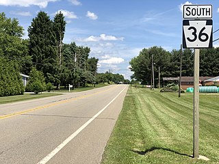
<span class="mw-page-title-main">Green Township, Forest County, Pennsylvania</span> Township in Pennsylvania, United States

Green Township is a township in Forest County, Pennsylvania, United States. The population was 371 at the 2020 census, down from 522 in 2010, which was, in turn, an increase from 397 in 2000.

<span class="mw-page-title-main">Howe Township, Forest County, Pennsylvania</span> Township in Pennsylvania, United States

Howe Township is a township in Forest County, Pennsylvania, United States. The population was 201 at the 2020 census, down from 405 in 2010.

<span class="mw-page-title-main">Tionesta, Pennsylvania</span> Borough in Pennsylvania, United States

Tionesta is a borough in and the county seat of Forest County, Pennsylvania, United States. The population was 475 at the 2020 Census. The name is a Native American word meaning "the home of the wolves". Visitors and residents are greeted to Tionesta with a sign reading "A special place with a relaxed pace"

<span class="mw-page-title-main">Ringgold Township, Jefferson County, Pennsylvania</span> Township in Pennsylvania, United States

Ringgold Township is a township in Jefferson County, Pennsylvania, United States. The population was 772 at the 2020 census.

<span class="mw-page-title-main">Washington Township, Jefferson County, Pennsylvania</span> Township in Pennsylvania, United States

Washington Township is a township in Jefferson County, Pennsylvania, United States. The population was 1,892 at the 2020 census. It was named for President George Washington.

<span class="mw-page-title-main">Winslow Township, Jefferson County, Pennsylvania</span> Township in Pennsylvania, United States

Winslow Township is a township in Jefferson County, Pennsylvania, United States. The population was 2,543 at the 2020 census. It was named for Associate Judge James Winslow.

<span class="mw-page-title-main">Beale Township, Pennsylvania</span> Township in Pennsylvania, United States

Beale Township is a township in Juniata County, Pennsylvania, United States. The population was 773 at the 2020 census, a decline from the figure of 830 tabulated in 2010.

<span class="mw-page-title-main">President Township, Venango County, Pennsylvania</span> Township in Pennsylvania, United States

President Township is a township in Venango County, Pennsylvania, United States. The population was 451 at the 2020 census, a decrease from 540 in 2010, which represented, in turn, a decrease from the figure of 543 at the 2000 census. It is located at the confluence of the Hemlock Creek and Allegheny River, and is largely made up of seasonal/recreational camps and cottages, which are situated near state gamelands.

<span class="mw-page-title-main">Union Township, Washington County, Pennsylvania</span> Township in Pennsylvania, United States

Union Township is a township in Washington County, Pennsylvania, United States. The population was 5,367 at the 2020 census.

<span class="mw-page-title-main">Sewickley Township, Westmoreland County, Pennsylvania</span> Township in Pennsylvania, United States

Sewickley Township is a township in Westmoreland County, Pennsylvania, United States. The population was 5,590 at the 2020 census.

<span class="mw-page-title-main">Falls Creek, Pennsylvania</span> Borough in Pennsylvania, United States

Falls Creek is a borough located in Jefferson and Clearfield counties in Pennsylvania, United States. The population was 1,036 at the 2020 census. Of this, 994 were in Jefferson County, and 42 were in Clearfield County.

References

  1. "2016 U.S. Gazetteer Files". United States Census Bureau. Retrieved Aug 13, 2017.
  2. 1 2 3 4 Bureau, US Census. "City and Town Population Totals: 2020-2022". Census.gov. US Census Bureau. Retrieved September 4, 2023.
  3. 1 2 "Geographic Identifiers: 2010 Census Summary File 1 (G001), Tionesta Township, Forest County, Pennsylvania". American FactFinder. U.S. Census Bureau. Archived from the original on February 13, 2020. Retrieved July 28, 2016.
  4. McKnight, William James (1917). Historical. J.H. Beers. p. 460.
  5. "U.S. Census website". United States Census Bureau . Retrieved 2008-01-31.

41°31′00″N79°28′59″W / 41.51667°N 79.48306°W / 41.51667; -79.48306