
Tiong Bahru Air Raid Shelter is a converted air raid shelter built between 1939 and 1941 at block 78 within the Tiong Bahru neighbourhood in Singapore. The shelter is preserved and is part of a heritage trail of the neighbourhood.
Tiong Bahru Air Raid Shelter is a converted air raid shelter built between 1939 and 1941 at block 78 within the Tiong Bahru neighbourhood in Singapore. The shelter is preserved and is part of a heritage trail of the neighbourhood.
Tiong Bahru's block 78's semi-basement was to be playgrounds, however had an option to be converted into an air raid shelter in times of emergency. [1] [2] The air raid shelter was converted from three play pavilions and four garages located at the semi-basement of block 78, which straddles Moh Guan Terrace and Guan Chuan Street. [3] The walls of the shelter are 19 inches thick, and the floor is made of concrete. [4] The shelters would cost $16,000 and could accommodate up to 2,000 people. [5]
In February 2012, it served as a museum for a short time before it was closed. [6] The shelter would remain closed to the public, with exception to those who are being brought on guided heritage tours. [3]

Air raid shelters are structures for the protection of non-combatants as well as combatants against enemy attacks from the air. They are similar to bunkers in many regards, although they are not designed to defend against ground attack.

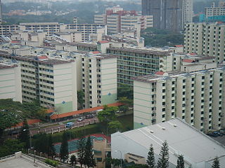
Ang Mo Kio is a planning area and residential town situated in the North-East of Singapore. Located approximately 11 km (6.8 mi) north of the Downtown Core district, Ang Mo Kio is the 3rd most populated planning area in the North-East Region and ranks 8th in terms of population in the country overall. The planning area is located at the south-western corner of the North-East Region, bordered by the planning areas of Yishun to the north, Sengkang to the north-east, Serangoon to the east, Bishan to the south and the Central Water Catchment to the west.

The Housing & Development Board, often referred to as the Housing Board, is a statutory board under the Ministry of National Development responsible for the public housing in Singapore. Established in 1960 as a result of efforts in the late 1950s to set up an authority to take over the Singapore Improvement Trust's (SIT) public housing responsibilities, the HDB focused on the construction of emergency housing and the resettlement of kampong residents into public housing in the first few years of its existence.

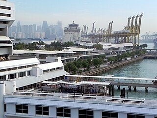
Outram Park MRT station is an underground Mass Rapid Transit (MRT) interchange station on the East West, North East and Thomson-East Coast lines located on the boundary of Bukit Merah and Outram planning areas, Singapore, near the junction of Outram Road, Eu Tong Sen Street and New Bridge Road. It is the nearest MRT station to the Singapore General Hospital, Police Cantonment Complex, Outram Community Hospital and the Health Promotion Board.

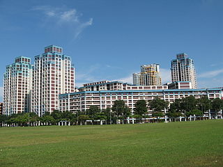
Queenstown is a planning area and satellite residential town situated on the south-westernmost fringe of the Central Region of Singapore. It borders Bukit Timah to the north, Tanglin to the northeast, Bukit Merah to the east and southeast, as well as Clementi to the northwest and west. Its southern and southwesternmost limits are bounded by the Pandan Strait.
Tiong Bahru is a housing estate located within the Bukit Merah Planning Area, in the Central Region of Singapore. Tiong Bahru was constructed in the 1920s by the Singapore Improvement Trust, the predecessor to the Housing Development Board and an entity of the British colonial authority providing mass public housing in Singapore and is the oldest housing estate in Singapore. The main estate consists of 30 apartment blocks with over 900 units of two to five rooms that are also commonly referred to as "walk-ups". There are also high-rise Housing and Development Board (HDB) flats and condominiums along Boon Tiong Road, Jalan Membina and Kim Tian Road which surround the main estate.
Bukit Merah, also known as Redhill, is a planning area and new town situated in the southernmost part of the Central Region of Singapore. the planning area borders Tanglin to the north, Queenstown to the west and the Downtown Core, Outram and Singapore River planning areas of the Central Area to the east.
The Singapore Improvement Trust (SIT) is a former government organisation that was responsible for urban planning and urban renewal in Singapore. Formally established in 1927 under the Singapore Improvement Ordinance, it was modelled after similar organisations in India. The SIT initially carried out back lane improvement schemes and marking out unsanitary buildings for demolition, but began constructing public housing from 1935. After 1945, the SIT initially focused its efforts on the repair of its residential developments. It resumed constructing public housing in 1947 but was unable to keep up with demand. The SIT was also involved in the development of a "Master Plan", which set out Singapore's developmental direction, from 1952 to 1958. In the late 1950s, plans were set out to replace the SIT with two departments—housing and planning—culminating in two bills that were passed in 1959. With the establishment of the successor organisations by the government of Singapore, the Housing and Development Authority and the Planning Authority, in 1960, the SIT was dissolved.
Public housing in Singapore is subsidised, built and managed by the Government of Singapore. Starting in the 1930s, the country's first public housing was built by the Singapore Improvement Trust (SIT) in a similar fashion to contemporaneous British public housing projects, and housing for the resettlement of squatters was built from the late 1950s. In the 1960s, under the SIT's successor the Housing and Development Board (HDB), public housing consisting of small units with basic amenities was constructed as quickly and cheaply as possible at high densities, and was used for resettlement schemes. From the late 1960s, housing programmes focused more on quality, public housing was built in new towns, and a scheme allowing residents to lease their flats was introduced. Throughout the 1970s and 1980s, more public housing options were provided for the middle class and efforts to increase community cohesion within housing estates were made. From the 1990s, the government began portraying public housing as an asset, introducing large-scale upgrading schemes and loosening regulations on the resale of public housing while additional housing programmes for the sandwich classes and elderly residents were introduced. Rising housing prices led to public housing being seen as an investment from the 2000s, and new technologies and eco-friendly features were incorporated into housing estates.

The Former Admiralty House is a historic building, located at Old Nelson Road within the Sembawang Planning Area in the North Region of Singapore. The building was used as the administration building of Furen International School (FIS) until November 2019 and is currently being refurbished for use as part of the Sembawang Sports and Community Hub.

Tiong Bahru Plaza is a shopping mall located in Tiong Bahru Estate, in Bukit Merah, Singapore, near Tiong Bahru Road, Jalan Membina and Bukit Ho Swee Crescent, which is where the entrance to the mall is located. It consists of a 20-storey office tower block, and a 6-storey shopping and entertainment complex, with 3 basement carparks. The mall is also directly linked to Tiong Bahru MRT Station of the East West Line, which is accessible from Exit B of the station.
Bukit Ho Swee is a subzone within the planning area of Bukit Merah, Singapore, as defined by the Urban Redevelopment Authority (URA). Its boundary is made up of the Alexandra Canal in the north; Kim Seng Road and Outram Road in the east; Zion Road and Jalan Bukit Ho Swee in the south; Delta Road and Lower Delta Road in the west.
My Queenstown Heritage Trail is a walking trail in Queenstown, Singapore. The trail was launched in 2010 by civic group, My Community, to promote the heritage, local culture and architectural styles in Queenstown.
Dakota Crescent is one of Singapore’s oldest housing estates built by Singapore Improvement Trust (SIT), the government development authority, in 1958.
The Jurong railway line is a former railway line located in Singapore. Stretching a total of 12 miles (19 km) from Bukit Timah to the Jurong industrial estate, the line consisted of a 9 miles (14 km) main line and three branches. The line was initially planned as part of the Jurong industrial estate by the Singapore government, to connect the industrial estate with Malaya and to facilitate the transfer of goods between Malaya and Jurong. A $6 million loan was given to the Malayan Railway for its construction, which was carried out by the railway and the Economic Development Board, and construction of the line took place between September 1963 and November 1965, with the first train services commencing in the same month. The line was then officially opened on 4 March 1966. However, the line's potential was limited by Singapore's separation from Malaysia in 1965, with 128,000 tons of freight transported on the line in 1974, and the line eventually closed in the 1990s. Portions of the line remain in place, some of which have become popular among explorers and wildlife enthusiasts.
78 Moh Guan Terrace, also known as The Horse-shoe Block, is a SIT block in Tiong Bahru, Singapore. It the only block in Singapore with the unique "horse-shoe" design.
The Dancing Girl is a sculpture in the Seng Poh Garden in Tiong Bahru, Singapore. It was the first public art piece in Tiong Bahru.
Tiong Bahru Galicier Pastry was a family-run traditional bakery selling various types of kueh in Tiong Bahru, Singapore.
The Tiong Bahru bus hijacking occurred on 29 November 1979 in Singapore. Two armed men, in an attempt to escape arrest for an earlier robbery, took hostages and then hijacked a bus, while exchanging gunfire with police. The incident ended when one of the men was wounded then committed suicide, and the other surrendered to the authorities.