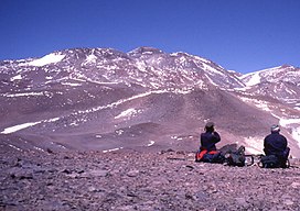
View of the main summit from central summit plateau
The complex covers a surface area of 25 square kilometres (9.7sqmi), it consists of stratovolcanoes, lava domes, and lava flows. There are reports of fumarolic activity, and de Silva and Francis (1991) considered that the volcano was last active in the Holocene.[1]Crater lakes with a smell of sulfur were reported in 2013.[3] The Tipas-Cerro Bayo complex was active 2.9-1.2 million years ago with dacites and rhyolites. Magma composition is typical for Andean stratovolcanoes. Tomographic studies of the underlying crust indicate a pattern of seismic attenuation beneath Tipas.[4]
↑ Scanu, Marcelo (2013). "Argentine Andes 2012-13"(PDF). The Alpine Journal: 311. Retrieved 23 October 2021.
↑ Kay, S. M.; Mpodozis, C.; Gardeweg, M. (7 August 2013). "Magma sources and tectonic setting of Central Andean andesites (25.5-28 S) related to crustal thickening, forearc subduction erosion and delamination". Geological Society, London, Special Publications. 385 (1): 303–334. doi:10.1144/SP385.11. S2CID129489335.
↑ "IGN Argentina". IGN Argentina. 14 April 2020. Retrieved 14 April 2020.
This page is based on this Wikipedia article Text is available under the CC BY-SA 4.0 license; additional terms may apply. Images, videos and audio are available under their respective licenses.