
Aldama Municipality is a municipality in the Mexican state of Chiapas, in southern Mexico. The municipal seat is Aldama, Chiapas.
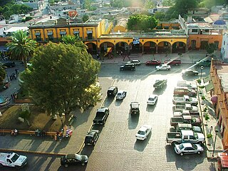
Chilcuautla is a town and one of the 84 municipalities of Hidalgo, in central-eastern Mexico. The municipality covers an area of 231.3 km².
Orizatlán is a town and one of the 84 municipalities of Hidalgo, in central-eastern Mexico. The municipal seat lies at Orizatlán. The municipality covers an area of 308 km².
Zimapán is a town and one of the 84 municipalities of Hidalgo, in central-eastern Mexico. The municipality covers an area of 860.9 km2 (332.4 sq mi).
Juchitepec is a municipality in State of Mexico in central Mexico. The municipal seat is the city of Juchitepec de Mariano Rivas. Juchitepec means “Hill of the Flowers” in Nahuatl. The municipality covers an area of 149.56 km2. It has one major community outside the seat called San Matias Cuijingo. The municipality is located at the southwest of the state, and borders the municipalities of Tenango del Aire, Tepetlixpa, Ozumba and Ayapango in the State of Mexico, and with Totolapan and Tlalnepantla in the state of Morelos to the south, and the borough of Milpa Alta in Mexico City to the west. A large part of the population is employed in commerce. Other major economic activities include agriculture and livestock. As of the 2010 census, the municipality had a total population of 23,497 inhabitants.

Rafael Lucio is a municipality located in the montane central zone of the Mexican state of Veracruz, about 9 km from the state capital Xalapa. It has a surface of 24.68 km2. It is located at 19°35′N96°59′W.
Tuzamapan de Galeana is a town and municipality in the state of Puebla in eastern Mexico. In 2020, the municipality had a population of 5,924, down 0.99% from 2010.
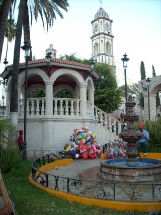
Naranjal is a municipality in the Mexican state of Veracruz, located 10 kilometres (6.2 mi) south of the city of Córdoba.

Seybaplaya is a municipality in the Mexican state of Campeche, located 27 kilometres (17 mi) southwest of the state capital of Campeche City. Its creation was approved in 2019 and came into force on 1 January 2021.

Dzitbalché is a municipality in the Mexican state of Campeche, located 73 kilometres (45 mi) northeast of the state capital of Campeche City. Its creation from the municipality of Calkiní was approved in 2019 and went into force on 1 January 2021.

Honduras de la Sierra is a municipality in the Mexican state of Chiapas, located approximately 150 kilometres (93 mi) southeast of the state capital of Tuxtla Gutiérrez. Gazetted in 2019, it is the newest municipality in Chiapas.
Rincón Chamula San Pedro is a municipality in the Mexican state of Chiapas, located approximately 54 kilometres (34 mi) north of the state capital of Tuxtla Gutiérrez. Unlike the mestizo population of the surrounding towns, its population is mostly indigenous Tzotzil.
Emiliano Zapata is a municipality in the Mexican state of Chiapas, located approximately 33 kilometres (21 mi) southeast of the state capital of Tuxtla Gutiérrez.
Tanhuato is a municipality in the Mexican state of Michoacán. It is located approximately 135 kilometres (84 mi) northwest of the state capital of Morelia.

Vista Hermosa is a municipality in the Mexican state of Michoacán, located approximately 150 kilometres (93 mi) northwest of the state capital of Morelia.
General Francisco R. Murguía is a municipality in the Mexican state of Zacatecas, located approximately 140 kilometres (87 mi) north of the state capital of Zacatecas City. Its municipal seat is located in Nieves.
Mezquital del Oro is a municipality in the Mexican state of Zacatecas, located approximately 190 kilometres (120 mi) southwest of Zacatecas City, the state capital.

Villa Jiménez is a town and the municipal seat of the municipality of Jiménez in the Mexican state of Michoacán.
Tunititlán is a town in the municipality of Chilcuautla, in the Mexican state of Hidalgo.
Pahuayo is a locality in Mexico located in the Municipality of Tlanchinol in the state of Hidalgo.


