Tlahualilo de Zaragoza

Last updated
Tlahualilo de Zaragoza
Municipal seat and city
Mexico States blank map.svg
Red pog.svg
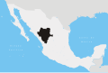
Tlahualilo de Zaragoza
Location in Mexico
Coordinates: 26°06′30″N103°26′35″W / 26.10833°N 103.44306°W / 26.10833; -103.44306 Coordinates: 26°06′30″N103°26′35″W / 26.10833°N 103.44306°W / 26.10833; -103.44306
CountryFlag of Mexico.svg  Mexico
State Durango
Municipality Tlahualilo
Population
 (2010)
  Total9,517

Tlahualilo de Zaragoza is a city located in the northeastern part of the Mexican state of Durango. Tlahualilo of Zaragoza is the municipal seat of the Tlahualilo municipio . [1] As of 2010, the city had a population of 9,517. [2] The city is part of the Comarca Lagunera metropolitan area, which has a population totalling more than 912,000 inhabitants in 2005. The municipality has a population of 22,244 [2] and borders the state of Coahuila in the east, the municipality of Mapimí to the west and the city of Gómez Palacio to the south.

Related Research Articles

<span class="mw-page-title-main">Durango, Colorado</span> City in Colorado, United States

Durango is a home rule municipality that is the county seat and the most populous municipality of La Plata County, Colorado, United States. The city population was 19,071 at the 2020 United States Census. Durango is the home of Fort Lewis College.

<span class="mw-page-title-main">Province of Zaragoza</span> Province of Spain

Zaragoza, also called Saragossa in English, is a province of northern Spain, in the central part of the autonomous community of Aragon. Its capital is Zaragoza, which is also the capital of the autonomous community. Other towns in Zaragoza include Calatayud, Borja, La Almunia de Doña Godina, Ejea de los Caballeros and Tarazona.

<span class="mw-page-title-main">Coahuila</span> State of Mexico

Coahuila, formally Coahuila de Zaragoza, officially the Free and Sovereign State of Coahuila de Zaragoza, is one of the 32 states of Mexico.

<span class="mw-page-title-main">Torreón</span> City in Coahuila, Mexico

Torreón is a city and seat of Torreón Municipality in the Mexican state of Coahuila. As of 2021, the city's population was 735,340. The metropolitan population as of 2015 was 1,497,734, making it the ninth-biggest metropolitan area in the country and the largest metropolitan area in the state of Coahuila, as well as one of Mexico's most important economic and industrial centers. The cities of Torreón; Gómez Palacio, Durango; Lerdo, Durango; Matamoros; Francisco I. Madero; San Pedro; Bermejillo, Durango; and Tlahualilo, Durango form the area of La Laguna or the Comarca Lagunera, a basin within the Chihuahuan Desert.

<span class="mw-page-title-main">Durango</span> State of Mexico

Durango, officially named Estado Libre y Soberano de Durango, is one of the 31 states which make up the 32 Federal Entities of Mexico, situated in the northwest of the country. With a population of 1,832,650, the 8th lowest of Mexico's states, Durango has Mexico's second-lowest population density, after Baja California Sur. The capital city, Victoria de Durango, is named after the first President of Mexico, Guadalupe Victoria.

<span class="mw-page-title-main">Durango (city)</span> City in Durango, Mexico

Durango, is the capital and largest city of the northern Mexican state of Durango and the seat of the Durango municipality. It has a population of 654,876 as of the 2015 census. The city's official name is Victoria de Durango, Victoria having been added in honor of the first president of Mexico, Guadalupe Victoria, who hailed from the state of Durango. The city is located in the Valley of Guadiana and sits at an altitude of 1,890 m (6,201 ft).

<span class="mw-page-title-main">Lerdo, Durango</span> City in Durango, Mexico

Ciudad Lerdo is a small city in the northeastern portion of the Mexican state of Durango. It serves as the municipal seat for the surrounding municipality of the same name.

<span class="mw-page-title-main">Gómez Palacio, Durango</span> City in Durango, Mexico

Gómez Palacio is a city and its surrounding municipality in northeastern Durango, Mexico, adjacent to the border of the state of Coahuila. The city is named in honor of former Durango governor, Francisco Gómez Palacio y Bravo.

<span class="mw-page-title-main">Municipalities of Chihuahua</span>

Chihuahua is a state in Northwest Mexico that is divided into 67 municipalities. According to the 2020 Mexican Census, Chihuahua is the 12th most populous state with 3,741,869 inhabitants and the largest by land area spanning 247,798.08 square kilometres (95,675.37 sq mi).

<span class="mw-page-title-main">Comarca Lagunera</span> Place in Mexico

The Comarca Lagunera or La Comarca de la Laguna is a region of northern Mexico occupying large portions of the states of Durango and Coahuila, with rich soils produced by periodic flooding of the Nazas and Aguanaval rivers. Neither river drains into either the Pacific Ocean or the Gulf of Mexico, but rather they created a series of inland lakes. The region was developed for large-scale irrigated cotton agriculture. During the Mexican Revolution, the region was the site of fierce fighting. Following the military phase of the Revolution, the region was part of the agrarian reform under President Lázaro Cárdenas. The dam named for Cárdenas now controls flooding of the rivers, but the groundwater resources are no longer recharged as a result. It is the 8th largest metropolitan area in Mexico.

Santiago Papasquiaro is a city located in a valley situated on the eastern slopes of the Sierra Madre Occidental in the state of Durango, Mexico. As of 2010, the city of Santiago Papasquiaro had a population of 26,121, while the municipality has a census population of 48,482 as of 2015. It is the fourth largest community in the state in terms of population, and is the municipal seat of the municipality of the same name. The municipality has an area of 7,238.4 km².

<span class="mw-page-title-main">Atizapán de Zaragoza</span> Municipality in State of Mexico, Mexico

Atizapán de Zaragoza is a municipality, in State of Mexico in Mexico. The municipality covers an area of 91.07 km². In 2010, the municipality had a total population of 489,937. At the west side of the city is the Zona Esmeralda district, considered one of the wealthiest in the State of Mexico and Greater Mexico City. The Valle Escondido and Chiluca country clubs are located here.

<span class="mw-page-title-main">Nazas River</span> River in Mexico

The Nazas River is a river located in northern Mexico, in the states of Coahuila and Durango. It is part of the endorheic Bolsón de Mapimí. It is only 560 kilometres (350 mi) long, but irrigates an area of 71,906 square kilometres (27,763 sq mi) in the middle of the desert. The Nazas is also nurtured by the San Juan, Ramos, Potreritos, del Oro, Nazas, Santiago, Tepehuanes and Peñón Blanco rivers. The river starts at the Sierra Madre Occidental. The aboriginal title for this stream is Tlahualilo, coming from the Nahuatl words tlalli meaning "fertile land" and ahualila, meaning "water for irrigation".

Matamoros is a city and seat of the Matamoros Municipality located in the southwestern part of the state of Coahuila in Mexico. It lies directly east of the larger city of Torreón, and is a part of Comarca Lagunera, a larger metropolitan area, that includes Torreón Municipality in Coahuila in addition to Gómez Palacio Municipality and Lerdo Municipality in the adjacent state of Durango.

<span class="mw-page-title-main">Canatlán Municipality</span> Municipality in Durango, Mexico

Canatlán is one of the 39 municipalities of Durango, in northwestern Mexico. The municipal seat lies at Ciudad Canatlán. The municipality covers an area of 468643.1 km2.

<span class="mw-page-title-main">General Simón Bolívar Municipality</span> Municipality in Durango, Mexico

General Simón Bolívar is one of the 39 municipalities of Durango, in north-western Mexico. The municipal seat lies at General Simón Bolívar. The municipality covers an area of 10,041 km².

<span class="mw-page-title-main">Mapimí Municipality</span> Municipality in Durango, Mexico

Mapimí is one of the 39 municipalities of Durango, in north-western Mexico. The municipal seat lies at Mapimí. The municipality covers an area of 7,126.7 km².

Tlahualilo is one of the 39 municipalities of Durango, in north-western Mexico. The municipal seat lies at Tlahualilo de Zaragoza. The municipality covers an area of 3,709.8 km².

The following is a list of highways in the state of Durango (DGO) in Mexico.

Zaragoza is a municipality in the Mexican state of Veracruz, located 297 kilometres (185 mi) southeast of the state capital of Xalapa and 10 kilometres (6.2 mi) southwest of the city of Minatitlán.

References

  1. Durango municipalities Archived 2007-09-27 at the Wayback Machine (Spanish)
  2. 1 2 "Tlahualilo". Catálogo de Localidades. Secretaría de Desarrollo Social (SEDESOL). Retrieved 23 April 2014.