Tobarra

Last updated
Tobarra
municipality
Tobarra-iglesia-de-la-Asuncion-reloj-de-la-villa.jpg
Church of the Assumption
Escudo de Tobarra.svg
Coat of arms
Spain location map.svg
Red pog.svg
Location in Spain.
Coordinates: 38°34′59″N1°40′59″W / 38.58306°N 1.68306°W / 38.58306; -1.68306 Coordinates: 38°34′59″N1°40′59″W / 38.58306°N 1.68306°W / 38.58306; -1.68306
Country Spain
Autonomous community Castile-La Mancha
Province Albacete
Comarca Campos de Hellín
Government
  MayorManuel Valcárcel Iniesta
Area
  Total324.96 km2 (125.47 sq mi)
Elevation
661 m (2,169 ft)
Population
 (2018) [1]
  Total7,738
  Density24/km2 (62/sq mi)
Demonym(s) Tobarreños
Time zone UTC+1 (CET)
  Summer (DST) UTC+2 (CEST)
Website Official website

Tobarra is a municipality in the province of Albacete in Spain, with a population of c. 8,000 as of 2009.

Contents

The area is famous for its "Moniquí" variety of apricots, its drum processions (tamboradas) and its Holy Week observances, declared by the government to be of National Tourist Interest. It has a "Dolorosa" sculpture by Francisco Salzillo and an articulated statue of Jesus that gives the blessing on Good Friday on a local hilltop designated Mount Calvary, before a congregation normally numbering some 30,000. After the trumpet sounds, the drums are silenced and the "Mektub" theme is sounded, while the Christ statue makes a gesture of blessing towards the four cardinal points. Other important events of the Tobarran Easter observances are the Descent from Paso Gordo from the Hermitage of the Incarnation on the afternoon of Good Thursday, and the "Cierre del Tambor" (closing drum ceremony) at midnight on Easter Sunday.

History

The settlement of Tobarra is ancient: prehistoric tools and spears have been found at its boundaries, and the Santa Ana valley contains Iberian graves.

The origin of the name Tobarra is Arabic from the word "Tabarrah". Tobarra was inhabited before the Roman conquest of the Iberian Peninsula, as shown by the fact that the Via Romana which connected Complutum (Alcalá de Henares) with Carthago Nova (Cartagena) was diverted several kilometres to pass through Tobarra, and afterward continued on its way to Illunum (Minateda).

During the Visigoth era a hermitage was carved out of the rock, a short distance from the current city centre, beside a quarry that was used from Roman times until well into the 17th century.

In the Muslim era a castle and a mosque (now gone) were built, as well as an extensive irrigation network. Some of the original wells from the Andalusian era still continue to supply water to an area that was, for many years, the most important orchard of Albacete.

In 1243 the area of Alcaraz was reconquered by "Infante Alfonso" (the future Alfonso X of Castile), although it soon regained its independence.

Ferdinand IV of Castile granted the city a franchise that would be confirmed by the successive kings and nobles of Tobarra until the era of the Catholic Monarchs.

In 1324 an expedition of Nasri Moors devastated Tobarra and took part of its enslaved population to Granada, which at that time had already fallen under the influence of the powerful Señorío de Villena, who would soon become Marquess. In 1476 it was definitively joined to the Spanish crown.

On Easter Sunday 1766, Tobarra became the second place in Spain, after Madrid, to rise up against food shortages, in the Esquilache Riots. (Indeed, the Marquis of Esquilache had slept in Tobarra the night before his exile).

In 1812 the French troops under General Soult burned the town in their retreat from Murcia. Tobarra had to begin again from zero.

In the 20th century, the destruction that occurred in Spanish Civil War did away with much of the local cultural inheritance, with the exception of the head of the "Ecce Homo" image and the "Virgen de los Dolores" sculpture by Francisco Salzillo.

Around 1950, Tobarra reached its peak population of nearly 14,000. Since then, the desarrollista (development) policy of the Franco government turned growth toward the east, to the provincial capitals, leaving Tobarra to create its own economic growth.

Main sights

Among its places of interest, the area includes:

Next to the Sanctuary are the ruins of a Muslim fortress, from which one can see the tower known as Ojos del Diablo (the Devil's Eyes).

Other sights include the Town Clock, the Convent of the Franciscan Order of Saint Joseph (currently being restored), the Hispano-Visigoth stone hermitage of Alborajico, the lagoon of Alboraj, the saladares of Cordovilla and the tower of El Castellar in Sierra.

Related Research Articles

León, Spain Place in Castile and León, Spain

León is the capital of the province of León, located in the northwest of Spain. Its city population of 127,817 (2015) makes it the largest municipality in the province, accounting for more than one quarter of the province's population. Including the metropolitan area, the population is estimated at 202,793 (2015).

El Puerto de Santa María Municipality in Andalusia, Spain

El Puerto de Santa María, locally known as El Puerto, is a municipality located on the banks of the Guadalete River in the province of Cádiz, Andalusia. As of 2016, the city has a population of c. 88,184, of which some 50,000 live in the urban center, and the remainder in the surrounding areas.

Jumilla Place in Murcia, Spain

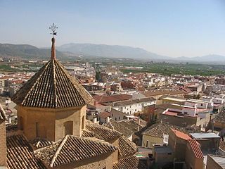
Jumilla is a town and a municipality in southeastern Spain. It is located in the north east of the Region of Murcia, close to the towns of Cieza and Yecla. According to the 2018 census, the town population was 25,547.

Mula, Spain Municipality in Murcia, Spain

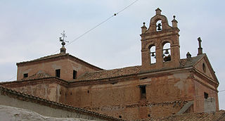
Mula is a municipality in the center of the autonomous community of Region of Murcia in southeastern Spain, with nearly 16,790 inhabitants. It is best known for the tamboradas held during the Holy Week. Tamboradas are a tradition in the area spanning the Murcian towns of Mula and Moratalla and the towns of Hellín and Baena in the provinces of Albacete and Córdoba, respectively.

Calasparra Municipality in Murcia, Spain

Calasparra is a municipality in the autonomous community of Murcia, Spain. It shares borders with Cieza, Mula, Cehegín, Moratalla and province of Albacete.

Liétor municipality of Spain

Liétor is a municipality in Albacete, Castile-La Mancha, Spain, located southeast of the Iberian peninsula, in the valley of the "Mundo" river. It has a population of 1,279 inhabitants. It comprises the districts of Cañada de Tobarra, Casablanca, El Ginete, Híjar, Mullidar, Talave and La Alcadima.

Campillo de Altobuey municipality of Spain

Campillo de Altobuey is a municipality in Cuenca, Castile-La Mancha, Spain. It has a population of 1,691.

Sahagún Municipality in Castile and León, Spain

Sahagún is a town and municipality of Spain, part of the autonomous community of Castile and León and the province of León. It is the main populated place in the Leonese part of the Tierra de Campos natural region.

Navas de San Juan Place in Jaén, Spain

Navas de San Juan is a Spanish village of the province of province of Jaén, Spain. According to the 2005 census (INE), the city has a population of 5,030 inhabitants. It is the biggest village in the region of El Condado. The river called Guadalimar runs for its municipal area.

Almendral municipality in Extremadura, Spain

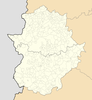
Almendral is a municipality located in the province of Badajoz, Extremadura, Spain. According to the 2004 census (INE), the municipality has a population of 1352 inhabitants.

Meco, Spain Municipality in Madrid, Spain

Meco is a municipality in the eastern part of the Autonomous Community of Madrid, (Spain). In 2006, Meco had a population of 11,094.

Region of Murcia Autonomous community and province of Spain

The Region of Murcia, is an autonomous community of Spain located in the southeast of the state, bordered by Andalusia, Castilla-La Mancha and the Valencian Community, on the Mediterranean coast.

Sierra Suroeste Comarca in Extremadura, Spain

Sierra Suroeste is a comarca located in southwestern province of Badajoz in the autonomous community of Extremadura, western Spain. Its capital and largest city is Jerez de los Caballeros.

La Alberca Municipality in Castile and León, Spain

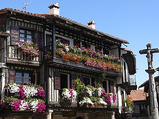
La Alberca is a municipality in the province of Salamanca in the autonomous community of Castilla y León, Spain. It is the capital of Sierra de Francia Comarca.

Hermitage of El Rocío cultural property in Almonte, Spain

The Hermitage of El Rocío is a hermitage at El Rocío in the countryside of Almonte, Province of Huelva, Andalusia, Spain. The hermitage is home to the Virgin of El Rocío, a small, much-venerated carved wood statue, and is the destination of an annual procession/pilgrimage on the second day of the Pentecost, known as the Romería de El Rocío, connected to the veneration of the Virgin of El Rocío; in recent years the Romería has brought together roughly a million pilgrims each year.

Virgin of El Rocío

The Virgin of El Rocío is a small carved wooden statue of the Virgin and Child, of which the only carved parts are the face, hands, and the Christ child, which is venerated at the Hermitage of El Rocío. The associated annual procession/pilgrimage, known as the Romería de El Rocío, draws roughly a million people each year.

Roque López Duarte Máyquez was a Spanish sculptor.

Aguilar del Río Alhama Municipality in La Rioja, Spain

Aguilar del Río Alhama is a village in the province and autonomous community of La Rioja, Spain. The municipality covers an area of 54.11 square kilometres (20.89 sq mi) and as of 2011 had a population of 549 people. It is located in a low altitude mountainous area, in the foothills of the Iberian System. It belongs to the region of Rioja Baja and is washed by the waters of the Alhama river.

Anguciana Municipality in La Rioja, Spain

Anguciana is a village in the province and autonomous community of La Rioja, Spain. It is situated in the northwest of the province. It depends on the judicial administration of Haro. The municipality covers an area of 5.05 square kilometres (1.95 sq mi) and as of 2011 had a population of 471 people.

Pecharromán village in Castile and León, Spain

Pecharromán is a village located in the Province of Segovia, Castile and León (Spain). It belongs to the municipality of Valtiendas and has 12 inhabitants (2016). The village is 80 kilometers away from Segovia, and 863 meters above sea level.

References

  1. Municipal Register of Spain 2018. National Statistics Institute.