Togoro Kotia

Last updated
Togoro Kotia
Commune
Mali adm location map.svg
Red pog.svg
Togoro Kotia
Location in Mali
Coordinates: 14°33′39″N4°40′29″W / 14.56083°N 4.67472°W / 14.56083; -4.67472 Coordinates: 14°33′39″N4°40′29″W / 14.56083°N 4.67472°W / 14.56083; -4.67472
CountryFlag of Mali.svg  Mali
Region Mopti Region
Cercle Ténenkou Cercle
Area [1]
  Total 1,000 km2 (400 sq mi)
Population (2009 census) [2]
  Total 13,687
  Density 14/km2 (35/sq mi)
Time zone GMT (UTC+0)

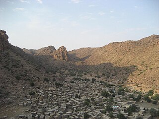
Togoro Kotia is a commune of the Cercle of Ténenkou in the Mopti Region of Mali. The principal village lies at Sossobé. The commune contains 13 villages and in 2009 had a population of 13,687.

Communes of Mali

A Commune is the third level administrative unit in Mali. Mali is divided into eight regions and one capital district (Bamako). These subdivisions bear the name of their principal city. The regions are divided into 49 Cercles. The Cercles and the district are divided into 703 Communes, with 36 Urban Communes and 667 Rural Communes, while some larger Cercles still contain Arrondissements above the Commune level, these are organisational areas with no independent power or office. Rural Communes are subdivided in Villages, while Urban Communes are subdivided into Quartier. Communes usually bear the name of their principal town. The capital, Bamako, consists of six Urban Communes. There were initially 701 communes until the Law No. 01-043 of 7 June 2001 created two new Rural Communes in the desert region in the north east of the country: Alata, Ménaka Cercle in the Gao Region and Intadjedite, Tin-Essako Cercle in the Kidal Region.

Ténenkou Cercle Cercle in Mopti Region, Mali

Ténenkou Cercle is an administrative subdivision of the Mopti Region of Mali. Its seat is the town of Ténenkou, which is also its largest town. The cercle is divided into communes.

Mopti Region Region in Mali

Mopti is the fifth administrative region of Mali, covering 79,017 km2. Its capital is the city of Mopti. During the 2012 Northern Mali conflict, the frontier between Southern Mali which is controlled by the central government and the rebel-held North ran through Mopti Region.

The commune lies in the Inner Niger Delta and each year between July and December the area is flooded. During this period most villages can only be accessed by boat.

Inner Niger Delta

The Inner Niger Delta, also known as the Macina or Masina, is the inland delta of the Niger River. It is an area of fluvial wetlands, lakes and floodplains in the semi-arid Sahel area of central Mali, just south of the Sahara desert.

Related Research Articles

Dandoli Commune and town in Mopti Region, Mali

Dandoli is a small village and rural commune in the Bandiagara Cercle of the Mopti Region of Mali. The commune contains 14 villages and in the 2009 census had a population of 9,853. The village of Dandoli lies 10 km northeast of Bandiagara.

Borko, Mali Commune and village in Mopti Region, Mali

Borko is a village and rural commune in the Cercle of Bandiagara of the Mopti Region of Mali. The village lies on the edge of the Dogon Plateau, 105 km northwest of Mopti and 73 km north-northwest of Bandiagara. In the 2009 census the commune had a population of 6,254. The village is set in a valley, and is only accessible by one entrance.

Dialloubé Commune and town in Mopti Region, Mali

Dialloubé is a small town and rural commune in the Cercle of Mopti in the Mopti Region of Mali. The commune covers an area of approximately 1,425 square kilometers and includes the town and 8 villages. In the 2009 census the commune had a population of 13,727.

Fatoma Commune and village in Mopti Region, Mali

Fatoma is a village and commune in the Cercle of Mopti in the Mopti Region of Mali. The commune contains 24 villages and in 2009 had a population of 24,595. The village of Fatoma lies 10 kilometres north of Sévaré.

Soye, Mali Commune and village in Mopti Region, Mali

Soye is a village and commune in the Cercle of Mopti in the Mopti Region of Mali. The commune contains 23 villages and in 2009 had a population of 20,684.

Koubaye Commune and village in Mopti Region, Mali

Koubaye is a village and commune in the Cercle of Mopti in the Mopti Region of Mali. The commune contains 8 villages and in 2009 had a population of 6,516.

Korombana Commune in Mopti Region, Mali

Korombana is a commune in the Cercle of Mopti in the Mopti Region of Mali. It is the most northerly commune in the cercle. The commune contains 32 villages and in 2009 had a population of 29,559. The main village (chef-lieu) is Korientzé.

Ouroubé Douddé Commune in Mopti Region, Mali

Ouroubé Douddé is a commune in the Cercle of Mopti in the Mopti Region of Mali. The commune contains nine villages and in 2009 had a population of 12,211. The main village is Sendégué.

Sio, Mali Commune in Mopti Region, Mali

Sio is a commune in the Cercle of Mopti in the Mopti Region of Mali.

Sasalbé Commune in Mopti Region, Mali

Sasalbé is a commune in the Cercle of Mopti in the Mopti Region of Mali. The commune contains nine villages. The administrative center (chef-lieu) is the village of N'Gouréma Toboro.

Diamnati Commune in Mopti Region, Mali

Diamnati is a commune in the Cercle of Bandigara in the Mopti Region of Mali. The commune contains 11 villages and at the time of the 2009 census had a population of 13,349. The main village of Dé lies 62 km northeast of Bandiagara.

Dandougou Fakala Commune in Mopti Region, Mali

Dandougou Fakala is a rural commune in the Cercle of Djenné in the Mopti Region of Mali. The commune contains ten villages. The administrative center (chef-lieu) is the village of Konio. In the 2009 census the commune had a population of 9,841.

Koubewel Koundia Commune and village in Mopti Region, Mali

Koubewel Koundia is a rural commune in the Cercle of Douentza in the Mopti Region of Mali. The commune contains 14 villages and had a population of 13,529 in the 2009 census. The main village (chef-lieu) is Koubewel.

Pel Maoudé Commune and village in Mopti Region, Mali

Pel Maoudé is a village and rural commune and seat of the Cercle of Koro in the Mopti Region of Mali. The commune covers an area of approximately 203 square kilometers and includes 9 villages. In the 2009 census the commune had a population of 13,727.

Dongo, Mali Commune in Mopti Region, Mali

Dongo is a commune of the Cercle of Youwarou in the Mopti Region of Mali. The principal village lies at Kormou-Marka. In 2009 the commune had a population of 11,421.

Ouro Ali Commune in Mopti Region, Mali

Ouro Ali is a rural commune of the Cercle of Djenné in the Mopti Region of Mali. The commune includes the villages of Senossa, Koloye, Ouro Djikoye, Siratintin, Weraka, Wono, Kotola, Djimatogo, Ali Samba, Kandia and Somena. The administrative center (chef-lieu) is the village of Senossa. In the census of 2009 the commune had a population of 10,354.

Pondori Commune in Mopti Region, Mali

Pondori is a commune of the Cercle of Djenné in the Mopti Region of Mali. The principal village lies at Gomitogo. The commune also includes the villages of Koba, Kobassa, Siroumou, Noina and Djera. In the census of 2009 the commune had a population of 4,315, a substantially lower value than the population of 7,748 recorded in the 1998 census.

Bamba, Mopti Commune in Mopti Region, Mali

Bamba is a rural commune of the Cercle of Koro in the Mopti Region of Mali. The commune contains 14 villages and in the 2009 census had a population of 13,610. Most of the population of the commune are Dogon. The administrative centre (chef-lieu) is the village of Déguéré.

Diaka, Mali Commune in Mopti Region, Mali

Diaka is a commune of the Cercle of Ténenkou in the Mopti Region of Mali. The principal village lies at Dia. In 2009 the commune had a population of 19,763.

References

  1. Plan de Sécurité Alimentaire Commune Rurale de Togoro-Kotia 2006-2010 (PDF) (in French), Commissariat à la Sécurité Alimentaire, République du Mali, USAID-Mali, 2006, archived from the original (PDF) on 2012-09-15.
  2. Resultats Provisoires RGPH 2009 (Région de Mopti) (PDF) (in French), République de Mali: Institut National de la Statistique.