Mopti is the fifth administrative region of Mali, covering 79,017 km2. Its capital is the city of Mopti. During the 2012 Northern Mali conflict, the frontier between Southern Mali which is controlled by the central government and the rebel-held North ran through Mopti Region.

Mopti is a town and an urban commune in the Inner Niger Delta region of Mali. The town is the capital of the Mopti Cercle and the Mopti Region. Situated 630 km northeast of Bamako, the town lies at the confluence of the Niger and the Bani Rivers and is linked by an elevated causeway to the town of Sévaré. The urban commune, which includes both Mopti and Sévaré, had a population of 114,296 in the 2009 census.
Gossi is a town and rural commune in the Cercle of Gourma-Rharous of the Tombouctou Region of Mali, lying northeast of Hombori and southwest of Gao. The town is just to the west of the main RN15 highway that links Mopti with Gao. It is on a seasonal lake, Mare de Gossi, and is surrounded by nature reserves in which a large herd of elephants live. The town is the site of a large cattle market. The commune contains around 31 villages and in the 2009 census, it had a population of 24,521. Around 90% of the population are nomadic pastoralists but there are permanent settlements around Lake Gossi, Lake Ebanguemalène and Lake Agoufou.
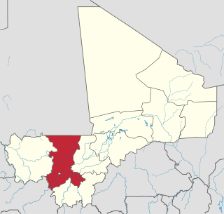
Koulikoro Region is a region in western Mali. It is the second administrative area of Mali and covers an area of 90,120 km2. Its capital is the city of Koulikoro.

Bandiagara is a small town and urban commune in the Mopti Region of Mali. The name translates roughly to "large eating bowl"—referring to the communal bowl meals are served in. Mainly on its Bandiagara Escarpment it has about 2,000 speakers of the vibrant Bangime language, an isolate used mainly as an anti-language; it has the highest point of the country.

Douentza is a town and urban commune in the Mopti Region of central Mali. The town lies 145 km east-northeast of Mopti on the RN16, a paved road that links Mopti and Gao. It is the administrative center of the Douentza Cercle.

Douentza Cercle is an administrative subdivision of the Mopti Region of Mali. The administrative center (chef-lieu) is the town of Douentza.
Ouattagouna or Ouatagouna is a small town and commune in the Cercle of Ansongo in the Gao Region of south-eastern Mali.
Dourou (Dúrù) is a village and rural commune in the Bandiagara Cercle of the Mopti Region of Mali. The commune contains 28 villages along the Bandiagara Escarpment which together at the time of the 2009 census had a population of 19,411. Around 95 percent of the population is Dogon with the remainder being Fulani.
Borko is a village and rural commune in the Cercle of Bandiagara of the Mopti Region of Mali. The village lies on the edge of the Dogon Plateau, 105 km northwest of Mopti and 73 km north-northwest of Bandiagara. In the 2009 census the commune had a population of 6,254. The village is set in a valley, and is only accessible by one entrance.
Konna is a town and rural commune in the Cercle of Mopti in the Mopti Region of Mali. The town lies 60 km northeast of Mopti on the eastern edge of the flood plain of the Niger River. The main RN16 highway linking Sévaré and Gao branches to the east just to the south of the town. The commune has an area of approximately 838 km2 and contains the town and 24 of the surrounding villages. In the 2009 census, it had a population of 36,767.
Soye (Sɔ̂y) is a village and commune in the Cercle of Mopti in the Mopti Region of Mali. The commune contains 23 villages and in 2009 had a population of 20,684.
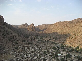
Sangha is a rural commune in the Cercle of Bandigara in the Mopti Region of Mali. The commune contains around 44 small villages and in the 2009 census had a population of 32,513. The administrative centre (chef-lieu) is the village of Sangha Ogol Leye, one of a cluster of at least 10 small villages at the top of the Bandiagara Escarpment.
Madiama is a rural commune and village in the Cercle of Djenné in the Mopti Region of Mali. The commune contains ten villages.
Dianweli or Dianwely (Jɔ́wⁿlè) is a rural commune in the Cercle of Douentza in the Mopti Region of Mali. The commune contains eight villages and had a population of 3,363 in the 2009 census. The main village (chef-lieu) is Dianwely Maoundé which is 8 km southeast of Douentza, the main town of the cercle.
Dinangourou is a village and commune of the Cercle of Koro in the Mopti Region of Mali. Jamsay Dogon is spoken in the village. A weekly Sunday market is hosted in the village. The local surname is Goro.
Dioungani is a village and commune of the Cercle of Koro in the Mopti Region of Mali. Jamsay Dogon is spoken in the commune.
Farimaké is a commune of the Cercle of Youwarou in the Mopti Region of Mali. The local government is based in the village of Gathi-Loumbo. The commune covers an area of 3,148 km2. It is bounded to the west by the commune of Youwarou, to the north by the communes of Dianké, Léré and Alzounoub, to the east by the commune of Nampalari and to the south by the communes of Kareri, Toguéré Coumbé and Bimbere Tama. The commune lies to the west of the Issa-Ber, the larger of the two branches of the Niger River that flow out of Lake Débo. The commume contains 29 small villages and in 2009 had a population of 11,869. The largest ethnic group are the Fulani who make up more than 40 percent of the population.
Tédié or Tédjé is a rural commune of the Cercle of Douentza in the Mopti Region of Mali. The commune contains 12 villages and in the 2009 census had a population of 6,733. The principal village (chef-lieu) is Tongo-Tongo.
Bamba is a rural commune of the Cercle of Koro in the Mopti Region of Mali. The commune contains 14 villages and in the 2009 census had a population of 13,610. Most of the population of the commune are Dogon. The administrative centre (chef-lieu) is the village of Déguéré.