Mali is a landlocked nation in West Africa, located southwest of Algeria, extending south-west from the southern Sahara Desert through the Sahel to the Sudanian savanna zone. Mali's size is 1,240,192 square kilometers.
The environment of China comprises diverse biotas, climates, and geologies. Rapid industrialization, population growth, and lax environmental oversight have caused many environmental issues and large-scale pollution.

The Bandiagara Escarpment is a sandstone cliff in the Dogon country of Mali. It rises about 500 m (1,600 ft) above the lower sandy flats to the south, and has a length of approximately 150 km (90 mi).

Hombori is a small town and rural commune in the Cercle of Douentza in the Mopti Region of Mali. The commune contains 25 villages and in the 2009 census had a population of 23,099. The town lies just to the north of the Hombori Tondo mesa on the R15 highway linking Mopti and Gao.
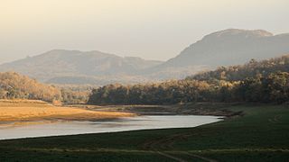
Satpura Tiger Reserve (STR) also known as Satpura National Park is located in the Narmadapuram district of Madhya Pradesh in India. Its name is derived from the Satpura range. It covers an area of 524 km2 (202 sq mi). Satpura National Park, along with the adjoining Bori and Pachmarhi wildlife sanctuaries, provides 2,200 km2 (850 sq mi) of unique central Indian highland ecosystem. It was set up in 1981.

Gorongosa National Park is at the southern end of the Great African Rift Valley in the heart of central Mozambique, Southeast Africa. The more than 4,000 square kilometres (1,500 sq mi) park comprises the valley floor and parts of surrounding plateaus. Rivers originating on nearby Mount Gorongosa water the plain.

The wildlife of Ivory Coast consists of the flora and fauna of this nation in West Africa. The country has a long Atlantic coastline on the Gulf of Guinea and a range of habitat types. Once covered in tropical rainforest, much of this habitat has been cleared, the remaining terrain being gallery forests and savanna with scattered groups of trees, resulting in a decrease in biodiversity. As of 2016, 252 species of mammal had been recorded in Ivory Coast, 666 species of bird, 153 species of reptile, 80 species of amphibian, 671 species of fish and 3660 species of vascular plant.

The wildlife of Uganda is composed of its flora and fauna. Uganda has a wide variety of different habitats, including mountains, hills, tropical rainforest, woodland, freshwater lakes, swamps and savanna with scattered clumps of trees. The country has a biodiverse flora and fauna reflecting this range of habitats and is known for its primates, including gorillas and chimpanzees. There are ten national parks and thirteen wildlife reserves; some 345 species of mammal and 1020 species of bird have been recorded in the country.

The wildlife of South Africa consists of the flora and fauna of this country in Southern Africa. The country has a range of different habitat types and an ecologically rich and diverse wildlife, vascular plants being particularly abundant, many of them endemic to the country. There are few forested areas, much savanna grassland, semi-arid Karoo vegetation and the fynbos of the Cape Floristic Region. Famed for its national parks and big game, 297 species of mammal have been recorded in South Africa, as well as 849 species of bird and over 20,000 species of vascular plants.

The wildlife of Niger is composed of its flora and fauna. The protected areas in the country total about 8.5 million hectares, which is 6.6 percent of the land area of the country, a figure which is expected to eventually reach the 11‑percent target fixed by the IUCN with the addition of more areas under the reserve category. Conservation of wildlife is ensured by laws and regulations enacted by the government of Niger, which has enforced a permanent ban on hunting so that animals such as lions, hippos and giraffes are safe in the wild.
The wildlife of Mali, composed of its flora and fauna, is widely varying from the Saharan desert zone to the Sahelian east–west zone, to Mali, a landlocked francophone country in North Africa; large swathes of Mali remain unpopulated but has three sub-equal vegetation zones; the country has Sahara Desert in the north, the Niger River Basin at its center and the Senegal River on the south.

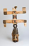
Dogon country is a region of eastern Mali and northwestern Burkina Faso populated mainly by the Dogon people, a diverse ethnic group in West Africa with diverse languages. Like the term Serer country occupied by the Serer ethnic group, Dogon country is vast, and lies southwest of the Niger River belt. The region is composed of three zones: the plateau, the escarpment and the Seno-Gondo plain.

Peru has some of the greatest biodiversity in the world. It belongs to the select group of mega diverse countries because of the presence of the Andes, Amazon rainforest, and the Pacific Ocean. It has the fourth-most tropical forests of any country and the ninth-most forest area. The country is ranked among the five countries with the greatest biodiversity in the world according to various studies.
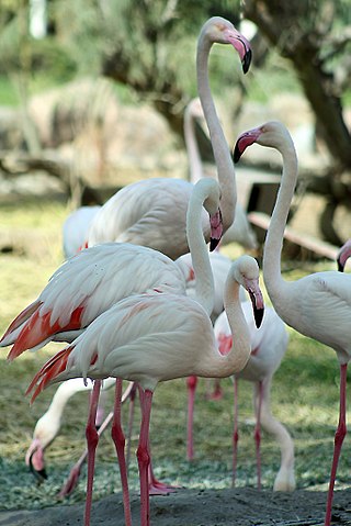
The wildlife of Bahrain is the flora and fauna of the archipelago of Bahrain. Apart from a strip of the north and west of the main island, where crops such as potatoes are grown with irrigation, the land is arid. With a very hot dry summer, a mild winter, and brackish groundwater, the plants need adaptations in order to survive. Nevertheless, 196 species of higher plant have been recorded here, as well as about seventeen species of terrestrial mammals, many birds and reptiles, and many migratory birds visit the islands in autumn and spring.
The wildlife of Turkmenistan is the flora and fauna of Turkmenistan, and the natural habitats in which they live. Turkmenistan is a country in Central Asia to the east of the Caspian Sea. Two thirds of the country is hot dry plains and desert, and the rest is more mountainous. Very little rain falls in summer and the chief precipitation occurs in the southern part of the country in the winter and spring. The Caspian coast has milder winters.
Mount Tom is a small peak, standing at 1357 feet, located in the town of Woodstock, Vermont. It is a part of the Marsh-Billings-Rockefeller National Historical Park. The peak has a multitude of hiking, running, and Nordic skiing trails, and has many sites dedicated to the national park. Standing in the middle of Woodstock, Vermont, the peak also is host to many annual town events, including the Road to the Pogue Race. Visible from the top are sights such as the village of Woodstock, the sister peak of Mount Tom, the Ottauquechee River, Vermont Route 4A, and many neighboring mountains.

Prespa National Park is a national park situated in southeastern Albania on the border triangle shared with Greece and North Macedonia. At approximately 277.5 km2 (107.1 sq mi), the park encompasses the country's sections of the Great and Small Prespa Lake. It is considerably characterised by high mountains, narrow islands, vast freshwater wetlands, salt marshes, meadows, reed beds and dense forests.

The Mali me Gropa-Bizë-Martanesh Nature Park is a habitat or species management area in central Albania adjacent with the border with Dajti National Park. It covers a surface area of 25,266.42 hectares (252.6642 km2). It is situated in Dibër and Tirana County with three municipalities, Xibër, Martanesh and Shëngjergj, and several villages within its territory. The International Union for Conservation of Nature (IUCN) has listed the landscape as Category V. The region has been as well recognised as an Important Plant Area of international importance by Plantlife.

The wildlife of Spain includes the diverse flora and fauna of Spain. The country located at the south of France has two long coastlines, one on the north on the Cantabrian Sea, another on the East and South East on the Mediterranean Sea, and a smaller one on the west and south west on the Atlantic Ocean, its territory includes a big part of the Iberian Peninsula, the Canary Islands, the Balearic Islands and two enclaves in North Africa, Ceuta and Melilla. and the different climate zones, Spain is one of the countries in Europe with the greatest biodiversity.