Hexham is a suburb of the city of Newcastle, about 15 km (9 mi) inland from the Newcastle CBD in New South Wales, Australia on the bank of the Hunter River.

The Hunter River is a major river in New South Wales, Australia. The Hunter River rises in the Liverpool Range and flows generally south and then east, reaching the Tasman Sea at Newcastle, the second largest city in New South Wales and a major harbour port. Its lower reaches form an open and trained mature wave dominated barrier estuary.
Stockton is a suburb of Newcastle, New South Wales, Australia, located 600 m (0.4 mi) from Newcastle's central business district. It is the only residential suburb of the City of Newcastle that lies north of the Hunter River.

Morpeth is a suburb of the city of Maitland in the Hunter Region of New South Wales, Australia. It is on the southern banks of the Hunter River at the border between the City of Maitland and Port Stephens Council LGAs. The major population centre, where almost all residents of the suburb reside, is the historical town of Morpeth which takes its name from Morpeth, Northumberland, near Newcastle upon Tyne, in England.

Hexham railway station is located on the Main Northern line in New South Wales, Australia. It serves the western Newcastle suburb of Hexham, and was opened on 1 August 1871.

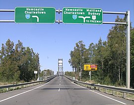
Raymond Terrace is a town in the Hunter Region of New South Wales, Australia, about 26 km (16 mi) by road north of Newcastle on the Pacific Highway. Established in 1837 it is situated at the confluence of the Hunter and Williams rivers. The town was named after Lieutenant Raymond, who had explored the Hunter River in 1797 and described the terraced appearance of trees in the area. Governor Lachlan Macquarie camped in the area in 1818, using "Raymond's Terrace" as the name for the place where his party had camped.
Nelson Bay is a significant township of the Port Stephens local government area in the Hunter Region of New South Wales, Australia. It is located on a bay of the same name on the southern shore of Port Stephens about 60 kilometres (37 mi) by road north-east of Newcastle, its nearest rail link. At the 2021 census, Nelson Bay had a population of 6,141.

Woodville is a rural suburb in the Hunter Region of New South Wales, Australia that is shared between the Port Stephens and Maitland local government areas (LGA). Most of the suburb lies to the east of the Paterson River in the Port Stephens LGA while a small area of approximately 1.3 square kilometres (0.5 sq mi), to the west of the Paterson, is within the boundaries of the Maitland LGA.

Tarro is a north-western suburb of the Newcastle City Council local government area in the Hunter Region of New South Wales, Australia. It, and parts of nearby Beresfield, was originally known as Upper Hexham, "lower" Hexham being an older settlement located about 5 kilometres (3 mi) to the east on the Hunter River. The name "Tarro" reportedly means "stone" in an Aboriginal language.

Woodberry is one of the easternmost suburbs of the City of Maitland in the Hunter Region of New South Wales, Australia. At the 2011 census, Woodberry's population was 3,155. Most of the population lives in residential subdivisions while almost 84% of the suburb's land is rural in nature. Rental accommodation is occupied by 33.33% of the residents.

Salt Ash is a rural suburb of the Port Stephens local government areas in the Hunter Region of New South Wales, Australia. It is located on the main road between Newcastle and Nelson Bay but is largely undeveloped, partly because it is the location of the Salt Ash Air Weapons Range which is used by pilots from RAAF Base Williamtown for training purposes.

Williamtown is a rural suburb of the Port Stephens local government area in the Hunter Region of New South Wales, Australia. It is located on the main road between Newcastle and Nelson Bay.

Fullerton Cove is a rural suburb of the Port Stephens local government area in the Hunter Region of New South Wales, Australia, located just north of Fern Bay and adjacent to Fullerton Cove, from which the suburb gets its name. The Worimi people are the traditional owners of the Port Stephens area. At the 2021 Australian census the population of Fullerton Cove was 745.

Fern Bay is the southernmost suburb of the Port Stephens local government area in the Hunter Region of New South Wales, Australia. It is located just north of Stockton, which is the only suburb of Newcastle that lies north of the Hunter River and to the east of the north arm of the Hunter River at the entrance to Fullerton Cove, a large body of water. To the east is the Tasman Sea. Despite the suburb only being 6 kilometres (3.7 mi) in a direct line from Newcastle, the need to cross the Hunter River results in Fern Bay being 16 km (9.9 mi) by road from the centre of the city.

Tanilba Bay is a suburb of the Port Stephens local government area in the Hunter Region of New South Wales, Australia. It is located on the Tilligerry Peninsula adjacent to the bay from which it got its name. "Tanilba" is said to mean "place of white flowers" in a local Indigenous language, presumably a reference to the flannel flowers which formerly thrived in the area. At the 2021 census Tanilba Bay had a population of 3,237. Tanilba Bay Public School is a co-ed government primary school located at 1A King Albert Avenue.

Kooragang is the northernmost and largest suburb of the city of Newcastle, in the Hunter Region of New South Wales, Australia. Dominated by Kooragang Island, the eastern part of the suburb is primarily industrial, while the western part of the suburb consists of nature reserves. Covering an area of 35.4 km2 (13.7 sq mi), at the 2016 census, there were no people living in the suburb.
Osterley is a small rural suburb of the Port Stephens local government area in the Hunter Region of New South Wales, Australia. Most of the small population lives in the elevated part of the suburb along Hinton Road, east of Barties Creek which is a tributary of the Hunter River. The area to the west of Barties creek is low-lying and subject to periodic flooding. .In 2016 117 people live there with a median age of 46.

Nelsons Plains is a primarily rural suburb of the Port Stephens local government area in the Hunter Region of New South Wales, Australia. It is situated on Seaham Road between the Hunter and Williams rivers. At the 2016 census the suburb had a population of 362.
Ferodale is a sparsely populated rural suburb of the Port Stephens local government area in the Hunter Region of New South Wales, Australia. A large portion of the suburb is occupied by Grahamstown Dam, the lower Hunter Region's main water storage reservoir.