
Liard River Hot Springs Provincial Park is a provincial park in British Columbia, Canada. It is home to the largest natural hot springs in Canada. It is a natural river of hot water rather than a spring fed man made pool The park is part of the larger Muskwa-Kechika Management Area. The community of Liard River, British Columbia is located nearby.

Babine Lake Marine Provincial Park is a provincial park in British Columbia, Canada. The park was established by Order-in-Council in 1993, comprising two sites at Pendleton Bay totalling 36.9 hectares. Another was established in the same year at Smithers Landing, comprising approximately 157.8 hectares. Three more sites were added in 2001, Hook (Deep) Bay, Pierre Creek, Pinkut Creek and Sandpoint. All sites combined comprise approximately 492 hectares.
Babine Mountains Provincial Park is a provincial park in British Columbia, Canada, located to the east of the Bulkley River between the town of Smithers (SW) and Babine Lake (NE). Established by Order-in-Council as the Babine Mountains Recreation Area in 1984, it was upgraded to park status and its name changed in 1999. It contains approximately 31,465 hectares.
Beaumont Provincial Park is a provincial park located at the southeast end of Fraser Lake, between Fort Fraser and the town of Fraser Lake, British Columbia, approximately 40 km west of Vanderhoof, British Columbia. The park contains the site of the original Fort Fraser.
Cormorant Channel Marine Provincial Park is a provincial park in British Columbia, Canada, located in the Pearse Islands, a small archipelago to the east of Cormorant Island and the Village of Alert Bay at the western end of Johnstone Strait.
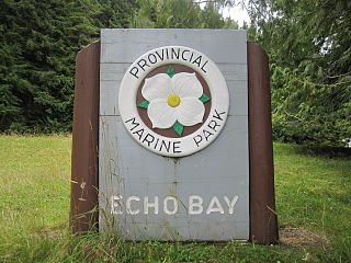
Echo Bay Marine Provincial Park is a provincial park in British Columbia, Canada, established in 1971 and containing 1.5 hectares. It is located at the bay of the same name, offshore from the community of the same name, which is the location of the Simoom Sound post office and is on the west side of Gilford Island.

Lakelse Lake Provincial Park is a provincial park in British Columbia, Canada located just west of Highway 37 between Terrace and Kitimat. The name is derived from the Coast Tsimshian language word "LaxGyels" - "fresh water mussel", for the mollusk that is found on the bottom of both Lakelse Lake and Lakelse River. Prior to Lakelse Lake becoming a provincial park, Hatchery Creek, which runs throughout the park, was the site of a sockeye salmon hatchery operated by the Canadian Government between 1919 and 1936. Lakelse Lake Provincial Park was established on March 16, 1956.

Nuchatlitz Provincial Park is a provincial park in British Columbia, Canada, located no the northwest side of Nootka Island, facing Nuchatlitz Inlet, on the west coast of Vancouver Island. Established in 1996, the park contains approximately 2105 ha.
Rainbow Alley Provincial Park is a provincial park in British Columbia, Canada.

Red Bluff Provincial Park is a provincial park in British Columbia, Canada.
The Kingcome River is a river in the Canadian province of British Columbia. Its drainage basin is 1,456 square kilometres (562 sq mi) in size.
The Sir Harry Range is a small mountain range in southwestern British Columbia, Canada, located on the west side of Huaskin Lake, between Grappler Sound and Seymour Inlet, north of Port McNeill. It has an area of 18 km2 and is a subrange of the Pacific Ranges which in turn form part of the Coast Mountains. The range was named for Sir Harry Verney whose son, Sir Edmund Verney commanded HMS Grappler while stationed at the Pacific Station from 1862 to 1866.
The New Westminster Land District is one of 59 land districts of British Columbia, Canada, which are the underlying cadastral divisions of that province, created with rest of those on Mainland British Columbia via the Lands Act of the Colony of British Columbia in 1860. The British Columbia government's BC Names system, a subdivision of GeoBC, defines a land district as "a territorial division with legally defined boundaries for administrative purposes" All land titles and surveys use the Land District system as the primary point of reference, and entries in BC Names for placenames and geographical objects are so listed.
Rose Lake is an unincorporated community on the Yellowhead Highway in the Bulkley Valley region of northwestern British Columbia, Canada. Its name is derived from the nearby waterbody Rose Lake. The community and the lake are along the northern mainline of the Canadian National Railway just northeast of Bulkley Lake.

Port Neville is a bay, port and locality on the north side of Johnstone Strait, south of Call Inlet, in the Central Coast region of British Columbia, Canada.
Kalugwis, or Karlukwees or Qalogwis, is the principal community of the Tlowitsis Nation of the Kwakwaka'wakw peoples of the Johnstone Strait region of the South Coast of British Columbia, Canada. It is located on the south shore of Turnour Island facing Beware Passage and is within Karlukwees Indian Reserve No. 1, a.k.a. Karlukwees 1, 10.8 ha.
The Washwash River is a river in the Central Coast region of British Columbia, Canada, flowing generally west out of the Pacific Ranges into the Tzeo River just above the Tzeo's mouth into the head of Owikeno Lake.
Drury inlet is an inlet in the Queen Charlotte Strait region of the Central Coast of British Columbia, Canada, extending west from Wells Passage to the northwest of North Broughton Island, northwest of the town of Port Hardy. Branching off to the northeast from the north side of the head of the inlet is Actaeon Sound.
Decker Lake is a community on the lake of the same name in the Bulkley River drainage of northwestern British Columbia, Canada. It is located northwest of the community of Burns Lake along British Columbia provincial highway 16, near the outlet of Decker Creek.
The Frog River is a tributary of the Kechika River in Northern British Columbia, Canada.