Related Research Articles

A web server is computer software and underlying hardware that accepts requests via HTTP or its secure variant HTTPS. A user agent, commonly a web browser or web crawler, initiates communication by making a request for a web page or other resource using HTTP, and the server responds with the content of that resource or an error message. A web server can also accept and store resources sent from the user agent if configured to do so.

In modern mapping, a topographic map or topographic sheet is a type of map characterized by large-scale detail and quantitative representation of relief features, usually using contour lines, but historically using a variety of methods. Traditional definitions require a topographic map to show both natural and artificial features. A topographic survey is typically based upon a systematic observation and published as a map series, made up of two or more map sheets that combine to form the whole map. A topographic map series uses a common specification that includes the range of cartographic symbols employed, as well as a standard geodetic framework that defines the map projection, coordinate system, ellipsoid and geodetic datum. Official topographic maps also adopt a national grid referencing system.
Topography is the study of the forms and features of land surfaces. The topography of an area may refer to the land forms and features themselves, or a description or depiction in maps.
MapQuest is an American free online web mapping service. It was launched in 1996 as the first commercial web mapping service. MapQuest vies for market share with competitors such as Apple Maps, Here and Google Maps.

NASA WorldWind is an open-source virtual globe. According to the website, "WorldWind is an open source virtual globe API. WorldWind allows developers to quickly and easily create interactive visualizations of 3D globe, map and geographical information. Organizations around the world use WorldWind to monitor weather patterns, visualize cities and terrain, track vehicle movement, analyze geospatial data and educate humanity about the Earth." It was first developed by NASA in 2003 for use on personal computers and then further developed in concert with the open source community since 2004. As of 2017, a web-based version of WorldWind is available online. An Android version is also available.
Microsoft Research Maps was a free online repository of public domain aerial imagery and topographic maps provided by the United States Geological Survey (USGS). The site was a collaboration between Microsoft Research (MSR), Bing Maps, and the USGS. It was in operation from June 1998 to March 2016. It had 30,000 to 50,000 visitors per day as of January 2010. The site was renamed in 2010, prior to which it had been known as TerraServer-USA.

The National Map is a collaborative effort of the United States Geological Survey (USGS) and other federal, state, and local agencies to improve and deliver topographic information for the United States. The purpose of the effort is to provide "...a seamless, continuously maintained set of public domain geographic base information that will serve as a foundation for integrating, sharing, and using other data easily and consistently".
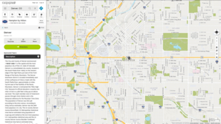
TopoZone is a website operated by Locality LLC that offers free online topographic maps.

DeLorme Publishing Company is a producer of personal satellite tracking, messaging, and navigation technology. The company's main product, inReach, integrates GPS and satellite technologies. inReach provides the ability to send and receive text messages to and from anywhere in the world by using the Iridium satellite constellation. By pairing with a smartphone, navigation is possible with access to free downloadable topographic maps and National Oceanic and Atmospheric Administration (NOAA) charts. On February 11, 2016, the company announced that it had been purchased by Garmin, another multinational producer of GPS products and services.
A GIS software program is a computer program to support the use of a geographic information system, providing the ability to create, store, manage, query, analyze, and visualize geographic data, that is, data representing phenomena for which location is important. The GIS software industry encompasses a broad range of commercial and open-source products that provide some or all of these capabilities within various information technology architectures.
TerraServer was a commercial website specializing in aerial and satellite imagery which was originally launched in 1997. It is owned and operated by TerraServer.com, Inc. in Raleigh, North Carolina. The company was previously named Aerial Images until May 2002 when the assets of Aerial Images were sold and the company renamed itself TerraServer.com, Inc.
URL shortening is a technique on the World Wide Web in which a Uniform Resource Locator (URL) may be made substantially shorter and still direct to the required page. This is achieved by using a redirect which links to the web page that has a long URL. For example, the URL "https://en.wikipedia.org/wiki/URL_shortening" can be shortened to "https://w.wiki/U". Often the redirect domain name is shorter than the original one. A friendly URL may be desired for messaging technologies that limit the number of characters in a message, for reducing the amount of typing required if the reader is copying a URL from a print source, for making it easier for a person to remember, or for the intention of a permalink. In November 2009, the shortened links of the URL shortening service Bitly were accessed 2.1 billion times.

The Geospatial Data Abstraction Library (GDAL) is a computer software library for reading and writing raster and vector geospatial data formats, and is released under the permissive X/MIT style free software license by the Open Source Geospatial Foundation. As a library, it presents a single abstract data model to the calling application for all supported formats. It may also be built with a variety of useful command line interface utilities for data translation and processing. Projections and transformations are supported by the PROJ library.
MapServer is an open-source development environment for building spatially enabled internet applications, built in the C language, and is widely known as one of the fastest Web mapping engines available. It can run as a CGI program or via MapScript which supports several programming languages. MapServer can access hundreds of data formats, any raster or vector format supported by GDAL, and reprojections on-the-fly are handled by PROJ. MapServer was originally developed by Steve Lime, then working at the University of Minnesota — so, it was previously referred to as "UMN MapServer", to distinguish it from commercial "map servers"; today it is commonly referred to as just "MapServer", and is maintained by the MapServer Project Steering Committee (PSC). MapServer was originally developed with support from NASA, which needed a way to make its satellite imagery available to the public.

Web mapping or an online mapping is the process of using, creating, and distributing maps on the World Wide Web, usually through the use of Web geographic information systems. A web map or an online map is both served and consumed, thus, web mapping is more than just web cartography, it is a service where consumers may choose what the map will show.
The Libre Map Project is an online collection of all digital USGS 1:24K scale topographic maps covering the United States, available as a free download.

A national mapping agency (NMA) is an organisation, usually publicly owned, that produces topographic maps and geographic information of a country. Some national mapping agencies also deal with cadastral matters.

The United States Geological Survey (USGS), founded as the Geological Survey, is an agency of the U.S. Department of the Interior whose work spans the disciplines of biology, geography, geology, and hydrology. The agency was founded on March 3, 1879, to study the landscape of the United States, its natural resources, and the natural hazards that threaten it. The agency also makes maps of extraterrestrial planets and moons based on data from U.S. space probes.
The Army Map Service (AMS) was the military cartographic agency of the United States Department of Defense from 1941 to 1968, subordinated to the United States Army Corps of Engineers. On September 1, 1968, the AMS was redesignated the U.S. Army Topographic Command (USATC) and continued as an independent organization until January 1, 1972, when it was merged into the new Defense Mapping Agency (DMA) and redesignated as the DMA Topographic Center (DMATC). On October 1, 1996, DMA was folded into the National Imagery and Mapping Agency (NIMA), which was redesignated as the National Geospatial-Intelligence Agency (NGA) in 2003.
References
- 1 2 About Topoquest - topoquest.com
- ↑ "topoquest.com whois lookup". www.who.is. Retrieved 2024-06-27.