Torcross

Last updated

Looking down on Torcross and Slapton Sands from Torcross Point. Slapton Ley is visible behind the houses. Torcross September 2015.jpg
Looking down on Torcross and Slapton Sands from Torcross Point. Slapton Ley is visible behind the houses.
The "inland" part of Torcross seen from across Slapton Ley. Slapton ley and torcross village.jpg
The "inland" part of Torcross seen from across Slapton Ley.
Salvaged Sherman M4A1 DD tank from Operation Tiger Sherman tank at memorial for those killed in Operation Tiger.JPG
Salvaged Sherman M4A1 DD tank from Operation Tiger

Torcross is a seaside village in the South Hams district of south Devon in England. It stands at grid reference SX822420 at the southern end of Slapton Sands, a narrow strip of land and shingle beach which separates the freshwater lake of Slapton Ley from Start Bay and carries the A379 coastal road north to Dartmouth.

Contents

Early history

The first mention of Torcross was recorded at the manorial court in the court rolls of 29 March 1602 when it was recorded that a representative of the new village reported that everything was "all well". In 1854 the coastal road between Kingsbridge and Dartmouth was built passing through Torcross giving a much needed lifeline to the community. In 1858 a coach service started between Dartmouth and Kingsbridge. [1]

WW2 evacuation and Exercise Tiger

In late 1943 Torcross was evacuated, along with many other villages in the South Hams area, to make way for 15,000 allied troops who needed the area to practice for the D-Day landings.

In the early hours of 28 April 1944 a tragic incident happened during Exercise Tiger: nine German torpedo boats (Schnellboote), alerted by heavy radio traffic, intercepted a three-mile-long convoy of vessels travelling from the Isle of Portland to Slapton Sands to undertake landing rehearsals for D Day. Two Tank landing ships (LST) were sunk in the engagement and 946 American servicemen died. Poor communications led to badly-timed shelling on the beach, killing about 300 more men. Over 1,000 lives were lost over the course of the operation, most of them through US Army friendly fire. [2] [3]

A Sherman amphibious tank and several plaques stand at Torcross car park between Slapton Ley and the beach as memorials to the men who lost their lives. The operation to salvage the tank from the shallow waters of Start Bay was financed by Ken Small, a Torcross hotelier, and was completed in 1984. [4]

Storms and coastal erosion

Over the years Torcross has survived a battering from some terrible storms. On 4 January 1979 enormous waves washed over the roofs of the dwellings causing substantial damage to all the buildings along the then beach front; in the aftermath lorry-loads of boulders were brought in from the Plymouth area as temporary protection and a new curved seawall was built. On 11 and 12 January 2001 another bad storm caused the loss of up to five metres of the beachhead along a stretch of beach about 1000 metres long. Part of the A379 road along Slapton Sands near Slapton village was also destroyed; it was not reopened for three months after being rerouted. 3,000 tons of boulders were initially used to protect the road, but were later removed because of damage to the Slapton Ley SSSI.

The maintenance of the road is vital to Torcross as it is the main access route to Dartmouth for the villagers and local businesses. South Hams District Council is working to keep the A379 from being eroded, realigning the road and importing shingle from parts of Slapton Sands that have a surplus. A study by Natural England after the 2001 storm confirmed that because of the reduction in the amount of shingle available and the increasing frequency of storms, coupled with a predicted 30 to 40 cm rise in sea level over the next 50 years, Slapton Sands is retreating and will continue to retreat. [5]

On Tuesday and Wednesday 4 and 5 February 2014 a storm caused extensive damage to the properties along the promenade with the sea entering all properties except one on the night of 4 February. The buildings were hit by green water that came over the sea wall and large shingle also hit them. The road was also covered with the beach and became unpassable. Another storm on the night of Friday 14 February resulted in thousands of tonnes of the beach being washed onto the beach road, 4 people had to be rescued from their cars that were washed off the road, the coastguards undertaking the rescue also got their vehicle stuck on the unpassable beach road.

In January 2015, some 27,000 tonnes of shingle was moved from further up the beach at a cost of £250,000 to strengthen the sea defences this was washed away by the next high tide. [6] During February 2016 the sea wall collapsed beyond the easternmost buildings, which resulted in the road being closed. Also the concrete promenade began to crack along its length.

See also

Related Research Articles

<span class="mw-page-title-main">Dartmouth, Devon</span> Town in England

Dartmouth is a town and civil parish in the English county of Devon. It is a tourist destination set on the western bank of the estuary of the River Dart, which is a long narrow tidal ria that runs inland as far as Totnes. It lies within the South Devon Area of Outstanding Natural Beauty and South Hams district, and had a population of 5,512 in 2001, reducing to 5,064 at the 2011 census. There are two electoral wards in the Dartmouth area. Their combined population at the above census was 6,822.

<span class="mw-page-title-main">Chesil Beach</span> Shingle beach in Dorset, England

Chesil Beach in Dorset, England is one of three major shingle beach structures in Britain. Its name is derived from the Old English ceosel or cisel, meaning "gravel" or "shingle". It runs for a length of 29 kilometres (18 mi) from West Bay to the Isle of Portland and in places is up to 15 metres (50 ft) high and 200 metres (660 ft) wide. Behind the beach is the Fleet, a shallow tidal lagoon. Both are part of the Jurassic Coast and a UNESCO World Heritage Site, and together form an SSSI and Ramsar Site.

<span class="mw-page-title-main">South Hams</span> Local government district in Devon, England

South Hams is a local government district on the south coast of Devon, England. Services divide between those provided by its own Council headquartered in Totnes, and those provided by Devon County Council headquartered in the city of Exeter.

<span class="mw-page-title-main">Salcombe</span> Town in Devon, England

Salcombe is a popular resort town in the South Hams district of Devon, south west England. The town is close to the mouth of the Kingsbridge Estuary, mostly built on the steep west side of the estuary. It lies within the South Devon Area of Outstanding Natural Beauty (AONB). The town's extensive waterfront and the naturally sheltered harbour formed by the estuary gave rise to its success as a boat and shipbuilding and sailing port and, in modern times, tourism especially in the form of pleasure boats and yachting. The town is also home to a traditional shellfish fishing industry. The town is part of the electoral ward of Salcombe and Malborough, for which the 2011 census recorded a total population of 3,353.

<span class="mw-page-title-main">Exercise Tiger</span> D-Day rehearsal in 1944

Exercise Tiger, or Operation Tiger, was one of a series of large-scale rehearsals for the D-Day invasion of Normandy, which took place in April 1944 on Slapton Sands in Devon. Coordination and communication problems resulted in friendly fire injuries during the exercise, and an Allied convoy positioning itself for the landing was attacked by E-boats of Nazi Germany's Kriegsmarine, resulting in the deaths of at least 749 American servicemen.

<span class="mw-page-title-main">South Pool</span> Village in Devon, England

South Pool is a village, parish and former manor in South Devon, England. It is situated 3 1/2 miles south-east of the town of Kingsbridge and 2 1/2 miles north-east of Salcombe. It is administered by the South Hams local authority. Historically it formed part of Coleridge Hundred. It falls within Woodleigh Deanery for ecclesiastical purposes. The village is in an area of outstanding natural beauty at the head of South Pool creek.

<span class="mw-page-title-main">Lyme Bay</span> Area of the English Channel

Lyme Bay is an area of the English Channel off the south coast of England. The south western counties of Devon and Dorset front onto the bay.

<span class="mw-page-title-main">Slapton, Devon</span> Village and civil parish in Devon, England

<span class="mw-page-title-main">Hallsands</span> Village in south Devon, England

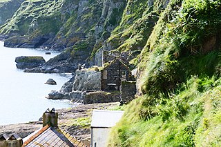
Hallsands is a village and beach in south Devon, England, in a precarious position between cliffs and the sea, between Beesands to the north and Start Point to the south.

<span class="mw-page-title-main">Thurlestone</span> Village in Devon, England

Thurlestone is a village located 5 miles (8.0 km) west of Kingsbridge in the South Hams district in south Devon, England. There is an electoral ward in the same name. The population at the 2011 census was 1,886.

<span class="mw-page-title-main">Start Bay</span> Bay in Devon, England

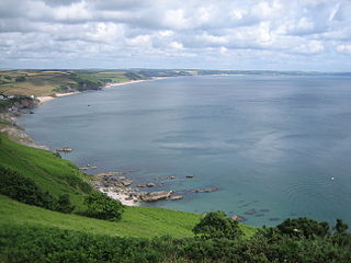
Start Bay is a sub-bay of the nautical definition of Lyme Bay in the English Channel in south-east Devon, England. The southernmost of three substantial Devon bays facing east it is between the Mew Stone which sits east of the River Dart's estuary and Start Point near the southernmost point of the county, Prawle Point. Along it, from south to north, are Hallsands, Beesands, Torcross, Slapton Sands, Strete, Blackpool Sands and Stoke Fleming. The South West Coast Path is above much of the bay. Its north end is 1.5 miles (2.4 km) south of Dartmouth; its middle is 4 miles (6.4 km) east of Kingsbridge.

<span class="mw-page-title-main">Slapton Ley</span> Lake on the south coast of Devon, England

Slapton Ley is a lake on the south coast of Devon, England, separated from Start Bay by a shingle beach, known as Slapton Sands.

<span class="mw-page-title-main">East Allington</span> Village in Devon, England

East Allington is a village and civil parish in the South Hams district of Devon, England, three miles (5 km) south of Halwell and just off the A381 road. It lies about three miles (5 km) from Kingsbridge and about ten miles (16 km) from Totnes. The coast at Slapton Sands is about five miles (8 km) to the south-east. Also in the parish is the hamlet of The Mounts, about one mile (1.6 km) away.

<span class="mw-page-title-main">A379 road</span> Road in Devon, England

The A379 is a road in the English county of Devon. It links points on the edges of that county's two principal cities, Exeter and Plymouth, by an indirect and largely coastal route. The A38 provides a faster and more direct inland route between Exeter and Plymouth, whilst the A380 provides a similarly faster route between Exeter and the Torbay area. However the A379 serves many small coastal communities and ports along the coast. The indented nature of the South Devon coast means that the road is usually out of sight of the sea, but the many rivers and estuaries are crossed by bridges and, in one case, a cable ferry.

<span class="mw-page-title-main">A381 road</span> Road in Devon, England

The A381 road is a non-trunk 'A'-class road in Devon, England which serves as an important link between the towns of Teignmouth, Kingsteignton, Newton Abbot, Totnes and Salcombe and many villages in between, with the busiest section having 6 lanes and carrying an average of over 40,000 vehicles per day. The route overlaps with other A-roads for several sections of its length. It is a faster route from Teignmouth to Salcombe than the A379 which meets it at both ends. It is under the control of Devon County Council as highway authority.

<span class="mw-page-title-main">The Mounts</span> Human settlement in England

The Mounts is a small hamlet, containing only 17 houses, situated on the A381 road between Totnes and Kingsbridge in Devon, England. It is part of the parish of East Allington, and lies about one mile away from the main village. Although The Mounts' postcode indicates it to be part of Totnes, it in fact lies much nearer to Kingsbridge.

<span class="mw-page-title-main">Exercise Fabius</span>

Exercise Fabius was a formal exercise for the Allied Operation Neptune in World War II. The other was Exercise Tiger, which had occurred a week earlier.

<span class="mw-page-title-main">Stokenham</span> Village in Devon, England

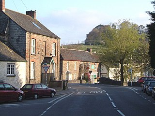
Stokenham is a village and civil parish in the English county of Devon. The population of the parish at the 2011 census was 1,895.

<span class="mw-page-title-main">Strete</span> Village in Devon, England

Strete is a coastal village and civil parish in the South Hams district of Devon, England, on the coast of Start Bay, within the South Devon Area of Outstanding Natural Beauty.

<span class="mw-page-title-main">Blacknor Fort</span>

Blacknor Fort is a 20th-century fort on the Isle of Portland, Dorset, England. It is located at Blacknor Point on the western side of Portland, close to Weston village.

References

  1. "Torcross". BBC News . Retrieved 14 August 2015.
  2. "Operation Tiger nightmare remembered". Western Morning News . 28 April 2009. Retrieved 14 August 2015.[ permanent dead link ]
  3. "Operation Tiger". Naval History and Heritage Command . Retrieved 14 August 2015.
  4. "Ken Small". Exercise Tiger Slapton.org. Retrieved 14 August 2015.
  5. "Slapton Sands". English Nature. Archived from the original on 22 March 2007. Retrieved 15 August 2015.
  6. "Major sea defence project gets underway". South Hams District Council . Retrieved 14 August 2015.[ permanent dead link ]

50°15′58″N3°39′15″W / 50.26619°N 3.65420°W / 50.26619; -3.65420