Toro Negro, Ciales, Puerto Rico

Last updated
Toro Negro
Barrio
Toro Negro, Ciales, Puerto Rico - panoramio.jpg
Toro Negro in Ciales
Toro Negro, Ciales, Puerto Rico locator map.png
Location of Toro Negro within the municipality of Ciales shown in red
Caribbean location map.svg
Red pog.svg
Toro Negro
Location of Puerto Rico
Coordinates: 18°12′52″N66°31′45″W / 18.214315°N 66.529199°W / 18.214315; -66.529199 [1]
Commonwealth Flag of Puerto Rico.svg  Puerto Rico
Municipality Flag of Ciales.svg Ciales
Area
[1]
  Total12.55 sq mi (32.5 km2)
  Land12.52 sq mi (32.4 km2)
  Water0.03 sq mi (0.08 km2)
Elevation
[2]
1,988 ft (606 m)
Population
 (2010)
  Total970
  Density77.5/sq mi (29.9/km2)
 Source: 2010 Census
Time zone UTC−4 (AST)

Toro Negro is a barrio in the municipality of Ciales, Puerto Rico. Its population in 2010 was 970. [3] [4] [5]

Contents

History

Toro Negro was in Spain's gazetteers [6] until Puerto Rico was ceded by Spain in the aftermath of the Spanish–American War under the terms of the Treaty of Paris of 1898 and became an unincorporated territory of the United States. In 1899, the United States Department of War conducted a census of Puerto Rico finding that the population of Toro Negro barrio was 2,252. [7]

Historical population
CensusPop.Note
1900 2,252
1910 1,859−17.5%
1920 2,06611.1%
1930 2,1082.0%
1940 2,2617.3%
1950 2,050−9.3%
1960 1,600−22.0%
1970 1,096−31.5%
1980 878−19.9%
1990 1,11827.3%
2000 1,27614.1%
2010 970−24.0%
U.S. Decennial Census
1899 (shown as 1900) [8] 1910-1930 [9]
1930-1950 [10] 1980-2000 [11] 2010 [12]

Sectors

Barrios (which are, in contemporary times, roughly comparable to minor civil divisions) [13] in turn are further subdivided into smaller local populated place areas/units called sectores (sectors in English). The types of sectores may vary, from normally sector to urbanización to reparto to barriada to residencial, among others. [14] [15] [16]

The following sectors are in Toro Negro barrio: [17]

Casa Blanca, Dos Bocas, La Piedra, and Vega Redonda.

The Ciales portion of the Toro Negro State Forest can be discovered from barrio Toro Negro in Ciales. [18]

See also

Related Research Articles

<span class="mw-page-title-main">Cañaboncito, Caguas, Puerto Rico</span> Barrio of Puerto Rico

Cañaboncito is a barrio in the municipality of Caguas, Puerto Rico. Its population in 2010 was 27,464. The barrio has over 90 sectors.

<span class="mw-page-title-main">Jaguas, Ciales, Puerto Rico</span> Barrio of Puerto Rico

Jaguas is a barrio in the municipality of Ciales, Puerto Rico. Its population in 2010 was 4,545.

<span class="mw-page-title-main">Pozas, Ciales, Puerto Rico</span> Barrio of Puerto Rico

Pozas is a barrio in the municipality of Ciales, Puerto Rico. Its population in 2010 was 1,430.

<span class="mw-page-title-main">Cuchillas, Corozal, Puerto Rico</span> Barrio of Puerto Rico

Cuchillas is a rural barrio in the municipality of Corozal, Puerto Rico. Its population in 2010 was 1,551.

<span class="mw-page-title-main">Guanajibo, Hormigueros, Puerto Rico</span> Barrio of Puerto Rico

Guanajibo is a barrio in the municipality of Hormigueros, Puerto Rico. Its population in 2010 was 5,959.

<span class="mw-page-title-main">Camino Nuevo</span> Barrio of Yabucoa, Puerto Rico

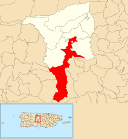
Camino Nuevo is a barrio in the municipality of Yabucoa, Puerto Rico. Its population in 2010 was 3,391.

Llave is a barrio in the island-municipality of Vieques, Puerto Rico. Its population in 2010 was 18.

<span class="mw-page-title-main">Puerto Ferro</span> Barrio of Vieques, Puerto Rico

Puerto Ferro is a barrio in the municipality of Vieques, Puerto Rico. Its population in 2010 was 705.

<span class="mw-page-title-main">Negros, Corozal, Puerto Rico</span> Barrio of Puerto Rico

Negros is a rural barrio in the municipality of Corozal, Puerto Rico. Its population in 2010 was 1,398.

<span class="mw-page-title-main">Cialitos, Ciales, Puerto Rico</span> Barrio of Puerto Rico

Cialitos is a barrio in the municipality of Ciales, Puerto Rico. Its population in 2010 was 1,449.

<span class="mw-page-title-main">Cordillera, Ciales, Puerto Rico</span> Barrio of Puerto Rico

Cordillera is a barrio in the municipality of Ciales, Puerto Rico. Its population in 2010 was 2,348.

<span class="mw-page-title-main">Frontón, Ciales, Puerto Rico</span> Barrio of Puerto Rico

Frontón is a barrio in the municipality of Ciales, Puerto Rico. Its population in 2010 was 2,228.

<span class="mw-page-title-main">Pesas, Ciales, Puerto Rico</span> Barrio of Puerto Rico

Pesas is a barrio in the municipality of Ciales, Puerto Rico. Its population in 2010 was 2,361.

<span class="mw-page-title-main">Ciales barrio-pueblo</span> Historical and administrative center (seat) of Ciales, Puerto Rico

Ciales barrio-pueblo is a barrio and the administrative center (seat) of Ciales, a municipality of Puerto Rico. Its population in 2010 was 1,009.

<span class="mw-page-title-main">Río Abajo, Cidra, Puerto Rico</span> Barrio of Puerto Rico

Río Abajo is a barrio in the municipality of Cidra, Puerto Rico. Its population in 2010 was 1,097.

<span class="mw-page-title-main">Rincón, Cidra, Puerto Rico</span> Barrio of Puerto Rico

Rincón is a barrio in the municipality of Cidra, Puerto Rico. Its population in 2010 was 4,332.

<span class="mw-page-title-main">Beatriz, Cidra, Puerto Rico</span> Barrio of Puerto Rico

Beatriz is a barrio in the municipality of Cidra, Puerto Rico. Its population in 2010 was 3,095.

<span class="mw-page-title-main">Hato Viejo, Ciales, Puerto Rico</span> Barrio of Puerto Rico

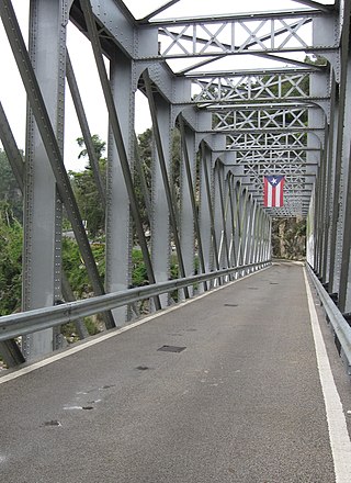
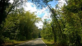
Hato Viejo is a barrio in the municipality of Ciales, Puerto Rico. Its population in 2010 was 2,442. Hato Viejo has more than a dozen sectors, a historic bridge, and folklore about a boy and a cave.

<span class="mw-page-title-main">Vaga, Morovis, Puerto Rico</span> Barrio of Puerto Rico

Vaga is a barrio in the municipality of Morovis, Puerto Rico. Vaga has three sectors and its population in 2010 was 471.

<span class="mw-page-title-main">Terranova, Quebradillas, Puerto Rico</span> Barrio of Puerto Rico

Terranova is a barrio in the municipality of Quebradillas, Puerto Rico. Its population in 2010 was 3,102.

References

  1. 1 2 "US Gazetteer 2019". US Census. US Government.
  2. U.S. Geological Survey Geographic Names Information System: Toro Negro barrio
  3. Picó, Rafael; Buitrago de Santiago, Zayda; Berrios, Hector H. Nueva geografía de Puerto Rico: física, económica, y social, por Rafael Picó. Con la colaboración de Zayda Buitrago de Santiago y Héctor H. Berrios. San Juan Editorial Universitaria, Universidad de Puerto Rico,1969.
  4. Gwillim Law (20 May 2015). Administrative Subdivisions of Countries: A Comprehensive World Reference, 1900 through 1998. McFarland. p. 300. ISBN   978-1-4766-0447-3 . Retrieved 25 December 2018.
  5. Puerto Rico: 2010 Population and Housing Unit Counts.pdf (PDF). U.S. Dept. of Commerce, Economics and Statistics Administration, U.S. Census Bureau. 2010.
  6. "Anuario del comercio, de la industria, de la magistratura y de la administración. 1881". Biblioteca Nacional de España (in Spanish). p. 1614. Retrieved 4 April 2023.
  7. Joseph Prentiss Sanger; Henry Gannett; Walter Francis Willcox (1900). Informe sobre el censo de Puerto Rico, 1899, United States. War Dept. Porto Rico Census Office (in Spanish). Imprenta del gobierno. p.  161.
  8. "Report of the Census of Porto Rico 1899". War Department Office Director Census of Porto Rico. Archived from the original on July 16, 2017. Retrieved September 21, 2017.
  9. "Table 3-Population of Municipalities: 1930 1920 and 1910" (PDF). United States Census Bureau. Archived (PDF) from the original on August 17, 2017. Retrieved September 21, 2017.
  10. "Table 4-Area and Population of Municipalities Urban and Rural: 1930 to 1950" (PDF). United States Census Bureau. Archived (PDF) from the original on August 30, 2015. Retrieved September 21, 2014.
  11. "Table 2 Population and Housing Units: 1960 to 2000" (PDF). United States Census Bureau. Archived (PDF) from the original on July 24, 2017. Retrieved September 21, 2017.
  12. Puerto Rico: 2010 Population and Housing Unit Counts.pdf (PDF). U.S. Dept. of Commerce Economics and Statistics Administration U.S. Census Bureau. 2010. Archived (PDF) from the original on 2017-02-20. Retrieved 2019-08-02.
  13. "US Census Barrio-Pueblo definition". factfinder.com. US Census. Archived from the original on 13 May 2017. Retrieved 5 January 2019.
  14. "Agencia: Oficina del Coordinador General para el Financiamiento Socioeconómico y la Autogestión (Proposed 2016 Budget)". Puerto Rico Budgets (in Spanish). Retrieved 28 June 2019.
  15. Rivera Quintero, Marcia (2014), El vuelo de la esperanza: Proyecto de las Comunidades Especiales Puerto Rico, 1997-2004 (first ed.), San Juan, Puerto Rico Fundación Sila M. Calderón, ISBN   978-0-9820806-1-0
  16. "Leyes del 2001". Lex Juris Puerto Rico (in Spanish). Retrieved 24 June 2020.
  17. "DESGLOSE DE SECTORES Y CENTROS DE VOTACIÓN CIALES 023" (PDF). Comisión Estatal de Elecciones Puerto Rico (in Spanish). 19 October 2018. Retrieved 15 June 2020.
  18. Toro Negro Waterfall Climb Archived 27 May 2013 at the Wayback Machine . Acampa. Retrieved 13 August 2013.