Tororo Airport

Last updated
Tororo Airport
Summary
Airport type Public
Owner/Operator Civil Aviation Authority of Uganda
Serves Tororo
Elevation  AMSL 3,900 ft / 1,189 m
Coordinates 0°40′53″N34°10′04″E / 0.68139°N 34.16778°E / 0.68139; 34.16778 Coordinates: 0°40′53″N34°10′04″E / 0.68139°N 34.16778°E / 0.68139; 34.16778
Map
Uganda location map.svg
Airplane silhouette.svg
TRY
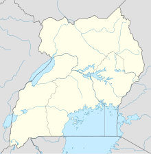
Location of the airport in Uganda
Runways
Direction Length Surface
m ft
18/36 1,400 4,593 Murram

Tororo Airport( IATA : TRY, ICAO : HUTO) is an airport serving the town of Tororo in the Eastern Region of Uganda.

An IATA airport code, also known as an IATA location identifier, IATA station code or simply a location identifier, is a three-letter code designating many airports around the world, defined by the International Air Transport Association (IATA). The characters prominently displayed on baggage tags attached at airport check-in desks are an example of a way these codes are used.

ICAO airport code four-letter code designating many airports around the world

The ICAOairport code or location indicator is a four-letter code designating aerodromes around the world. These codes, as defined by the International Civil Aviation Organization and published in ICAO Document 7910: Location Indicators, are used by air traffic control and airline operations such as flight planning.

Tororo Place in Eastern Region of Uganda, Uganda

Tororo is a town in the Eastern Region of Uganda. It is the main municipal, administrative, and commercial center of Tororo District. There are many shops, banks, supermarkets here. Tororo is a trading hub where many people come from the surrounding villages to work. There are a number of ATM's around town with one at Barclay's accepting all major cards. MTN and Airtel mobile agents are throughout the town.

Contents

Location

The airport is about 3 kilometres (2 mi) by road south of the town centre. [1] This is about 249 kilometres (155 mi), by road, and 205 kilometres (127 mi), by air, north-east of Entebbe International Airport, the largest airport in Uganda. [2] The coordinates of this airport are 00°40'53.0"N, 34°10'04.0"E (Latitude:0.681389; Longitude:34.167778). [3]

Entebbe International Airport airport

Entebbe International Airport is the principal international airport of Uganda. It is near the town of Entebbe, on the shores of Lake Victoria, and approximately 40.5 kilometres (25 mi) by road south-west of the central business district of Kampala, the capital and largest city of Uganda. The headquarters of the Civil Aviation Authority of Uganda have been relocated to a new block off the airport highway, but adjacent to the airport terminals.

Overview

The airport is at an average elevation of 3,900 feet (1,200 m) and has a single murram-surfaced runway (18/36), measuring 4,593 feet (1,400 m) long and 98 feet (30 m) wide. [4]

As of June 2015, the Civil Aviation Authority of Uganda had plans to develop this facility into a regional airport. [5]

The Civil Aviation Authority of Uganda (CAA) is the government agency responsible for licensing, monitoring, and regulating civil aviation matters. It is administered by the Uganda Ministry of Works and Transport.

See also

Transport in Uganda

Transport in Uganda refers to the transportation structure in Uganda. The country has an extensive network of paved and unpaved roads.

Related Research Articles

Soroti Airport

Soroti Airport is an airport serving Soroti, a town in the Eastern Region of Uganda, approximately 290 kilometres (180 mi), by road, north-east of Kampala, Uganda's capital and largest city. The airport is immediately north-east of the town's central business district. The GPS coordinates of Soroti Airport, Uganda are Latitude: 1.7275800; Longitude: 33.6228600.

Lindi Airport

Lindi Airport is an airport serving Lindi, the capital of the Lindi Region of Tanzania. It is also known as Kikwetu Airport.

Arua Airport

Arua Airport is a civilian airport serving the city of Arua in the Northern Region of Uganda. As of November 2016, it is one of the 47 airports in the country.

Kasese Airport

Kasese Airport is an airport in Uganda.

Nagongera Place in Uganda

Nagongera is a town in Tororo District, in the Eastern Region of Uganda.

Masindi Airport airport

Masindi Airport is an airport in Uganda.

Kisoro Airport

Kisoro Airport is an airport serving the town of Kisoro in Uganda and nearby Bwindi Impenetrable National Park and Mgahinga Gorilla National Park. It is in extreme southwestern Uganda, approximately 343 kilometres (213 mi) by air southwest of Entebbe International Airport, the country's largest civilian and military airport. It is one of twelve upcountry airports administered by the Civil Aviation Authority of Uganda.

Kidepo Airport

Kidepo Airport is an airfield in Northern Region, Uganda. The airport is at Lomej, approximately 3 kilometres (2 mi) south of the headquarters of Kidepo Valley National Park, and 456 kilometres (283 mi) northeast of Entebbe International Airport, the country’s largest civilian and military airport.

Jinja Airport

Jinja Airport is a small civilian and military airport in Uganda. It serves the town of Jinja in Jinja District, Busoga, Eastern Region. It is adjacent to the Uganda Senior Command and Staff College of the Uganda People's Defence Force at Kimaka, a suburb of Jinja. It is approximately 94 kilometres (58 mi) east of Entebbe International Airport, the country’s largest airport.

Kakira Airport

Kakira Airport is one of the 46 airports in Uganda. It is in Kakira, Jinja District, Eastern Region. The geographic coordinates of this airport are 00 degrees, 29 minutes, 56 seconds north and 33 degrees, 16 minutes, 57 seconds east. It is approximately 107 kilometres (66 mi), by air, east of Entebbe International Airport, the country’s largest civilian and military airport.

Lira Airport

Lira Airport is an airport serving Lira, a town in the Lira District of Uganda. Lira Airport is one of twelve upcountry airports that are administered by the Civil Aviation Authority of Uganda. It is also one of the 46 airports in the country.

Adjumani Airport airport in Uganda

Adjumani Airport is an airport that serves the town of Adjumani in the Northern Region of Uganda, close to the international border with South Sudan. It is approximately 376 kilometres (234 mi) by air north of Entebbe International Airport, the country's largest civilian and military airport.

Kabale Airport

Kabale Airport is an airstrip serving Kabale, a town in the Kabale District in the Western Region of Uganda. It is one of the 46 airports in the country.

Hima Cement Limited (HCL) is a cement manufacturer in Uganda. It is a subsidiary of Bamburi Cement Limited, the construction materials manufacturer based in Kenya, which in turn is owned by Lafarge of France.

Tororo Girls Secondary School, commonly known as Tororo Girls School (TGS), is an all-girls boarding school covering grades 8 -13 in the Eastern Region of Uganda.

Bugungu Airstrip

Bugungu Airstrip is an airport serving the Bugungu Wildlife Reserve in the Murchison Falls National Park (MFNP), in Uganda.

Rhamu Airport

Rhamu Airport is an airport in Kenya.

The Jinja–Iganga–Bugiri–Tororo Road is a road in the Eastern Region of Uganda, connecting the towns of Jinja and Tororo. Sometimes referred to as Tororo–Jinja Road, it is a busy transport corridor, connecting traffic from neighboring Kenya, and northeastern Uganda to Jinja, a major commercial and industrial center, and ultimately to Kampala, the country's capital and points beyond.

Moriah Aviation Training Centre (MATC), is an aviation training school in Uganda, that provides training for prospective pilots, cabin crew staff, aviation customer managers and related courses in the aviation industry.

References

  1. Globefeed.com (18 August 2016). "Distance between Municipal Gardens, Tororo, Eastern Region, Uganda and Tororo Airfield, Tororo, Eastern Region, Uganda". Globefeed.com. Retrieved 18 August 2016.
  2. Globefeed.com (18 August 2016). "Distance between Entebbe International Airport, Entebbe, Central Region, Uganda and Tororo Airfield, Tororo, Eastern Region, Uganda". Globefeed.com. Retrieved 18 August 2016.
  3. Google (18 August 2016). "Location of Tororo Airport, Tororo, Uganda" (Map). Google Maps . Google. Retrieved 18 August 2016.
  4. GCM (18 August 2016). "TRY - Tororo Airport Data". Great Circle Mapper (GCM). Retrieved 18 August 2016.
  5. Tentena, Paul (28 June 2015). "Uganda eyes Chinese loan for airport". East African Business Week . Kampala. Retrieved 19 August 2016.