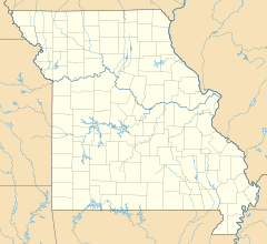
St. Louis is the second-largest city in Missouri, United States. It sits near the confluence of the Mississippi and the Missouri Rivers, on the western bank of the latter. As of 2019, the city proper had an estimated population of around 300,000, while the bi-state metropolitan area, which extends into Illinois, had an estimated population of over 2.8 million, making it the largest metropolitan area in Missouri, the second-largest in Illinois, the seventh-largest in the Great Lakes Megalopolis, and the 22nd-largest in the United States.

Mexico, formerly known as New Mexico, is a city in Audrain County, Missouri. The population was 11,543 at the 2010 census. It is the county seat, home to the Missouri Military Academy, and annually hosts the Miss Missouri Pageant. The micropolitan statistical area consists of Audrain County. It is a part of the Columbia, Missouri metropolitan area.

Mount Pleasant is a large suburban town in Charleston County, South Carolina, United States. In the Low Country, it is the fourth largest municipality and largest town in South Carolina, and for several years was one of the state's fastest-growing areas, doubling in population between 1990 and 2000. The population was 67,843 at the 2010 census. The estimated population in 2019 was 91,684.

The Kansas City metropolitan area is a bi-state metropolitan area anchored by Kansas City, Missouri. Its 14 counties straddle the border between the U.S. states of Missouri and Kansas. With 8,472 square miles (21,940 km2) and a population of more than 2.1 million people, it is the second-largest metropolitan area centered in Missouri and is the largest metropolitan area in Kansas, though Wichita is the largest metropolitan area centered in Kansas. Alongside Kansas City, Missouri, these are the suburbs with populations above 100,000: Overland Park, Kansas; Kansas City, Kansas; Olathe, Kansas; Independence, Missouri; and Lee's Summit, Missouri.

West Adams is a historic neighborhood in the South Los Angeles region of Los Angeles, California. The area is known for its large number of historic buildings, structures and notable houses and mansions throughout Los Angeles. It is a youthful, densely populated area with a high percentage of African American and Latino residents. The neighborhood has several public and private schools.
Soulard is a historic neighborhood in St. Louis, Missouri.

The Grand Center Arts District is located in the Midtown St. Louis Historic District north of the Saint Louis University campus. Referred to colloquially as Grand Center, the neighborhood's formal name is Covenant Blu Grand Center. The neighborhood is a member of the Global Cultural Districts Network.

Fort Zumwalt Park is a park in O'Fallon, Missouri, that features the rebuilt homestead fort of Jacob Zumwalt.

Laumeier Sculpture Park is a 105-acre open-air museum and sculpture park located in Sunset Hills, Missouri, near St. Louis and is maintained in partnership with St. Louis County Parks and Recreation Department. It houses over 60 outdoor sculptures and features a 1.4-mile (2.3 km) walking trail, and educational programs. There is also an indoor gallery, an 1816 Tudor stone mansion, which was the former residence of Henry and Matilda Laumeier. Laumeier is accredited by the American Alliance of Museums. The park sees about 300,000 visitors each year and operates on a $1.5 million budget.

West Ashley, or more formally, west of the Ashley, is one of the six distinct areas of the city proper of Charleston, South Carolina. As of March 2020, its estimated population was 82,341. Its name is derived from the fact that the land is west of the Ashley River.

College Hill is a historic neighborhood of Providence, Rhode Island, and one of six neighborhoods comprising the city's East Side. It is roughly bounded by South and North Main Street to the west, Power Street to the south, Governor Street and Arlington Avenue to the east and Olney Street to the north. The neighborhood's primary commercial area extends along Thayer Street, a strip frequented by students in the Providence area.

Shaw is a neighborhood in St. Louis, Missouri. It is bordered on the North by Interstate 44, the east by S. Grand Blvd., the west by Tower Grove Ave and the Missouri Botanical Gardens, and the south by Tower Grove Park. The Shaw Neighborhood is a local historic district whose historic structure and character is protected by ordinance.

The Missouri Governor's Mansion is a historic U.S. residence in Jefferson City, Missouri. It is located at 100 Madison Street. On May 21, 1969, it was added to the U.S. National Register of Historic Places. It is located in the Missouri State Capitol Historic District.
Baden is a neighborhood of St. Louis, Missouri.
O'Fallon is a city located along Interstates 64 and 70 between Lake St. Louis and St. Peters in St. Charles County, Missouri, United States. It is part of the St. Louis metropolitan statistical area. As of the 2010 census, O'Fallon had a population of 79,329, making it the largest suburb of St. Louis, as well as the largest municipality in St. Charles County and the seventh-largest in Missouri. O'Fallon's namesake in St. Clair County, Illinois, is also part of the St. Louis metropolitan statistical area. The two O'Fallons are one of the few pairs of same-named municipalities to be part of the same MSA.

College Hill is a neighborhood of the City of St. Louis, Missouri. The name College Hill was given to this area because it was the location of the Saint Louis University College Farm. This area, bounded generally by Warne Ave., O'Fallon Park, I-70, Grand Boulevard, and W. Florissant Ave., was acquired by the University for garden and recreation purposes in 1836. It was subdivided in the early 1870s.

Forest Park Southeast (FPSE) is a neighborhood of St. Louis, Missouri. It is bordered by Interstate 64 to the north, Vandeventer Avenue to the east, Interstate 44 to the south, and Kingshighway Boulevard and Forest Park to the west. Adjoining neighborhoods include Kings Oak and The Hill to the west, Southwest Garden to the south, Botanical Heights to the southeast, Midtown to the east, and the Central West End to the north.

Franklin Park is a neighborhood located on the Near East Side of Columbus, Ohio. Both the historic neighborhood and landmark, the Franklin Park Conservatory and Botanical Gardens, are named after the 88-acre park.
Indian Camp Creek Park is a public park in Foristell, Missouri. It is located in the northwestern part of St. Charles County and is operated by the St. Charles County Parks Department. It is the county's largest park at 603 acres.
Quail Ridge Park is a public park in Wentzville, Missouri. It is operated by the St. Charles County Parks Department.