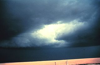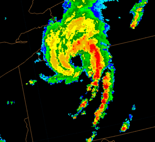
A thunderstorm, also known as an electrical storm or a lightning storm, is a storm characterized by the presence of lightning and its acoustic effect on the Earth's atmosphere, known as thunder. Relatively weak thunderstorms are sometimes called thundershowers. Thunderstorms occur in a type of cloud known as a cumulonimbus. They are usually accompanied by strong winds, and often produce heavy rain and sometimes snow, sleet, or hail, but some thunderstorms produce little precipitation or no precipitation at all. Thunderstorms may line up in a series or become a rainband, known as a squall line. Strong or severe thunderstorms include some of the most dangerous weather phenomena, including large hail, strong winds, and tornadoes. Some of the most persistent severe thunderstorms, known as supercells, rotate as do cyclones. While most thunderstorms move with the mean wind flow through the layer of the troposphere that they occupy, vertical wind shear sometimes causes a deviation in their course at a right angle to the wind shear direction.

A supercell is a thunderstorm characterized by the presence of a mesocyclone: a deep, persistently rotating updraft. For this reason, these storms are sometimes referred to as rotating thunderstorms. Of the four classifications of thunderstorms, supercells are the overall least common and have the potential to be the most severe. Supercells are often isolated from other thunderstorms, and can dominate the local weather up to 32 kilometres (20 mi) away. They tend to last 2–4 hours.

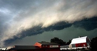
A squall is a sudden, sharp increase in wind speed lasting minutes, contrary to a wind gust lasting seconds. They are usually associated with active weather, such as rain showers, thunderstorms, or heavy snow. Squalls refer to the increase to the sustained winds over that time interval, as there may be higher gusts during a squall event. They usually occur in a region of strong sinking air or cooling in the mid-atmosphere. These force strong localized upward motions at the leading edge of the region of cooling, which then enhances local downward motions just in its wake.

A severe thunderstorm warning is an alert issued by national weather forecasting agencies to warn the public that severe thunderstorms are imminent or occurring. The warning is issued when trained storm spotters or Doppler weather radar indicate that a thunderstorm is producing or will soon produce dangerously large hail and high winds, capable of causing significant damage. Flooding is also caused by a thunderstorm's torrential rainfall sometimes. A similar warning is issued by Environment Canada's Meteorological Service of Canada from their offices in Vancouver, Edmonton, Toronto, Montreal and Dartmouth. Skywarn issues the severe thunderstorm warnings for the United Kingdom. In Australia, severe thunderstorm warnings are issued by the Bureau of Meteorology.

A squall line or quasi-linear convective system (QLCS) is a line of thunderstorms forming along or ahead of a cold front. In the early 20th century, the term was used as a synonym for cold front. It contains heavy precipitation, hail, frequent lightning, strong straight-line winds, and possibly tornadoes and waterspouts. Strong straight-line winds can occur where the squall line is in the shape of a bow echo. Tornadoes can occur along waves within a line echo wave pattern (LEWP), where mesoscale low-pressure areas are present. Some bow echoes which develop within the summer season are known as derechos, and they move quite fast through large sections of land. On the back edge of the rainband associated with mature squall lines, a wake low can be present, sometimes associated with a heat burst.

A weather front is a boundary separating air masses of different characteristics such as air density, wind, and humidity. Disturbed weather often arises from these differences. For instance, cold fronts can bring bands of thunderstorms or be preceded by squall lines, while warm fronts are usually preceded by stratiform precipitation and fog. In summer, subtler humidity gradients known as or dry lines can trigger severe weather. Some fronts produce no precipitation and little cloudiness, although there is invariably a wind shift.

This article describes severe weather terminology used by the National Weather Service (NWS) in the United States. The NWS, a government agency operating as an arm of the National Oceanic and Atmospheric Administration (NOAA) branch of the United States Department of Commerce (DoC), defines precise meanings for nearly all of its weather terms.

A mesoscale convective system (MCS) is a complex of thunderstorms that becomes organized on a scale larger than the individual thunderstorms but smaller than extratropical cyclones, and normally persists for several hours or more. A mesoscale convective system's overall cloud and precipitation pattern may be round or linear in shape, and include weather systems such as tropical cyclones, squall lines, lake-effect snow events, polar lows, and Mesoscale Convective Complexes (MCCs), and generally forms near weather fronts. The type that forms during the warm season over land has been noted across North America, Europe, and Asia, with a maximum in activity noted during the late afternoon and evening hours.

Severe storms in Australia refers to the storms, including cyclones, which have caused severe damage in Australia.

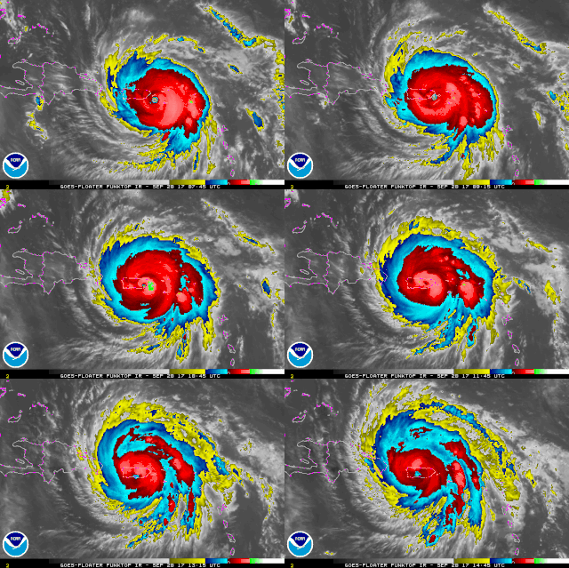
Landfall is the event of a storm moving over land after being over water. More broadly, and in relation to human travel, it refers to 'the first land that is reached or seen at the end of a journey across the sea or through the air, or the fact of arriving there'.
A particularly dangerous situation (PDS) tag is enhanced wording first used by the Storm Prediction Center (SPC), a national guidance center of the United States National Weather Service, for tornado watches and eventually expanded to use for other severe weather watches and warnings by local NWS forecast offices. It is issued at the discretion of the forecaster composing the watch or warning and implies that there is an enhanced risk of very severe and life-threatening weather, usually a major tornado outbreak or a long-lived, extreme derecho event, but possibly another weather hazard such as an exceptional flash flood or fire.

An air-mass thunderstorm, also called an "ordinary", "single cell", or "garden variety" thunderstorm, is a thunderstorm that is generally weak and usually not severe. These storms form in environments where at least some amount of Convective Available Potential Energy (CAPE) is present, but very low levels of wind shear and helicity. The lifting source, which is a crucial factor in thunderstorm development, is usually the result of uneven heating of the surface, though they can be induced by weather fronts and other low-level boundaries associated with wind convergence. The energy needed for these storms to form comes in the form of insolation, or solar radiation. Air-mass thunderstorms do not move quickly, last no longer than an hour, and have the threats of lightning, as well as showery light, moderate, or heavy rainfall. Heavy rainfall can interfere with microwave transmissions within the atmosphere.

Severe weather refers to any dangerous meteorological phenomena with the potential to cause damage, serious social disruption, or loss of human life. Types of severe weather phenomena vary, depending on the latitude, altitude, topography, and atmospheric conditions. High winds, hail, excessive precipitation, and wildfires are forms and effects of severe weather, as are thunderstorms, downbursts, tornadoes, waterspouts, tropical cyclones, and extratropical cyclones. Regional and seasonal severe weather phenomena include blizzards (snowstorms), ice storms, and duststorms.
A flash flood watch is issued by the National Weather Service when conditions are favorable for flash flooding in flood-prone areas, usually when grounds are already saturated from recent rains, or when upcoming rains will have the potential to cause a flash flood. These watches are also occasionally issued when a dam may break in the near future.
Convective storm detection is the meteorological observation, and short-term prediction, of deep moist convection (DMC). DMC describes atmospheric conditions producing single or clusters of large vertical extension clouds ranging from cumulus congestus to cumulonimbus, the latter producing thunderstorms associated with lightning and thunder. Those two types of clouds can produce severe weather at the surface and aloft.

A cold front is the leading edge of a cooler mass of air at ground level that replaces a warmer mass of air and lies within a pronounced surface trough of low pressure. It often forms behind an extratropical cyclone, at the leading edge of its cold air advection pattern—known as the cyclone's dry "conveyor belt" flow. Temperature differences across the boundary can exceed 30 °C (86 °F) from one side to the other. When enough moisture is present, rain can occur along the boundary. If there is significant instability along the boundary, a narrow line of thunderstorms can form along the frontal zone. If instability is weak, a broad shield of rain can move in behind the front, and evaporative cooling of the rain can increase the temperature difference across the front. Cold fronts are stronger in the fall and spring transition seasons and weakest during the summer.
A weather warning generally refers to an alert issued by a meteorological agency to warn citizens of approaching dangerous weather. A weather watch, on the other hand, typically refers to an alert issued to indicate that conditions are favorable for the development of dangerous weather patterns, although the dangerous weather conditions themselves are not currently present.
The following is a glossary of tornado terms. It includes scientific as well as selected informal terminology.

This glossary of meteorology is a list of terms and concepts relevant to meteorology and atmospheric science, their sub-disciplines, and related fields.


