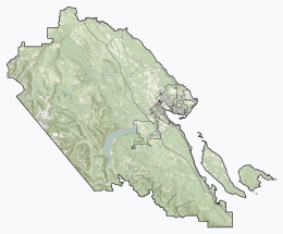
Hornby Island of British Columbia, Canada, is one of the two northernmost Gulf Islands, located near Vancouver Island's Comox Valley, the other being Denman Island.

Big Bunsby Marine Provincial Park is a provincial park on the west coast of northern Vancouver Island in British Columbia, Canada, to the southeast of the Brooks Peninsula in Checleset Bay. It is accessible only by boat.

Vargas Island Provincial Park is a provincial park in British Columbia, Canada, comprising the west side of the island of the same name, which is located west of Meares Island and northwest of the resort community of Tofino in the Clayoquot Sound region of the West Coast of Vancouver Island, British Columbia, Canada. The park was created as part of the Clayoquot Land-Use Decision on July 13, 1995 and contains 5,805 hectares, 1,543 hectares of it being upland and 4,262 hectares being foreshore. Also located on Vargas Island, on its north side, is Epper Passage Provincial Park.
Ferry Island Provincial Park is a Class C provincial park in British Columbia that is located on the south side of the Fraser River northeast of Rosedale. This park is northwest of Bridal Falls, British Columbia and adjacent to the Agassiz-Rosedale Bridge. The Ferry Island Park was established in 1963, and it has an area of about 29 hectares.

Flores Island Marine Provincial Park, also known as Flores Island Provincial Park, is a provincial park in British Columbia, Canada, located on the island of the same name in the central Clayoquot Sound region of the West Coast of Vancouver Island, British Columbia, Canada. The park contains 7113 ha. and was created on July 13, 1995, as part of the Clayoqout Land-Use Decision. Gibson Marine Provincial Park, which was created in 1967, adjoins it to the southeast. Sulphur Passage Provincial Park is off the northeast coast of Flores Island, surrounding Obstruction Island.
Hardy Island Marine Provincial Park is a provincial park located near the southern tip of the Hardy Island in British Columbia, Canada. The park as created by BC Parks on 6 March 1992 to protect local flora and fauna. The park itself becomes a small island during high tide.

Helliwell Provincial Park is a provincial park in British Columbia, Canada located on a headland at the northeast end of Hornby Island.

Hesquiat Peninsula Provincial Park is a provincial park at the western extremity of the Clayoquot Sound region of the West Coast of Vancouver Island, British Columbia, Canada. The park was established by order-in-council on July 12, 1995 as part of the Clayoquot Land-Use Decision.
Kin Beach Provincial Park is a Class C provincial park in British Columbia, Canada, located just northwest of Kye Bay, to the north of Comox, British Columbia. As a Class "C" park, it is managed locally by a park board.

Kitson Island Marine Provincial Park is a provincial park protecting all 45 hectares of Kitson Island and Kitson Islet. The park is located within the asserted traditional territory of the Tsimshian and Metlakatla First Nation, at the mouth of the Skeena River in British Columbia, Canada.
Kitty Coleman Provincial Park, also known as Kitty Coleman Beach Provincial Park, is a Class C provincial park located in British Columbia, Canada. It is located on Vancouver Island, in the Comox Valley, south of the mouth of the Oyster River just northeast of Courtenay.

Maquinna Marine Provincial Park and Protected Area is a provincial park in British Columbia, Canada, located northwest of Tofino in the Clayoquot Sound region of the West Coast of Vancouver Island, protecting Ramsay Hot Springs, which is the name-source of the cove, settlement and former post office of Hot Springs Cove.
Memory Island Provincial Park is a provincial park located on Vancouver Island in British Columbia, Canada. It was established by BC Parks on 23 August 1945 to protect a small island located at the southern end of Shawnigan Lake.

Miracle Beach Provincial Park is a provincial park on the eastern shore of Vancouver Island in British Columbia, Canada. Located between Comox and Campbell River, the park includes a foreshore area in the Strait of Georgia, much of the Black Creek estuary, and a forested area. According to its Master Plan, it fulfills primarily a recreational role with a focus on beach play, picnicking, nature appreciation, and camping, and a secondary conservation role with a focus on the natural shoreline and estuary. I support of its recreational focus the park is developed with a day-use parking area with accessible trails leading to the shoreline and a camping area with 200 drive-in sites. The park is also hosts a nature centre building and a sheltered group picnic shelter. Vegetation in the park is typical for the region's second-growth forests with Douglas-fir most prominent. Common associates include Western hemlock, Sitka spruce, red alder and bigleaf maple. Salal and sword fern are the most abundant shrub. Black Creek, which flows through the park, is a spawning area for coho salmon.
Mount Geoffrey Escarpment Provincial Park is a Class-A provincial park in British Columbia, Canada, located on the southwest coast of Hornby Island. It covers an area of 187 hectares, stretching from the Shingle Spit ferry landing in the west to Ford Cove in the east.

Mount Maxwell Provincial Park is a provincial park in the Gulf Islands of British Columbia, Canada. It is located on Burgoyne Bay and the Sansum Narrows on the western shores of Saltspring Island.

Rosewall Creek Provincial Park is a provincial park in British Columbia, Canada, located northwest of the community of Bowser. The park is situated along picturesque Rosewall Creek, south of Fanny Bay on central Vancouver Island. The park features a mixture of coniferous trees interspersed with striking broad leaf maple trees. One of the best times to visit this park is in the fall when the color of the maple leaves makes an attractive backdrop for photographers.
Santa Gertrudis-Boca del Infierno Provincial Park, legally Santa-Boca Provincial Park, is a provincial park on Nootka Island in British Columbia, Canada. It was established on 30 April 1996 to protect and Santa Gertrudis Cove and Boca del Infierno Bay, which are located on the southeastern shore of Nootka Island.

Shannon Falls Provincial Park is a provincial park in British Columbia, Canada. It is located 58 kilometers (36 mi) from Vancouver and 2 kilometers (1.2 mi) south of Squamish along the Sea to Sky Highway.
Sulphur Passage Provincial Park is a provincial park in British Columbia, Canada, located in the central part of the Clayoquot Sound region of the West Coast of Vancouver Island, British Columbia, Canada. It is located around Obstruction Island to the northeast of Flores Island. The eponymous Sulphur Passage is located on the east side Obstruction Island.