Trige | |
|---|---|
Town | |
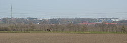 Trige seen from west | |
 Trige Location in Denmark  Trige Trige (Denmark Central Denmark Region) | |
| Coordinates: 56°15′11″N10°8′50″E / 56.25306°N 10.14722°E | |
| Country | Denmark |
| Region | Central Denmark Region |
| Municipality | Aarhus Municipality |
| Area | |
| • Urban | 1.5 km2 (0.6 sq mi) |
| Population (2025) [1] | |
| • Urban | 3,459 |
| • Urban density | 2,300/km2 (6,000/sq mi) |
| Time zone | UTC+1 (CET) |
| • Summer (DST) | UTC+2 (CEST) |
| Postal code | DK-8380 Trige |
Trige is a town and suburb of Aarhus in Denmark. It has a population of 3,459 (1 January 2025). [1]
Bærmoseskov is a newly raised 80 hectare woodland at the outskirts of Trige, part of the New Forests of Aarhus. [2]
 Trige church
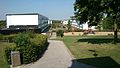 Trigeparken, a large public housing project
 Bærmoseskov a newly raised woodland