Sidon or Saida is the third-largest city in Lebanon. It is located in the South Governorate, of which it is the capital, on the Mediterranean coast. Tyre to the south and Lebanese capital Beirut to the north are both about 40 kilometres away. Sidon has a population of about 80,000 within city limits, while its metropolitan area has more than a quarter-million inhabitants.

Tunis is the capital and largest city of Tunisia. The greater metropolitan area of Tunis, often referred to as "Grand Tunis", has about 2,700,000 inhabitants. As of 2020, it is the third-largest city in the Maghreb region and the eleventh-largest in the Arab world.

Benghazi is the second-most-populous city in Libya as well as the largest city in Cyrenaica, with an estimated population of 1,207,250 in 2020. Located on the Gulf of Sidra in the Mediterranean, Benghazi is also a major seaport.

Iloilo, officially the Province of Iloilo, is a province in the Philippines located in the Western Visayas region. Its capital and largest city is Iloilo City, the regional center of Western Visayas. Iloilo occupies the southeast portion of the Visayan island of Panay and is bordered by the province of Antique to the west, Capiz to the north, the Jintotolo Channel to the northeast, the Guimaras Strait to the east, and the Iloilo Strait and Panay Gulf to the southwest.

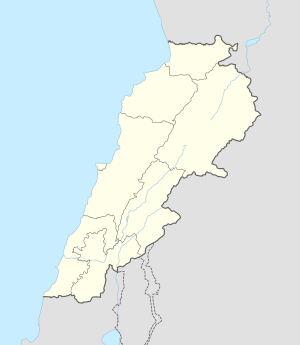
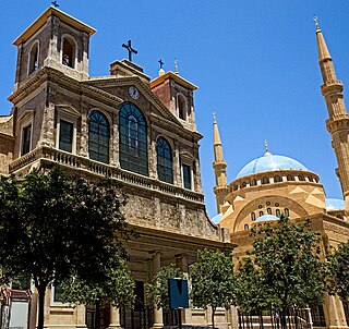
Tripoli is the largest and most important city in northern Lebanon and the second-largest city in the country. Situated 81 km (50 mi) north of the capital Beirut, it is the capital of the North Governorate and the Tripoli District. Tripoli overlooks the eastern Mediterranean Sea, and it is the northernmost seaport in Lebanon. The city is predominantly inhabited by Sunni Muslims, with smaller populations of Alawites and Christians, including Maronites and Armenians among others.

Quanzhou is a prefecture-level port city on the north bank of the Jin River, beside the Taiwan Strait in southern Fujian, People's Republic of China. It is Fujian's largest most populous metropolitan region, with an area of 11,245 square kilometers (4,342 sq mi) and a population of 8,782,285 as of the 2020 census. Its built-up area is home to 6,669,711 inhabitants, encompassing the Licheng, Fengze, and Luojiang urban districts; Jinjiang, Nan'an, and Shishi cities; Hui'an County; and the Quanzhou District for Taiwanese Investment. Quanzhou was China's 12th-largest extended metropolitan area in 2010.

A mellah is the place of residence historically assigned to Jewish communities in Morocco.

Rørvik is a port town and administrative centre in the municipality of Nærøysund in Trøndelag county, Norway. It is on the eastern side of the Vikna archipelago on the island of Inner-Vikna. The 1.82-square-kilometre (450-acre) town has a population (2023) of 3,615 and a population density of 1,715 inhabitants per square kilometre (4,440/sq mi).The municipality has a population (2023) of 10,014.

Sabratha, in the Zawiya District of Libya, was the westernmost of the ancient "three cities" of Roman Tripolis, alongside Oea and Leptis Magna. From 2001 to 2007 it was the capital of the former Sabratha wa Sorman District. It lies on the Mediterranean coast about 70 km (43 mi) west of modern Tripoli. The extant archaeological site was inscribed as a UNESCO World Heritage Site in 1982.

Sfax is a city in Tunisia, located 270 km (170 mi) southeast of Tunis. The city, founded in AD 849 on the ruins of Berber Taparura, is the capital of the Sfax Governorate, and a Mediterranean port. Sfax has a population of 330,440. Its main industries include phosphate, olive and nut processing, fishing and international trade. The city is the second-most populous in the country after the capital, Tunis.

Bahraich district is one of the districts of Uttar Pradesh state of India, and Bahraich town is the district headquarters. Bahraich District is a part of Devipatan Division.
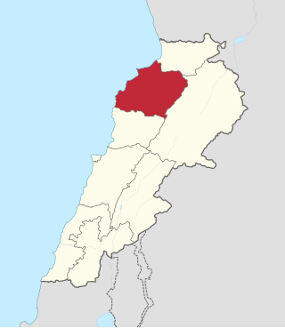
North Governorate is one of the governorates of Lebanon and one of the two governorates of North Lebanon. Its capital is Tripoli. Ramzi Nohra has been its governor since May 2, 2014. The population of North Governorate is 731,251.

Saha District is a gu in western Busan, South Korea. It has an area of 40.89 km², and a population of about 375,000. About a third of the area is forest land. Saha-gu became a gu of Busan in 1983. It is home to the Seunghak Campus of Dong-A University.

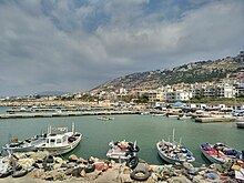
El-Mina or El Mina, is a coastal independent town that neighbors Tripoli, Northern Lebanon. El-Mina occupies the location of the old Phoenician city of Tripolis. It acts as the harbor city for the neighboring Tripoli, Lebanon's second-largest city, situated 5 km to the east.
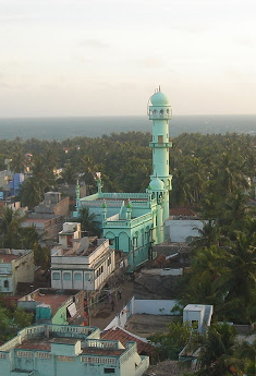
Pudumadam is a village located in the Ramanathapuram district of the Indian state of Tamil Nadu. Situated near the old National Highway 49, which connects Kochi and Dhanushkodi, Pudumadam serves as a vital gateway to the picturesque Pamban Island. The village is approximately 25 kilometers away from the city of Ramanathapuram and 37 kilometers away from the renowned pilgrimage site of Rameswaram. The nearest train station is Uchippuli, located just 4 kilometers away from Pudumadam.

Kalmunai is a city located in the Ampara District of Eastern Province, Sri Lanka.
The tourism industry in Lebanon has been important to the local economy historically and comprises a major source of revenue for the country.

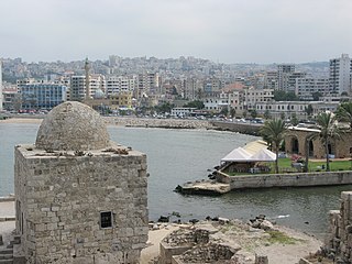
The Port of Tripoli is the second major port in Lebanon. The port covers an approximate area of 3 square kilometres (1.2 sq mi), with a water area of 2.2 square kilometres (0.85 sq mi), and the land area composing of 320,000 square metres (3,400,000 sq ft), and a 420,000 square metres (4,500,000 sq ft) dump area adjacent to the current port, reserved for the future Container Terminal and Free Market Zone.

Blue economy is a term in economics relating to the exploitation, preservation and regeneration of the marine environment. Its scope of interpretation varies among organizations. However, the term is generally used in the scope of international development when describing a sustainable development approach to coastal resources. This can include a wide range of economic sectors, from the more conventional fisheries, aquaculture, maritime transport, coastal, marine and maritime tourism, or other traditional uses, to more emergent activities such as coastal renewable energy, marine ecosystem services, seabed mining, and bioprospecting.
Gunugus or Gunugu was a Berber and Carthaginian town in northwest Africa in antiquity. It passed into Roman control during the Punic Wars and was the site of a colony of veteran soldiers. It survived the Vandals and Byzantines but was destroyed during the Muslim invasion of the area.