Tropical Cyclone Formation Alert

Last updated
A TCFA was issued for this tropical disturbance, which later became Severe Tropical Storm Etau. INVEST 92W 2015-09-05 0100Z.jpg
A TCFA was issued for this tropical disturbance, which later became Severe Tropical Storm Etau.

A Tropical Cyclone Formation Alert (TCFA) is a bulletin released by the U.S. Navy-operated Joint Typhoon Warning Center in Honolulu, Hawaii or the Fleet Weather Center in Norfolk, Virginia, warning of the possibility of a tropical cyclone forming from a tropical disturbance that has been monitored. Such alerts are generally always issued when it is fairly certain that a tropical cyclone will form and are not always released before cyclone genesis, particularly if the cyclone appears suddenly. The TCFA consists of several different checks that are performed by the on-duty meteorologist of the system and its surroundings. If the condition being checked is met, a certain number of points are given to the system.

Contents

Parts of the TCFA

Section 1

The first section of the TCFA contains information on the area of the alert as well as the estimated center of the circulation. The estimated maximum sustained winds are provided as well.

Section 2

The second section generally contains more specific information pertaining to the system. Information such as location relative to nearby cities or places of interest can usually be found in this section. Some of the reasoning for the issuance of the TCFA, which usually consists of recent changes in the system, can be found here. The section always ends with a statement as to the potential for development, which the JTWC will rank as either low, medium, or high (formerly poor, fair, or good).

Section 3

This final section contains the time of the next bulletin on this system, which will update the system's progress over the elapsed time. The bulletin will be either another TCFA, a cancellation message, or the first advisory/warning on the system. The issuance of another TCFA would occur if the system remains in a state similar to its current state. A cancellation message would indicate that the likelihood of the system to develop into a tropical cyclone at the current time has decreased. An advisory would indicate that a tropical cyclone has indeed formed, and poses a future threat to the areas in the box defined in Section 1.
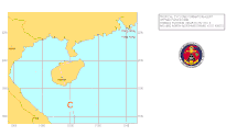
Sample alert

The TCFA graphic for this alert. No storm formed from this system. TCFA-WPAC-9506.gif
The TCFA graphic for this alert. No storm formed from this system.
WTPN22 PGTW 031030

MSGID/GENADMIN/NAVPACMETOCCEN PEARL HARBOR HI/JTWC//
SUBJ/TROPICAL CYCLONE FORMATION ALERT 031021Z JUL 06//
RMKS
1. FORMATION OF A SIGNIFICANT TROPICAL CYCLONE IS POSSIBLE WITHIN
100 NM EITHER SIDE OF A LINE FROM 16.4N 110.2E TO 19.7N 109.2E
WITHIN THE NEXT 12 TO 24 HOURS. AVAILABLE DATA DOES NOT JUSTIFY
ISSUANCE OF NUMBERED TROPICAL CYCLONE WARNINGS AT THIS TIME.
WINDS IN THE AREA ARE ESTIMATED TO BE 20 TO 25 KNOTS. METSAT IMAGERY
AT 030900Z INDICATES THAT A CIRCULATION CENTER IS LOCATED
NEAR 16.7N 110.1E. THE SYSTEM IS MOVING NORTH-NORTHWESTWARD AT
07 KNOTS.
2. REMARKS: THE AREA OF CONVECTION PREVIOUSLY LOCATED NEAR 16.3N
110.2E, IS NOW LOCATED NEAR 16.7N 110.1E, APPROXIMATELY 130 NM SOUTH-
SOUTHEAST OF HAINAN, CHINA. RECENT ANIMATED INFRARED IMAGERY SHOWS
CONVECTION HAS CONTINUED TO BECOME MORE CONSOLIDATED AND THERE IS NOW
NORTHERLY RETURN FLOW IN THE NORTHWESTERN QUADRANT OF SYSTEM. UPPER
LEVEL ANALYSIS INDICATES FAVORABLE EQUATORWARD OUTFLOW AND MODERATE
VERTICAL WIND SHEAR. MAXIMUM SUSTAINED SURFACE WINDS ARE ESTIMATED AT
20 TO 25 KNOTS. MINIMUM SEA LEVEL PRESSURE IS ESTIMATED TO BE NEAR
1003 MB. THE POTENTIAL FOR THE DEVELOPMENT OF A SIGNIFICANT TROPICAL
CYCLONE WITHIN THE NEXT 24 HOURS IS UPGRADED TO HIGH.
3. THIS ALERT WILL BE REISSUED, UPGRADED TO WARNING OR CANCELLED

BY 041030Z.//

Issuance checklist

The JTWC and FWC-N follow a checklist when deciding whether or not to issue a TCFA on tropical disturbances. The checklist is updated every few years, and the JTWC checklist may differ slightly from the FWC-N checklist, which is shown below. If a system gets 35 to 38 points, a TCFA may be issued depending on Dvorak trends, and if a system gets 39 points or more a TCFA should be issued.

Surface

ConditionPoints
A circulation is evident using visible satellite, shortwave infrared, microwave imagery or QuikSCAT/Windsat ambiguities
3 points
A circulation has been evident for at least 24 hours
5 points
A westerly surface- or gradient-level wind of 5 kn that is within 200 nmi (370 km, 230 mi) south of the centre of the disturbance
5 points
Any wind associated with the system is at least 20 kn
2 points
Any wind associated with the system is at least 25 kn
3 points
Any wind associated with the system is at least 30 kn
4 points
A weather station within 200 nm of the system has reported had a pressure drop of 2 mb over 24 hours
3 points
A weather station within 200 nmi of the system has had a pressure drop of 3 mb over 24 hours
4 points
The estimated MSLP of the system is less than 1010 to 1009 mb
3 points
The estimated MSLP of the system is 1008 mb or less
4 points

500 mb height

ConditionPoints
There is evidence of at least an inverted trough
2 points
There is evidence of a closed circulation in the system
4 points

200 mb height

ConditionPoints
Westerly flow of at least 15 kn over the disturbance
-4 points
There is evidence of anticyclonic outflow over the centre of the disturbance
4 points
Easterly flow of at most 20 kt over the disturbance
3 points

Sea surface temperature

ConditionPoints
The sea surface temperature is 26 Celsius (78.8 Fahrenheit) or higher
3 points

Satellite data

ConditionPoints
The system has persisted for at least 24 hours
3 points
The system has persisted for at least 48 hours
4 points
The system has persisted for at least 72 hours
5 points
The system has a Dvorak classification of T1.0 to T1.5 from all three agencies (TAFB, SAB, AFWA)
3 points
The system has a Dvorak classification of T1.5 to T2.0 from all three agencies
5 points
The Dvorak final-T number has decreased by T0.5 to T1.0 from two or more agencies
-2 points

Miscellaneous

ConditionPoints
The cloud system is at least 5 degrees latitude away from the equator
3 points
The tropical system is within 72 hours of reaching a Department of Defense resource
3 points
The cloud system center and the satellite centre fixes for the system are within 2 degrees of each other
2 points

See also

Related Research Articles

<span class="mw-page-title-main">Cyclone Agni</span> North Indian Ocean severe cyclonic storm in 2004

Severe Cyclonic Storm Agni was a tropical cyclone of the 2004 North Indian Ocean cyclone season notable for its record proximity to the equator. It was the second North Indian Ocean cyclone to receive a name, after Onil earlier in the year. Agni formed on November 28 well to the southwest of India in the Arabian Sea, and steadily intensified as it tracked northwestward. The Joint Typhoon Warning Center (JTWC) estimated peak 1 minute sustained winds of 120 km/h (75 mph), while the India Meteorological Department (IMD) estimated peak 3 minute sustained winds of 100 km/h (60 mph); the IMD is the official warning center for the north Indian Ocean. After peaking, it weakened due to wind shear, dry air, and cooler waters, and the JTWC issued its final advisory on December 3 as it approached the coast of Somalia. The remnants of Agni moved along the Somalian coastline until dissipating on December 5.

<span class="mw-page-title-main">2008 Pacific typhoon season</span> Typhoon season in the Western Pacific Ocean

The 2008 Pacific typhoon season was a below average season which featured 22 named storms, eleven typhoons, and two super typhoons. The season had no official bounds; it ran year-round in 2008, but most tropical cyclones tend to form in the northwestern Pacific Ocean between May and November. These dates conventionally delimit the period of each year when most tropical cyclones form in the northwestern Pacific Ocean.

<span class="mw-page-title-main">2006–07 South Pacific cyclone season</span> Tropical cyclone season

The 2006–07 South Pacific cyclone season was an event in the annual cycle of tropical cyclone formation. It began on November 1, 2006 and ended on April 30, 2007. These dates conventionally delimit the period of each year when most tropical cyclones form in the southern Pacific Ocean east of 160°E. Additionally, the regional tropical cyclone operational plan defines a tropical cyclone year separately from a tropical cyclone season, and the "tropical cyclone year" runs from July 1, 2006 to June 30, 2007.

<span class="mw-page-title-main">Cyclones BOB 03 and Yemyin</span> North Indian Ocean deep depression and cyclonic storm in 2007

Deep Depression BOB 03 and Cyclonic Storm Yemyin were a pair of deadly tropical cyclones that made landfalls on India and Pakistan in June 2007. The Pakistan Meteorological Department referred to both as Tropical Cyclone 03B, naming it "Tropical Cyclone Yemyin". At the time, the official WMO body responsible for tropical cyclones in the Arabian Sea, the India Meteorological Department (IMD), did not name them. However, the IMD reassessed the second system to have reached cyclonic storm strength, and retroactively named it Yemyin.

<span class="mw-page-title-main">1999 North Indian Ocean cyclone season</span> Cyclone season in the North Indian ocean

The 1999 North Indian Ocean cyclone season was an event in the annual cycle of tropical cyclone formation. The North Indian Ocean cyclone season has no official bounds, but cyclones tend to form between April and December, with peaks in May and November. These dates conventionally delimit the period of each year when most tropical cyclones form in the northern Indian Ocean.

<span class="mw-page-title-main">2008–09 South-West Indian Ocean cyclone season</span> Cyclone season in the Southwest Indian Ocean

The 2008–09 South-West Indian Ocean cyclone season was a slightly above average event in tropical cyclone formation. It began on November 15, 2008, and officially ended on April 30, 2009, with the exception for Mauritius and the Seychelles, for which it ended on May 15, 2009. These dates conventionally delimit the period of each year when most tropical cyclones form in the basin, which is west of 90°E and south of the Equator. Tropical cyclones in this basin were monitored by the Regional Specialised Meteorological Centre in Réunion.

<span class="mw-page-title-main">2009 North Indian Ocean cyclone season</span> North Indian Ocean tropical cyclone season

The 2009 North Indian Ocean cyclone season was an event in the annual cycle of tropical cyclone formation. The North Indian Ocean cyclone season has no official bounds, but cyclones tend to form between April and December, with peaks in May and November. These dates conventionally delimit the period of each year when most tropical cyclones form in the northern Indian Ocean.

<span class="mw-page-title-main">2009 Pacific typhoon season</span> Typhoon season in the Western Pacific Ocean

The 2009 Pacific typhoon season was a below average season that spawned only 22 named storms, 13 typhoons, and five super typhoons. It was also recognized as the deadliest season in the Philippines for decades. The first half of the season was very quiet whereas the second half of the season was extremely active. The season's first named storm, Kujira, developed on May 3 while the season's last named storm, Nida, dissipated on December 3.

<span class="mw-page-title-main">2009–10 South-West Indian Ocean cyclone season</span> Cyclone season in the Southwest Indian Ocean

The 2009–10 South-West Indian Ocean tropical cyclone season was a near average event in tropical cyclone formation. The season officially started on July 1, 2009, and ended on June 30, 2010, after incorporating the tropical cyclone season which ran from November 1 to April 30 for all areas except for Mauritius and the Seychelles, for which it ended on May 15, 2010. In this basin which officially runs from 30 to 90E, and is, to the south of the equator, the main warning center is the Regional Specialized Meteorological Center on La Réunion Island; however they delegate the naming of Cyclones to the Meteorological services of Mauritius and Madagascar.

<span class="mw-page-title-main">2011 Pacific typhoon season</span> Typhoon season in the Western Pacific Ocean

The 2011 Pacific typhoon season was a below average season that produced a total of 21 named storms, 8 typhoons, and four super typhoons. This season was much more active than the previous season, although both seasons were below the Pacific typhoon average of 26. The season ran throughout 2011, though most tropical cyclone tend to develop between May and October. The season's first named storm, Aere, developed on May 7 while the season's last named storm, Washi dissipated on December 19.

<span class="mw-page-title-main">2012 North Indian Ocean cyclone season</span> North Indian Ocean tropical cyclone season

The 2012 North Indian Ocean cyclone season was a very inactive season. The season had a very late start, with the first system forming in October. During the season, only five systems formed, of which only two became cyclonic storms. Both the storms made landfall, and they, along with the deep depressions, were responsible for 128 deaths and economic losses worth at least $56.7 million.

<span class="mw-page-title-main">2012–13 South-West Indian Ocean cyclone season</span> Cyclone season in the Southwest Indian Ocean

The 2012–13 South-West Indian Ocean cyclone season was a slightly above average event in tropical cyclone formation in the Southern hemisphere tropical cyclone year starting on July 1, 2012, and ending on June 30, 2013. Within this basin, tropical and subtropical disturbances are officially monitored by the Regional Specialised Meteorological Centre on Réunion island, while the Mauritius and Madagascar weather services assign names to significant tropical and subtropical disturbances. The first tropical disturbance of the season developed on October 12 and rapidly developed into the earliest known intense tropical cyclone on record during October 14.

<span class="mw-page-title-main">2016 North Indian Ocean cyclone season</span> North Indian Ocean tropical cyclone season

The 2016 North Indian Ocean cyclone season was an event in the annual cycle of tropical cyclone formation. It was the deadliest season since 2010, killing more than 400 people. The season was an average one, seeing four named storms, with one further intensifying into a very severe cyclonic storm. The first named storm, Roanu, developed on 19 May while the season's last named storm, Vardah, dissipated on 18 December. The North Indian Ocean cyclone season has no official bounds, but cyclones tend to form between April and December, with the two peaks in May and November. These dates conventionally delimit the period of each year when most tropical cyclones form in the northern Indian Ocean.

<span class="mw-page-title-main">2021 Pacific typhoon season</span> Typhoon season in the Western Pacific Ocean

The 2021 Pacific typhoon season was the second consecutive to have below-average tropical cyclone activity, with twenty-two named storms, and was the least active since 2011. Nine became typhoons, and five of those intensified into super typhoons. This low activity was caused by a strong La Niña that had persisted from the previous year. The season's first named storm, Dujuan, developed on February 16, while the last named storm, Rai, dissipated on December 21. The season's first typhoon, Surigae, reached typhoon status on April 16. It became the first super typhoon of the year on the next day, also becoming the strongest tropical cyclone in 2021. Surigae was also the most powerful tropical cyclone on record in the Northern Hemisphere for the month of April. Typhoons In-fa and Rai are responsible for more than half of the total damage this season, adding up to a combined total of $2.02 billion.

<span class="mw-page-title-main">2022 Pacific typhoon season</span> Typhoon season in the Western Pacific Ocean

The 2022 Pacific typhoon season was the third consecutive season to have below-average tropical cyclone activity, with twenty-five named storms, although it was more active than the previous seasons by named storm count. Ten became typhoons, and three of those intensified into super typhoons. This low activity was caused by an unusually strong La Niña that had persisted from 2020. The season's first named storm, Malakas, developed on April 6, while the last named storm, Pakhar, dissipated on December 12. The season's first typhoon, Malakas, reached typhoon status on April 12. The season ran throughout 2022, though most tropical cyclones typically develop between May and October. Tropical storms Megi and Nalgae were responsible for more than half of the casualties, while typhoons Hinnamnor and Nanmadol both caused $1 billion in damages.

<span class="mw-page-title-main">2021–22 South-West Indian Ocean cyclone season</span> Cyclone season in the Southwest Indian Ocean

The 2021–22 South-West Indian Ocean cyclone season featured the record latest start for the first system to develop. Despite the late start, it was an above-average season that produced 12 named storms, with 5 becoming tropical cyclones. The season began on 15 November 2021, and ended on 30 April 2022, with the exception for Mauritius and the Seychelles, for which it ended on 15 May 2022. These dates conventionally delimit the period of each year when most tropical and subtropical cyclones form in the basin, which is west of 90°E and south of the Equator. However, tropical cyclones that form at any time between 1 July 2021 and 30 June 2022 will count towards the season total. Tropical and subtropical cyclones in this basin are monitored by the Regional Specialised Meteorological Centre in Réunion and unofficially by the Joint Typhoon Warning Center.

<span class="mw-page-title-main">2021–22 South Pacific cyclone season</span> Cyclone season in the South Pacific Ocean

The 2021–22 South Pacific cyclone season was a near average tropical cyclone season within the South Pacific Ocean to the east of 160°E. The season officially started from November 1, 2021, and officially ended on April 30, 2022, however a tropical cyclone could form at any time between July 1, 2021, and June 30, 2022, and would count towards the season total. During the season, tropical cyclones will be officially monitored by the Fiji Meteorological Service, Australian Bureau of Meteorology and New Zealand's MetService. The United States Armed Forces through the Joint Typhoon Warning Center (JTWC) will also monitor the basin and issue unofficial warnings for American interests. The FMS attaches a number and an F suffix to tropical disturbances that form in or move into the basin while the JTWC designates significant tropical cyclones with a number and a P suffix. The BoM, FMS and MetService all use the Australian Tropical Cyclone Intensity Scale and estimate windspeeds over a period of ten minutes, while the JTWC estimated sustained winds over a 1-minute period, which are subsequently compared to the Saffir–Simpson hurricane wind scale (SSHWS).

<span class="mw-page-title-main">2023 North Indian Ocean cyclone season</span> North Indian Ocean tropical cyclone season

The 2023 North Indian Ocean cyclone season is an ongoing event in the annual cycle of tropical cyclone formation. The North Indian Ocean cyclone season has no official bounds, but cyclones tend to form between April and December, with the peak from May to November. These dates conventionally delimit the period of each year when most tropical cyclones form in the northern Indian Ocean.

<span class="mw-page-title-main">2022–23 Australian region cyclone season</span> Cyclone season in Australia

The 2022–23 Australian region cyclone season is the period of the year when most tropical cyclones form in the Southern Indian Ocean and Pacific Oceans between 90°E and 160°E. The season officially started on 1 November 2022 and will finish on 30 April 2023, however, a tropical cyclone could form at any time between 1 July 2022 and 30 June 2023 and would count towards the season total. During the season, tropical cyclones will be officially monitored by one of the three tropical cyclone warning centres (TCWCs) for the region which are operated by the Australian Bureau of Meteorology, National Weather Service of Papua New Guinea and the Indonesian Agency for Meteorology, Climatology and Geophysics. The United States Joint Typhoon Warning Center (JTWC) and other national meteorological services including Météo-France and the Fiji Meteorological Service will also monitor the basin during the season.

<span class="mw-page-title-main">2022–23 South Pacific cyclone season</span> Cyclone season in the South Pacific Ocean

The 2022–23 South Pacific cyclone season is the period of the year when most tropical cyclones form within the South Pacific Ocean to the east of 160°E. The season officially started on November 1, 2022, and will end on April 30, 2023, however a tropical cyclone could form at any time between July 1, 2022, and June 30, 2023, and would count towards the season total. During the season, tropical cyclones will be officially monitored by the Fiji Meteorological Service, Australian Bureau of Meteorology and New Zealand's MetService. The United States Armed Forces through the Joint Typhoon Warning Center (JTWC) will also monitor the basin and issue unofficial warnings for American interests. The FMS attaches a number and an F suffix to tropical disturbances that form in or move into the basin while the JTWC designates significant tropical cyclones with a number and a P suffix. The BoM, FMS and MetService all use the Australian Tropical Cyclone Intensity Scale and estimate windspeeds with a period of approximately ten minutes, while the JTWC estimates sustained winds over a 1-minute period, which are subsequently compared to the Saffir–Simpson hurricane wind scale (SSHWS).

References