Turnford, Hertfordshire

Last updated

Turnford
Garden of New River Arms, with pub sign and houses in High Road, Turnford, in background - geograph.org.uk - 99087.jpg
High Road, Turnford
Hertfordshire UK location map.svg
Red pog.svg
Turnford
Location within Hertfordshire
Population8146 with Wormley
OS grid reference TL3639204404
District
Shire county
Region
Country England
Sovereign state United Kingdom
Post town Broxbourne
Postcode district EN10
Dialling code 01992
Police Hertfordshire
Fire Hertfordshire
Ambulance East of England
UK Parliament
List of places
UK
England
Hertfordshire
51°43′17″N0°01′31″W / 51.7213°N 0.0252°W / 51.7213; -0.0252

Turnford is a village in the Borough of Broxbourne, in Hertfordshire, England, in an area generally known as the Lee Valley. It is bounded by Wormley to the north, Cheshunt to the south and west, and its eastern boundary is formed largely by the Lee Navigation. Central London at Charing Cross is approximately 18 miles (29 km) south. At the 2001 census, together with Wormley, the village had a population of 8,146 in 3,399 households. [1]

Contents

History

Turnford lies in a site where evidence of Palaeolithic, Late Bronze Age and Iron Age relics have been recorded. By the late Saxon period the village existed as a farm belonging to the manor of Cheshunt. A Benedictine nunnery was established in the 12th century on Turnford Marsh. Part of the medieval buildings survived within a farm until gravel quarrying destroyed the remains in 1955. Turnford remained a hamlet up to the 19th century until the nursery industry began to move out of North London in the 1880s. Growers including Thomas Rochford grew grapes, tomatoes, cucumbers and other items. By the late 20th century this industry had moved away to be replaced by housing estates where Thomas Rochford Way and Rochford Close are a reminder of the area's horticultural past. [2]

Etymology

The name Turnford appears to have Saxon origins and is probably a compound of Old English tun and ford - the ford by the farm. [2]

The village today

Much of Turnford due to its good transport links and close proximity to London is given over to residential development. However, its western boundary is mostly rural and to the east includes the Turnford and Cheshunt Pits a SSSI located in the Lee Valley Park.

Amenities include a selection of retail outlets, essential services, two public houses including the Grade II listed Bull's Head Inn. [3] and is home to Haileybury Turnford (formerly Turnford School) and the Hertford Regional College.

Bull's Head Inn Bulls Head Pub, Turnford - geograph.org.uk - 1131915.jpg
Bull's Head Inn

In 2014, the area of Wormley & Turnford was awarded £1m from the Big Local Trust to invest in the community over the next 10 years. Completely resident volunteer led, it will enable locals to regenerate their community. [4]

Watercourses

Passing under the A10 road from west to east Turnford Brook a River Lea tributary flows in a culvert alongside the High Road, Turnford before flowing under the West Anglia railway line to merge with the Small River Lea in the River Lee Country Park. Accessed from the New River Path [5] the Turnford Pumping Station built in 1870 stands close to the man-made New River. The building houses a unique stationary steam engine built by Boulton and Watt in 1845. [6] Forming a boundary between Hertfordshire and Essex the Lee Navigation flows in a southerly direction on Turnford's eastern fringe. Pedestrian and cycle access from the B176, Cheshunt Wash 51°42′54″N0°01′20″W / 51.715°N 0.0221°W / 51.715; -0.0221 links to the towpath of the river to join the Lee Valley Walk.

Public transport

West Anglia Main Line railway stations Cheshunt and Broxbourne are both approximately 2 miles (3.2 km) distant. Several bus routes serve Turnford including 310, 310A, 410. [7] There are plans to open a new railway station in Turnford. [8] As part of the Broxbourne Local Plan by the Borough of Broxbourne and Hertfordshire County Council, "the proposed station would [provide] access to Hertford Regional College and also serve the Brookfield development. The new station is proposed to be located at a site between the Regional College and Groom Road, with access provided from the Turnford High Road/The Springs roundabout through the college car park and along the undeveloped strip of land between Robinia Road/Sorbus Road to the north and Landau Way/Tarpan Way to the South." [9] The plans also include the opening of Park Plaza North station between Turkey Street and Theoblads Grove, and the four-tracking of the West Anglia Main Line. [10] [11]

Governance

The village together with Wormley form one of ten electoral wards in the Broxbourne constituency. [12]

Notable people

Footballer Ossie Ardiles lived in the village whilst playing for Tottenham Hotspur in the 1970s and 1980s.

Related Research Articles

<span class="mw-page-title-main">Hertfordshire</span> County of England

Hertfordshire is a county in the East of England region and is one of the home counties. It borders Bedfordshire to the north, Cambridgeshire to the north-east, Essex to the east, Greater London to the south, and Buckinghamshire to the west and the south-west.

<span class="mw-page-title-main">Hoddesdon</span> Town in Hertfordshire, England

Hoddesdon is a town in the Borough of Broxbourne, Hertfordshire, lying entirely within the London Metropolitan Area and Greater London Urban Area. The area is on the River Lea and the Lee Navigation along with the New River.

<span class="mw-page-title-main">Borough of Broxbourne</span> Place in England

The Borough of Broxbourne is a local government district with borough status in Hertfordshire, England. Its council is based in Cheshunt. Other settlements in the borough include Broxbourne, Hoddesdon and Waltham Cross. The eastern boundary of the district is the River Lea. The borough covers 20 square miles (52 km2) in south east Hertfordshire, and had an estimated population of 99,000 in 2021.

<span class="mw-page-title-main">Cheshunt</span> Town in Hertfordshire, England

Cheshunt is a town in the Borough of Broxbourne in Hertfordshire, England, 13 miles (21 km) north of London on the River Lea and Lee Navigation and directly south of Broxbourne. It contains a section of the Lee Valley Park, including much of the River Lee Country Park. To the north lies Broxbourne and Wormley, Waltham Abbey to the east, Waltham Cross and Enfield to the south, and Cuffley to the west.

<span class="mw-page-title-main">Lea Valley lines</span> Commuter railway lines in London, England

The Lea Valley lines are two commuter lines and two branches in north-east London, so named because they run along the Lower Lea Valley of the River Lea. They were part of the Great Eastern Railway, now part of the Anglia Route of Network Rail.

<span class="mw-page-title-main">Broxbourne railway station</span> Network Rail station in Hertfordshire, England

Broxbourne railway station is on the West Anglia Main Line serving the towns of Broxbourne and Hoddesdon in Hertfordshire, England. It is 17 miles 17 chains (27.7 km) down the line from London Liverpool Street and is situated between Cheshunt and Roydon. Its three-letter station code is BXB and it is in fare zone B.

<span class="mw-page-title-main">Cheshunt railway station</span> National Rail station in Hertfordshire, England

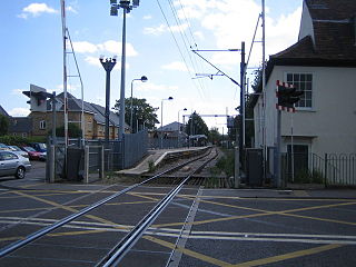
Cheshunt is a National Rail and London Overground station in Cheshunt, Hertfordshire, England. On the National Rail network it is on the West Anglia Main Line, 14 miles 1 chain (22.6 km) from London Liverpool Street and situated between Waltham Cross and Broxbourne. On the London Overground network it is one of three northern termini of the Lea Valley lines.

<span class="mw-page-title-main">Waltham Cross railway station</span> National Rail station in Hertfordshire, England

Waltham Cross railway station is on the West Anglia Main Line, serving the suburban town of Waltham Cross in Hertfordshire, and the neighbouring Waltham Abbey in Essex, England. It is 12 miles 63 chains (20.6 km) down the line from London Liverpool Street and is situated between Enfield Lock and Cheshunt. Its three-letter station code is WLC and it is in Travelcard zone 7.

<span class="mw-page-title-main">Waltham Cross</span> Town in Hertfordshire, England

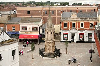
Waltham Cross is a town in the Borough of Broxbourne, Hertfordshire, England, located 12 miles (19 km) north of central London. In the south-eastern corner of Hertfordshire, it borders Cheshunt to the north, Waltham Abbey to the east, and Enfield to the south, forming part of the metropolitan area of London and the Greater London Urban Area.

Enfield Lock is an area in the London Borough of Enfield, north London. It is approximately located east of the Hertford Road between Turkey Street and the Holmesdale Tunnel overpass, and extends to the River Lee Navigation, including the Enfield Island Village. The locality gains its name from the lock on the River Lee Navigation. Today's Enfield Lock was rebuilt in 1922. The area forms part of the Lee Valley Park and the Enfield Lock Conservation Area. On its eastern boundary Enfield Lock has marshland formerly used as a testing site between the Royal Small Arms Factory and the Gunpowder Mills, beyond this is the village of Sewardstone and the Epping forest boundary. To the south is Brimsdown, the north Waltham Cross and to the west Bullsmoor and Freezywater. Enfield Lock forms part of the London boundary.

<span class="mw-page-title-main">Broxbourne</span> Town in Hertfordshire, England

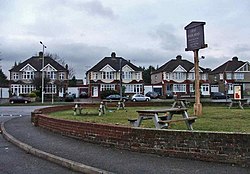
Broxbourne is a town in the Borough of Broxbourne district, in Hertfordshire, England, with a population of 15,303 at the 2011 Census. It is located to the south of Hoddesdon and to the north of Cheshunt, 17 miles (27 km) north of London. The town is near the River Lea, which forms the boundary with Essex, and 5 miles (8.0 km) north of the M25 motorway. To the west of the town are Broxbourne Woods, a national nature reserve. The Prime Meridian runs just east of Broxbourne.

<span class="mw-page-title-main">Lea Valley Walk</span> Long-distance footpath in South East England

The Lea Valley Walk is a 50-mile (80 km) long-distance path located between Leagrave, the source of the River Lea near Luton, and the Thames, at Limehouse Basin, Limehouse, east London. From its source much of the walk is rural. At Hertford the path follows the towpath of the River Lee Navigation, and it becomes increasingly urbanised as it approaches London. The walk was opened in 1993 and is waymarked throughout using a swan logo.

<span class="mw-page-title-main">Turnford Brook</span> Stream in Hertfordshire, England

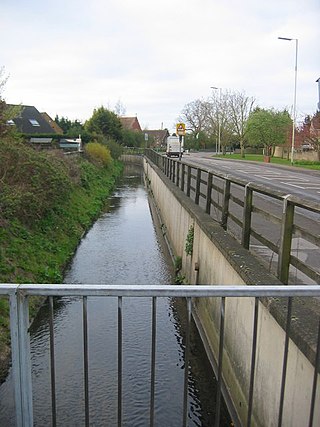
Turnford Brook is a minor tributary of the River Lea. The brook flows through the Borough of Broxbourne for approximately 3 miles (5 km).

<span class="mw-page-title-main">Hertford East branch line</span> Railway line in Hertfordshire, England

The Hertford East branch line is a railway line in Hertfordshire, England running between Hertford East and Broxbourne. The line follows the route of the Lea Valley, serving intermediate towns and villages. It branches off the West Anglia Main Line north of Broxbourne, and could be seen as part of the Lea Valley lines—a collection of commuter routes into London. It is 5 miles 64 chains (9.33 km) in length.

<span class="mw-page-title-main">Aqueduct Lock</span>

Aqueduct Lock is a lock on the River Lee Navigation close to Turnford.

<span class="mw-page-title-main">Wormley, Hertfordshire</span> Human settlement in England

Wormley is a village and former civil parish, lying between Hoddesdon and Cheshunt in the Broxbourne district, in the county of Hertfordshire, England. The village is part of the ward of Wormley and Turnford, which had a population of 8,146 at the 2001 census. In 1931 the parish had a population of 930. The parish was abolished in 1935 and absorbed into Hoddesdon.

<span class="mw-page-title-main">New River Path</span>

The New River Path is a long-distance footpath which follows the course of the 17th-century aqueduct, the New River, for 28 miles (45 km) from its source in Hertfordshire to its original end in Islington, London. The path is waymarked and all signs display the words "New River Path" on a green background.

The Broxbourne Council election, 1996 was held to elect council members of the Broxbourne Borough Council, the local government authority of the borough of Broxbourne, Hertfordshire, England.

The Broxbourne Council election, 2012 was held on 3 May 2012 to elect council members of the Broxbourne Borough Council, the local government authority of the borough of Broxbourne, Hertfordshire, England.

References

  1. Census data
  2. 1 2 Archaeology data service Retrieved 22 November 2012
  3. British listed buildings Retrieved 19 November 2012
  4. The Big Local Trust Retrieved 5 March 2015
  5. New River Path Retrieved 23 November 2012
  6. Turnford pumping station Retrieved 20 November 2012
  7. Bus services Retrieved 19 November 2012
  8. Retrieved 10 November 2023
  9. Page 84, Broxbourne Local Plan Retrieved 10 November 2023
  10. Page 7, Broxbourne Local Plan Retrieved 10 November 2023
  11. "Two new train stations on London Liverpool Street line could be built in Hertfordshire," Herts Live Retrieved 10 November 2023
  12. Wormley and Turnford ward Retrieved 15 November 2012