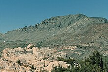
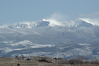
Mount Dana is a mountain in the U.S. state of California. Its summit marks the eastern boundary of Yosemite National Park and the western boundary of the Ansel Adams Wilderness. At an elevation of 13,061 feet (3,981 m), it is the second highest mountain in Yosemite, and the northernmost summit in the Sierra Nevada which is over 13,000 feet (3,962.4 m) in elevation. Mount Dana is the highest peak in Yosemite that is a simple hike to the summit. The mountain is named in honor of James Dwight Dana, who was a professor of natural history and geology at Yale.
Mount Eisenhower, formerly Mount Pleasant, is a mountain in the Presidential Range in the White Mountains of New Hampshire approximately 4,760 ft (1,450 m) high. Named after President Dwight D. Eisenhower, its summit offers a 360° view. It is inaccessible by road.

Argentine Peak is a high mountain summit in the Front Range of the Rocky Mountains of North America. The 13,743-foot (4,189 m) thirteener is located in Arapaho National Forest, 8.5 miles (13.6 km) southwest by south of Georgetown, Colorado, United States. The summit lies on the Continental Divide between Clear Creek and Summit counties.

Capitol Peak is a high and prominent mountain summit in the Elk Mountains range of the Rocky Mountains of North America. It is the 52nd highest mountain in North America. The 14,137-foot (4,309 m) fourteener is located in the Maroon Bells-Snowmass Wilderness of White River National Forest, 8.7 miles (14.0 km) east by south of the community of Redstone in Pitkin County, Colorado, United States.

Cloud Peak is the highest peak within the Bighorn Mountains in the U.S. state of Wyoming.

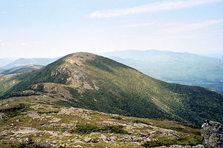
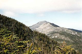
Mount Lafayette is a 5,249-foot (1,600 m) mountain at the northern end of the Franconia Range in the White Mountains of New Hampshire, United States. It lies in the town of Franconia in Grafton County, and appears on the New England Fifty Finest list of the most topographically prominent peaks in New England. The mountain's upper reaches are located in the alpine zone, an area where only dwarf vegetation exists due to the harsh climate.

Mount Lyell is the highest point in Yosemite National Park, at 13,114 feet (3,997 m). It is located at the southeast end of the Cathedral Range, 1+1⁄4 miles northwest of Rodgers Peak. The peak as well as nearby Lyell Canyon is named after Charles Lyell, a well-known 19th century geologist. The peak had one of the last remaining glaciers in Yosemite, Lyell Glacier. The Lyell Glacier is currently considered to be a permanent ice field, not a living glacier. Mount Lyell divides the Tuolumne River watershed to the north, the Merced to the west, and the Rush Creek drainage in the Mono Lake Basin to the southeast.
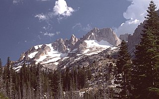
Matterhorn Peak is located in the Sierra Nevada, in California, at the northern boundary of Yosemite National Park. At 12,285 feet (3,744 m) elevation, it is the tallest peak in the craggy Alps-like Sawtooth Ridge and the northernmost 12,000-foot (3,700 m) peak in the Sierra Nevada. The peak also supports the Sierra's northernmost glacier system. It was named after the Matterhorn in the Alps. Matterhorn Peak is near Twin Peaks, and just north of Whorl Mountain.
Truchas Peak is the second highest peak in the U.S. State of New Mexico behind Wheeler Peak. It is in the Sangre de Cristo Mountains 26 miles (42 km) northeast of Santa Fe. It lies within the Pecos Wilderness, part of the Santa Fe National Forest. The name of the peak is Spanish for "trout" (plural). It is the highest point in both Rio Arriba and Mora counties. It is also the most southerly peak and land area in the continental United States to rise above 13,000 feet (3,962 m).

Stratton Mountain is a mountain located in Windham County, Vermont, in the Green Mountain National Forest. The mountain is the highest point of Windham County, and of the southern Green Mountains generally. A fire tower located on the summit is generally open for climbing by the public. There is also a small caretaker cabin at the summit that is inhabited in season by a caretaker from the Green Mountain Club. The northern end of the mountain is occupied by Stratton Mountain Resort.
Seward Mountain is a mountain located in Franklin County, New York, of which it is the highest point. Seward Mtn. is named after William H. Seward (1801–1872), Governor of New York (1839–1842), and United States Secretary of State (1861–1869). The mountain is part of the Seward Mountains of the Adirondacks. Seward Mountain is flanked to the southwest by Donaldson Mountain, and to the east faces Seymour Mountain across Ouluska Pass.

Sonora Peak is a mountain in the Central Sierra Nevada of California north of Sonora Pass. Located on the boundary between Alpine and Mono counties, it is the highest point in Alpine County. Due to the high elevation, most of the precipitation this mountain receives consists of snow.

James Peak is a high mountain summit in the Front Range of the Rocky Mountains of North America. The 13,294 foot thirteener is located on the Continental Divide in the James Peak Wilderness of Arapaho National Forest and Roosevelt National Forest, 5.2 miles (8.4 km) east-southeast of the Town of Winter Park, Colorado, United States. The summit is the tripoint of Clear Creek, Gilpin, and Grand counties. The peak is the highest point in Gilpin County and the second-highest in the James Peak Wilderness.

The La Garita Wilderness is a U.S. Wilderness Area located in the La Garita Mountains of southern Colorado. The 129,626-acre (524.58 km2) wilderness established in 1964 in Gunnison and Rio Grande National Forests includes segments of the Colorado Trail and the Continental Divide Trail. At 14,014 feet (4,271 m), San Luis Peak is the highest point in the wilderness area.

Merced Peak, with an elevation of 11,731 feet (3,576 m), is the highest point in the Clark Range, just surpassing three other peaks; Red Peak, Gray Peak, and Mount Clark.
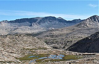
Kuna Peak is a summit on the boundary between Mono and Tuolumne counties, in the United States, is the highest point on Kuna Crest. With an elevation of 13,008 feet (3,965 m), Kuna Peak is the 146th-highest summit in the state of California, and is the third-highest mountain in Yosemite National Park.

Johnson Peak is the highest mountain, in Tuolumne Meadows, Yosemite National Park.
Tuolumne Peak is a mountain, in Yosemite National Park, in the area of Tuolumne Meadows. It is a fractured granite, twin summited peak, and is close to geographic center of the park. Tuolumne Peak is located approximately 2.5 miles (4.0 km) northeast of Mount Hoffmann via a granite ridge-line. It is climbed less often than Hoffman, probably due to a more difficult approach.
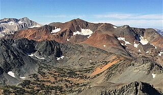
Excelsior Mountain is the 21st-highest mountain in Yosemite National Park, on the northeastern border of Yosemite. It is the next high peak, north of Mount Conness. Excelsior Mountain is mostly made of rust-colored metamorphic rock, similar to Mount Dana, which is also close.

Mount Lovenia is a 13,219-foot elevation (4,029 m) mountain summit located on the common border that Duchesne County shares with Summit County in the U.S. state of Utah.