
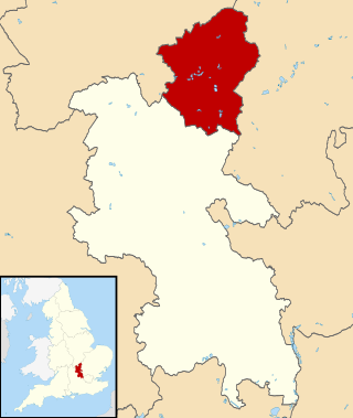
Bedfordshire is a ceremonial and historic county in the East of England. It is bordered by Northamptonshire to the north, Cambridgeshire to the north-east, Hertfordshire to the south and the south-east, and Buckinghamshire to the west. The largest settlement is Luton which had a population of 225,262 in 2021.

Watling Street is a historic route in England that crosses the River Thames at London and which was used in Classical Antiquity, Late Antiquity, and throughout the Middle Ages. It was used by the ancient Britons and paved as one of the main Roman roads in Britannia. The route linked Dover and London in the southeast, and continued northwest via St Albans to Wroxeter. The line of the road was later the southwestern border of the Danelaw with Wessex and Mercia, and Watling Street was numbered as one of the major highways of medieval England.
The City of Milton Keynes is a unitary authority area with both borough and city status, in Buckinghamshire. It is the northernmost district of the South East England Region. The borough abuts Bedfordshire, Northamptonshire and the remainder of Buckinghamshire.

Bletchley is a constituent town of Milton Keynes, Buckinghamshire, England. It is situated in the south-west of Milton Keynes, and is split between the civil parishes of Bletchley and Fenny Stratford and West Bletchley.

Broughton is a historic village, modern district and civil parish in Milton Keynes, Buckinghamshire, England, situated approximately 3 miles (4.8 km) east of Central Milton Keynes. As of 2020, it is governed by Broughton and Milton Keynes Joint Parish Council, which it shares with the neighboring Milton Keynes parish. Today, Broughton is a large district of (greater) Milton Keynes that has been developed around the original village and that grew substantially during the 2000s and 2010s.
Fenny Stratford is a constituent town of Milton Keynes, Buckinghamshire, England and in the civil parish of Bletchley and Fenny Stratford. Originally an independent town, it was included in the Milton Keynes "designated area" in 1967. From 1895 it formed an urban district with Bletchley, until 1974 when it became part of the (then) District of Milton Keynes. It is located at the southern edge of the city, just east of Bletchley and west of the A5.
Great Brickhill is a village and civil parish in the unitary authority area of Buckinghamshire, England. It is on the border with the City of Milton Keynes, located 6 miles (9.7 km) south-east of Central Milton Keynes, and 3 miles (4.8 km) in the same direction from Fenny Stratford.

Loughton is an ancient village and modern district in the civil parish of Loughton and Great Holm in Milton Keynes, Buckinghamshire, England. The village spreads between Watling Street and the modern A5 road, to the west of, and about 1 mile from, Central Milton Keynes.
Shenley Brook End is a village, district and wider civil parish in Milton Keynes, Buckinghamshire, England, located about 2 miles (3.2 km) north-west of Bletchley, and 2.5 miles (4.0 km) south-west of Central Milton Keynes. Together with its neighbouring districts of Shenley Church End, Shenley Wood and Shenley Lodge, the districts are collectively known as "The Shenleys".

Shenley Church End is a village, district and wider civil parish in Milton Keynes, Buckinghamshire, England, about 2 miles (3.2 km) south-west of Central Milton Keynes, and the same distance north-west of Bletchley. Together with its neighbouring districts of Shenley Brook End, Shenley Wood and Shenley Lodge, the districts are collectively known as "The Shenleys".

Stony Stratford is a constituent town of Milton Keynes, Buckinghamshire, England. Historically it was a market town on the important route from London to Chester. It is also the name of a civil parish with a town council in the City of Milton Keynes. It is in the north-west corner of the Milton Keynes urban area, bordering Northamptonshire and separated from it by the River Great Ouse.
Denbigh is a district in Milton Keynes, Buckinghamshire, England, to the north of Fenny Stratford and on the eastern side of the West Coast Main Line. It is in the civil parish of Bletchley and Fenny Stratford and is categorised by the Office for National Statistics as part of the Bletchley built-up area. The A5 forms its eastern and northern boundary; parts of Bletcham Way and Saxon St form its southern boundary. The overall district has five sub districts, divided by Watling St/Denbigh Rd, the 'uptick' of Bletcham Way and Grafton Street, and Saxon Street northbound. The district names are planning designations that have persisted without ever being changed to the style "North Denbigh" etc. as is the norm elsewhere in Britain.

This history of Milton Keynes details its development from the earliest human settlements, through the plans for a 'new city' for 250,000 people in northern Southeast England, its subsequent urban design and development, to the present day. Milton Keynes, founded in 1967, is the largest settlement and only city in Buckinghamshire. At the 2021 census, the population of its urban area was estimated to have exceeded 256,000.

The Milton Keynes grid road system is a network of predominantly national speed limit, fully landscaped routes that form the top layer of the street hierarchy for both private and public transport in Milton Keynes, Buckinghamshire. The system is unique in the United Kingdom for its innovative use of street hierarchy principles: the grid roads run in between districts rather than through them. This arrangement permits higher speed limits due to the absence of buildings close to the roads – although more recently some have been limited in part to 40 mph (64 km/h). The grid road system also serves an important purpose of discouraging through-traffic from travelling through neighborhoods and thus reduces traffic noise and pollution in pedestrian areas. Motor traffic is segregated from pedestrian and leisure cycling traffic, which uses the alternative Milton Keynes redway system. Almost all grid junctions are roundabouts, and the absence of traffic lights enables free and efficient movement of traffic.
The Watling Valley Ecumenical Partnership is a Local Ecumenical Partnership (LEP) in Milton Keynes, England which belongs to the Church of England, The Baptist Union, the Methodist Church and the United Reformed Church. The Watling Valley is a large area on the western side of Milton Keynes. This area is covered by one Anglican Parish.
Abbey Hill is a civil parish that covers the Two Mile Ash, Kiln Farm, and Wymbush districts of Milton Keynes in Buckinghamshire, England. As the first tier of Local Government, the parish council is responsible for the people, living and working in this area of Milton Keynes.
Loughton and Great Holm is a civil parish in the City of Milton Keynes, Buckinghamshire, England. It includes the districts of Loughton, Great Holm, the National Bowl and Elfield Park, West Rooksley, Loughton Lodge, and Knowlhill. It is bordered by H4 Dansteed Way to the north, V4 Watling Street to the west, a tiny stretch of H8 Standing Way to the south, and the West Coast Main Line to the east. Originally named Loughton, it was renamed to Loughton and Great Holm in 2013
Whitehouse is a neighbourhood and civil parish that covers a large new development area on the western flank of Milton Keynes, Buckinghamshire, England. As the first tier of Local Government, its community council is responsible for the people, living and working in this area of Milton Keynes.


