
Two Mile Hill is a small district and parish on the eastern edge of the City of Bristol, just to the west of Kingswood which itself is in South Gloucestershire. [1] Two Mile Hill Primary School is located in the area. [2]
Two Mile Hill is a small district and parish on the eastern edge of the City of Bristol, just to the west of Kingswood which itself is in South Gloucestershire. [1] Two Mile Hill Primary School is located in the area. [2]
It is not known how the name for the area came about however it is speculated that it was done when the area was split off from the nearby St George's parish and based on Two Mile Hill Road that runs through it. [3] Queen Street in the area was named locally as one of the most congested rat run streets in Bristol. [4] The area used to house a retail outlet run by the supporters trust of Bristol Rovers F.C. It would mostly be used by fans for merchandise sales before matches at the Memorial Stadium as well as for ticket sales. In 2018, it was closed by the supporters trust due to lack of revenue and due to duplicating services already offered at the Memorial Stadium. [5]
The Church of England parish church is St Michael, on Two Mile Hill Road. [6] [3] The church was constructed in 1848 in the Gothic Revival style. St Michael's is one of Bristol's seven Commissioners' churches. In 1994 it was granted grade II listed status by English Heritage. [7] Two Mile Hill was the location selected by John Wesley, one of the founders of Methodism, as the location for a Methodist school and preaching house. [8] The area also housed the first Primitive Methodist Church chapel in the United Kingdom. It was opened in 1841 but was remodelled in 1849 when it was taken over by the Salvation Army. [9]

John Wesley was a British cleric, theologian, and evangelist, who was a leader of a revival movement within the Church of England known as Methodism. The societies he founded became the dominant form of the independent Methodist movement that continues to this day.

Mere is a small town and civil parish in Wiltshire, England. It lies at the extreme southwestern tip of Salisbury Plain, close to the borders of Somerset and Dorset. The parish includes the hamlets of Barrow Street, Burton, Charnage, Limpers Hill, Rook Street and Southbrook.
Calne is a town and civil parish in Wiltshire, southwestern England, at the northwestern extremity of the North Wessex Downs hill range, a designated Area of Outstanding Natural Beauty.
Midsomer Norton is a town near the Mendip Hills in Bath and North East Somerset, England, 10 miles (16 km) south-west of Bath, 10 miles (16 km) north-east of Wells, 10 miles (16 km) north-west of Frome, 12 miles (19 km) west of Trowbridge and 16 miles (26 km) south-east of Bristol. It has a population of around 13,000. Along with Radstock and Westfield it used to be part of the conurbation and large civil parish of Norton Radstock, but is now a town council in its own right. It is also part of the unitary authority of Bath and North East Somerset.

Westhoughton is a town and civil parish in the Metropolitan Borough of Bolton, Greater Manchester, England. It is 4 miles (6 km) southwest of Bolton, 5 miles (8 km) east of Wigan and 13 miles (21 km) northwest of Manchester.

Coalpit Heath is a small village in the parish of Westerleigh, South Gloucestershire, England, south of Yate and east of Frampton Cotterell in South Gloucestershire.

Oldland Common is a village in the far south region of South Gloucestershire, England, on the outskirts of Bristol. It is in the civil parish of Bitton, approximately 8 miles between the centres of cities Bristol and Bath.
Pill is a village in North Somerset, England, situated on the southern bank of the Avon, about 4 miles (6 km) northwest of Bristol city centre. The village is the largest settlement in the civil parish of Pill and Easton-in-Gordano. The former hamlets of Lodway and Ham Green are now contiguous with Pill, and the village of Easton in Gordano is nearby. The parish extends northwest beyond the M5 motorway to include the Royal Portbury Dock.

Markfield is a commuter village in both the National Forest and Charnwood Forest and in the Hinckley and Bosworth district of Leicestershire, England. The settlement dates back to at least the time of the Norman conquest and is mentioned in the Domesday Book under the name Merchenefeld. A variant of this is still used as the name for the village primary school, Mercenfeld. It is to the south-east of Junction 22 of the M1, and to the south of the A50. The highest point in Markfield is shown on OS sheet 129 at 222 metres above sea level. Nearby places are Newtown Linford, Groby, Field Head, and Stanton under Bardon. In the 1841 census its population was recorded at 1,203. In the 2011 census the parish had a population of 5681. Markfield is within the LE67 postcode district. In 2012 Hinckley & Bosworth Borough Council published an overview of Markfield conservation area.
Bristol Community Church is a charismatic church located in Kingswood, Bristol, England.
Soundwell, Bristol is a suburb of Bristol, England in the South Gloucestershire District. It is situated between Kingswood and Staple Hill.

The Diocese of Bristol is an ecclesiastical jurisdiction or diocese of the Church of England in the Province of Canterbury, England. It is based in the city of Bristol and covers South Gloucestershire and parts of north Wiltshire, as far east as Swindon. The diocese is headed by the Bishop of Bristol and the Episcopal seat is located at the Cathedral Church of the Holy and Undivided Trinity, commonly known as Bristol Cathedral.

Kingswood or Kingswood with Burgh Heath is a residential area on the North Downs in the Borough of Reigate and Banstead in Surrey, England. Part of the London commuter belt, Kingswood is just to the east of the A217 separating it from Tadworth and has a railway station. Burgh Heath in its north is combined with it to form a ward. Reigate is 3.6 miles (5.8 km) south of its centre and London is 15.5 miles (24.9 km) to the north northeast. Kingswood with Burgh Heath had a population of 6,891 in 2011.

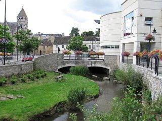
Highworth is a market town and civil parish in the Borough of Swindon, England, about 6 miles (10 km) northeast of Swindon town centre. The 2011 Census recorded a population of 8,151. The town is notable for its Queen Anne and Georgian buildings, dating from its pre-eminence in the 18th century. It also has a 13th-century church, St. Michael's.
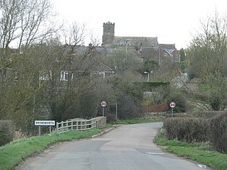
Brinkworth is a village and civil parish in northern Wiltshire, England. The village lies between Royal Wootton Bassett and Malmesbury, about 1 mile (1.6 km) north of the M4 motorway and 9 miles (14 km) west of Swindon.

Gipsy Hill in south London is a hilly neighbourhood spanning the southern parts of the London Boroughs of Lambeth and Southwark characterised for its great views of the City of London and Dulwich.

Bishopsworth is the name of both a council ward of the city of Bristol in the United Kingdom, and a suburb of the city which lies within that ward. Bishopsworth contains many council estates.

Holy Trinity Church, Kingswood, is an Anglican parish church in Kingswood, South Gloucestershire, England. It has been designated as a grade II* listed building.

Joseph Benson was an early English Methodist minister, one of the leaders of the movement during the time of Methodism's founder John Wesley.