Tyrone, New York

Last updated

Tyrone, New York
Nickname: 
USA New York location map.svg
Red pog.svg
Tyrone, New York
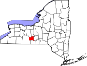
Location within the state of New York
Coordinates: 42°25′N77°4′W / 42.417°N 77.067°W / 42.417; -77.067
Country United States
State New York
County Schuyler
Area
[1]
  Total39.63 sq mi (102.64 km2)
  Land37.30 sq mi (96.60 km2)
  Water2.33 sq mi (6.04 km2)
Elevation
1,690 ft (515 m)
Population
 (2020) [2]
  Total1,650 Increase2.svg
  Estimate 
(2021) [2]
1,635
  Density42.50/sq mi (16.41/km2)
Time zone UTC-5 (Eastern (EST))
  Summer (DST) UTC-4 (EDT)
ZIP code
14887
Area code 607
FIPS code 36-75924
GNIS feature ID0979568
Website http://www.townoftyrone.org/

Tyrone is a town in Schuyler County, New York, United States. The population was 1,650 at the 2020 census. [2]

Contents

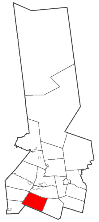
The town of Tyrone is in the northwest part of the county and is east of Bath.

History

The "Lamoka Culture" people lived in the area up to about 1300 BCE. The Lamoka site is a National Historic Landmark.

The town was first settled around 1800. The town was formed from the Town of Wayne while still part of Steuben County in 1822. The town of Tyrone was named by Gen. William Kernan, one of the original settlers and the father of United States Senator Francis Kernan. Tyrone became part of the newly created Schuyler County in 1845. [3]

Geography

According to the United States Census Bureau, the town has a total area of 39.6 square miles (103 km2), of which, 37.5 square miles (97 km2) is land and 2.1 square miles (5.4 km2) (5.36%) is water.

The northern town line (and part of the eastern town boundary) is the border of Yates County, the eastern border running along the old Preemption Line, and the western town line is border of Steuben County.

New York State Route 226 runs northeast to southwest through the town. New York State Route 230 crosses the northwest corner of Tyrone.

Lamoka Lake is mostly within the town at its western town line.

Demographics

Historical population
CensusPop.Note
1830 1,880
1840 2,12212.9%
1850 1,894−10.7%
1860 2,09610.7%
1870 1,993−4.9%
1880 2,0593.3%
1890 1,680−18.4%
1900 1,586−5.6%
1910 1,285−19.0%
1920 1,100−14.4%
1930 1,050−4.5%
1940 1,024−2.5%
1950 1,0765.1%
1960 1,1375.7%
1970 1,25410.3%
1980 1,47917.9%
1990 1,6209.5%
2000 1,7145.8%
2010 1,597−6.8%
2020 1,6503.3%
2021 (est.)1,635 [2] −0.9%
U.S. Decennial Census [4]

As of the census [5] of 2000, there were 1,714 people, 664 households, and 492 families residing in the town. The population density was 45.7 inhabitants per square mile (17.6/km2). There were 1,296 housing units at an average density of 34.6 per square mile (13.4/km2). The racial makeup of the town was 96.32% White, 1.23% African American, 0.35% Native American, 0.06% Asian, 0.41% from other races, and 1.63% from two or more races. Hispanic or Latino of any race were 0.82% of the population.

There were 664 households, out of which 31.0% had children under the age of 18 living with them, 60.8% were married couples living together, 8.6% had a female householder with no husband present, and 25.9% were non-families. 20.5% of all households were made up of individuals, and 10.2% had someone living alone who was 65 years of age or older. The average household size was 2.58 and the average family size was 2.94.

In the town, the population was spread out, with 27.0% under the age of 18, 5.5% from 18 to 24, 24.4% from 25 to 44, 25.8% from 45 to 64, and 17.4% who were 65 years of age or older. The median age was 41 years. For every 100 females, there were 106.0 males. For every 100 females age 18 and over, there were 100.5 males.

The median income for a household in the town was $31,597, and the median income for a family was $34,444. Males had a median income of $30,250 versus $22,404 for females. The per capita income for the town was $14,842. About 10.5% of families and 13.5% of the population were below the poverty line, including 17.7% of those under age 18 and 6.5% of those age 65 or over.

Communities and locations in the Town of Tyrone

Related Research Articles

Catlin is a town in Chemung County, New York, United States. The population was 2,554 at the 2020 census. The town is named after Phineas Catlin, a surveyor and public official. Catlin is in the northwestern corner of the county, northwest of Elmira. It is part of the Elmira Metropolitan Statistical Area.

<span class="mw-page-title-main">Schuyler Falls, New York</span> Town in New York, United States

Schuyler Falls is a town in Clinton County, New York, United States. The population was 5,181 at the 2010 census. The town was named after Peter Schuyler, who bought the mill on the Salmon River from Zephaniah Platt.
<span class="mw-page-title-main">Columbia, New York</span> Town in New York, United States

Columbia is a town in Herkimer County, New York, United States. As of the 2020 census, the town population was 1,569. The town is at the southern border of the county and is southeast of Utica.

<span class="mw-page-title-main">Schuyler, New York</span> Town in Herkimer County, New York, US

Schuyler is a town in Herkimer County, New York, United States. The population was 3,420 at the 2010 census. The town is in the western part of Herkimer County and is east of Utica.

<span class="mw-page-title-main">Trenton, New York</span> Town in New York, United States

Trenton is a town in Oneida County, New York, United States. The population was 4,297 at the 2020 census.

<span class="mw-page-title-main">Exeter, New York</span> Town in New York, United States

Exeter is a town in Otsego County, New York, United States. The town is located in the northern part of the county. The population was 987 at the 2010 census. It is named after the county town and cathedral city of Exeter in England.

Hector is a town in the northeastern corner of Schuyler County, New York, United States. The population was 4,916 at the 2020 census. The town is named after Hector Ely, who at the time was the firstborn son of the town founders. Hector is west of Ithaca.

Orange is a town in Schuyler County, New York, United States. The population was 1,408 at the 2020 census.

Reading is a town in Schuyler County, New York, United States. The population was 1,719 at the 2020 census.

Bradford is a town in Steuben County, New York, United States. The population was 811 at the 2020 census. The town is named after Major Robert Bradford, and is located in the northeastern section of the county, north of Corning.

Pulteney is a town in Steuben County, New York, United States. The population was 1,260 at the 2020 census. The name is derived from the name of the original pioneer tract of land.

Urbana is a town in Steuben County, New York, United States. The population was 2,125 at the 2020 census.

Wayne is a town located in the northeast corner of Steuben County, New York, United States. As of the 2020 census, the town population was 1,006. The town was named after the Revolutionary War general, Anthony Wayne.
<span class="mw-page-title-main">Ontario, New York</span> Town in Wayne County, New York, US

Ontario is a town in the northwest corner of Wayne County, New York, United States. The population was 9,778 at the 2000 census, and 10,136 at the 2010 census. The town is named after the Great Lake on its northern border.

<span class="mw-page-title-main">Barrington, New York</span> Town in New York, United States

Barrington is a town in Yates County, New York, United States. The population was 1,681 at the 2010 census.

<span class="mw-page-title-main">Starkey, New York</span> Town in New York, United States

Starkey is a town in Yates County, New York, United States. The population was 3,573 at the 2010 census. The town is in the southeastern section of the county and is south of Geneva.

<span class="mw-page-title-main">Plattsburgh (town), New York</span> Town in New York, United States

Plattsburgh is a town in Clinton County, New York, United States. The population was 11,886 at the 2020 census. The town is named after Zephaniah Platt, an early land owner, and it surrounds the separate and more populous city of the same name. The town is in the eastern part of the county, in the North Country region of the state of New York. The region's airport, Plattsburgh International Airport, is located in the southern part of the town.

<span class="mw-page-title-main">Herkimer, New York</span> Town in New York, United States

Herkimer is a town in Herkimer County, New York, United States, southeast of Utica. It is named after Nicholas Herkimer. The population was 9,566 at the 2020 census, down from 10,175 in 2010.

<span class="mw-page-title-main">Stillwater, New York</span> Town in New York, United States

Stillwater is a town in Saratoga County, New York, United States, with a population of 8,287 at the 2010 census. The town contains a village called Stillwater. The town is at the eastern border of the county, southeast of Saratoga Springs and borders both Rensselaer and Washington counties. Saratoga National Historical Park is located within the town's limits. There is a hamlet in Minerva, Essex County, New York, with the same name which has nothing to do with this town.

Lansing is a town in Tompkins County, New York, United States. The population was 11,565 at the 2020 census.

References

  1. "2016 U.S. Gazetteer Files". United States Census Bureau. Retrieved July 5, 2017.
  2. 1 2 3 4 Bureau, US Census. "City and Town Population Totals: 2020—2021". Census.gov. US Census Bureau. Retrieved October 6, 2022.
  3. Sexton, John L. (1885). An Outline History of Tioga and Bradford Counties in Pennsylvania, Chemung, Steuben, Tioga, Tompkins and Schuyler in New York by Townships, Villages, boro's and Cities. Elmira, NY: Gazette Company. p.  4. Gazette Company (Elmira, N.Y.).
  4. "Census of Population and Housing". Census.gov. Retrieved June 4, 2015.
  5. "U.S. Census website". United States Census Bureau . Retrieved January 31, 2008.
  6. "National Register of Historic Places". Weekly List of Actions Taken on Properties: 12/08/14 through 12/12/14. National Park Service. December 19, 2014.
  7. "National Register Information System". National Register of Historic Places . National Park Service. March 13, 2009.

42°25′N77°4′W / 42.417°N 77.067°W / 42.417; -77.067