At the time of the line's inauguration in 1986, it ran from Enkheim to the Hauptwache and then continued along the Bockenheimer Landstrasse all the way up to Bockenheim and then continued to their terminus in Hausen for U7, whereas for U6, it then continued to their terminus in Praunheim.
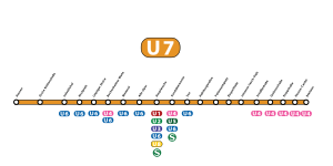
The longer of the two branches of the line is used by the line U7 (formerly U6 until the end of 2018) and is located on the median strip of the usually two-lane Ludwig-Landmann-Straße, which serves as an entry and exit road. The line, on which until 1986 the tram line 22 reversed, was already extended in the 1970s in connection with the construction of the central workshop on the Heerstraße urban railway and road-independent. For the opening of the C route, therefore, hardly any conversion measures were required, only the existing platforms were brought to a uniform length of 90 meters. A further expansion took place only in recent years, the route was thereby equipped with barrier-free elevated platforms and entrances.
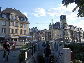
The route begins with a three-track turning plant on the Heerstraße at the height of a substation. It is largely surrounded by agricultural fields on which the business park Praunheim is to be built in the future. From there, the one-kilometer connecting section takes you to the Stadtbahn central workshop in Rödelheim, which is about one kilometer away. There, all VGF rail vehicles are serviced. After this junction, the route crosses the orthogonal Heerstraße and merges into the median strip of Ludwig-Landmann-Straße. There is - now about 100 meters away - the same name Stadtbahnstation Heerstraße. It received a high platform in mid-layer in 2004 and was merged with the formerly very close station Ebelfeld and therefore moved to the south. In order to not extend the transfer routes to the bus line 60, which is actually only operated by the Heerstraße, the bus stop was relocated to Ludwig-Landmann-Straße and a turning point was built immediately before the terminus of the U6. The bus stop is currently still in the provisional state, while the light rail station is equipped according to the latest stop design of the VGF. It opens up the settlement of Praunheim, which was built in the 1920s as part of Ernst May's New Frankfurt Housing Development Program, as well as a small shopping center.
U5 railcar as U6 at the army road
About 500 meters further on is the Stadtbahnstation Friedhof Westhausen, which bears the name of the nearby cemetery. The cemetery Westhausen is one of the largest cemeteries in Frankfurt and also houses a memorial to 4788 Italian military and civilians who died in World War II. The cemetery in turn is named after the 1929-31 built settlement Westhausen, which begins at the station and was also designed by Ernst May. Together with the next station Stephan-Heise-Straße, the settlement of more than a thousand apartments and the Liebig-Gymnasium will be developed. Both stations are very similar developed: They both have high platforms, each with a ground-level access and an underpass, which is combined at the cemetery Westhausen by ramps with the walkway of the Kollwitzstraße, the Ludwig-Landmann-Straße under.
Stadtbahn station Hausener Weg
In the further course of the route, the developed as a city highway A 66 is crossed and thus leave the district Praunheim, on whose boundary incidentally, the settlement Westhausen. Behind the motorway bridge is the station Hausener Weg. It lies at the intersection of the same street with the Ludwig-Landmann-Straße, opens up the adjacent residential areas of Hausen and Rödelheim and offers the possibility to change bus line 34. The bus stop was the first to be rebuilt according to barrier-free guidelines. The former ground-level platforms were replaced by elevated platforms and built traffic-light pedestrian crossings instead of underpasses. In contrast to the previous two stations, the underpass could no longer be connected to the platforms because the new ramps to the pedestrian crossing are located above. However, it remains passable as a connection between both sides of the street. In addition, there are still stairs to the Niddauferweg at the southeast end of the station. The Nidda is crossed directly after the station Hausener Weg.
The following station Fischstein had as last still low platforms. The conversion was completed at the end of May 2011. (→ see below); the station was moved some 100 m into the city.
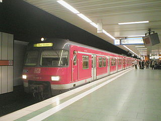
Due to the Stadtbahn central workshop on the Heerstraße, the very varied traffic on this section of various vehicles - from light rail vehicles of all series to low-floor tram vehicles to work cars and old museum vehicles - is commonplace.
The western end of the U6 (formerly U7) runs at ground level on the central strip of the street on high way through the district Hausen. Unlike the route to the army road, it was only inaugurated in 1986, the railway line and received its own railway body and elevated platforms. The former here running tram line 18, however, had some single-track route, but continued to the final stop Praunheim bridge, one kilometre to the north.
The terminus Hausen is located at the beginning of the Praunheimer highway at the Willi Brundert settlement. After a few 100 meters, the motorway A 66 is underpassed. The following stop Große Nelkenstraße opens up the old Hausener town center with the bread factory. This station is the only one to have two side platforms, which are not arranged opposite, but staggered: the train stops in the direction of travel before the junction of the Great Carnation Road.
After 1.2 kilometres, the track meets the U7 (formerly U6) and the street Am Industriehof and joins there together with the other route in the station Industriehof.
Bockenheim and Westend
The two western branch lines from Hausen and Praunheim converge in the Friedrich-Wilhelm-von-Steuben-Straße and reach the station Industriehof. The station is located on the eastern edge of the industrial park Industriehof in the amount of Insterburger Straße. South of the station close tram tracks in the direction of Breitenbachbrücke, which are only used for operating trips. Between these tracks, the subway goes via a ramp into the C-tunnel, the centerpiece of the C-line.
The C-tunnel crosses under the Main-Weser-Bahn and swings to the east in the old center of the district Bockenheim. The following station Kirchplatz is located below the Ginnheimer Landstraße and the adjoining blocks. The namesake of this station is the Protestant Jakobskirche, which is located at the northern end of the small square. In addition to ecclesiastical motifs can be found in the subway station and old pictures of the formerly independent city Bockenheim. Along the route, it is the first subterranean station in the postmodern style of the 1980s. After about 400 meters, the tunnel reaches the relatively narrow Leipziger Straße, where the two tunnel tubes run over each other. Under this Bockenheimer main shopping street is the same metro station, which is decorated with pictures of older subway systems such as Paris or London.
Underground station Westend
After another east swing the subway, again next to each other, reaches the former tower of the Frankfurt Landwehr, the Bockenheimer Warte, and thus the Frankfurt Westend. The subway station Bockenheimer Warte is located below the square of the same name and thus essentially opens up the Campus Bockenheim of the Johann Wolfgang Goethe University Frankfurt am Main. On the walls are photos from the everyday life of the university from the 80s. Via the western exit, the stop of tram line 16, which is located in front of the Bockenheimer Depot, can be reached. The station is since 2001 interchange station to the D-line. At the eastern end of the platform, a common B-level, designed as a rotunda, connects the entrances to both station structures. Immediately after the station is south of the tunnel tube a single-track connection curve to the D-line, which is used only for operating trips. It is the only underground connection between two ground routes in Frankfurt.
The continuation of the route leads below the Bockenheimer Landstraße and gets to the subway station Westend. The station of the architectural office A.C. Walter and Partner is characterized by floral elements and thus indicates the proximity to the palm garden. The area surrounding the station, the eponymous district Westend-Süd, but is also known for many office towers, such as the neighboring WestendDuo. At the end of the 1.3km long Bockenheimer Landstraße, the route leaves the Westend.\
The Central section
Following this, the line reaches the Opernplatz in front of the Alte Oper, under which the A.C. Walter designed subway station Alte Oper is located. The station was built as the first Frankfurt tunnel station completely free of columns and attacks with its arched structures the neo-Renaissance architecture of the famous opera house. Immediately behind the station, the C-Tunnel merges with the S-Bahn City Tunnel, opened in 1978. Both routes now follow together the course of the known as Freßgass Great Bockenheimer road to the main train junction.
The Hauptwache station is a four-track railway station with the S-Bahn. The subway uses the two outer tracks, which are accessible via two side platforms. Across them is the station of the A-line, which can be changed here. The four-track tunnel under the Zeil joins the upper station. The Hauptwache is considered the central square of the city, many important main roads of the city start here.
The station Konstablerwache is also a four-track community station. However, here are two middle platforms arranged so that each can be changed at the same platform between subway and subway. At the Konstablerwache you can also change to the lines of the B-line and to the tram.
After the extension of the S-Bahn line to the south and a small "track apron" with siding, the three-track underground station Zoo in Ostend is reached. It is located under the Alfred-Brehm-Platz in front of the Gesellschaftshaus of the Frankfurt Zoo. In the immediate vicinity are also the Heinrich von Gagern Gymnasium and two hospitals. The platform hall, designed with numerous animal motifs, also extends over the B-level above. The northern one of the two platforms is a central platform on which each metro line runs in the city on its own track. Meanwhile, the southern platform is shared with just one track from all trains out of town.
Zoo - Ostbahnhof
While the western track branches have been used since the opening, the underground station Zoo was a common terminus of both lines for several years. Now the route branches here on the two eastern branch lines. The route to Ostbahnhof is at only about 750 meters, the shortest leg of the Frankfurt subway network. The two tunnels connect to the two outer tracks of Zoo subway station. The northern track coming from Ostbahnhof crosses the tunnel of the connecting line to Enkheim. Thus, a plan-free threading of the U6 trains on the trunk line is possible.
The route initially runs under the zoo grounds and then traverses a few bends in a right-hand bend and the Danziger Platz. He is the forecourt of the Ostbahnhof. At the southeastern end is the reception building and below it the subway station Ostbahnhof. Opened in 1999, this section is the latest addition to the C route and offers links to regional transport. The Ostbahnhof has no S-Bahn connection, but could be greatly upgraded by the planned Nordmainische S-Bahn and the new building of the European Central Bank on the grounds of the neighboring Grossmarkthalle in the future.
The outer walls of the underground station are decorated with large black and white photographs of the Main river and its bridges from the 19th to the 21st century. Decorated in the 19th century. The central platform has direct daylight through the glass roof of the central access building on Danziger Platz in front of the station building. The station was only accessible from there for eight years. In order to allow access from Hanauer Landstraße, located south of the Ostbahnhof, another entrance was built and the platform of the underground station extended. In addition, the tram line 11 received there an additional stop to allow a better transfer.
Zoo - Enkheim
After crossing the zoo, the subway line leads to the Rhönstraße and runs along their course of the road. From the intersection Waldschmidtstraße to the Frankfurter Alleenring, there is the subway station Habsburgerallee, which is named after this southeastern section of the Ringstraße. Like the following two stations, this one is very simple compared to the train stations in Bockenheim and the Westend. Dominant design elements are the octagonal pillars, according to which ceiling lights and floor coverings are directed. The color of the pillar and the motifs on the outer walls are the most striking differentiator in the three stations of the Ostend line. In the station Habsburgerallee the columns are green and on the wall there is a mosaic with donkeys by the artist Manfred Stumpf. The following underground station, Parliament Square, is located at the end of the Rhönstraße below a densely built-up square. Nearby is the Ostpark. The columns of the station are yellow and the wall motifs show black-and-white images of people communicating.
The last tunnel station of the Ostend line is the subway station Eissporthalle, which lies below the settlement Bornheimer slope planned by Ernst May and belongs already to the borough Bornheim. The settlement and the underground station are on the edge of the nearly 20-meter-high elevation of the same name. One entrance is on the Ratsweg, another leads directly from the slope to the fairground in front of the Eissporthalle Frankfurt. The station architecture in this case has blue columns and wintry photographs on wine-red walls.
The C-Tunnel ends between the ice rink and the stadium on Bornheimer Hang, and the tracks lead through a portal out of the Bornheimer Hang.
The section of the route passes through the Bergen area, and ends at Enkheim. The metro station at Habsburgerallee, which is named after this southeastern section of the Ringstraße, stretches to the Frankfurter Alleenring. Like the following two stations, this one is very simple compared to the train stations in Bockenheim and the Westend. Dominant design elements are the octagonal pillars, according to which ceiling lights and floor coverings are directed. The color of the pillar and the motifs on the exterior walls are the most striking distinguishing feature in the three stations of the Ostend Line. In the station Habsburgerallee the columns are green and on the wall there is a mosaic with donkeys by the artist Manfred Stumpf. The following underground station, Parliament Square, is located at the end of the Rhönstraße below a densely built-up square. Nearby is the Ostpark. The columns of the station are yellow and the wall motifs show black-and-white images of people communicating.
The eastern section of the U7 between Johanna-Tesch-Platz and Enkheim was converted from a former tram route in 1992. The lines 18 (Inheidener Str [today Ernst-May Square] - Zoo - Hanauer Highway - Eissporthalle - Enkheim) and 23 (Bornheim - Ratsweg - Eissporthalle - Enkheim) and on a stretch of which also the line 20 (Bornheim - Ratsweg - Eissporthalle - Bergen [until 1986], then line 12). For the subway stations were built with elevated platforms, enlarged curve radii and reduced crossings and equipped with traffic lights.
The route runs - immediately after leaving the tunnel (at the stadium on the Bornheimer slope) - north along the road Am Erlenbruch. At the junction of the Borsigallee, the track turns left to the north and continues on the median strip of this road. At the Seckbacher Station Gwinnerstraße branched off until 1992, the tram line 20 (last 12) to Bergen, which was shut down with the start of operation of the subway. The Seckbacher station Kruppstraße is located about 100 meters before the end of the eastern section of the A 66, which is of great importance for commuters from the eastern hinterland. For this reason, here is the large Seckbacher park-and-ride parking garage, which will encourage motorists to change to the subway. Until March 30, 1957 was still here at the former city limits (to the district of Hanau) the terminus Lahmeyerstraße tram 18, which was then extended on 31 March, until about today's terminus in Enkheim. The following station connects the shopping center Hessen-Center and opposite markets. The terminus Enkheim has been extensively redesigned, thus located between the two outer platforms a two-lane one-way bus lane with breakpoints for the change in or from further bus lines.
Gallery
Eissporthalle Station
Habsburgerallee station
U7 station Parlamentsplatz
U6 terminus Ostbahnhof
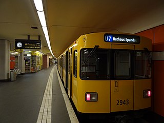
Inaugural train of the Linie U7 to Enkheim onMay30,1992
Future Plans
Currently there are plans to extend the branch of the U6 from the Ostbahnhof along the Hanauer Landstraße to the Ratswegkreisel. Subsequently, the district of Fechenheim is to be reached on the current tram line in central position of the Hanauer highway. The planning is in some competition with the construction of the North-Main S-Bahn line to Hanau, because instead of the S-Bahn also an extension of the U6 to Hanau is possible. Since the city has decided in favor of the North-Main S-Bahn line, the construction is unlikely.
A short extension of the urban railway line in the district of Bergen-Enkheim along the street lamp to the mountain pool Bergen is currently not pursued. The reasons are the immediately adjacent nature reserve and the unclear development of the building area lamp.
At the western end of the U6, plans were made in the 1980s to extend the route to Steinbach or even further to Kronberg-Oberhöchstadt. To Steinbach this could be used for an originally planned city highway kept track including underpass under the A 5, a former gas station of the American Army on the highway could be converted into a park-and-ride place. The project was included in the General Transportation Plan in 2005, but there is no concrete timetable for the construction.
After the decision of the Roman coalition of 9 June 2017 to build a new district along the A5 motorway between Praunheim and Niederursel and Steinbach in the west, the extension of the U6 underground line over the current terminal Heerstraße out in the direction of Steinbach again discussed.
Also since 2005, a reactivation of the former tram line to Bergen in the general traffic plan is provided, which is to be supplemented by a short tunnel in the old town of Berger.
In early 2013, the Frankfurt Department of Transportation had a possible extension of the subway line 6 to Eschborn check. The Frankfurt Department of Transportation commissioned a correspondingly concrete study of the project, which concerned the extension of subway line 6, which currently ends at Heerstraße in Praunheim. A stop in the industrial park Helfmann-Park was considered possible. According to the mayor of Eschborn, this would "further enhance the Eschborn location". The Greens in the high Taunuskreis also advocated for an expansion of the U6 beyond Eschborn with stops in Steinbach and Kronberg, since the city of Oberursel in the high Taunuskreis long ago via the subway line 3 was connected to the Frankfurt subway network is. In March 2014, however, the city council of Frankfurt decided against the further expansion of the U6 in the Taunus, as the estimated costs of around 30 million euros were considered not "portable".
Many commuters who work on weekdays mainly from the direction of Frankfurt in the offices of the business park at Helfmann Park in Eschborn resident companies, now remains only the hope of the Regional Tangent West. The planning of the Regional Tangent West provides for a total of three new stops for the industrial estate in the southeast of Eschborn.
Related Research Articles
U6 is a 19.9 km (12.4 mi) long rapid transit line on the Berlin U-Bahn with 29 stations. It runs in a north-south direction from the Berlin locality of Tegel in the north via Friedrichstraße to Mariendorf, a locality in the southern part of the city. It is one of the five large profile ("Großprofil") lines.
The U7 is a rail line on the Berlin U-Bahn. It runs completely underground for a length of 31.8 kilometres (19.8 mi) through 40 stations and connects Spandau, via Neukölln, to Gropiusstadt and Rudow. The U7 was originally the south-eastern branch of the Nord-Süd-Bahn (U6) that ran between the branching point at Belle-Alliance-Straße (Mehringdamm) and Grenzallee; however, in the 1960s, this stretch was separated from the rest of the line and extended at each end to form a new line.
U9 is a line on the Berlin U-Bahn. The line was opened on 28 August 1961 as Line G.
The public transit system in Frankfurt is part of the Rhein-Main-Verkehrsverbund transport network and consists of several carriers who all use the same fare system. Therefore, one ticket is valid for a journey which may include several modes of transit run by different operators. The fares are paid in advance of travel at a ticket vending machine or at the driver on board a bus. There are no turnstiles or other controlling barriers; instead, a proof-of-payment system is used. Plainclothes fare inspectors are employed and carry out random checks to ensure passengers have paid. If found to be travelling without a ticket, then they are required to pay a fine of €60. A single way trip within Frankfurt costs between €1.80 and €2.80, and a journey to the suburbs outside Frankfurt costs between €4.65 and €9.10 approx. There are also some discounts for children for groups or day tickets. A day ticket for traveling within Frankfurt costs €7.
The Munich U-Bahn is an electric rail rapid transit network in Munich, Germany. The system began operation in 1971, and is operated by the municipally owned Münchner Verkehrsgesellschaft. The network is integrated into the Münchner Verkehrs- und Tarifverbund and interconnected with the Munich S-Bahn. The U-Bahn currently comprises eight lines, serving 96 stations, and encompassing 103.1 kilometres (64.1 mi) of routes.
Westend-Nord and Westend-Süd are two city districts of Frankfurt am Main, Germany. The division into a northern and a southern part is mostly for administrative purposes as the Westend is generally considered an entity. Both city districts are part of the Ortsbezirk Innenstadt II.
Dornbusch is a quarter of Frankfurt am Main in Hesse, Germany. It is located north of the city center and north of the River Main, and is part of the Ortsbezirk Mitte-Nord. Dornbusch is surrounded by Eckenheim, Nordend-West, Westend-Nord, Bockenheim, Ginnheim and Eschersheim.
The Frankfurt U-Bahn is a Stadtbahn system serving Frankfurt, Hesse, Germany. Together with the Rhine-Main S-Bahn and the Frankfurt Straßenbahn, it forms the backbone of the public transport system in Frankfurt. Its name derives from the German term for underground, Untergrundbahn. Since 1996, the U-Bahn has been owned and operated by Stadtwerke Verkehrsgesellschaft Frankfurt am Main (VGF), the public transport company of Frankfurt, and is part of the Rhein-Main-Verkehrsverbund (RMV) transport association. The licence contract is up to 31 December 2031 and is renewable. The contracting authority of VGF is the municipal transport company traffiQ.
The Stuttgart Stadtbahn is a light rail system in Stuttgart, Germany. The Stadtbahn began service on 28 September 1985. It is operated by the Stuttgarter Straßenbahnen AG (SSB), which also operates the bus systems in that city. The Stuttgart Stadtbahn is successor system of a tram network (Straßenbahnen) that characterized the urban traffic in Stuttgart for decades.
The U-Bahn Line B is the second line in the network of the Frankfurt U-Bahn. It leads in west–east direction from the central railway station (Hauptbahnhof) over the old town to Konstablerwache, where it splits into two branches to Bornheim and Preungesheim. Originally planned as an independent main line, the D line represents an extension of the U4 to Bockenheimer Warte from the central railway station.
Bankenviertel is the name of the central business district in Frankfurt, Germany where many banks, insurance companies, and other financial institutions are located. It is the most important German financial hub, if not one of the largest in Europe along with La Défense in the Paris aire urbaine and London's City and Canary Wharf.
The Frankfurt am Main tramway network is a network of tramways forming a major part of the public transport system in Frankfurt am Main, a city in the federal state of Hesse, Germany.
The Frankfurt City Tunnel is a standard gauge railway in Frankfurt and the core of the Rhine-Main S-Bahn. The line runs underground for its entire length.
Frankfurt am Main Konstablerwache station is a major train station and metro station at the Konstablerwache square in the city centre of Frankfurt am Main, Germany.
Frankfurt (Main) West station is a railway station for regional and S-Bahn services in Frankfurt, Germany, on the Main-Weser Railway, in the district of Bockenheim, near the Frankfurt Trade Fair grounds and the Bockenheim campus of the Goethe University Frankfurt.
Frankfurt-Rödelheim station is a regional and S-Bahn station in western Frankfurt am Main, Germany on the Homburg line, in the district of Rödelheim. The Kronberg line branches off the Homburg line north of the station. The junction with the Rebstock curve of the former Bad Nauheim–Wiesbaden line (Bäderbahn) is south of the station. The station connects with several bus lines.
Frankfurt (Main) East station serves regional rail services in the Ostend district of Frankfurt, Germany. Its container terminal is one of the two remaining freight yards in the city, after the much larger Frankfurt central freight yard (Hauptgüterbahnhof) was closed. The freight yard of Frankfurt's eastern river port also lies to the east.
The A line is the north-to-south main line of the Frankfurt U-Bahn. It is the oldest and longest line of the U-Bahn system. Served by four routes starting at Südbahnhof Railway Station in Sachsenhausen, the A line runs through downtown Frankfurt up to Heddernheim Station in the north of the city, where it branches out to Ginnheim, Oberursel (U3), Riedberg and Bad Homburg (U2). The U9 service between Ginnheim, Riedberg and Nieder-Eschbach does not use the central section and tunnels of the line, making it the only light rail service of the network that does not serve downtown Frankfurt. The Riedberg and Ginnheim branches were planned as parts of the future D line subway but are operationally part of the A line until the D line development and construction is finished.
U-Bahn Line D is a partially completed north‒south route of the Frankfurt U-Bahn underground rail network, planned since the 1960s. As of 2021 three sections had been constructed and were in use for U-Bahn services, plus a long section operated with trams. As the route is not continuous there are no through services, but instead underground services U1, U4, U8, U9 and tram lines 12, 15, 21 all partially serve some of the stops on the route then transfer to other routes. The planned Ginnheim Curve extension would run via the University's Campus Westend to fill the missing gap.
The Stammstrecke 2 of the Munich U-Bahn is one of three main routes in the subway network of the Bavarian capital Munich. It runs from north to south, as well as east, and is currently operated by the underground U1 and U2 lines. Since 12 December 2011, the U7 line runs during high traffic times and since 15 December 2013 the U8 line assists on Saturdays. The U1 and U2 lines only run together on one route, in the central inner city area, before and after that, they are branched away from each other. The main line 2 has a total length of 33.8 kilometers and 38 underground stations. It runs exclusively in the city of Munich and completely in the tunnel.
References
↑ C trunk line mileage is referenced from km 10.00, at the intersection of the C and A tunnels at Hauptwache station.
↑ In the C1 tunnel towards Enkheim, the distances are calculated differently due to the cross-platform interchange system, each starting at the corresponding branch off the main line: Track 1 towards Enkheim begins at the junction between Zoo and Frankfurt Ost stations. Track 2 from Enkheim is measured from the junction between Zoo and Konstablerwache stations.
↑ City Surveying Office Frankfurt am Main (Ed.): DVD Official city maps Frankfurt am Main 2009. City Surveying Office Frankfurt am Main, Frankfurt am Main 2009.
This page is based on this Wikipedia article Text is available under the CC BY-SA 4.0 license; additional terms may apply. Images, videos and audio are available under their respective licenses.