Related Research Articles

Cimarron County is the westernmost county in the U.S. state of Oklahoma. Its county seat is Boise City. As of the 2020 census, its population was 2,296, making it the least-populous county in Oklahoma; and indeed, throughout most of its history, it has had both the smallest population and the lowest population density of any county in Oklahoma. Located in the Oklahoma Panhandle, Cimarron County contains the only community in the state (Kenton) that observes the Mountain Time Zone. Black Mesa, the highest point in the state, is in the northwest corner of the county. The Cimarron County community of Regnier has the distinction of being the driest spot in Oklahoma ranked by lowest annual average precipitation, at just 15.62 inches; at the same time, Boise City is the snowiest location in Oklahoma ranked by highest annual average snowfall, at 31.6 inches.
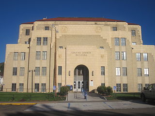
Colfax County is a county in the U.S. state of New Mexico. As of the 2020 census, the population was 12,387. Its county seat is Raton. It is south from the Colorado state line. This county was named for Schuyler Colfax (1823–1885), seventeenth Vice President of the United States under U.S. President Ulysses S. Grant.

Scouting in Oklahoma has a long history, from the 1910s to the present day, serving thousands of youth in programs that suit the environment in which they live.

Cimarron is a village in Colfax County, New Mexico, United States, which sits on the eastern slopes of the Sangre de Cristo Mountains. The population was 792 at the 2020 census, making it the fourth most populous municipality in Colfax County.

Boise City is a city in and the county seat of Cimarron County, in the Panhandle of Oklahoma, United States. The population was 1,166 at the 2020 census, a decline of 7.9 percent from 1,266 in 2010.

Philmont Scout Ranch is a ranch located in Colfax County, New Mexico, United States, near the village of Cimarron; it covers 140,177 acres (56,728 ha) of wilderness in the Sangre de Cristo Mountains on the east side of the Cimarron Range of the Rocky Mountains. Donated by oil baron Waite Phillips, the ranch is owned and operated by the Boy Scouts of America. It is a National High Adventure Base where crews of Scouts and Venturers take part in backpacking treks and other outdoor activities. By land area, it is one of the largest youth camps in the world. During the 2019 season, between June 8 and August 22, an estimated 24,000 Scouts and adult leaders backpacked through the Ranch's extensive backcountry. That same year 1,302 staff were responsible for the Ranch's summer operations.
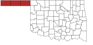
The Oklahoma Panhandle is a salient in the extreme northwestern region of the U.S. state of Oklahoma, consisting of Cimarron County, Texas County and Beaver County, from west to east. As with other salients in the United States, its name comes from the similarity of its shape to the handle of a pan. Its largest city is Guymon in Texas County. Black Mesa State Park, located in Cimarron County, is the highest point in the state. Other points of interest include Beaver Dunes Park, Optima Lake, and the Optima National Wildlife Refuge. Oklahoma Panhandle State University is ten miles away from Guymon.

Waite Phillips was an American petroleum businessman who created a fully integrated operation that combined petroleum producing, refining and marketing. With headquarters in Tulsa, Oklahoma, he also developed several office complexes and engaged in banking and ranching. Phillips was a philanthropist for both local Tulsa institutions and national causes. In Tulsa he built a 72-room mansion for his residence, which he later donated to the city; it became the Philbrook Museum of Art. He gave 127,000 acres (510 km2) of his favorite ranch in New Mexico to the Boy Scouts of America, together with an office building as part of its endowment. The ranch is now Philmont Scout Ranch, one of the largest youth camps in the world. Phillips also made a substantial bequest to the University of Southern California, which named a building after him.

The Villa Philmonte is a large ranch home located outside of Cimarron, New Mexico, on Philmont Scout Ranch, owned by the Boy Scouts of America. It was listed on the National Register of Historic Places in 1995 as part of Villa Philmonte Historic District, which included two contributing buildings, two contributing structures, and two contributing sites. Those resources are the Villa Philmonte, an associated guesthouse, two courtyards, and a pool, pergola and pond.

Urraca Mesa is a large mesa located in Colfax County in northern New Mexico, U.S., on the property of Philmont Scout Ranch. It reaches an elevation of 8,594 feet (2,619 m).

Buffalo Bill Ranch State Historical Park, known as Scout's Rest Ranch, is a living history state park located west of North Platte, Nebraska. The ranch was established in 1878 with an initial purchase of 160 acres south of the Union Pacific tracks by William Cody. The 4,000 acre ranch was sold in 1911 and has been under the management of the Nebraska Game and Parks Commission since 1964. The 25 acre historic state park, added to the National Register of Historic Places in 1978 and designated a National Historic Landmark in 2021, is open weekdays from April to October. The house and outbuildings can be toured, including a museum documenting Cody's life from a Pony Express rider to his Wild West shows.

The St. James Hotel, located in historic downtown Cimarron, New Mexico, is a historic hotel, restaurant and bar. Today, guests can stay at the historic hotel, in either the historic section or in a modern addition. The hotel is in the National Register of Historic Places and is part of the Cimarron Historic District.

Lucien Bonaparte Maxwell was a mountain man, rancher, scout, and farmer who at one point owned more than 1,700,000 acres (6,900 km2). Along with Thomas Catron and Ted Turner, Maxwell was one of the largest private landowners in United States history. In 1959, he was inducted into the Hall of Great Westerners of the National Cowboy & Western Heritage Museum.
The Maxwell Land Grant, also known as the Beaubien-Miranda Land Grant, was a 1,714,765-acre (6,939.41 km2) Mexican land grant in Colfax County, New Mexico, and part of adjoining Las Animas County, Colorado. This 1841 land grant was one of the largest contiguous private landholdings in the history of the United States. The New Mexico communities of Cimarron, Dawson, Elizabethtown, Baldy Town, Maxwell, Miami, Raton, Rayado, Springer, Ute Park and Vermejo Park came to be located within the grant, as well as numerous places that are now ghost towns.

Rayado was the first permanent settlement in Colfax County, New Mexico, United States and an important stop on the Santa Fe Trail. The name Rayado derives from the Spanish term for "streaked", perhaps in reference to the lot lines marked out by Lucien Maxwell.
Rancho Cienega del Gabilán was a 48,781-acre (197.41 km2) Mexican land grant in present-day Monterey County and San Benito County, California.

The Casa del Gavilan is a historic bed and breakfast located six miles south of Cimarron, New Mexico. The property is at the base of Urraca Mesa and is surrounded by the property of Philmont Scout Ranch. The bed and breakfast has six guest rooms. The Casa del Gavilan is also referred to as The Nairn Place due to its original owners.
Philmont Scout Ranch is located in the Sangre de Cristo Mountains of the Rocky Mountains of New Mexico. Philmont is about 12 miles (19 km) across at its widest point, and about 30 miles (48 km) long. The southern part of the ranch is mostly grasslands/prairie, while the north is rocky and rugged, but a small part of the eastern area is prairie.
Chase Ranch Cimarron, New Mexico was founded in 1867 by Manly and Theresa Chase. As pioneers, from Wisconsin by way of Colorado, they crossed the Raton Pass in a covered wagon and establish a new home in New Mexico. Manly Chase purchased the land from Lucien Maxwell, part of the Maxwell Land Grant. The ranch is near the Ponil Creek, a mile north of the Cimarron River, not far from the Santa Fe Trail. The Ranch included the old Kit Carson homestead. Before the arrival of pioneers, the land was populated by Apaches and Ute people. Manly provided the local Native Americans with beef, creating peaceful coexistence.

The Ute Park Fire was a wildfire one mile east of Ute Park, New Mexico in the United States. The fire started on May 31, 2018. The cause remains under investigation. The fire burned a total of 36,740 acres (149 km2) and was contained on June 19, 2018. It threatened the communities of Cimarron and Ute Park, with mandatory evacuations in place from June 1 2, respectively, until June 8th: when both were lifted. The fire destroyed 14 buildings and threatened over 750 structures.
References
- ↑ "The EXG Story". Express Ranches. Archived from the original on 5 May 2018. Retrieved 8 June 2022.
- ↑ "Robert A. Funk - Founder and Chairman". Express Employment Professionals. Archived from the original on 24 December 2010. Retrieved 8 June 2022.
- ↑ http://www.allbusiness.com/legal/legal-services-litigation/14714888-1.html [ dead link ]
- ↑ David E. Emery (1998). "History of Jack and Gertrude Nairn and the Casa del Gavilan Cimarron, New Mexico". Casa del Gavilan Historic Inn. Archived from the original on 7 December 2010. Retrieved 14 December 2010.
- ↑ "New Mexico SRM Summer Field Tour" (PDF). Society for Range Management. Archived from the original (PDF) on 28 September 2010. Retrieved 14 December 2010.
- ↑ "Amarillo News". KVII. 5 May 2018. Archived from the original on 5 May 2018. Retrieved 5 May 2018.