
Stark County is a county located in the northeastern part of U.S. state of Ohio. As of the 2020 census, the population was 374,853. Its county seat is Canton. The county was created in 1808 and organized the next year. It is named for John Stark, an officer in the American Revolutionary War.

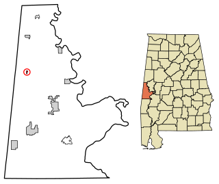
Uniontown is a city in Perry County, Alabama, in west-central Alabama. As of the 2020 census, the population of the city is 2,107, up 18.7% over 2010. Of the 573 cities in Alabama, Uniontown is the 207th most populous.
Emelle is a town in Sumter County, Alabama, United States. It was named after the daughters of the man who donated the land for the town. The town was started in the 19th century but not incorporated until 1981. The daughters of the man who donated were named Emma Dial and Ella Dial, so he combined the two names to create Emelle. Emelle was famous for its great cotton. The first mayor of Emelle was James Dailey. He served two terms. The current mayor is Roy Willingham Sr. The population was 32 at the 2020 census.
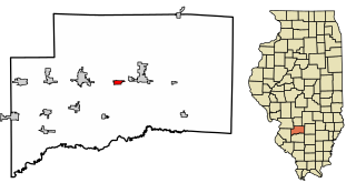
Beckemeyer is a village in Wade Township, Clinton County, Illinois, United States. The population was 923 as of the 2020 census.

Oshtemo Charter Township is a charter township of Kalamazoo County in the U.S. state of Michigan. The 2020 census recorded a population of 23,747, up from 21,705 at the 2010 census. The township was organized in 1839.

Fort Shawnee is census-designated place (CDP) in Allen County, Ohio, United States. The population was 6,263 at the 2020 census. It is included in the Lima, Ohio Metropolitan Statistical Area. Fort Shawnee is adjacent to the city of Lima and the village of Cridersville in Auglaize County. In 2012, village residents voted to disincorporate the village. According to the United States Census Bureau, the village had a total area of 7.25 square miles (18.78 km2), of which 7.21 square miles (18.67 km2) is land and 0.04 square miles (0.10 km2) is water.

Mack North was a census-designated place (CDP) in Hamilton County, Ohio, United States. The population was 3,529 at the 2000 census. For the 2010 census, it became part of the Mack CDP.
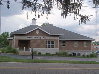
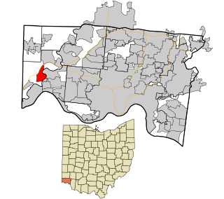
Greentown is a census-designated place in northern Stark County, Ohio, United States. The population was 3,382 at the 2020 census. It is part of the Canton–Massillon metropolitan area.

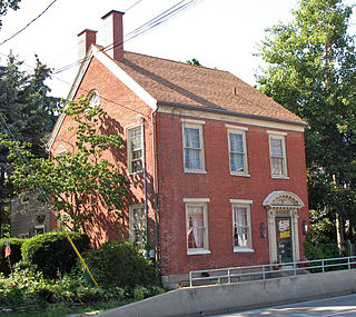
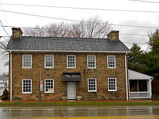
Hartville is a village in northern Stark County, Ohio, United States. The population was 3,329 at the 2020 census. It is part of the Canton–Massillon metropolitan area. Hartville lies halfway between Akron and Canton at the intersection of State Routes 43 and 619.

Limaville is a census-designated place (CDP) and former village in Stark County, Ohio, United States. The population was 151 at the 2020 census. It is part of the Canton–Massillon Metropolitan Statistical Area.

Meyers Lake is a village in central Stark County, Ohio, United States. The population was 724 at the 2020 census. It is part of the Canton–Massillon metropolitan area.
Perry Heights is a census-designated place in Stark County, Ohio, United States. The population was 8,391 at the 2020 census. It is part of the Canton–Massillon metropolitan area.

Union Township is a township in Adams County, Pennsylvania, United States. The population was 3,148 at the 2010 census.

East Uniontown is a census-designated place (CDP) in Fayette County, Pennsylvania, United States. The population was 2,419 at the 2010 census, down from 2,760 at the 2000 census.
Hopwood is a census-designated place (CDP) in Fayette County, Pennsylvania, United States. The population was 2,090 at the 2010 census, up from 2,006 at the 2000 census. It is located in North Union and South Union townships. The village was named after John Hopwood.
Walterhill, also known as Walter Hill, is a census-designated place (CDP) in Rutherford County, Tennessee. The population was 401 at the 2010 census.

Erlands Point-Kitsap Lake is an unincorporated area and former census-designated place (CDP) in Kitsap County, Washington, United States. The population was 2,935 at the 2010 census. For the 2020 census, the area was split into two CDPs, Erlands Point and Kitsap Lake.

Evansville is a town in Natrona County, Wyoming, United States. It is part of the Casper, Wyoming Metropolitan Statistical Area. The population was 2,746 at the 2020 census.
Hooven is a census-designated place (CDP) in southeastern Whitewater Township, Hamilton County, Ohio, United States. The population was 464 at the 2020 census.

Casmalia is a census-designated place (CDP) in Santa Barbara County, California located just outside the borders of Vandenberg Air Force Base about 5 miles (8.0 km) southwest of Santa Maria. The ZIP Code is 93429, and the community is inside area code 805. The population was 138 at the 2010 census.


