
Richmond is a coastal city in the Lower Mainland region of British Columbia, Canada. It occupies almost the entirety of Lulu Island, between the two estuarine distributaries of the Fraser River. Encompassing the adjacent Sea Island and several other smaller islands and uninhabited islets to its north and south, it neighbours Vancouver and Burnaby on the Burrard Peninsula to the north, New Westminster and Annacis Island to the east, Delta to the south, and the Strait of Georgia to the west.

The University of British Columbia (UBC) is a public research university with campuses near Vancouver and in Kelowna, British Columbia. Established in 1908, it is British Columbia's oldest university. The university ranks among the top three universities in Canada. With an annual research budget of $759 million, UBC funds over 8,000 projects a year.

The Museum of Anthropology at the University of British Columbia (UBC) campus in Vancouver, British Columbia, Canada is renowned for its displays of world arts and cultures, in particular works by First Nations of the Pacific Northwest. As well as being a major tourist destination, MOA is a research and teaching museum, where UBC courses in art, anthropology, archaeology, conservation, and museum studies are given. MOA houses close to 50,000 ethnographic objects, as well as 535,000 archaeological objects in its building alone.

Kitsilano is a neighbourhood located in the city of Vancouver, British Columbia, Canada. Kitsilano is named after Squamish chief August Jack Khatsahlano, and the neighbourhood is located in Vancouver's West Side along the south shore of English Bay, between the neighbourhoods of West Point Grey and Fairview. The area is mostly residential with two main commercial areas, West 4th Avenue and West Broadway, known for their retail stores, restaurants and organic food markets.
Langara College is a public degree-granting college in Vancouver, British Columbia, Canada, which serves approximately 22,000 students annually through its university, career, and continuing studies programs. The college takes its name from the neighbourhood in which it is situated, which was named after Spanish Admiral Juan de Lángara.

The Musqueam Indian Band is a First Nations band government in the Canadian province of British Columbia. It is the only First Nations band whose reserve community lies within the boundaries of the City of Vancouver.

Marpole, originally a Musqueam village named c̓əsnaʔəm, is a mostly residential neighbourhood of 23,832 in 2011, located on the southern edge of the city of Vancouver, British Columbia, immediately northeast of Vancouver International Airport, and is approximately bordered by Angus Drive to the west, 57th Avenue to the north, Ontario Street to the east and the Fraser River to the south. It has undergone many changes in the 20th century, with the influx of traffic and development associated with the construction of the Oak Street Bridge and the Arthur Laing Bridge.
The Vancouver School of Theology is a ecumenical divinity school located on the campus of and formally affiliated with the University of British Columbia. VST is called to educate and form thoughtful, engaged and generous Christian leaders.
West Point Grey is a neighbourhood in the northwest of the city of Vancouver, British Columbia, Canada. It is located on Point Grey and is bordered by 16th Avenue to the south, Alma Street to the east, English Bay to the north, and Blanca Street to the west. Notable beaches within the West Point Grey boundary include Spanish Banks, Locarno and Jericho. Immediately to the south is Pacific Spirit Regional Park and to the east is Kitsilano.

Dunbar–Southlands is a neighbourhood on the western side of Vancouver, British Columbia, Canada, that stretches north from the Fraser River and covers most of the land between the mouth of the Fraser and English Bay.
X̱wáýx̱way or x̌ʷay̓x̌ʷəy̓ , rendered in English as Xway xway and Whoiwhoi, is a First Nations village site, located in what is now Stanley Park in Vancouver, British Columbia, Canada. The village was located on the eastern peninsula of the park, near what is now Lumberman's Arch. The village was home for many Squamish, Musqueam and Tsleil-waututh people, but after European colonization began in the Vancouver area, the inhabitants were forced to re-locate to nearby villages. The village was named for a mask ceremony; thus, the best translation of x̱wáýx̱way would be "masked dance performance".

The UBC Farm is a 24-hectare farm, and forest system, on the southern end of the University of British Columbia (UBC) campus in Vancouver, British Columbia, Canada. The farm is operated by the Centre for Sustainable Food Systems, which is part of the Faculty of Land and Food Systems, and has existed in its current form since 2000. It hosts a variety of crops and fruits, as well as some animals and composting facilities. Several academic programs allow the students to use the farm for research and teaching.
Shaughnessy Golf & Country Club is a private golf club in Canada, located on Southwest Marine Drive in Vancouver, British Columbia.
David Ho Ting-kwok is a Vancouver based entrepreneur originally from Hong Kong. He founded the now defunct Harmony Airways, and owns the University Golf Club. He has a minority interest in MCL Motors since selling it to Dilawri Automotive Group in 2010. In 2005 he was named the Businessman of the Year by the Vancouver Junior Board of Trade. Ho is a former member of the Vancouver Police Board.
The University Endowment Lands (UEL) is an unincorporated area that lies to the west of the city of Vancouver, British Columbia, Canada, and adjacent to the University of British Columbia (UBC) and the lands associated with that campus. Pacific Spirit Regional Park lies within the UEL. The UEL is part of Metro Vancouver. Mail sent to the UEL is addressed to "Vancouver" rather than the UEL.

The Great Marpole Midden, is an ancient Musqueam village and burial site located in the Marpole neighbourhood of Vancouver, British Columbia.
The University of British Columbia Graduate School of Journalism offers a two-year Masters of Journalism program offered at the University of British Columbia's Point Grey campus in Vancouver, British Columbia. The program requires students to focus on an area of reporting specialization. The school has also developed a reputation in teaching multimedia journalism and was one of the first programs in North America to replace craft streams with an integrated journalism curriculum. The program has 60 students a year, with close to 20 faculty members, adjuncts and staff. Faculty members come from a variety of traditional and new media organizations including CBC, BBC News Online, CBS News 60 Minutes, The Globe and Mail, The Vancouver Sun, and The Tyee.
Debra Sparrow, or θəliχʷəlʷət (Thelliawhatlwit), is a Musqueam weaver, artist and knowledge keeper. She is self-taught in Salish design, weaving, and jewellery making.
The First Nations Endangered and Endangered Languages Program was initiated in 1996 as part of University of British Columbia’s ongoing commitment to community-based collaboration with First Nations peoples, in recognition of the profound importance of First Nations languages, and the rich cultural traditions they represent. FNEL and UBC’s Vancouver Campus is located on the traditional, ancestral, and unceded territory of the hən̓q̓əmin̓əm̓-speaking Musqueam people.
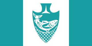
The Musqueam flag represents the Musqueam Nation and people. It was designed by Musqueam artist Susan Point, who also helped design the flag of Nunavut. The design of the flag is a white Canadian pale on a teal field, with an arrowhead in the centre depicting a salmon leaping above a net.