The Niagara Frontier Transportation Authority (NFTA) is a New York State public-benefit corporation responsible for the public transportation oversight of Erie and Niagara counties. The NFTA, as an authority, oversees a number of subsidiaries, including the NFTA Metro bus and rail system, the Buffalo-Niagara International Airport, the Niagara Falls International Airport and NFTA Small Boat Harbor. The NFTA Metro bus and rail system is a multi-modal agency, utilizing various vehicle modes, using the brand names: NFTA Metro Bus, NFTA Metro Rail, NFTA Metrolink and NFTA PAL. In 2021, the system had a ridership of 12,503,900, or about 49,900 per weekday as of the fourth quarter of 2021.

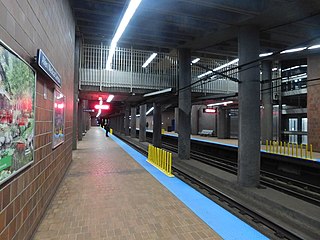
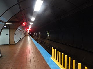
Buffalo Metro Rail is the public transit rail system in Buffalo, New York, operated by the Niagara Frontier Transportation Authority (NFTA). The system consists of a single, 6.4-mile-long (10.3 km) light rail line that runs for most of the length of Main Street from KeyBank Center in Canalside to the south campus of the University at Buffalo in the northeast corner of the city. The first section of the line opened in October 1984; the current system was completed in November 1986. In 2021, the system had a ridership of 1,890,200, or about 7,400 per weekday as of the fourth quarter of 2021.

Kenmore station is a light rail station on the MBTA Green Line, located under Kenmore Square in the Fenway/Kenmore neighborhood of Boston, Massachusetts. The station opened on October 23, 1932 as a one-station extension of the Boylston Street subway to relieve congestion in the square. Kenmore is the primary station for passengers wishing to visit Fenway Park, located one block away.

Balboa Park station is a Bay Area Rapid Transit (BART) station and Muni Metro complex located south of Balboa Park in southern San Francisco, California. It is an intermodal hub served by four BART routes, three Muni Metro lines, and a number of Muni bus routes. The station complex also includes two rail yards, Cameron Beach Yard and Green Light Rail Center, where Muni maintains Muni Metro trains and heritage streetcars. BART uses a below-grade island platform on the west side of the complex; Muni Metro routes use several smaller side platforms located on surface-level rail loops around the yards.

Seneca is a Buffalo Metro Rail station located in the 200 block of Main Street between Seneca and Swan Streets in the Free Fare Zone, which allows passengers free travel between Erie Canal Harbor and Fountain Plaza station. Passengers continuing northbound past Fountain Plaza are required to provide proof-of-payment. On June 27, 2019, The Buffalo News announced that Merchants Insurance, which has been located at 260 Main Street since the 1960s, bought the naming rights for $161,000 for initially five years, with the option to renew for another five years.

Church is a Buffalo Metro Rail station located in the 300 block of Main Street in the Free Fare Zone, which allows passengers free travel between Erie Canal Harbor and Fountain Plaza. Passengers continuing northbound past Fountain Plaza are required to have proof-of-payment. Church is the closest to the Buffalo Metropolitan Transportation Center, located two blocks east at Ellicott and North Division Streets.

Lafayette Square is a Buffalo Metro Rail station near City Hall and is near the center of the Buffalo Central Business District at Lafayette Square located in the 400 block of Main Street in the Free Fare Zone, which allows passengers free travel between Erie Canal Harbor station and Fountain Plaza station. Passengers continuing northbound past Fountain Plaza are required to have proof-of-payment. Lafayette Square station is the closest to the Buffalo & Erie County Public Library, located one block east at Washington and Clinton Streets. On February 28, 2019, The Buffalo News announced that Evans Bank, which opened its downtown headquarters in the Main-Court Building the previous October, bought the naming rights to the station for nearly $161,000 for five years and nearly $352,000 if extended to 10 years.
Allen/Medical Campus is a Buffalo Metro Rail station located at the corner of Main and Allen Streets at the northern end of Buffalo, New York's downtown and is the last underground station to the south requiring payment before entering the Free Fare Zone. The station was temporarily closed in 2015 to incorporate a new building at the University at Buffalo School of Medicine and Biomedical Sciences into the station's aboveground entrances.

Summer–Best is a Buffalo Metro Rail station located at the junction of Summer, Best and Main Streets.

Utica is a Buffalo Metro Rail station located at the corner of Main and East Utica Streets.
Delavan/Canisius College is a Buffalo Metro Rail station located at the northeast corner of Main Street and East Delavan Avenue and is known as having one of the longest escalators set up in the country. Delavan/Canisius College station was also bored through rock and remnants of Cold Spring that are visible through occasional water running on the track bed floors.

Humboldt–Hospital is a Buffalo Metro Rail station located at the western terminus of Kensington Avenue and Main Street and is the only station with entrances on both sides of the Main Street for passengers to enter and exit from. To not confuse, Kensington Avenue rejoins Main Street in Snyder, New York at its eastern terminus. Since Humboldt–Hospital station served as a terminal due to Amherst Street station serving as the northern terminus from May 20, 1985 to November 10, 1986, about 580 feet north is a double crossover. The area near the station is a mix of housing and medical offices, anchored by the Sisters of Charity Hospital. The Parkside residential community is directly to the east of the station and is also a short distance from Delaware Park.

Amherst Street is a Buffalo Metro Rail underground station located at the corner of Main and Amherst Streets. From May 18, 1985 to November 10, 1986, due to construction issues at LaSalle station, Amherst Street station served as the northern terminus. The station has been referenced by rapper Westside Gunn numerous times.

LaSalle is a Buffalo Metro Rail underground station located at the corner of Main Street and LaSalle Avenue and is one stop from the northern terminus. Original drafting plans had the station used as a turnout between the current Metro Rail line and three proposed extensions; the Tonawanda Line, which would extend service into the cities of Tonawanda and Niagara Falls; the North Buffalo Line, which would extend service to Elmwood Avenue on an abandoned railroad right-of-way between Hertel and Kenmore Avenues; and the East Buffalo line, to connect the Main Street line with the proposed Airport Line, carrying passengers to the Buffalo-Niagara International Airport. The only visible sign of the turnout is located below ground by way of partially finished tunnel just west of the LaSalle station platforms. From May 20, 1985 to November 10, 1986, due to construction issues at LaSalle station, Amherst Street station served as the northern terminus. Since November 10, 1986, University station serves as the northern terminus.

Buffalo–Exchange Street station is an Amtrak station in Buffalo, New York. The station serves six Amtrak trains daily: two daily Empire Service round trips between Niagara Falls and New York City and one Maple Leaf round trip between Toronto and New York City. There is also daily Amtrak Thruway bus service at the station, operating between the Buffalo Metropolitan Transportation Center and Jamestown station in Jamestown, New York, via Dunkirk and Fredonia, and serving the communities along the southeast shore of Lake Erie.

Since the Buffalo Metro Rail light rail was proposed in the 1970s, there have been multiple proposals for expanding the system, which is currently a single 6.4-mile (10.3 km) long line. Public officials, agencies and advocacy groups have created plans, with the most recent and formidable being an extension to the town of Amherst. One organization, the Citizens Regional Transportation Corporation (CRTC), promotes the implementation and expansions of light-rail service for the City of Buffalo and the surrounding Buffalo/Niagara region in New York State.

The International Railway Company (IRC) was a transportation company formed in a 1902 merger between several Buffalo-area interurban and street railways. The city railways that merged were the West Side Street Railway, the Crosstown Street Railway and the Buffalo Traction Company. The suburban railroads that merged included the Buffalo & Niagara Electric Street Railway, and its subsidiary the Buffalo, Lockport & Olcott Beach Railway; the Buffalo, Depew & Lancaster Railway; and the Niagara Falls Park & River Railway. Later the IRC acquired the Niagara Gorge Railroad (NGRR) as a subsidiary, which was sold in 1924 to the Niagara Falls Power Company. The NGRR also leased the Lewiston & Youngstown Frontier Railroad.

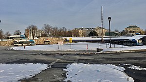
The Buffalo Metropolitan Transportation Center is located on the southeast corner of North Division and Ellicott Streets in Downtown Buffalo, New York. The transportation center is open 24 hours daily.

Transportation in Buffalo, New York is dominated by automobile use, but other modes of transportation exist in the city.