The Broads is a network of mostly navigable rivers and lakes in the English counties of Norfolk and Suffolk. Although the terms "Norfolk Broads" and "Suffolk Broads" are correctly used to identify specific areas within the two counties respectively, the whole area is frequently referred to as the Norfolk Broads.

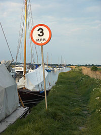
Wroxham is a village and civil parish in the English county of Norfolk. The civil parish of Wroxham has an area of 6.21 square kilometres, and in 2001, had a population of 1,532 in 666 households. A reduced population of 1,502 in 653 households was noted in the 2011 Census. The village is situated within the Norfolk Broads on the south side of a loop in the middle reaches of the River Bure. It lies in an elevated position above the Bure, between Belaugh Broad to the west, and Wroxham Broad to the east and south east. Wroxham is some eight miles north-east of Norwich, to which it is linked by the A1151 road. The village and broad lie in an area of fairly intensive agriculture, with areas of wet woodland adjoining the broad and river. For the purposes of local government, the parish falls within the district of Broadland although the river, broad and their immediate environs fall within the executive area of the Broads Authority. On the northern side of the Bure is the village of Hoveton, often confused with Wroxham.

Horning is an ancient village and parish in the English county of Norfolk. It covers an area of 11 km2 and had a population of 1,033 in the 2001 census. Horning parish lies on the northern bank of the River Bure south of the River Thurne and is located in The Broads National Park. For the purposes of local government, it falls within the district of North Norfolk, although areas alongside the rivers and broads fall into the executive area of the Broads Authority.

The Norfolk Wildlife Trust (NWT) is one of 46 wildlife trusts covering Great Britain, Northern Ireland, Isle of Man and Alderney. Founded in 1926, it is the oldest of all the trusts. It has over 35,500 members and eight local groups and it manages more than fifty nature reserves and other protected sites. It also gives conservation advice to individuals and organisations, provides educational services to young people on field trips and organises entertainment and information events at nature reserves. The NWT reserves include twenty-six Sites of Special Scientific Interests, nine national nature reserves, twelve Nature Conservation Review sites, sixteen Special Areas of Conservation, twelve Special Protection Areas, eleven Ramsar sites, two local nature reserves, four Geological Conservation Review sites and five which are in Areas of Outstanding Natural Beauty.
Ranworth Broad is a 136-hectare (340-acre) nature reserve on the Norfolk Broads north-east of Norwich in Norfolk, United Kingdom. It is managed by the Norfolk Wildlife Trust. it is part of Bure Broads and Marshes Site of Special Scientific Interest and Bure Marshes Nature Conservation Review site, Grade I and National Nature Reverse. It is also part of the Broadland Ramsar site and Special Protection Area, and The Broads Special Area of Conservation.

Cockshoot Broad is a 5-hectare (12-acre) nature reserve north-east of Norwich in Norfolk. It is managed by the Norfolk Wildlife Trust. It is part of the Bure Broads and Marshes Site of Special Scientific Interest, and the Broadland Ramsar site and Special Protection Area, and The Broads Special Area of Conservation. It is also part of the Bure Marshes National Nature Reserve and Nature Conservation Review site, Grade I.

The Halvergate Marshes are an area of grazing marsh in the east of the English county of Norfolk. They form part of the area of The Broads and lie between the River Bure and the River Yare, bordering Breydon Water on the east. The marshes cover an area of around 2,642 hectares An area of 1,432.7-hectare (3,540-acre) is a biological Site of Special Scientific Interest. Some areas are also in the Breydon Water Local Nature Reserve, the Broadland and Breydon Water Ramsar sites, The Broads Special Area of Conservation, and The Broads and Breydon Water Special Protection Areas.

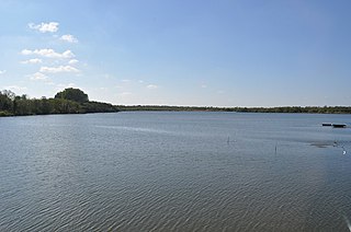
Breydon Water is a 514.4-hectare (1,271-acre) biological Site of Special Scientific Interest at Great Yarmouth, Norfolk. It is a Local Nature Reserve, a Ramsar site and a Special Protection Area. It is part of the Berney Marshes and Breydon Water nature reserve, which is managed by the Royal Society for the Protection of Birds (RSPB).

The River Bure is a river in the county of Norfolk, England, most of it in the Broads. The Bure rises near Melton Constable, 11 miles (18 km) upstream of Aylsham, which was the original head of navigation. Nowadays, the head of navigation is 10 miles (16 km) downstream at Coltishall Bridge. After Aylsham Lock and Burgh Bridge, the Bure passes through Buxton Lammas, Coltishall, Belaugh, Wroxham, Horning, past St. Benet's Abbey, through Oby, Acle, Stokesby, along the northern border of the Halvergate Marshes, through Runham and Great Yarmouth where it meets Breydon Water and flows into the sea at Gorleston.

Acle is a market town on the River Bure on the Norfolk Broads in Norfolk, located halfway between Norwich and Great Yarmouth. It has the only bridge across the River Bure between Wroxham and Great Yarmouth.
The River Ant is a tributary river of the River Bure in the county of Norfolk, England. It is 27 kilometres (17 mi) long, and has an overall drop of 27 metres from source to mouth. It is said that the Ant was formerly known as the River Smale and that this is the origin of the name of the village of Smallburgh.

The River Thurne is a river in Norfolk, England in The Broads. Just 7 miles (11 km) long, it rises 2 miles (3.2 km) from the coast near Martham Broad and is navigable from West Somerton. It flows southwest and is linked by Candle Dyke and Heigham Sound to both Horsey Mere and Hickling Broad. It continues southwest and flows through Potter Heigham and enters the River Bure just south of Thurne dyke, near St Benet's Abbey.

The A149 is commonly known as "The Coast Road" to local residents and tourists, as this road runs along the North Norfolk coast from King's Lynn to Great Yarmouth, via coastal villages.

Smallburgh is a village and a civil parish in the English county of Norfolk. The village is fourteen miles (21 km) south-east of Cromer, fourteen miles (21 km) north-east of Norwich and 132 miles (212 km) north-east of London. The village lies five miles (8 km) south-east of the nearby town of North Walsham. The nearest railway station is at Worstead for the Bittern Line which runs between Sheringham, Cromer and Norwich. The nearest airport is Norwich International Airport. At the 2001 census it had a population of 518 in 219 households. For the purposes of local government, it falls within the district of North Norfolk.

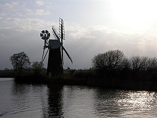
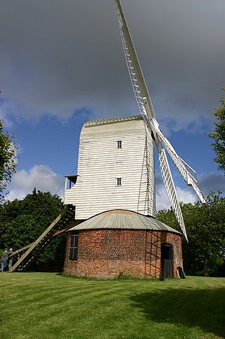
Berney Arms Windmill is a tower mill located at Berney Arms alongside the River Yare at the south-western end of Breydon Water in the English county of Norfolk. The windmill is in an isolated spot in The Broads around 3.5 miles (5.6 km) north-east of the village of Reedham and 4 miles (6.4 km) south-west of Great Yarmouth. The mill has no road access but can be accessed by boat, by foot or from Berney Arms railway station. It is a scheduled monument under the care of English Heritage.
Palmer's Drainage Windmill is located to the north of Upton Dyke close to the village of Upton in the English county of Norfolk. Upton Dyke runs westerly from the River Bure in the civil parish of Upton with Fishley . The Drainage mill can be found to the east of the village of Upton.
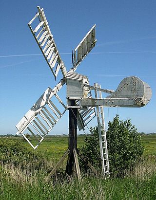
Thrigby Post Windmill is located in the civil parish of Mautby in the English county of Norfolk. The mill is on the south side of Mill Lane 1,125 yards (1.029 km) east of the village of Thrigby. The post mill is north of The River Bure, Breydon Water and the Halvergate Marshes.

Barnby Broad and Marshes is a Site of Special Scientific Interest (SSSI) in the Waveney district of the English county of Suffolk. The site is 189.6 hectares in size. It is in the parishes of North Cove and Barnby, located between Beccles and Lowestoft in the north of the county. The site is bordered on its southern edge by the East Suffolk railway line and to the north by the River Waveney. It is a Special Area of Conservation, a Special Protection Area under the EC Birds Directive, and a Ramsar internationally important wetland site. There are two Suffolk Wildlife Trust nature reserves in the site, Castle Marshes and North Cove.
Bure Broads and Marshes is a 741.1-hectare (1,831-acre) biological Site of Special Scientific Interest north-east of Norwich in Norfolk. Most of it is a Nature Conservation Review site, Grade I and National Nature Reserve. Two areas are nature reserves managed by the Norfolk Wildlife Trust, Cockshoot Broad and Ranworth Broad. It is part of the Broadland Ramsar site and Special Protection Area and The Broads Special Area of Conservation,

Upton Broad and Marshes is a 195.4-hectare (483-acre) biological Site of Special Scientific Interest east of Norwich in Norfolk. It is a Nature Conservation Review site, Grade I and a larger area of 318-hectare (790-acre) is managed by the Norfolk Wildlife Trust. It is part of the Broadland Ramsar site and Special Protection Area, and The Broads Special Area of Conservation.