Related Research Articles

The geography of Mozambique consists mostly of coastal lowlands with uplands in its center and high plateaus in the northwest. There are also mountains in the western portion. The country is located on the east coast of southern Africa, directly west of the island of Madagascar. Mozambique has a tropical climate with two seasons, a wet season from October to March and a dry season from April to September.

Malawi is a landlocked country in southeast Africa. It is wholly within the tropics; from about 9°30S at its northernmost point to about 17°S at the southernmost tip. The country occupies a thin strip of land between Zambia and Mozambique, extending southwards into Mozambique along the valley of the Shire River. In the north and north east it also shares a border with Tanzania. Malawi is connected by rail to the Mozambican ports of Nacala and Beira. It lies between latitudes 9° and 18°S, and longitudes 32° and 36°E.

Sofala is a province of Mozambique. It has a population of 2,259,248. Beira is the capital of the province, named for the ruined port of Sofala which is 35 kilometres (22 mi) to the south.

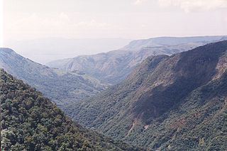
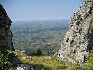
The Eastern Highlands, also known as the Manica Highlands, is a mountain range on the border of Zimbabwe and Mozambique. The Eastern Highlands extend north and south for about 300 kilometres (190 mi) through Zimbabwe's Manicaland Province and Mozambique's Manica Province.

The Luangwa River is one of the major tributaries of the Zambezi River, and one of the four biggest rivers of Zambia. The river generally floods in the rainy season and then falls considerably in the dry season. It is one of the biggest unaltered rivers in Southern Africa and the 52,000 square kilometres (20,000 sq mi) that make up the surrounding valley are home to abundant wildlife.

Gorongosa National Park is at the southern end of the Great African Rift Valley in the heart of central Mozambique, Southeast Africa. The more than 4,000 square kilometres (1,500 sq mi) park includes the valley floor and parts of surrounding plateaus. Rivers originating on nearby Mount Gorongosa water the plain.

South Luangwa National Park in eastern Zambia, the southernmost of three national parks in the valley of the Luangwa River. It, is a world-renowned wildlife haven. It is simply know to locals simply as "the South Park."Concentrations of game along the meandering Luangwa River and its lagoons are amongst the most intense in Africa. The river teems with hippo and crocodile and provides a lifeline for one of the greatest diversities of habitat and wildlife, supporting more than 60 species of mammals and over 400 species of birds.It marks the end of the Great Rift Valley.
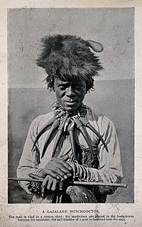
Gazaland is the historical name for the region in southeast Africa, in modern-day Mozambique and Zimbabwe, which extends northward from the Komati River at Delagoa Bay in Mozambique's Maputo Province to the Pungwe River in central Mozambique.
Zambezi Escarpment is a name used for the escarpments forming both sides of the rift valley or graben in which lie the middle Zambezi river and Lake Kariba. They are fault scarps, rising 500 to 600 m higher than the lake or river, running from the Batoka Gorge roughly 800 km to the lower Zambezi, and facing each other about 50 to 100 km apart, closer in the west and opening up in the east.
Pungwe River is a 400 km (250 mi) long river in Zimbabwe and Mozambique. It rises below Mount Nyangani in the Eastern Highlands of Zimbabwe and then flows southeasteastward through the Manica and Sofala provinces of Mozambique. the Pungwe enters the Urema Valley, the southernmost portion of the Great Rift Valley, where it forms the southern boundary of Gorongosa National Park. The Urema River joins it, and the river follows the rift valley southward. Large seasonal wetlands form around the Pungwe and Urema rivers in the rift valley section. It empties into the Mozambique Channel at Beira, forming a large estuary. It is one of the major rivers of Mozambique and often causes floods.

Macossa District is a district of Manica Province in western Mozambique. The principal town is Macossa. The district is located in the east of the province, and borders with Tambara District in the north, Maringué District of Sofala Province in the northeast, Gorongosa District of Sofala Province in the east, Gondola District in the south, Báruè District in the west, and with Guro District in the northwest. The area of the district is 9,554 square kilometres (3,689 sq mi). It has a population of 27,245 as of 2007.

Cheringoma District is a district of Sofala Province in Mozambique. The principal town is Inhaminga. The district is located in the northeast of the province, and borders with Caia District in the north, Marromeu District in the northeast, Muanza District in the south, Gorongosa District in the west, and with Maringué District in the northwest. In the south, it is bounded by the Indian Ocean. The area of the district is 6,954 square kilometres (2,685 sq mi). It has a population of 34,133 as of 2007.

The Zambezian coastal flooded savanna is a flooded grasslands and savannas ecoregion in Mozambique. It includes the coastal flooded savannas and grasslands in the deltas of the Zambezi, Pungwe, Buzi, and Save rivers.

The Zambezian and mopane woodlands is a tropical and subtropical grasslands, savannas, and shrublands ecoregion of southeastern Africa.

Mount Morrumbala, also known as Mount Tembe, is a mountain in Morrumbala District of Zambezia Province in central Mozambique.
The Cheringoma Plateau is a low plateau in Sofala Province of Mozambique. It lies mostly within Cheringoma, Muanza, and Marromeu districts.
The Ufipa Plateau is a highland in southwestern Tanzania. It lies mostly in Rukwa Region, near the border with Zambia. The plateau is named for the Fipa people who inhabit it.
The Southern Eastern Rift is a freshwater ecoregion in Kenya and Tanzania.
The Bight of Sofala/Swamp Coast is a marine ecoregion along the eastern coast of Africa, characterized by extensive mangrove swamps and coastal wetlands. It extends along the coast of Mozambique, from Angoche to Bazaruto Archipelago. It adjoins the East African coral coast ecoregion to the north, and the Delagoa ecoregion to the south.
The Choa Mountains are a mountain range in Manica Province of Mozambique. The mountains lie in Báruè District, west of Catandica.
References
- ↑ Vijoen, Richard (2016). Africa’s Top Geological Sites". Penguin Random House South Africa, Sep 1, 2016.
- ↑ Vijoen, Richard (2016). Africa’s Top Geological Sites". Penguin Random House South Africa, Sep 1, 2016.
- ↑ Burgess, Neil, Jennifer D’Amico Hales, Emma Underwood (2004). Terrestrial Ecoregions of Africa and Madagascar: A Conservation Assessment. Island Press, Washington DC.