Ustic

Last updated
Ustic Moisture Regime
Ustic Kandihumult (Fine, kaolinitic, isohyperthermic).jpg
Ustic Kandihumult
(Fine, Kaolinitic, Isohyperthermic)
Used in WRB, USDA soil taxonomy
Climate Semi-arid

Ustic is a class of soil moisture regime. It is one of a range of different soil moisture regimes, such as: aquic moisture regime, aridic moisture regime, udic moisture regime and xeric moisture regime. The ustic moisture regime is intermediate between the aridic regime and the udic regime. [1]

Contents

Definition

The ustic moisture regime (Latin: ustus, burnt) applies to soils in which moisture is present, but limited, at times in which conditions are suitable for plant growth. A suborder of Mollisol, the ustic moisture regime is wetter than the aridic moisture regime and drier than the udic moisture regime. For a soil to be classified as ustic, averaged across the year, stored moisture plus rainfall is less than the amount of water lost from the soil via evapotranspiration. The ustic moisture regime is common in semi-arid and sub-humid climates. [2]

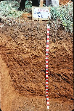
Geography and Climate of Ustic Soils

Global locations of Soil moisture regimes Soil moisture regimes.jpg
Global locations of Soil moisture regimes

There are certain climate conditions which characterises a particular soil as ustic: the soil temperature must be 22 °C (degrees Celsius) or above annually, or winter contra summer soil temperatures must vary by less than 6 °C at a particular depth of 50 cm below the soil surface. The soil moisture control section of ustic soil is dry, in some or most parts, for at least 90 or more cumulative days in a normal year. Ustic soil is also moist, in some parts, for more than 180 cumulative or 90 consecutive days per year. [2]

If the soil temperature is 22 °C and above annually, or if winter contra summer soil temperatures vary by more than 6 °C at a particular depth of 50 cm below the soil surface, the soil moisture control section of ustic soil is dry, in some or most parts, for at least 90 or more cumulative days in a normal year. Although it is not dry in all parts for more than half of these cumulative days, at a soil depth of 50 cm the soil temperature is greater than 5 °C. In the event that the moisture control section is moist in all parts for 45 or more consecutive days in the four months after the winter solstice, the moisture control section is then dry in all parts for less than 45 consecutive days in the four months after the summer solstice. [2]

Regions with an ustic soil moisture regime often experience erratic rainfall which mostly occurs during the growing season. Summer droughts are erratic, but frequent. Ustolls (soils characterized with the ustic soil moisture regime) are the most commonly occurring suborder of Mollisols [3] in the U.S., primarily located in the southern Great Plains, New Mexico, Texas, and Oklahoma. Most Ustolls display an accumulation of calcium carbonate in the soil profile - a calcic horizon. [4]

The ustic soil moisture regime is also common in Central Africa (Zambia, Tanzania, Angola), in India, and in some countries of Eastern Europe and South America. [5]

Characteristics of Alternative Moisture Regimes

Soil Moisture regimes affects soil genesis (formation), and the usage and maintenance of soil condition, so they are used as a soil classification criterion for soils with similar properties and Morphology. [6] The following are the four other major soil moisture regimes:

Aquic (or Perudic)

Soils that have the aquic moisture regime are virtually free of dissolved oxygen because they are saturated by water. To have an aquic moisture regime, a soil must be saturated for at least a few days a year, because it’s implicit in the concept that dissolved oxygen is virtually absent. It is also implicit that the soil temperature is above biologic zero for some time while the soil is saturated, because dissolved oxygen is removed from ground water by respiration of micro-organisms. The level of ground water fluctuates with the seasons; it is highest in the rainy season or in fall, winter, or spring when cold weather virtually stops evapotranspiration. [1]

Udic

The soil moisture control section is not dry in any part for around 90 days in the udic moisture regime. The soil moisture control section becomes udic if the mean soil temperature is lower than 22 °C and the mean summer and winter soil temperatures (at a depth of 50 cm from the soil surface) differ by 6 °C or more, is dry in all parts for less than 45 consecutives days in the 4 months following the summer solstice. Soils that have an udic moisture regime commonly occur in areas of humid climates that have well distributed rainfall: i.e. they have adequate summer or winter rains, and generally cool summers. [1]

Aridic

The moisture control section in the aridic moisture regime is dry when the temperature of soil, at a depth of 50 cm from the soil surface, is above 5 °C for more than half of the cumulative days per year and moist when it’s above 8 °C for less than 90 consecutive days. Soils that have an aridic moisture regime normally occur in an arid or a semi-arid climate. [1]

Xeric

The xeric (Greek: xeros, dry) moisture regime is the typical moisture regime in areas where winters are cool and moist and summers are warm and dry - i.e. Mediterranean climates. The soil moisture control section is dry in summer and moist in winter in all parts for 45 or more consecutive days in 4 months. Also, the moisture control section is moist when the temperature of the soil, at a depth of 50 cm from the soil surface, is higher than 6 °C for more than half of the cumulative days per year, or higher than 8 °C for 90 or more consecutive days. The mean annual temperature of the soil is lower than 22 °C, and there is a difference of 6 °C between the mean soil temperature in summer and winter. [1]

Plants in the Ustic Moisture Regime

A principle characteristic of ustic soil is that it is preferable for the cultivation of crops that are tolerant, albeit resistant, to periods of drought. Moisture regimes have significant practical importance in the field of agriculture. For example, under an ustic moisture regime the commercial growth of maize is generally considered to require supplemental irrigation: however, this is not required under an udic moisture regime. [7] [8] [9]

Advantages

In many regions possessing thermic or mesic soil temperature regimes, there are relatively short warm seasons followed by a longer cold season, limiting the period during which grain can be harvested and re-planted. Consequently, these regions require rapid sowing, harvesting, transport and storage, all of which increase the costs of the operation. [10]

Regions possessing an ustic soil moisture regime have a significantly large window for the harvesting of crops at the onset of the dry season. For example, Brazilian farmers in the Cerrado region leverage on the warm dry season to harvest their grain at a more leisurely pace. This allows them to simultaneously enjoy greater efficiency and reduced costs. In certain parts of the Cerrado, the cultivation of two crops (usually soybeans and sorghum) are possible annually. [10]

See also

Related Research Articles

Climate Statistics of weather conditions in a given region over long periods

Climate is the long-term average of weather, typically averaged over a period of 30 years. More rigorously, it denotes the mean and variability of meteorological variables over a time spanning from months to millions of years. Some of the meteorological variables that are commonly measured are temperature, humidity, atmospheric pressure, wind, and precipitation. In a broader sense, climate is the state of the components of the climate system, which includes the ocean and ice on Earth. The climate of a location is affected by its latitude, terrain, and altitude, as well as nearby water bodies and their currents.

Kalahari Desert A semi-arid sandy savanna in Southern Africa

The Kalahari Desert is a large semi-arid sandy savannah in Southern Africa extending for 900,000 square kilometres (350,000 sq mi), covering much of Botswana, and parts of Namibia and South Africa.

Subarctic climate

The subarctic climate is a climate characterised by long, usually very cold winters, and short, cool to mild summers. It is found on large landmasses, away from the moderating effects of an ocean, generally at latitudes from 50° to 70°N poleward of the humid continental climates. Subarctic or boreal climates are the source regions for the cold air that affects temperate latitudes to the south in winter. These climates represent Köppen climate classification Dfc, Dwc, Dsc, Dfd, Dwd and Dsd.

Temperate climate Main climate class

In geography, the temperate climates of Earth occur in the middle latitudes, which span between the tropics and the polar regions of Earth. These zones generally have wider temperature ranges throughout the year and more distinct seasonal changes compared to tropical climates, where such variations are often small.

Subtropics Geographic and climate zone

The subtropics are geographic and climate zones located roughly bordered the tropics at latitude 23° 27' and the temperate zones, north and south of the Equator.

Semi-arid climate Climate with precipitation below potential evapotranspiration

A semi-arid climate, semi-desert climate, or steppe climate is the climate of a region that receives precipitation below potential evapotranspiration, but not as low as a desert climate. There are different kinds of semi-arid climates, depending on variables such as temperature, and they give rise to different biomes.

Dryland farming Techniques for non-irrigated farming when it is normally required

Dryland farming and dry farming encompass specific agricultural techniques for the non-irrigated cultivation of crops. Dryland farming is associated with drylands, areas characterized by a cool wet season followed by a warm dry season. They are also associated with arid conditions, areas prone to drought and those having scarce water-resources.

USDA soil taxonomy (ST) developed by United States Department of Agriculture and the National Cooperative Soil Survey provides an elaborate classification of soil types according to several parameters and in several levels: Order, Suborder, Great Group, Subgroup, Family, and Series. The classification was originally developed by Guy Donald Smith, former director of the U.S. Department of Agriculture's soil survey investigations.

Mollisol

Mollisols are a soil order in USDA soil taxonomy. Mollisols form in semi-arid to semi-humid areas, typically under a grassland cover. They are most commonly found in the mid-latitudes, namely in North America, mostly east of the Rocky Mountains, in South America in Argentina (Pampas) and Brazil, and in Asia in Mongolia and the Russian Steppes. Their parent material is typically base-rich and calcareous and include limestone, loess, or wind-blown sand. The main processes that lead to the formation of grassland Mollisols are melanisation, decomposition, humification and pedoturbation.

Humid continental climate Category in the Köppen climate classification system

A humid continental climate is a climatic region defined by Russo-German climatologist Wladimir Köppen in 1900, typified by four distinct seasons and large seasonal temperature differences, with warm to hot summers and cold winters. Precipitation is usually distributed throughout the year. The definition of this climate regarding temperature is as follows: the mean temperature of the coldest month must be below −3 °C (26.6 °F) and there must be at least four months whose mean temperatures are at or above 10 °C (50 °F). In addition, the location in question must not be semi-arid or arid. The Dfb, Dwb and Dsb subtypes are also known as hemiboreal.

Climate of Chicago

The climate of Chicago is classified as hot-summer humid continental, with all four seasons distinctly represented: Winters are cold and see frequent snow and near 0 °F (−18 °C) windchill temperatures, while summers are warm and humid with temperatures being hotter inland, spring and fall bring bouts of both cool and warm weather and fairly sunny skies. Annual precipitation in Chicago is moderate and relatively evenly distributed, the driest months being January and February and the wettest July and August. Chicago's weather is influenced during all four seasons by the nearby presence of Lake Michigan.

Vertisol Clay-rich soil, prone to cracking

A Vertisol, or Vertosol, is a soil type in which there is a high content of expansive clay minerals, many of them known as montmorillonite, that form deep cracks in drier seasons or years. In a phenomenon known as argillipedoturbation, alternate shrinking and swelling causes self-ploughing, where the soil material consistently mixes itself, causing some Vertisols to have an extremely deep A horizon and no B horizon.. This heaving of the underlying material to the surface often creates a microrelief known as gilgai.

In USDA soil taxonomy, a Psamment is defined as an Entisol which consists basically of unconsolidated sand deposits, often found in shifting sand dunes but also in areas of very coarse-textured parent material subject to millions of years of weathering. This latter case is characteristic of the Guiana Highlands of northern South America. A Psamment has no distinct soil horizons, and must consist entirely of material of loamy sand or coarser in texture. In the World Reference Base for Soil Resources (WRB), Psamments are known as Arenosols.

Pachypodium habitats consist of isolated, specialized, micro–environmental niches, generally xeric, rocky, frost-free areas within parts of western Madagascar and southern Africa. Pachypodium species are often indifferent to the regional ecological, biotic zone of vegetation, a fact which explains some of Pachypodium morphology and architecture. The large scale vegetation zones are in some cases irrelevant to the micro-environments of Pachypodium, in the sense that the xeric niches may be embedded in larger mesic biomes.

Argentine Northwest

The Argentine Northwest is a geographic and historical region of Argentina composed of the provinces of Catamarca, Jujuy, La Rioja, Salta, Santiago del Estero and Tucumán.

Climate of Australia

Australia's climate is governed mostly by its size and by the hot, sinking air of the subtropical high pressure belt. This moves north-west and north-east with the seasons. The climate is variable, with frequent droughts lasting several seasons, thought to be caused in part by the El Niño-Southern Oscillation. Australia has a wide variety of climates due to its large geographical size. The largest part of Australia is desert or semi-arid. Only the south-east and south-west corners have a temperate climate and moderately fertile soil. The northern part of the country has a tropical climate, varying between grasslands and desert. Australia holds many heat-related records: the continent has the hottest extended region year-round, the areas with the hottest summer climate, and the highest sunshine duration.

Climate of Texas

Texas' weather varies widely, from arid in the west to humid in the east. The huge expanse of Texas encompasses several regions with distinctly different climates: Northern Plains, Trans-Pecos Region, Texas Hill Country, Piney Woods, and South Texas. Generally speaking, the part of Texas that lies to the east of Interstate 35 is subtropical, while the portion that lies to the west of Interstate 35 is arid desert.

Climate of the United States Varies due to changes in latitude, and a range of geographic features

The climate of the United States varies due to changes in latitude, and a range of geographic features, including mountains and deserts. Generally, on the mainland, the climate of the U.S. becomes warmer the further south one travels, and drier the further west, until one reaches the West Coast.

Climate of Chile

The climate of Chile comprises a wide range of weather conditions across a large geographic scale, extending across 38 degrees in latitude, making generalizations difficult. According to the Köppen system, Chile within its borders hosts at least seven major climatic subtypes, ranging from low desert in the north, to alpine tundra and glaciers in the east and southeast, tropical rainforest in Easter Island, Oceanic in the south and Mediterranean climate in central Chile. There are four seasons in most of the country: summer, autumn, winter, and spring.

Climatic regions of Argentina

Due to its vast size and range of altitudes, Argentina possesses a wide variety of climatic regions, ranging from the hot subtropical region in the north to the cold subantarctic in the far south. Lying between those is the Pampas region, featuring a mild and humid climate. Many regions have different, often contrasting, microclimates. In general, Argentina has four main climate types: warm, moderate, arid, and cold in which the relief features, and the latitudinal extent of the country, determine the different varieties within the main climate types.

References

  1. 1 2 3 4 5 Natural Resources Conservation Service. "Keys to Soil Taxonomy, United States Department of Agriculture, Natural Resources Conservation Service, Twelfth Edition, 2014".
  2. 1 2 3 Natural Resources Conservation Service (2010). Keys to Soil Taxonomy (Eleventh ed.). United States Department of Agriculture. p. 28.
  3. National Soil Survey Center. "Soil Survey Technical Note 9: Populating Taxonomic Moisture Class and Subclass in NASIS". United States Department of Agriculture. Retrieved 26 November 2014.
  4. Grunwald, Sabine. "Mollisols". University of Florida - Soils & Water Science Department. Retrieved 17 October 2014.
  5. "Soil Genesis and Development". Plant & Soil Sciences. Retrieved 20 October 2014.
  6. Tim, Kettler. "Soil Genesis and Development, Lesson 6 - Global Soil Resources and Distribution". Plant & Soil Sciences eLibrary. National Science Publisher. Retrieved 17 October 2014.
  7. Foth, Henry; Schafer, John W. Soil Geography and Land Use. New York: John Wiley & Sons.
  8. McKeague, J. A.; Eilers, R. G.; Thomasson, A. J.; Reeve, M. J.; Bouma, J.; Grossman, R. B.; Favrot, J. C.; Renger, M.; Strebel, O. (1984). "Tentative assessment of soil survey approaches to the characterization and interpretation of air-water properties of soils". Geoderma. 34 (1): 69–100. Bibcode:1984Geode..34...69M. doi:10.1016/0016-7061(84)90006-5.
  9. Soil Survey Staff (1981). Soil survey manual, Revised edition. Washington, D. C.: U. S. Govt. Printing Office.
  10. 1 2 Buol, Stanley W (2009). "Soils and agriculture in central-west and north Brazil". Sci. Agric. 66 (5): 697–707. doi: 10.1590/s0103-90162009000500016 .