
Polychlorinated biphenyls (PCBs) are highly carcinogenic chemical compounds, formerly used in industrial and consumer products, whose production was banned in the United States by the Toxic Substances Control Act in 1976 and internationally by the Stockholm Convention on Persistent Organic Pollutants in 2001.

Superfund is a United States federal environmental remediation program established by the Comprehensive Environmental Response, Compensation, and Liability Act of 1980 (CERCLA). The program is administered by the Environmental Protection Agency (EPA). The program is designed to investigate and clean up sites contaminated with hazardous substances. Sites managed under this program are referred to as Superfund sites. There are 40,000 federal Superfund sites across the country, and approximately 1,300 of those sites have been listed on the National Priorities List (NPL). Sites on the NPL are considered the most highly contaminated and undergo longer-term remedial investigation and remedial action (cleanups).

Love Canal is a neighborhood in Niagara Falls, New York, United States, infamous as the location of a 0.28 km2 (0.11 sq mi) landfill that became the site of an enormous environmental disaster in the 1970s. Decades of dumping toxic chemicals harmed the health of hundreds of residents; the area was cleaned up over the course of 21 years in a Superfund operation.
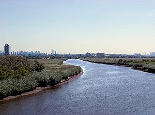
Berry's Creek is a tributary of the Hackensack River in the New Jersey Meadowlands in Bergen County, New Jersey. The creek watershed contains a diverse array of wetlands, marshes, and wildlife. The creek runs through a densely populated region and has been subject to extensive industrial pollution during the 19th and 20th centuries. Several companies discharged toxic chemicals into the creek in the 20th century, and these chemicals have remained in the sediment. The creek has the highest concentrations of methyl mercury of any fresh-water sediment in the world. Portions of the creek watershed are Superfund sites and cleanup projects began in the late 20th century.
VOCs are a dangerous contaminant of groundwater, leading to groundwater pollution. They are generally introduced to the environment through careless industrial practices.
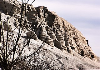
Tar Creek Superfund site is a United States Superfund site, declared in 1983, located in the cities of Picher, Douthat and Cardin, Ottawa County, in northeastern Oklahoma. From 1900 to the 1960s lead mining and zinc mining companies left behind huge open chat piles that were heavily contaminated by these metals, cadmium, and others. Metals from the mining waste leached into the soil, and seeped into groundwater, ponds, and lakes. Because of the contamination, Picher children have suffered elevated lead, zinc and manganese levels, resulting in learning disabilities and a variety of other health problems. The EPA declared Picher to be one of the most toxic areas in the United States.

In 1990, the Allied Paper, Inc./Portage Creek/Kalamazoo River in southwestern Michigan was declared by the Environmental Protection Agency (EPA) to be a Superfund site – in other words, an abandoned industrial site containing significant amounts of toxic waste. The EPA and companies responsible for the waste in this area, which includes a three-mile section of Portage Creek as well as part of the Kalamazoo River, into which it flows, are currently involved in an effort to reduce the amount of toxic waste at the site, which is contaminated by PCBs from paper mills and other factories.
The Killing Ground is a 1979 American documentary film written by Brit Hume. The film portrays environmental and human health effects of toxic waste dump-sites in Niagara Falls, New York and other locations. It was nominated for an Academy Award for Best Documentary Feature.
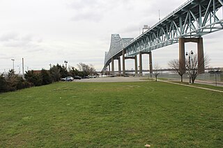
Wade Dump was a rubber recycling facility and illegal industrial waste storage and disposal facility in Chester, Pennsylvania. It was located at 1 Flower Street on the western bank of the Delaware River just north of the Commodore Barry Bridge.
Imperial Oil is a current Superfund site located off Orchard Place near Route 79 in Morganville, Marlboro Township, Monmouth County, New Jersey. This site is one of 114 Superfund sites in New Jersey. It is in the U.S. Environmental Protection Agency (EPA) Region 2 Superfund area of control and organization. The 15-acre (61,000 m2) Imperial Oil Co./Champion Chemicals site consisted of six production, storage, and maintenance buildings and 56 above-ground storage tanks.
Cooper Drum Company recycled closed top, steel drums on a 3.8-acre (15,000 m2) facility in South Gate, California from 1976 to 2003. They used strong chemicals to recondition the drums, leading to public concern about health impacts on the surrounding community. In particular, staff and students from Tweedy Elementary School, which borders the Cooper Drum site to the south, complained of health problems that may have resulted from exposure to toxic chemical coming from Cooper Drum Company. In June 2001, the Cooper Drum site was placed on the Superfund list, marking the site as one of the most high priority toxic cleanup sites in the United States.
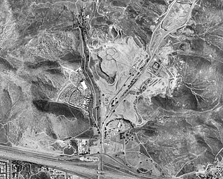
The Stringfellow Acid Pits are a toxic waste dump, and a Superfund site, located in Jurupa Valley, California, United States, just north of the neighborhood of Glen Avon. The site became the center of national news coverage in the early 1980s, in part because it was considered one of the most polluted sites in California, and because it became linked with mismanagement and scandal in the U.S. Environmental Protection Agency.
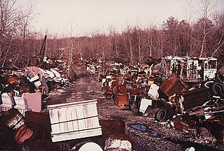
The Krejci Dump was a privately owned dump occupying 47 acres (19 ha) on several sites along Hines Hill Road near Boston Heights, Summit County, Ohio. After the area was converted into part of the then-Cuyahoga Valley National Recreation Area, the National Park Service discovered that the property, part of one of the most-heavily used parks in the country, was also one of the most contaminated sites in the United States Environmental Protection Agency's Region V. The dump subsequently became a Superfund cleanup site.
The Oakdale Dump is an Environmental Protection Agency Superfund site located in Oakdale, Minnesota, and comprises three non-contiguous properties that were used for dumping from the late 1940s until the 1950s by the 3M corporation. The properties are named the Abresch, Brockman, and Eberle sites for their respective property owners at the time of disposal activities. The Abresch site is the largest of the three properties at about 55 acres. The Brockman site is located immediately southwest of the Abresch site and encompasses 5 acres. The Eberle site is located roughly 2,500 feet north of the Abresch site and encompasses 2 acres.
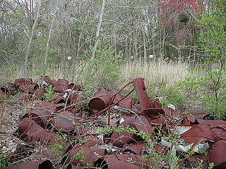
Shpack Landfill is a hazardous waste site in Norton, Massachusetts. After assessment by the United States Environmental Protection Agency (EPA) it was added to the National Priorities List in October 1986 for long-term remedial action. The site cleanup is directed by the federal Superfund program. The Superfund site covers 9.4 acres, mostly within Norton, with 3.4 acres in the adjoining city of Attleboro. The Norton site was operated as a landfill dump accepting domestic and industrial wastes, including low-level radioactive waste, between 1946 and 1965. The source of most of the radioactive waste, consisting of uranium and radium, was Metals and Controls Inc. which made enriched uranium fuel elements for the U.S. Navy under contract with the U.S. Atomic Energy Commission. Metals and Controls merged with Texas Instruments in 1959. The Shpack landfill operation was shut down by a court order in 1965.

Between 1947 and 1977, General Electric polluted the Hudson River by discharging polychlorinated biphenyls (PCBs) causing a range of harmful effects to wildlife and people who eat fish from the river. Other kinds of pollution, including mercury contamination and cities discharging untreated sewage, have also caused problems in the river.

Moyer's Landfill was a privately owned landfill in Collegeville, Pennsylvania, United States. It was originally farmland outside the town. In the 1940s, the owner started accepting trash and municipal waste as a way to make additional money. The original landfill was 39 acres and did not have a liner to protect the land from contaminate. A liner was added to a new section in the late 1970s. Over time, the landfill accepted sewage, and industrial wastes which contained hazardous substances in addition to municipal waste. The site was closed by the EPA in 1981, and was one of the first "Superfund" sites added to the National Priorities List.
Emmell's Septic Landfill (ESL) is located at 128 Zurich Ave, Galloway Township, New Jersey and takes up about 38 acres of space. The landfill was in operation from 1967 until 1979. ESL disposed of liquid and solid waste including many chemicals such as volatile organic compounds (VOCs), Polychlorinated Biphenyls (PCBs), Trichloroethene and Vinyl chloride which all had their own effect on the environment and community. These chemicals affected the groundwater required millions of dollars to reconstruct the groundwater pathways and provide clean water to residents. The landfill holds a Hazardous Ranking Score of a 50/100, qualifying for the Superfund National Priority List. In August 1999, the state acknowledged the site's contamination and held town meetings and provided research upon the site such as groundwater samples. In July 1997, a sitewide investigation was called upon by the United States Environmental Protection Agency. In total the clean up was estimated to cost $5 million to fund this superfund site, and a grant of $3.9 million was given by the Federal Government under the Recovery Act Funding (Previti). Today, the project is still ongoing however, greatly improved since the landfill was discovered.
The Diamond Head Oil Refinery is a former oil reprocessing facility located in Kearny, New Jersey, United States, that was designated as a Superfund site by the Environmental Protection Agency (EPA). It opened up in 1946, but then stopped production in 1979 and has been inactive since then. The refinery was shut down in 1980 and the EPA designated it as a Superfund site in 1991 due to the discovery of toxic chemicals in the soil and the surface water. This created a dangerous work environment for the workers at the facility. The EPA proposed a clean up plan for the site, but it has yet to take effect. So far, the Diamond Head site is still in the process of being cleaned up. Although cleanup plans were discussed and finalized, the future of the Diamond Head Oil Refinery and its cleanup state is unknown.
Forest Waste Products is a 120-acre (49-hectare) Superfund site in Forest Township northwest of Otisville, Michigan.


