Velasco, Texas

Last updated

Velasco, Texas
Ghost Town
Nicknames: 
  • Republic of Texas Capital
  • Town of Old Velasco [1]
Velasco Texas.jpg
Velasco in Brazoria County, Texas
USA Texas location map.svg
Red pog.svg
Velasco, Texas
Usa edcp location map.svg
Red pog.svg
Velasco, Texas
Coordinates: 28°57′43″N95°21′38″W / 28.96191°N 95.3605°W / 28.96191; -95.3605 (Velasco, Texas)
CountryUnited States
U.S. State Texas
County Brazoria County
Incorporated Town Freeport
Founded in Mexican Texas 1821
Founded by Old Three Hundred
Time zone UTC-6 (Central (CST))
  Summer (DST) UTC-5 (CDT)
ZIP code
77541
North American Numbering Plan 979
GNIS feature ID 1381075
Website Fort Velasco

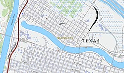
Velasco was a town in Texas, United States, that was later merged with the city of Freeport by an election conducted by eligible voters of both municipalities on February 9, 1957. The consolidation effort passed by a margin of 17 votes. Founded in 1831, Velasco is situated on the east side of the Brazos River in southeast Texas. It is 16 miles (26 km) south of Angleton, and 4 miles (6.4 km) from the Gulf of Mexico.

Contents

The town's early history is closely tied with the Battle of Velasco and the Texas Revolution. Velasco was an important entry point for American settlers in Texas. In 1836 following the decisive Battle of San Jacinto, Velasco was named a temporary capital of the Republic of Texas by the interim President David G. Burnet. [2] In 1837, the final actions of the Battle of the Brazos River occurred there.

History

Velasco was originally located on the Gulf Coast on the east side of the mouth of the Brazos River where Fort Velasco and present-day Surfside is located on the Texas Gulf Coast. [2] In 1821, the schooner Lively landed at the site with 38 men, the first of Stephen F. Austin's colonists. [3] At the time, Texas was part of Mexico, but Austin had obtained permission to bring American settlers into the area, with the first colonists settling in what is now southern Brazoria County. [2]

Velasco consisted of a single house until 1831 when Mexico set up a customs port there and dispatched troops to help the customs collector. [2] More than 25,000 settlers entered through the port. [2] The town was named for a Mexican general, as was Quintana, on the opposite side of the river. [2]

Velasco was the site of the Battle of Velasco in 1832. [2] The battle was fought on June 26, 1832, between Texas colonists and Mexico four years before the Texas Revolution. The Mexican commander during the conflict, Domingo de Ugartechea, tried to stop the Texans from transporting a cannon up the Brazos River to attack the city of Anahuac. The Texans were led by Brazoria Alcalde, John Austin, and schoolteacher and farmer Henry Smith. The Texan militia eventually prevailed over the greatly outnumbered Mexicans. Ugartechea surrendered after a three-day battle, once he realized he would not be receiving reinforcements. His soldiers had also run out of ammunition.

In 1834, a cholera epidemic reduced the population to 100. [2] After the Battle of San Jacinto, President David G. Burnet made the town the temporary capital of the Republic of Texas. [2] Government records were housed at Fort Velasco until the first capital of Texas was established at Columbia. [2] General Antonio López de Santa Anna signed the Treaties of Velasco on May 14, 1836, acknowledging Texas independence. [2]

Antebellum period

Between the Texas Revolution and the American Civil War, Velasco and Quintana served as summer resorts for wealthy plantation families of the region. [2] Galveston businessmen Samuel May Williams and Thomas F. McKinney established warehouses and organized shipping at the port. By 1838, a seminary for young ladies, Velasco Female Academy, and a school for young men, taught by Oxford graduates, were established. Comfortable hotels were built to accommodate visitors and patrons of the racetrack, which was located a short distance upriver. A local post office operated from 1846 until 1891 when mail was rerouted through Quintana. Antebellum Velasco had business houses, homes, a hotel, boardinghouses, wharves, and a customs house. Steamboats embarked from the wharves for Galveston and New Orleans. [2] With the completion in 1856 of the first intracoastal canal to Galveston Bay, however, the town began to decline, as much of its shipping was diverted to Galveston. [2]

U.S. Civil War

During the U.S. Civil War, the port of Velasco was fortified by Confederate troops and eight gun batteries, and Union ships were forced to go to New Orleans for drinking water, food, and fuel. [2] The port played an active role in the exchange of cotton for European guns, ammunition, milled goods, and medicines for the army and home use. Federal vessels attempted to stop vital trade and fired upon shore defenses, patrols, and small craft seeking to outrun them. [2]

Postbellum decline

With the ruin of the plantation system after the war, Velasco and Quintana declined as resorts. In 1875, a hurricane destroyed the old town records. By 1884, Old Velasco's residents numbered only 50. [2]

New Velasco

The new town of Velasco was surveyed and laid out four miles upriver in 1891 when a new Velasco post office was established. [2] The port was officially opened by the United States Secretary of the Treasury William Windom on July 7, 1891. [2] Over $1,000,000 worth of lots were sold to Midwesterners looking for greener pastures and a seaside environment. By 1892, New Velasco had 136 business establishments and 167 residences, an electric light plant, and a planing mill. Jetties were built by the Brazos River Channel and Dock Company by 1897, and the newly dug deepwater port ran to a depth of 17½ feet. [2]

Much of Velasco, first owned by John A. and William H. Wharton, was later sold to an agent of the English Rothschild family. They planned to establish a great seaport at the site. [2] By 1896, the community had a new lighthouse, several churches, schools, hotels, a national bank, a cottonseed oil mill, cotton gins, special and general stores, and two weekly newspapers. [2] Old Velasco and Crescent Beach could be reached by electric railroad.

Galveston Hurricane and aftermath

The population had reached 3,000 when the Galveston hurricane of 1900 wrecked the town. [2] Velasco rebuilt slowly, enduring fluctuations of poverty and prosperity. [2] By 1914, with a population of 1,000 and only one newspaper remaining, the community had a fish and oyster plant and shipped cattle, cotton, cane sugar, and syrup. [2] The population dropped to a low of 400 in the mid-1930s during the Great Depression, when the town supported only 12 businesses. [2]

Brazos River diversion and World War II

The port of Freeport had been built on the Brazos River four miles upstream. The river below the port required frequent dredging to accommodate larger ships. In 1929, the U.S. Army Corps of Engineers diverted the course of Brazos River three miles west, leaving the four-mile segment of the Old Brazos as a stand-alone ship channel. [4]

Diversion of the Brazos River and the formation of a tidal estuary deep enough to accommodate large vessels in the old river channel subsequently revived both Velasco and nearby Freeport. [2] Construction of chemical-industry facilities during World War II increased available jobs, and the population grew from 900 in 1940, when the city was incorporated with E. F. Roeller as mayor, to 5,200 by 1950. [2]

With a population estimated at 4,000 in 1956, Velasco was annexed by Freeport on July 27, 1957. [5] The community subsequently became part of the Brazosport industrial and port area and Brazosport Independent School District.

Government and infrastructure

The Texas Department of Criminal Justice Clemens Unit is located in an unincorporated area in Brazoria County, near Velasco. [6]

Related Research Articles

<span class="mw-page-title-main">Brazoria County, Texas</span> County in Texas, United States

Brazoria County is a county in the U.S. state of Texas. As of the 2020 census, the population of the county was 372,031. The county seat is Angleton.

<span class="mw-page-title-main">Angleton, Texas</span> City in Texas, United States

Angleton is a city in and the county seat of Brazoria County, Texas, United States, within the Houston–The Woodlands–Sugar Land metropolitan area. Angleton lies at the intersection of State Highway 288, State Highway 35, and the Union Pacific Railroad. The population was 19,429 at the 2020 census. Angleton is in the 14th congressional district, and is represented by Republican Congressman Randy Weber.

<span class="mw-page-title-main">Brazoria, Texas</span> City in Texas, United States

Brazoria is a city in the U.S. state of Texas, in the Houston–The Woodlands–Sugar Land metropolitan area and Brazoria County. As of the 2020 U.S. Census, the city population was 2,866.

<span class="mw-page-title-main">Freeport, Texas</span> City in Texas, United States

Freeport is a city in Brazoria County, Texas, United States, located on the Gulf of Mexico. According to the 2020 census, the city population was 10,696, down from 12,049 in 2010.

<span class="mw-page-title-main">Jones Creek, Texas</span> Village in Texas, United States

Jones Creek is a village in Brazoria County, Texas, United States. The population was 2,020 at the 2010 census. It is the first location in Texas where Stephen F. Austin settled.

<span class="mw-page-title-main">Lake Jackson, Texas</span> City in Texas, United States

Lake Jackson is a city in Brazoria County, Texas, United States, within the Greater Houston metropolitan area. As of the 2020 census, the city population was 28,177.

<span class="mw-page-title-main">Oyster Creek, Texas</span> City in Texas, United States

For the river in Fort Bend and Brazoria Counties, Texas see: Oyster Creek (Texas).

<span class="mw-page-title-main">Quintana, Texas</span> Town in Texas, United States

Quintana is a town in Brazoria County, Texas, United States. Its population was 56 at the 2010 census.

<span class="mw-page-title-main">Surfside Beach, Texas</span> City in Texas, United States

Surfside Beach, also known locally as Surfside, is a city in Brazoria County, Texas, United States, that is situated on Follet's Island by the Gulf of Mexico near the city of Freeport. The population was 482 at the 2010 census. The city has claimed the "Cradle of Texas Liberty" title due to the fact that the Treaty of Velasco which ended hostilities between Texas and Mexico was signed at Fort Velasco, which was located near the city's current City Hall.

<span class="mw-page-title-main">West Columbia, Texas</span> City in Texas, United States

West Columbia is a city in Brazoria County in the U.S. state of Texas. The city is centered on the intersection of Texas Highways 35 & 36, 55 miles (89 km) southwest of downtown Houston. The population was 3,644 at the 2020 census.

<span class="mw-page-title-main">Brazos River</span> River in Texas

The Brazos River, called the Río de los Brazos de Dios by early Spanish explorers, is the 11th-longest river in the United States at 1,280 miles (2,060 km) from its headwater source at the head of Blackwater Draw, Roosevelt County, New Mexico to its mouth at the Gulf of Mexico with a 45,000-square-mile (116,000 km2) drainage basin. Being one of Texas' largest rivers, it is sometimes used to mark the boundary between East Texas and West Texas.

<span class="mw-page-title-main">Battle of Velasco</span>

The Battle of Velasco, fought June 25-26, 1832, was the first true military conflict between Mexico and Texians in the Texas Revolution, colloquially referred to as the "Boston Harbor of Texas" It began when Texian Militia attacked Fort Velasco, located in what was then Velasco and what is now the city of Surfside Beach. The Mexican commander during the conflict, Domingo de Ugartechea, tried to stop the Texians, under John Austin, from transporting a cannon down the Brazos River to attack the city of Anahuac. The Texian Militia eventually prevailed over the Mexicans. Ugartechea surrendered after a two-day battle, once he realized he would not be receiving reinforcements, and his soldiers had almost run out of ammunition.

<span class="mw-page-title-main">Anahuac disturbances</span> Uprisings of settlers in Texas in 1832 and 1835

The Anahuac disturbances were uprisings of settlers in and around Anahuac, Texas, in 1832 and 1835 which helped to precipitate the Texas Revolution. This eventually led to the territory's secession from Mexico and the founding of the Republic of Texas. Anahuac was located on the east side of the Trinity River near the north shore of Galveston Bay, which placed it astride the trade route between Texas and Louisiana and from there to the rest of the United States. In new attempts to curtail smuggling and enforce customs tariffs from the coastal settlements, Mexico placed a garrison there after 1830. American settlers came into conflict with Mexican military officers, rose up against them, and increased political activity and residents of numerous communities declared support for the federalists, who were revolting against the Mexican Government.

<span class="mw-page-title-main">San Luis Pass (Galveston Island)</span> Natural water inlet in Texas, United States

San Luis Pass is a strait of water at the south-western end of Galveston Island off the Texas Gulf Coast of the U.S. state of Texas. It connects the sheltered waters of West Bay to the open Gulf of Mexico. Fishermen and swimmers have been killed in the Pass' treacherous waters, largely due to the aggressive oceanic currents of Gulf Stream, fluctuating tides in marginal sea, marine sediment, and uncertainties of continental margin. The San Luis Pass-Vacek Toll Bridge spans San Luis Pass from Galveston County to Brazoria County.

<span class="mw-page-title-main">East Columbia, Texas</span> Unincorporated community in Texas, United States

East Columbia is an Unincorporated community in Brazoria County, Texas, United States. It is located nine miles west from Angleton. It was one of the most important inland ports in Texas. The river port became a vital component in the plantation-based economy that developed along the Brazos River in the 19th century. The community was founded in 1824 by Josiah Hughes Bell. A native of South Carolina, Bell came to Texas with Stephen F. Austin's Old 300 colony in 1821. Bell built a landing of log-lines docks and timbered stops on the Brazos River just below Varner's Creek. Bell laid out the town and called it Marion. Bell sold the townsite to Walter C. White in 1827. By the mid-1800s the town had a population of 800. The arrival of the railroad in the area led to the decline of steamboat traffic which had an adverse effect on the town's fortunes. Storms in 1900, 1909, and 1913 were destructive to the community. When oil was discovered in West Columbia in 1918, merchants abandoned East Columbia. By the 1970s the town's post office had already closed and its population had decreased substantially.

The Brazosport Facts is the largest daily newspaper for Brazoria County, Texas, a part of the Greater Houston area. The newspaper is owned by Southern Newspapers Inc., and began in 1913.

<span class="mw-page-title-main">Texas Gulf Coast</span> Texas coastal boundary with Gulf of Mexico

Texas Gulf Coast is an intertidal zone which borders the coastal region of South Texas, Southeast Texas, and the Texas Coastal Bend. The Texas coastal geography boundaries the Gulf of Mexico encompassing a geographical distance relative bearing at 367 miles (591 km) of coastline according to CRS and 3,359 miles (5,406 km) of shoreline according to NOAA.

Port Freeport is the smallest (geographically) deep-water seaport along the U.S Gulf Coast. Located in Freeport, Texas . It has rail access, represents both private and public facilities. It is ranked 10th in the nation for chemicals, 19th in the nation for total tonnage, 26th in the nation for container traffic, handles over 100,000 vehicles per year and has more than 1,000 ships per year. Forbes magazine (2017) ranked Port Freeport as one of the top 10 fastest growing seaports for exports in the U.S.

Fort Velasco was a small circular palisade fort built by a garrison of Mexican soldiers at Velasco, Texas at the present-day location of Surfside Beach on the northeast bank at the mouth of the Brazos River and Texas Gulf Coast. The name also applies to at least three other forts built at almost the same location, one during the Texas Revolution, and two during the Civil War.

Brazosport is an unincorporated community in Brazoria County, Texas, United States. According to the Handbook of Texas, the community had a population of 61,198 in 2000. It is located within the Greater Houston metropolitan area.

References

  1. "Site of Town of Old Velasco - Brazoria County ~ Marker Number: 9604". Texas Historic Sites Atlas. Texas Historical Commission. 1969.
  2. 1 2 3 4 5 6 7 8 9 10 11 12 13 14 15 16 17 18 19 20 21 22 23 24 25 26 27 28 Weir, Merle. "Velasco, Texas". Handbook of Texas Online . Texas State Historical Association. Archived from the original on May 6, 2011. Retrieved January 9, 2010.
  3. "Four Miles Southeast to the Original Town of Velasco - Brazoria County ~ Marker Number: 9606". Texas Historic Sites Atlas. Texas Historical Commission. 1936.
  4. "Modern Brazos Delta". Rice University Gulf of Mexico Research Group. Archived from the original on June 21, 2010. Retrieved January 10, 2010.
  5. Kleiner, Diana J. "Freeport, Texas". Handbook of Texas Online . Texas State Historical Association. Archived from the original on October 2, 2012. Retrieved April 18, 2010.
  6. "Convict Leasing and State Account Farming (1883-1909) Archived 2010-07-25 at the Wayback Machine ." Texas State Library and Archives. Retrieved on April 29, 2011.